- Empire, Michigan
Infobox Settlement
official_name = Empire, Michigan
settlement_type = Village
nickname =
motto =
imagesize =
image_caption =
image_
imagesize =
image_caption =
image_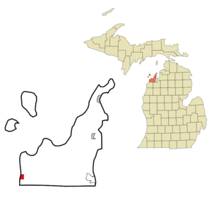
mapsize = 250px
map_caption = Location of Empire, Michigan
mapsize1 =
map_caption1 =subdivision_type = Country
subdivision_name =United States
subdivision_type1 = State
subdivision_name1 =Michigan
subdivision_type2 = County
subdivision_name2 = Leelanaugovernment_footnotes =
government_type =
leader_title =
leader_name =
leader_title1 =
leader_name1 =
established_title =
established_date =area_footnotes =
area_magnitude =
area_total_km2 = 3.2
area_land_km2 = 3.0
area_water_km2 = 0.2
area_total_sq_mi = 1.2
area_land_sq_mi = 1.2
area_water_sq_mi = 0.1population_as_of = 2000
population_footnotes =
population_total = 378
population_density_km2 = 126.8
population_density_sq_mi = 328.5timezone = Eastern (EST)
utc_offset = -5
timezone_DST = EDT
utc_offset_DST = -4
elevation_footnotes =
elevation_m = 186
elevation_ft = 610
latd = 44 |latm = 48 |lats = 39 |latNS = N
longd = 86 |longm = 3 |longs = 33 |longEW = Wpostal_code_type =
ZIP code
postal_code = 49630
area_code = 231
blank_name = FIPS code
blank_info = 26-25980GR|2
blank1_name = GNIS feature ID
blank1_info = 0625588GR|3
website =
footnotes =Empire is a village in Leelanau County in the
U.S. state ofMichigan . The population was 378 at the 2000 census. The village is located within Empire Township.Description
Situated approximately 25 miles due west of
Traverse City , Empire is nestled in the center of theSleeping Bear Dunes National Lakeshore . With the Empire Bluffs to the south and the widely recognizable sand dunes of the National Lakeshore to the north, the area possesses breathtaking vistas of the dunes, North Manitou and South Manitou islands, and Lake Michigan. Most Sleeping Bear Dunes panoramas portrayed on postcards are taken from a walking trail which runs to the top of the Empire Bluffs. A wide beach separates Lake Michigan from its close neighbor, South Bar Lake. The much smaller South Bar Lake stays considerably warmer than the big lake during the summer months, and is good for young children.The Empire beach boasts the
Robert H. Manning Memorial Lighthouse , which was built in 1991 as a memorial to Robert H. Manning, a life-long resident of Empire and avid fisherman. Additionally, the beach offers a famous antique anchor which was discovered by Douglas Manning, son of Robert H. Manning, and Michelle Stryker in 1977. Every year, the village of Empire celebrates the raising of the anchor on the third Saturday in July.The small village of Empire is located up a short hill, just a few minutes walk from the beach.
Geography
According to the
United States Census Bureau , the village has a total area of 1.2square mile s (3.2km² ), of which, 1.1 square miles (3.0 km²) of it is land and 0.1 square miles (0.2 km²) of it (7.26%) is water. Empire is considered to be part ofNorthern Michigan .Geographic features
*
South Bar Lake
*Lake Michigan Major highways
{|
*
* on the east.Demographics
As of the
census GR|2 of 2000, there were 378 people, 187 households, and 104 families residing in the village. Thepopulation density was 328.5 per square mile (126.9/km²). There were 276 housing units at an average density of 239.8/sq mi (92.7/km²). The racial makeup of the village was 98.94% White, 0.26% Native American, 0.26% Asian, and 0.53% from two or more races.There were 187 households out of which 16.6% had children under the age of 18 living with them, 47.1% were married couples living together, 5.9% had a female householder with no husband present, and 43.9% were non-families. 39.6% of all households were made up of individuals and 16.6% had someone living alone who was 65 years of age or older. The average household size was 2.02 and the average family size was 2.70.
In the village the population was spread out with 15.6% under the age of 18, 6.3% from 18 to 24, 19.3% from 25 to 44, 35.2% from 45 to 64, and 23.5% who were 65 years of age or older. The median age was 49 years. For every 100 females there were 94.8 males. For every 100 females age 18 and over, there were 96.9 males.
The median income for a household in the village was $39,722, and the median income for a family was $52,813. Males had a median income of $31,042 versus $24,250 for females. The
per capita income for the village was $27,850. About 2.7% of families and 7.4% of the population were below thepoverty line , including 7.8% of those under age 18 and 6.0% of those age 65 or over.U.S. Air Force (Empire Air Force Station)
For many years, the village was host to many servicemen and women stationed at
Empire Air Force Station . This was mainly a radar site during the Cold War. Its main function was to protect the northern skies of the United States from military threats. In its later years, the site was turned over to the Federal Aviation Administration. Though much of the site is gone now, there is a museum and historical marker in the village. There is an annual reunion of members of Empire AFS.Local attractions
*Michigan
Shore to Shore Riding & Hiking Trail runs from Empire passes through Grayling and on to Oscoda, and points north and south. It is a 500 mile interconnected system of trails. [ [http://www.kerchevalave.com/mtra/sh2sh.html Michigan Shore to Shore Riding and Hiking Trail] .]*Empire historical center and museum [ [http://www.leelanaucounty.com/government0293.asp Empire museum.] ]
There are a number of recurring local events. A calendar is available. [ [http://www.empirechamber.com/ Empire Chamber of Commerce] ]
*The Empire Winterfest, held each year in mid-February has been celebrated for the past twenty-five years. Events include ice skating, curling and the polar bear dip into South Bar Lake. There is also a pool tournament held in the Empire Village Inn (known to locals simply as "The V.I.") and a pancake breakfast put on by the Empire Lion's Club in the Empire town hall.
*Empire is the home of the Dunegrass Festival. A three day music festival featuring folk and bluegrass groups, as well as a multitude of stands from local artisans and business owners.
*Empire Heritage Days (2nd weekend in October).
*Empire Asparagus Festival (3rd weekend in May -- weekend before Memorial Day weekend).
Notes
Further reading
* [http://clarke.cmich.edu/localhistory/Leelanau.htm Clarke Historical Library, Central, Michigan University, Bibliography for Leelanau County]
*Bogue, Margaret. "Around the Shores of Lake Michigan: A Guide to Historic Sites". Madison, WI: University of Wisconsin Press, 1985.
*Reed, Earl H. "The Dune Country. Berrien Springs", MI: Hardscrabble Books, 1979. [Reprint of 1916 Edition] .
*Ruchhoft, Robert H. "Exploring North Manitou, South Manitou, High and Garden Islands of the Lake Michigan Archipelago". Cincinnati, OH: Pucelle Press, 1991.
*Wood, Mable C. "Scooterville", U.S.A. Grand Rapids, MI: Eerdmans, 1962External links
* [http://www.empirechamber.com/ Empire Chamber of Commerce.]
* [http://www.leelanau.cc/empirevillage.asp Empire Village home page.]
* [http://www.leelanauchamber.com/empire.shtml Leelenau Chamber of Commerce.]
Wikimedia Foundation. 2010.