- North Manitou Island
-
North Manitou Island 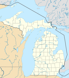
 North Manitou Island (Michigan)
Geography Location Lake Michigan, Sleeping Bear Dunes National Lakeshore Coordinates 45°07′10″N 86°01′01″W / 45.11944°N 86.01694°WCoordinates: 45°07′10″N 86°01′01″W / 45.11944°N 86.01694°W Area 22.3 sq mi (57.8 km2) Country State Michigan County Leelanau County Township Leland Township Demographics Population Uninhabited North Manitou Island is located in Lake Michigan, approximately 12 miles (19 km) west-northwest of Leland, Michigan. It is nearly eight miles long and over four miles (6 km) wide, with 20 miles (32 km) of shoreline. It has a land area of 57.876 km² (22.346 sq mi) and has no population. Smaller South Manitou Island lies to its southwest.
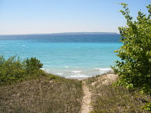
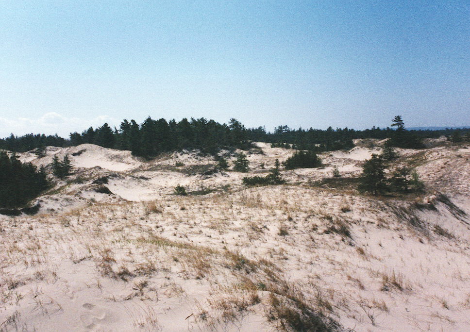
 North Manitou Island: southern dunes
 North Manitou Island: southern end of the island looking south
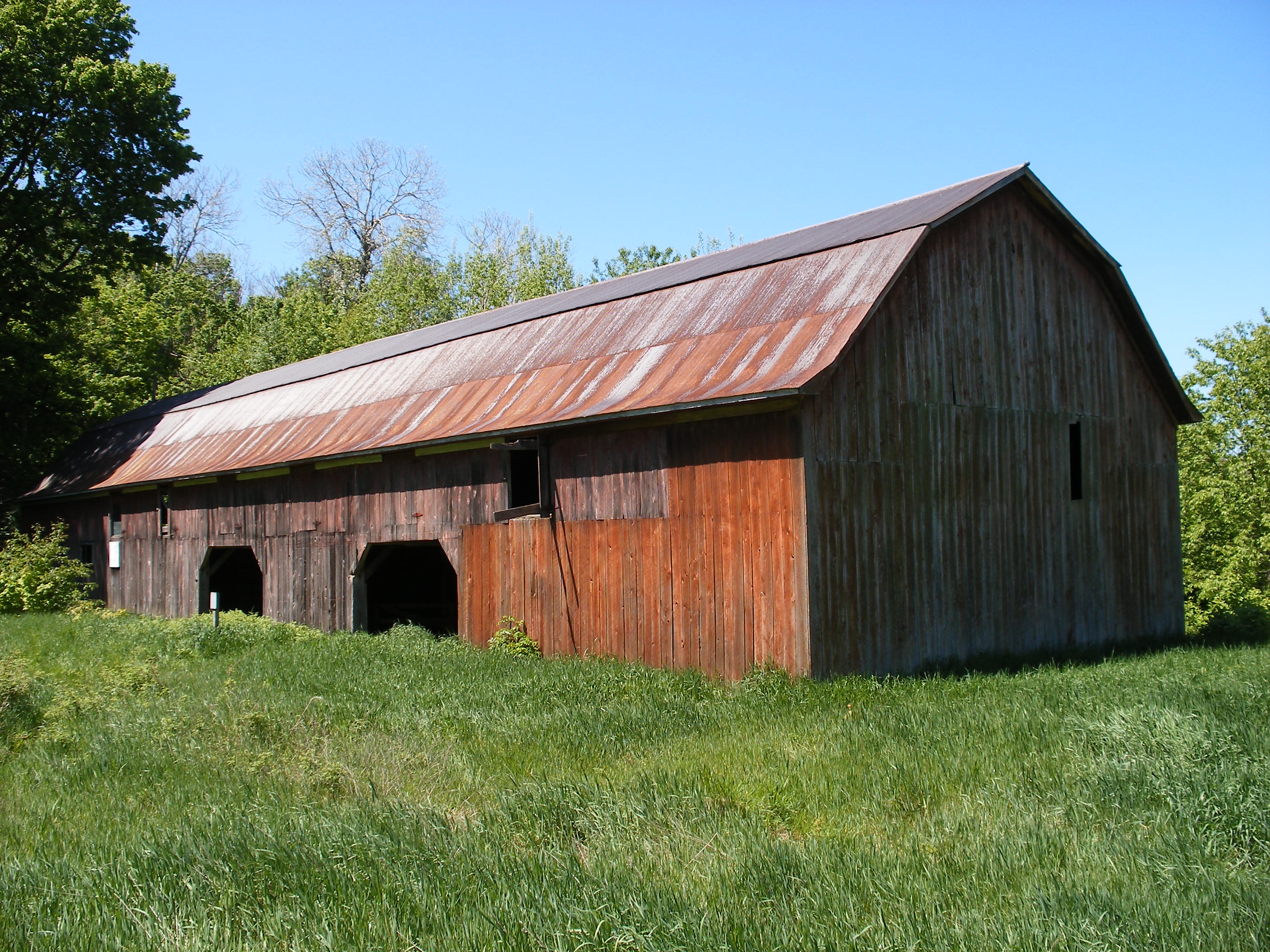
 North Manitou Island: Swenson's Barn on the western side of the island
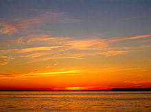
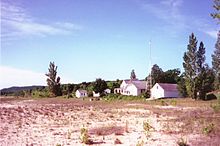 North Manitou Island: Rangers House on the Eastern side of the island near the ferry dock
Both islands are in Leelanau County and are part of the Sleeping Bear Dunes National Lakeshore, although they are over 6 miles (9.7 km) offshore. Park passes and camping fees are required. The island can be accessed by a ferry service from Leland; private watercraft are permitted with limited docking. No wheeled vehicles are allowed on the island other than those used by the National Park Service or to cart off a dead deer. No campfires are allowed on the island except at public firepits near the ranger station. Similarly there is only one water spigot, and one outhouse, in the same area.
Perhaps according to Native American mythology, perhaps a legend created in more recent times, the traditional version of the Chippewa legend goes that long ago the mother bear Mishe Mokwa and her two cubs sought to cross Lake Michigan from the Wisconsin shore to escape a great forest fire. The mother bear made it across, but her twin cubs played and splashed instead of swimming hard to make it across. They drowned in the lake, forming the two Manitou islands. The mother bear lies and waits forever for her cubs to reach the shore - the Sleeping Bear Dunes. Most archeologists believe early habitation by Native Americans was only temporary due to the island's scarcity of natural resources and the abundance of resources on the mainland. Despite this, there are signs of activity by Native Americans and some of the earliest archeological sites ever found in Michigan are located there. This includes seven sites, mostly on the east side [1]. These sites date back to between 8,000 and 600 B.C. Items found include: stone and flint tools, a copper awl, pottery and the remains of a canoe[2].
The initial Island settlements were built by wood cutters supplying the fleet of Great Lakes' wood-burning steamers with cord wood. Nicholas Pickard was probably the first (between 1842 and 1846). Interestingly, there is no record that Mr. Pickard actually owned any land on North Manitou when he began cutting wood there. It is important to keep in mind that while the record is clear the a wood-cutting station was established first on South Manitou, many travelers who have left us their written accounts didn't make it clear which island they visited. Over 150 years later it can be difficult, if not impossible, to tell whether some stories of visiting "the Manitous" refer to North or South. Margaret Fuller's well known "Summer on the Lakes, 1843," for example, very probably recounts a visit to South Manitou. Piers were constructed on the eastern and western sides of the Island for the steamers to load wood while traveling up and down Lake Michigan.
After the passing of the wood-burning steamers, there were several more woodcutting eras on the Island - for sawn boards and raw logs. Among others there was the Smith & Hull operation on the West Side (1906 to about 1915), Peter Stormer's east side and north end, a World War II era sawmill (near the site of the old dock in the Settlement), and The Lake Michigan Hardwood Company sawmill and later raw log cutting.
Some island settlers turned to farming, growing apples and cherries. This didn't work out very well. The sandy soil is difficult to work. And the growing season on the island is later than on the mainland - so harvested crops had to be transported across Lake Michigan during rough weather. The old island saying is "It always blows in cherry season." Remnants of these orchards are still there. From the late 1940s through the 1960s the William R. Angell Foundation (owner of most of the Island by that time) used the imported deer population as an economic resource, hosting hunters. The Foundation artificially supported an abundant deer population with commercial salt blocks and custom feed manufactured by Kellogg Company. The deer pruned the island's forests, giving an open, park-like feeling to even the deepest woods. A 4,000-foot (1,200 m) lighted runway, now a field in "The Settlement" on the eastern side of the Island, next to the designated camping grounds and firepits, was used to bring in the hunters.
A summer colony grew on the east side of the island starting in the late 19th Century. A group of successful Chicago businessmen built cottages (some of which remain on "Cottage Row"). The National Park Service occupies the old US Life-Saving Station (later, of course, the US Coast Guard) grounds near where the Leland boat lands campers. At the south end of the Island was a lighthouse (built in 1896, automated in 1932, discontinued in 1938 and destroyed in 1942).
After the foundation sold most of the island to the United States Government, the deer population started to decline due to the lack of artificial feed. The woods have grown up, many clearings are being obliterated; previously open space is rapidly being taken over by the woods. Now, after decades of regrowth, it is hard to spot any deer at all. All buildings that were built after the 1950s have been slated for demolition or have already been torn down.
Though at various times it was the least populated of the Manitou islands, apple and cherry orchards were planted during its settlement period. Now uninhabited except by the rotating National Park ranger and maintenance crews assigned there, the homesteads and most of the buildings of the island's former settlers lie in varying states of ruin. Various buildings are shored up during the summer months. There is a cemetery in the southeast of the island where some of the islands former inhabitants are buried.
The Manitou islands are surrounded by over 50 known shipwrecks; a few of these are popular (and protected) diving spots.
The island has a system of trails, the remnants of the island's unpaved roads. On the west side of the island one may still walk the "old grade" - the roadbed of the narrow-gauge logging railroad. Wilderness camping is permitted throughout the island, and there are several designated camping sites near the ranger station at the dock. Filtered water is available at the ranger station, with limited natural inland water sources. There is one sizeable inland lake, Lake Manitou, suitable for fishing, and another, Tamarack Lake, which is now essentially a cedar swamp. The island is flanked by dunes on its northwest and southwest sides.
Island mammals include coyote, beaver, white-tailed deer, and eastern chipmunk. The raccoon population died out due to disease shortly before 2002. Numerous songbirds, waterfowl, and various raptors can be seen; of particular note is the endangered Piping Plover, which nests here. Bald eagles are commonly seen, especially during spring and early summer nesting season. Garter snakes are abundant on the island. There is an annual deer hunting season to limit the size of the population.
References
- North Manitou Island: Block 1101, Census 9703, Leelanau County, Michigan United States Census Bureau
- ^ Rita Hadra Rusco, North Manitou Island: Between Sunrise and Sunset (Ravenna, MI: Rogers Printing, 1991)
- ^ George Weeks, Sleeping Bear: Yesterday and Today (Franklin, MI: A&M, 1990)
Tending a 'Comfortable Wilderness,' A History of Agricultural Landscapes on North Manitou Island, Sleeping Bear Dunes National Lakeshore, Michigan by Eric MacDonald and Arnold R. Alanen [U.S. Department of the Interior, Omaha, Nebraska: 2000]
External links
- North Manitou Island, Leelanau Michigan Information- http://www.northmanitou.com
- North Manitou Island, National Park
- Manitou Island Transit
- North Manitou Island maps, photos and history
- [1]
Categories:- Islands of Michigan
- Protected areas of Leelanau County, Michigan
- Sleeping Bear Dunes National Lakeshore
- Islands of Lake Michigan


Wikimedia Foundation. 2010.