- Oscoda, Michigan
-
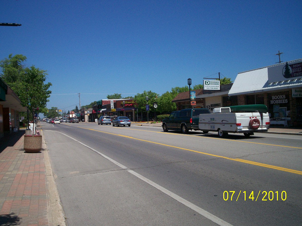
Oscoda, Michigan — CDP — Downtown Oscoda, looking northbound on US-23 Location of Oscoda within Iosco County, Michigan
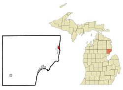
Coordinates: 44°25′13″N 83°19′51″W / 44.42028°N 83.33083°WCoordinates: 44°25′13″N 83°19′51″W / 44.42028°N 83.33083°W Country United States State Michigan County Iosco Township Oscoda Area - Total 0.9 sq mi (2.5 km2) - Land 0.9 sq mi (2.3 km2) - Water 0.1 sq mi (0.2 km2) Population (2000) - Total 922 - Density 1,135.7/sq mi (440.2/km2) Time zone Eastern (EST) (UTC-5) - Summer (DST) EDT (UTC-4) ZIP code 48750 Area code(s) 989 FIPS code 26-61320[1] GNIS feature ID 634132[2] Oscoda is an unincorporated community in the U.S. state of Michigan located on the northern side of the Au Sable River where it enters Lake Huron. The community of Au Sable is on the other side of the river. Oscoda is in Oscoda Township in Iosco County, and not in Oscoda County, which is to the northwest. The 1990 census population was 1061, although 3,000 personnel were stationed at nearby Wurtsmith Air Force Base. Oscoda is a census-designated place (CDP) for statistical purposes. As of the 2000 census (several years after the closure of the air force base), the population was 992. The post office at Oscoda first opened with the name AuSable on September 23, 1856. The name changed to Oscoda on July 1, 1875.[3]
Nearby is the Lumberman's Monument, in honor of the lumberjacks that first populated the area. The State of Michigan has designated Oscoda as the official home of Paul Bunyan due to the earliest documented publications in the Oscoda Press, August 10, 1906, by James MacGillivray (later revised and published in The Detroit News in 1910).[4]
Wurtsmith Air Force Base (originally Camp Skeel) was located just outside the community from 1923 to 1993. Wurtsmith was the site of the Strategic Air Command's 379th Bombardment Wing consisting of one nuclear-armed B-52 bomber squadron and one air refueling squadron equipped with KC-135s. The Charter Township of Oscoda created a Redevelopment Authority with the cooperation of the Michigan Legislature. The Wurtsmith Renaissance Zone was created in 1997, which exempted businesses and residents of the 5,000 acres (20 km2) zone from all state and most local taxes.
The Oscoda-Wurtsmith Airport is now a public airport. It occupies a portion of the base and is primarily used for cargo and light general aviation activities.[5] Other tenants include the Aune Medical Center, Alcona Health Center Dental Clinic, Alpena Community College, Yankee Air Force Museum - Wurtsmith Division,[6] and numerous private businesses. The former military housing units have been refurbished and now serve as a major population base in the Oscoda area.
Contents
Geography
According to the United States Census Bureau, the CDP has a total area of 0.9-square-mile (2.3 km2), of which 0.9-square-mile (2.3 km2) is land and 0.1-square-mile (0.26 km2) (7.37%) is water.
Oscoda is considered to be part of Northern Michigan and is near the Huron National Forest, which offers outdoor recreational opportunities such as hunting, swimming, cross-country skiing and fishing. The forest contains 330 miles of hiking trails.
Major highways and a notable scenic byway
- River Road, running parallel with the Au Sable River, is a designated National Scenic Byway for the 23 miles (37 km) that go into Oscoda.[7]
- Iosco County Rd. F41, follows alongside Oscoda-Wurtsmith Airport and connects Oscoda with nearby Mikado.
Demographics
As of the census[1] of 2000, there were 992 people, 460 households, and 260 families residing in the CDP. The population density was 1,135.7 per square mile (440.2/km²). There were 599 housing units at an average density of 685.8 per square mile (265.8/km²). The racial makeup of the CDP was 94.15% White, 0.40% Black or African American, 1.21% Native American, 1.71% Asian, 0.71% from other races, and 1.81% from two or more races. Hispanic or Latino of any race were 1.71% of the population.
There were 460 households out of which 24.3% had children under the age of 18 living with them, 45.9% were married couples living together, 7.8% had a female householder with no husband present, and 43.3% were non-families. 38.9% of all households were made up of individuals and 17.8% had someone living alone who was 65 years of age or older. The average household size was 2.14 and the average family size was 2.80.
In the CDP the population was spread out with 22.4% under the age of 18, 4.8% from 18 to 24, 24.9% from 25 to 44, 26.0% from 45 to 64, and 21.9% who were 65 years of age or older. The median age was 44 years. For every 100 females there were 88.2 males. For every 100 females age 18 and over, there were 86.4 males.
The median income for a household in the CDP was $30,000, and the median income for a family was $42,250. Males had a median income of $24,667 versus $22,772 for females. The per capita income for the CDP was $16,191. About 4.4% of families and 8.3% of the population were below the poverty line, including 6.4% of those under age 18 and none of those age 65 or over.
Neighborhoods
Oscoda consists of several neighborhoods, including Piety Hill[8], Hull Island[9], Brewster Park, Silver Sands[10], Lakewood Shores West, Lakewood Shores East, Jordanville, and the Villages of Oscoda.
Local attractions
- A historical museum is in Oscoda.[11]
- Michigan Shore to Shore Riding & Hiking Trail runs from Empire to Oscoda, and points north and south. It is a 500-mile (800 km) interconnected system of trails.[12]
Notable residents
- Eric Harris, one of the Columbine High School massacre perpetrators lived in Oscoda as a young child, from 1989–1992, while his father worked on Wurtsmith Air Force Base.[13]
- Jack Abbott was born in Oscoda when his father was stationed at Wurtsmith Air Force Base
Media
Newspapers
- The Iosco County News-Herald is the newspaper of record for Iosco County.[14]
- The Oscoda Press is a weekly newspaper serving northern Iosco County and southern Alcona County[15]
- The Alpena News[16] is the daily newspaper of record for much of northeastern Lower Peninsula of Michigan.[17]
- Daily editions of the Detroit Free Press and The Detroit News are also available throughout the area.
Radio
- WCMB 95.7 FM is owned by Central Michigan and offers a public radio format.
- WWTH 100.7 FM is a country music format based in Oscoda.
References
- ^ a b "American FactFinder". United States Census Bureau. http://factfinder.census.gov. Retrieved 2008-01-31.
- ^ U.S. Geological Survey Geographic Names Information System: Oscoda, Michigan
- ^ U.S. Geological Survey Geographic Names Information System: Oscoda Post Office
- ^ Oscoda Press on Paul Bunyan designation
- ^ Oscoda-Wurtsmith flight information
- ^ Yankee Air Force Museum, Wurtsmith Division
- ^ River Road Scenic Byway at America's Byways.
- ^ Au Sable Township
- ^ Oscoda Press
- ^ Ludington Daily News
- ^ Oscoda-Au Sable Historical Society and Museum.
- ^ Michigan Shore to Shore Riding and Hiking Trail.
- ^ http://www.acolumbinesite.com/
- ^ Iosco County News Herald home page
- ^ Oscoda Press home page
- ^ The Alpena News
- ^ Alpena News
External links
- Clarke Historical Library, Central Michigan University, Bibliography on Iosco County
- List of events and calendar for Oscoda
- Oscoda Area Chamber of Commerce calendar of events
Municipalities and communities of Iosco County, Michigan County seat: Tawas City Cities 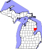
Charter
townshipsGeneral law
townshipsUnincorporated
communitiesCategories:- Unincorporated communities in Iosco County, Michigan
- Census-designated places in Michigan
- Populated places established in 1856


Wikimedia Foundation. 2010.