- M-247 (Michigan highway)
-
M-247

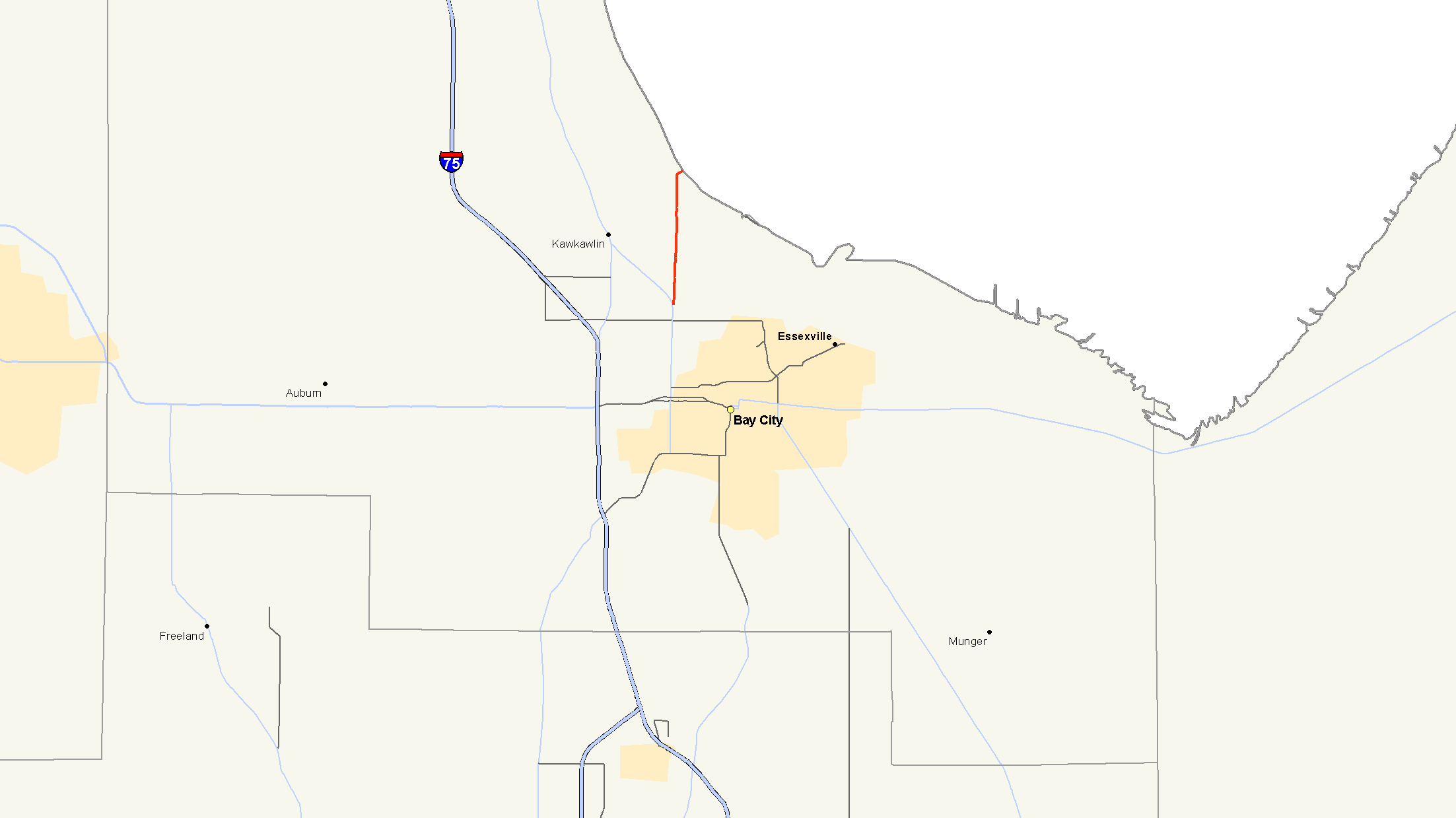
Map of Bay City area with M-247 highlighted in redRoute information Maintained by MDOT Length: 3.036 mi[2] (4.886 km) Existed: 1961[1] – present Major junctions South end:  M-13 near Bay City
North end: Bay City Recreation Area Location Counties: Bay Highway system Michigan State Trunkline Highway System
Interstate • US • State←  M-239
M-239I-275  →
→M-247 is a north–south state trunkline highway in the US state of Michigan, connecting M-13 to the Bay City Recreation Area, entirely within Bangor Township. As a state trunkline, M-247 runs north from M-13 before turning to access the park, a distance of 3.036 miles (4.886 km). The highway carries just over 6,000 vehicles a day on average. The roadway has been part of the state trunkline highway system since the 1920s, and from 1961 until 1998, it was the highest non-Interstate highway in the state. Before it was given the M-247 designation, the roadway has been a part of M-111 and M-47.
Contents
Route description
Starting at its southern terminus at M-13, M-247 follows Euclid Avenue north about 2.7 miles (4.3 km), crossing the Kawkawlin River. When it meets Beaver Road, M-247 turns east leading directly into the state park and ends at its entrance.[3] The entire roadway passes through suburban Bay City near the Saginaw Bay.[4] None of the highway is listed on the National Highway System, a system of regionally important highways.[5]
The Michigan Department of Transportation (MDOT) measures the traffic volumes on its highways using a calculation called average annual daily traffic (AADT). This value is an expression of the number of vehicles that use a section of roadway on any average day of the year. When the department surveyed M-247 in 2009, the southernmost section near M-13 carried 6,135 vehicles; the remainder carried 6,224 vehicles. As a subset of these figures, 190 commercial vehicles used the trunkline on average. This was an overall increase from 2008 when the sections carried 5,031 and 5,573 vehicles respectively, but a decrease from the 214 commercial vehicles.[6]
History
By 1929, the first highway designation along the current M-247 was assigned. That first number was M-111,[7] which lasted until 1937 when all of M-111 became part of M-47.[8] In early 1961, the roadway changed numbers once more. This time M-47 was realigned to a former section of US Highway 10 (US 10), and the connection to the state park was assigned the M-247 designation.[1] This was the highest highway number in the state, excluding Interstates, until the 1998 designation of M-553 in the Upper Peninsula.[9]
Major intersections
The entire highway is in Bangor Township, Bay County.
Mile[2] Destinations Notes 0.000  M-13 / LHCT
3.036 Bay City Recreation Area entrance 1.000 mi = 1.609 km; 1.000 km = 0.621 mi References
- ^ a b Michigan State Highway Department (1961). Official Highway Map (Map). (Includes all changes through July 1, 1961)
- ^ a b "MDOT Physical Reference Finder Application". Michigan Department of Transportation. 2009. http://www.mcgi.state.mi.us/prfinder/. Retrieved August 29, 2010.
- ^ Michigan Department of Transportation (2009). Control Section/Physical Reference Atlas (Map). http://mdotwas1.mdot.state.mi.us/public/maps/pr/. Retrieved July 26, 2009.
- ^ Google, Inc. Google Maps – Overview Map of M-247 (Map). Cartography by Google, Inc. http://maps.google.com/maps?f=q&source=s_q&hl=en&geocode=&q=Bay+City,+Michigan&sll=37.0625,-95.677068&sspn=64.409204,65.654297&ie=UTF8&hq=&hnear=Bay+City,+Bay,+Michigan&ll=43.651913,-83.912115&spn=0.058687,0.064116&t=h&z=14. Retrieved August 29, 2010.
- ^ Michigan Department of Transportation (April 23, 2006) (PDF). National Highway System, Michigan (Map). http://www.michigan.gov/documents/MDOT_NHS_Statewide_150626_7.pdf. Retrieved October 7, 2008.
- ^ "Traffic Monitoring Information System". Michigan Department of Transportation. 2008. http://mdotnetpublic.state.mi.us/tmispublic/. Retrieved December 13, 2010.
- ^ Michigan State Highway Department (May 1, 1929). Official Highway Service Map (Map). Cartography by MSHD.
- ^ Michigan State Highway Department (December 1, 1937). 1937/8 Official Michigan Highway Map (Map). Cartography by Rand McNally (Winter ed.). Section J12.
- ^ "MDOT Accepts Responsibility for 120 Miles of Local Roads" (Press release). Michigan Department of Transportation. September 24, 1998. Archived from the original on December 24, 2007. http://web.archive.org/web/20071224101556/http://www.michigan.gov/mdot/0,1607,7-151-9620_11057-94859--,00.html. Retrieved August 26, 2008.
External links
Categories:- State highways in Michigan

Wikimedia Foundation. 2010.