- Nares Strait
-
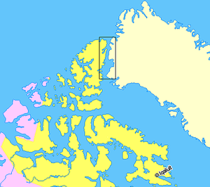 Nares Strait (boxed) is between Ellesmere Island and Greenland.
Nares Strait (Danish: Nares StrædetCoordinates: 80°N 70°W / 80°N 070°W) is a waterway between Ellesmere Island and Greenland that is the northern part of Baffin Bay where it meets the Lincoln Sea. From south to north, the strait includes Smith Sound, Kane Basin, Kennedy Channel, Hall Basin and Robeson Channel. During 1962–64 a 20 km by 10 km ice island drifted southward from the Lincoln Sea through the Nares and Davis Straits to the Atlantic Ocean (Labrador Sea).[1] Nares strait has a nearly permanent current from the north, powered by the Beaufort Gyre, making it harder to traverse for ships coming from south*.
In 1964, its name, from the British naval officer George Strong Nares, was agreed by the Danish (Stednavneudvalget, now Stednavnenævnet) and Canadian governments.
The strait and neighbouring waters are usually hazardous for navigation and shipping. During August, however, it is usually navigable by icebreakers. Prior to 1948, only five vessels were recorded as having successfully navigated north of Kane Basin. In 2009 the ship Arctic Sunrise made the first known June transit into the Arctic Ocean.[2]
Hans Island, a tiny island lying within the strait, is claimed by both Denmark (on behalf of Greenland) and Canada.
References
Missing 'Ice Arches' Contributed to 2007 Arctic Ice Loss
- ^ Münchow, Andreas; Melling, Humfrey; Falkner, Kelly K (2006). "An Observational Estimate of Volume and Freshwater Flux Leaving the Arctic Ocean Through Nares Strait". Journal of Physical Oceanography 36 (11): 2026. http://muenchow.cms.udel.edu/papers/Nares_JPO2005.pdf. Retrieved 2010-12-23..
- ^ Barkham, Patrick (2009-09-01). "The Sermilik fjord in Greenland: a chilling view of a warming world". The Guardian (London). http://www.guardian.co.uk/environment/2009/sep/01/sermilik-fjord-greenland-global-warming.
Further reading
- Dawes, Peter R., and J. William Kerr. Nares Strait and the Drift of Greenland A Conflict in Plate Tectonics. Meddelelser om Grønland, 8. Copenhagen: [s.n.], 1982.
- Sadler, H. E. 1976. Water, Heat and Salt Transports Through Nares Strait, Ellesmere Island. "Journal of the Fisheries Research Board of Canada", 33, 2286-2295..
- Zreda, M, J England, F Phillips, D Elmore, and P Sharma. 1999. "Unblocking of the Nares Strait by Greenland and Ellesmere Ice-Sheet Retreat 10,000 Years Ago". Nature. 398, no. 6723: 139.
Straits of Nunavut Kitikmeot Region Alexandra · Bellot · Dease · Dolphin and Union · Franklin · James Ross · Rae · Simpson · Victoria · WellingtonKivalliq Region Qikiqtaaluk Region 
This article about a specific oceanic location or ocean current is a stub. You can help Wikipedia by expanding it.
