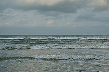
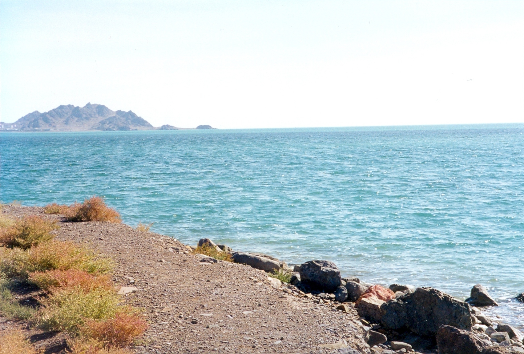
- Caspian Sea
-
Caspian Sea 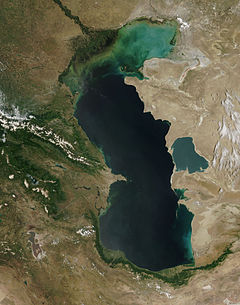
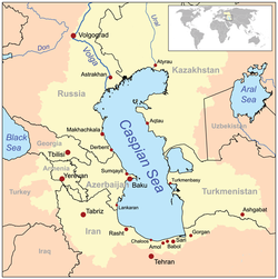
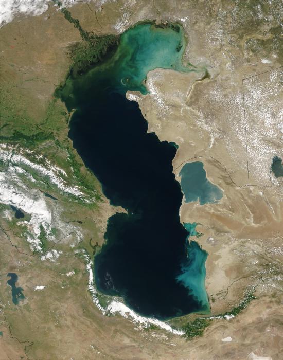
As captured by the MODIS on the orbiting Terra satellite Coordinates 41°40′N 50°40′E / 41.667°N 50.667°ECoordinates: 41°40′N 50°40′E / 41.667°N 50.667°E Lake type Endorheic, Saline, Permanent, Natural Primary inflows Volga River, Ural River, Kura River, Terek River Primary outflows Evaporation Catchment area 3,626,000 km2 (1,400,000 sq mi)[1] Basin countries Azerbaijan, Iran, Kazakhstan, Russia, Turkmenistan Max. length 1,030 km (640 mi) Max. width 435 km (270 mi) Surface area 371,000 km2 (143,200 sq mi) Average depth 187 m (610 ft) Max. depth 1,025 m (3,360 ft) Water volume 69,400 km3 (16,600 cu mi) Residence time 250 years Shore length1 7,000 km (4,300 mi) Surface elevation −28 m (−92 ft) Islands 26+ (see Island below) Settlements Baku (Azerbaijan), Rasht (Iran), Aktau (Kazakhstan), Makhachkala (Russia), Türkmenbaşy (Turkmenistan) (see article) References [1] 1 Shore length is not a well-defined measure. The Caspian Sea (Azerbaijani: Xəzər dənizi, Persian: دریای خزر, Russian: Каспийское море, Kazakh: Каспий теңізі, Turkmen: Hazar deňizi) is the largest enclosed body of water on Earth by area, variously classed as the world's largest lake or a full-fledged sea.[2][3] The sea has a surface area of 371,000 km2 (143,200 sq mi) (not including Garabogazköl Aylagy) and a volume of 78,200 km3 (18,800 cu mi).[4] It is in an endorheic basin (it has no outflows) and is bounded to the northwest by Russia, to the west by Azerbaijan, to the south by Iran, to the southeast by Turkmenistan, and to the northeast by Kazakhstan.
The ancient inhabitants of its littoral perceived the Caspian Sea as an ocean, probably because of its saltiness and seeming boundlessness. It has a salinity of approximately 1.2%, about a third the salinity of most seawater. The Caspian Sea has been called Gilan (دریای گیلان) on ancient maps. In Iran, it is referred to as Daryâ-ye Mazandaran (دریای مازندران), meaning "the Sea of Mazandaran" in Persian, and sometimes also as Daryâ-ye Khazar.[5]
Geological history
Like the Black Sea, the Caspian Sea is a remnant of the ancient Paratethys Sea. The Caspian Sea became landlocked about 5.5 million years ago due to tectonic uplift and a fall in sea level. During warm and dry climatic periods, the landlocked sea has all but dried up, depositing evaporitic sediments like halite that have become covered by wind-blown deposits and were sealed off as an evaporite sink[6] when cool, wet climates refilled the basin.[7] Due to the current inflow of fresh water, the Caspian Sea is a freshwater lake in its northern portions. It is more saline on the Iranian shore, where the catchment basin contributes little flow. Currently, the mean salinity of the Caspian is one third that of the Earth's oceans. The Garabogazköl embayment, which dried up when water flow from the main body of the Caspian was blocked in the 1980s but has since been restored, routinely exceeds oceanic salinity by a factor of 10.[8]
Geography
The Caspian Sea is the largest inland body of water in the world and accounts for 40 to 44 percent of the total lacustrine waters of the world.[9] The coastlines of the Caspian are shared by Azerbaijan, Iran, Kazakhstan, Russia, and Turkmenistan. The Caspian is divided into three distinct physical regions: the Northern, Middle, and Southern Caspian.[10] The North-Middle boundary is the Mangyshlak Threshold, which runs through Chechen Island and Cape Tiub-Karagan. The Middle-South boundary is the Apsheron Threshold, a sill of tectonic origin between the Eurasian continent and an oceanic remnant,[11] that runs through Zhiloi Island and Cape Kuuli.[12] The Garabogazköl bay is the saline eastern inlet of the Caspian, which is part of Turkmenistan and at times has been a lake in its own right due to the isthmus which cuts it off from the Caspian.
Divisions between the three regions are dramatic. The Northern Caspian only includes the Caspian shelf,[13] and is very shallow; it accounts for less than one percent of the total water volume with an average depth of only 5–6 metres (16–20 ft). The sea noticeably drops off towards the Middle Caspian, where the average depth is 190 metres (620 ft).[12] The Southern Caspian is the deepest, with oceanic depths of over 1,000 metres (3,300 ft). The Middle and Southern Caspian account for 33 percent and 66 percent of the total water volume, respectively.[10] The northern portion of the Caspian Sea typically freezes in the winter, and in the coldest winters, ice will form in the south.
Over 130 rivers provide inflow to the Caspian, with the Volga River being the largest. A second affluent, the Ural River, flows in from the north, and the Kura River flows into the sea from the west. In the past, the Amu Darya (Oxus) of Central Asia in the east often changed course to empty into the Caspian through a now-desiccated riverbed called the Uzboy River, as did the Syr Darya farther north. The Caspian also has several small islands; they are primarily located in the North and have a collective land area of roughly 2,000 km2 (770 sq mi). Adjacent to the North Caspian is the Caspian Depression, a low-lying region 27 metres (89 ft) below sea level. The Central Asian steppes stretch across the northeast coast, while the Caucasus mountains hug the Western shore. The biomes to both the north and east are characterized by cold, continental deserts. Conversely, the climate to the southwest and south are generally warm with uneven elevation due to a mix of highlands and mountain ranges; the drastic changes in climate alongside the Caspian have led to a great deal of biodiversity in the region.[8]
Fauna
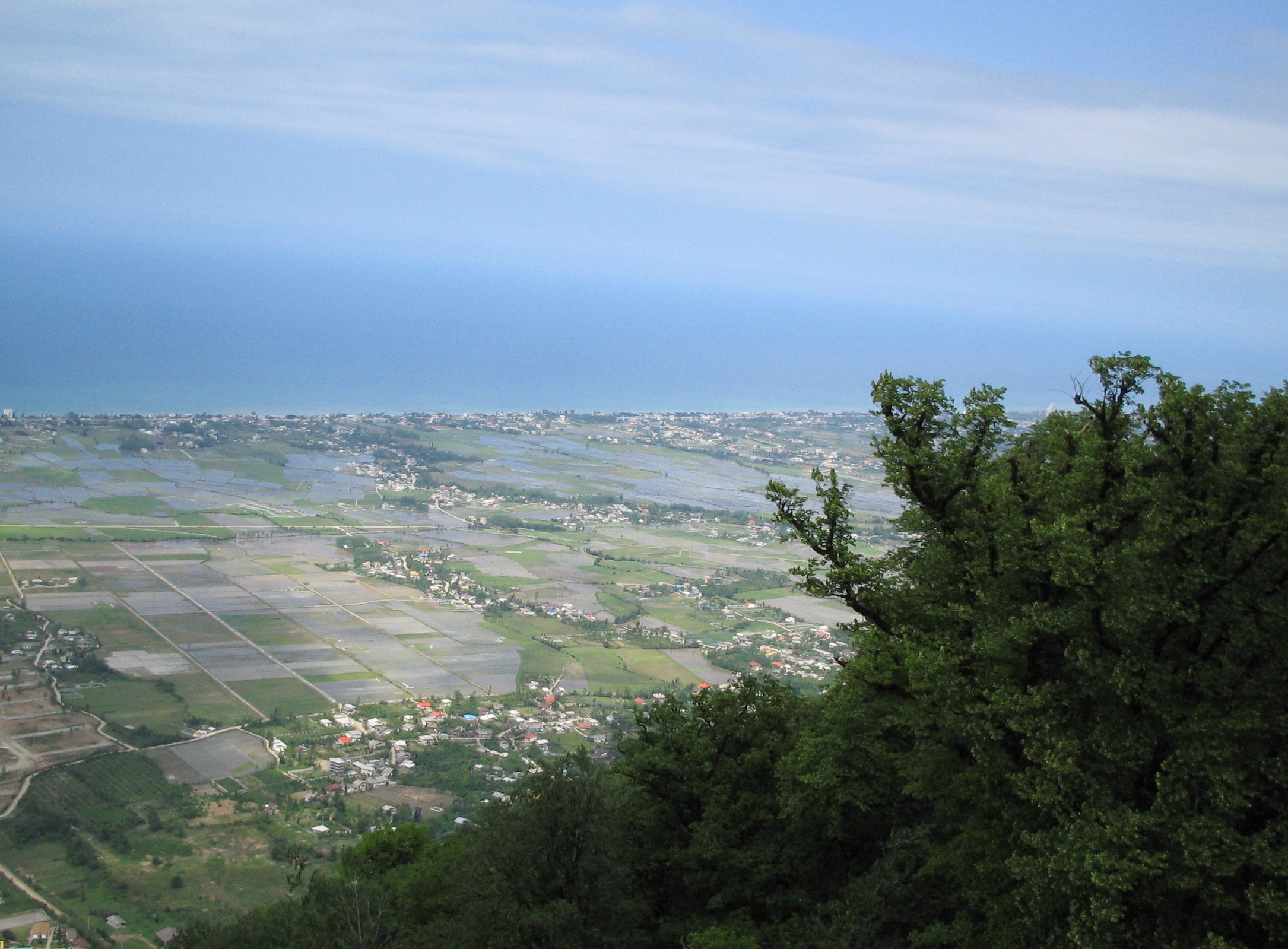
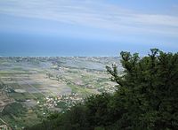 An aerial view of the southern Caspian coast as viewed from atop the Alborz mountains in Mazandaran, Iran
The Caspian Sea holds great numbers of sturgeon, which yield eggs that are processed into caviar. Overfishing has depleted a number of the historic fisheries including the economic exhaustion of the tuna fishery.[14] In recent years overfishing has threatened the sturgeon population to the point that environmentalists advocate banning sturgeon fishing completely until the population recovers. However, the high price of sturgeon caviar allows fisherman to afford bribes to ensure the authorities look the other way, making regulations in many locations ineffective.[15] Caviar harvesting further endangers the fish stocks, since it targets reproductive females. The Caspian Sea along with the Black Sea is also home to the native Zebra mussel, which has been accidentally introduced and become an invasive species in many countries. The native range of the Common Carp extends to the Caspian Sea as well as the Black Sea and Aral Sea. Like the Zebra mussel it also has become an invasive species where it has been introduced.
The Caspian seal (Phoca caspica, Pusa caspica in some sources), which is endemic to the Caspian Sea, is one of very few seal species that live in inland waters (see also Baikal seal, Saimaa Ringed Seal). The area has given its name to several species of birds, including the Caspian gull and the Caspian tern. There are several species and subspecies of fish endemic to the Caspian Sea, including the kutum (also known as Caspian white fish), Caspian Marine Shad, Caspian roach, Caspian bream (some report that the Bream occurring in the Aral Sea is the same subspecies), and a Caspian "salmon" (a subspecies of trout, Salmo trutta caspiensis). The "Caspian salmon" is critically endangered.[15]
Environmental issues
The Volga River, the largest in Europe, drains 20% of the European land area and is the source of 80% of the Caspian’s freshwater inflow. Its lower reaches are heavily developed with numerous unregulated releases of chemical and biological pollutants. Although existing data are sparse and of questionable quality, there is ample evidence to suggest that the Volga is one of the principal sources of transboundary contaminants into the Caspian. The magnitude of fossil fuel extraction and transport activity constitute risks to water quality. Underwater oil and gas pipelines have been constructed or proposed, increasing potential environmental threats.[16]
Hydrological characteristics
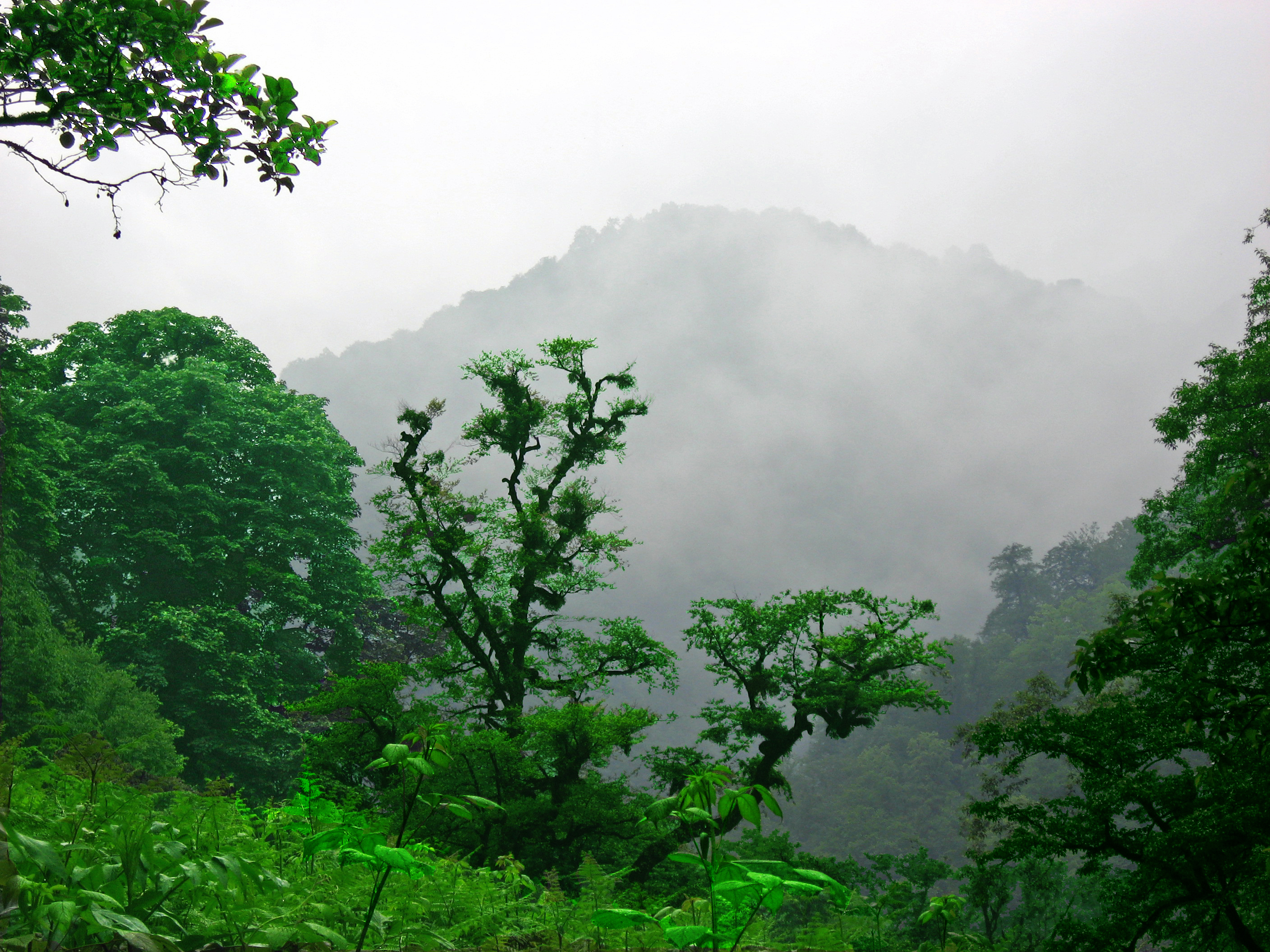
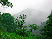 Iran's Northern Caspian Hyrcanian mixed forests is created by the moisture captured from the Caspian sea and the Alborz mountain range of Iran, Gilan.
The Caspian has characteristics common to both seas and lakes. It is often listed as the world's largest lake, although it is not a freshwater lake. The Caspian became landlocked about 5.5 million years ago due to plate tectonics.[9] The Volga River (about 80% of the inflow) and the Ural River discharge into the Caspian Sea, but it has no natural outflow other than by evaporation. Thus the Caspian ecosystem is a closed basin, with its own sea level history that is independent of the eustatic level of the world's oceans. The level of the Caspian has fallen and risen, often rapidly, many times over the centuries. Some Russian historians[who?] claim that a medieval rising of the Caspian, perhaps caused by the Amu Darya changing its inflow to the Caspian from the 13th century to the 16th century, caused the coastal towns of Khazaria, such as Atil, to flood. In 2004, the water level was -28 metres, or 28 metres (92 ft) below sea level.
Over the centuries, Caspian Sea levels have changed in synchronicity with the estimated discharge of the Volga, which in turn depends on rainfall levels in its vast catchment basin. Precipitation is related to variations in the amount of North Atlantic depressions that reach the interior, and they in turn are affected by cycles of the North Atlantic Oscillation. Thus levels in the Caspian sea relate to atmospheric conditions in the North Atlantic thousands of miles to the northwest. These factors make the Caspian Sea a valuable place to study the causes and effects of global climate change.[citation needed]
The last short-term sea-level cycle started with a sea-level fall of 3 m (9.84 ft) from 1929 to 1977, followed by a rise of 3 m (9.84 ft) from 1977 until 1995. Since then smaller oscillations have taken place.[17][dead link]
Human history
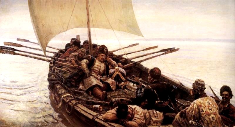
 The 17th-century cossack rebel and pirate Stenka Razin, on a raid in the Caspian (Vasily Surikov, 1906).
The earliest human remains around Caspian are from Dmanisi dating back to around 1.8 ma and yielded a number of skeletal remains of Homo erectus or ergaster. More later evidence for human occupation of the region come from a number of caves in Georgia and Azerbaijan such as Kudaro and Azykh Caves. There is evidence for Lower Palaeolithic human occupation at south of Caspian from western Alburz. These are Ganj Par and Darband Cave sites. Neanderthal remains also have been discovered at a cave site in Georgia. Discoveries in the Huto cave and the adjacent Kamarband cave, near the town of Behshahr, Mazandaran south of the Caspian in Iran, suggest human habitation of the area as early as 11,000 years ago.[18][19]
Etymology
The word Caspian is derived from the name of the Caspi (Persian: کاسپی), an ancient people that lived to the south west of the sea in Transcaucasia.[20] Strabo wrote that "to the country of the Albanians belongs also the territory called Caspiane, which was named after the Caspian tribe, as was also the sea; but the tribe has now disappeared".[21] Moreover, the Caspian Gates, which is the name of a region in Tehran province of Iran, is another possible piece of evidence that they migrated to the south of the sea. The Iranian city Qazvin shares the root of its name with that of the sea. In fact, the traditional Islamic name for the sea itself is, Bahr al-Qazwin (Sea of Qazvin).[22]
According to Indian Hindu beliefs, the name 'Caspian' is supposed to have been derived from the Sanskrit word 'Kashyapa' the name of an ancient Indian Sage.[23][24][25]
In classical antiquity among Greeks and Persians it was called the Hyrcanian Ocean.[26] In Persian antiquity, as well as in modern Iran, it is known as the mazandaran sea (Persian: مازندران). Among Indians it was called Kashyap Sagar. In Turkic speaking countries it is known as the Khazar Sea. Old Russian sources call it the Khvalyn (Khvalynian) Sea (Хвалынское море /Хвалисское море) after the Khvalis, inhabitants of Khwarezmia. Ancient Arabic sources refer to as Baḥr Gilan (Arabic: بحر جیلان - the Caspian/Gilan Sea).
Turkic languages use a consistent nomenclature that is different from the Indo-European languages above. For instance, in Turkmen, the name is Hazar deňizi, in Azeri, it's Xəzər dənizi, and in modern Turkish, it's Hazar denizi. In all these cases, the second word simply means "sea", and the first word refers to the historical Khazars who had a large empire based to the North of the Caspian Sea between the 7th and 10th centuries.
Cities near the Caspian Sea
Historic cities by the sea include
- Hyrcania, ancient state in the north of Iran
- Tamisheh, Mazandaran province of Iran
- Anzali, Gilan province of Iran
- Astara, Gilan province of Iran
- Atil, Khazaria
- Khazaran
- Baku, Azerbaijan
- Derbent, Dagestan, Russia
Modern cities

 Caspian Sea shore, Türkmenbaşy, Turkmenistan.
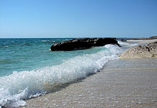 Caspian Sea near Aktau, Mangistau region, Kazakhstan
Major cities by the Caspian Sea:
 Caspian Sea shore, near Bandar Anzali, Iran
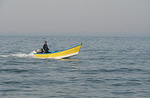 Caspian Sea Babolsar, Iran
- Iran
- Ali Abad
- Amol
- Astaneh-ye Ashrafiyeh
- Astara
- Babol
- Babolsar
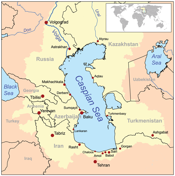
 Map of the Caspian Sea, yellow shading indicates Caspian drainage basin. (Since this map was drawn, the adjacent Aral Sea has greatly decreased in size.)
 - Bandar Anzali
- Bandar-e-gaz
- Bandar Torkaman
- Behshahr
- Chaloos
- Fenderesk
- Ghaem Shahr
- Gonbad-e Kavus
- Gorgan
- Jooybar
- Kordkuy
- Lahijan
- Langrud
- Mahmood Abad
- Neka
- Nowshahr
- Nur
- Ramsar
- Rasht
- Rudbar
- Rudsar
- Sari
- Tonekabon
- Kazakhstan
- Atyrau (formerly Guriev)
- Aqtau (formerly Shevchenko)
- Russia
- Turkmenistan
- Türkmenbaşy (formerly Krasnovodsk)
- Hazar (formerly Çeleken)
- Esenguly
- Garabogaz (formerly Bekdaş)
Islands
 Caspian Hyrcanian mixed forests, Northern Iran and Southern Azerbaijan
The Caspian Sea has numerous islands throughout, all of them near the coasts. There are none in deeper parts of the Sea. Ogurja Ada is the largest island. The island is 37 km long, with gazelles roaming freely in it.
In the North Caspian, the majority of the islands are small and uninhabited, like the Tyuleniy Archipelago, an Important Bird Area (IBA), although some of them do have human settlers.
Many of the islands nearby the Azerbaijan coast hold significant geopolitical and economic importance due to their oil reserves. Bulla Island is off the coast of Azerbaijan, and holds tremendous oil reserves. Pirallahı Island, off the Azerbaijani coast as well, also possesses oil reserves; it was one of the first places in Azerbaijan found to have oil, and was the first place in the Caspian Sea to have sectional drilling done. Nargin was used as a former Soviet base and is the largest island in the Baku bay. Ashuradeh is situated on the easternmost end of Miankaleh peninsula to the north east of Gorgan Bay, near the Iranian coast. It was separated from the peninsula after islanders created a channel.
Various islands, particularly around Azerbaijan, have suffered extensive environmental damage due to oil production. Vulf, for example, suffered severe ecological damage from oil production in the neighboring islands, although Caspian seals and various species of marine birds continue to be found.
Hydrocarbon resources
Historical development
The Caspian area is rich in energy resources. Wells were being dug in the region as early as the 10th century.[27] By the 16th century, Europeans were aware of the rich oil and gas deposits around the area. English traders Thomas Bannister and Jeffrey Duckett described the area around Baku as “a strange thing to behold, for there issueth out of the ground a marvelous quantity of oil, which serveth all the country to burn in their houses. This oil is black and is called nefte. There is also by the town of Baku, another kind of oil which is white and very precious (i.e., petroleum)."[28]
The world’s first offshore wells and machine-drilled wells were made in Bibi-Heybat Bay, near Baku, Azerbaijan. In 1873, exploration and development of oil began in some of the largest fields known to exist in the world at that time on the Absheron peninsula near the villages of Balakhanli, Sabunchi, Ramana and Bibi Heybat. Total recoverable reserves were more than 500 million tons. By 1900, Baku had more than 3,000 oil wells, 2,000 of which were producing at industrial levels. By the end of the 19th century, Baku became known as the "black gold capital", and many skilled workers and specialists flocked to the city.
By the turn of the 20th century, Baku was the center of international oil industry. In 1920, when the Bolsheviks captured Azerbaijan, all private property - including oil wells and factories - was confiscated. Afterwards, the republic's entire oil industry came under the control of the Soviet Union. By 1941, Azerbaijan was producing a record 23.5 million tons of oil, and the Baku region supplied nearly 72% of all oil extracted in the entire USSR.[27]
In 1994, the "Contract of the Century" was signed, signaling the start of major international development of the Baku oil fields. The Baku–Tbilisi–Ceyhan pipeline, a major pipeline allowing Azerbaijan oil to flow straight to the Turkish Mediterranean port of Ceyhan, opened in 2006.
Current concerns
The oil in the Caspian basin is estimated to be worth over US $12 trillion. The sudden collapse of the USSR and subsequent opening of the region has led to an intense investment and development scramble by international oil companies. In 1998 Dick Cheney commented that "I can't think of a time when we've had a region emerge as suddenly to become as strategically significant as the Caspian."[29]
A key problem to further development in the region is the status of the Caspian Sea and the establishment of the water boundaries among the five littoral states (see below). The current disputes along Azerbaijan's maritime borders with Turkmenistan and Iran could potentially affect future development plans.
Much controversy currently exists over the proposed Trans-Caspian oil and gas pipelines. These projects would allow western markets easier access to Kazakh oil, and potentially Uzbek and Turkmen gas as well. The United States has given its support for the pipelines. Russia officially opposes the project on environmental grounds. Analysts note that the pipelines would bypass Russia completely, thereby denying the country valuable transit fees, as well as destroying its current monopoly on westward-bound hydrocarbon exports from the region.[30] Recently both Kazakhstan and Turkmenistan have expressed their support for the Trans-Caspian Pipeline.[31]
Existing and proposed canals
Although the Caspian Sea is endorheic, its main tributary, Volga, is connected by important shipping canals with the Don River (and thus the Black Sea) and with the Baltic Sea, with branch canals to Northern Dvina and to the White Sea.
Another Caspian tributary, the Kuma River, is connected by an irrigation canal with the Don basin as well.
Canals proposed in the past
The Main Turkmen Canal, construction of which was started in 1950, would run from Nukus on the Amu-Darya to Krasnovodsk on the Caspian Sea. It would be used not only for irrigation, but also for shipping, connecting the Amu-Darya and the Aral Sea with the Caspian. The project was abandoned soon after the death of Joseph Stalin, in favor of the Qaraqum Canal, which runs on a more southerly route and does not reach the Caspian.[32]
Since the 1930s through the 1980s, the projects for a Pechora-Kama Canal were widely discussed, and some construction experiments using nuclear explosions were conducted in 1971. For this project, shipping was a secondary consideration; the main goal was to redirect some of the water of the Pechora River (which flows into the Arctic Ocean) via the Kama into the Volga. The goals were both irrigation and stabilizing the water level in the Caspian, which was thought to be falling dangerously fast at the time.
Eurasia Canal
In June 2007, in order to boost his oil-rich country's access to markets, Kazakhstan's President Nursultan Nazarbaev proposed a 700 km link between the Caspian and Black seas. It is hoped that the "Eurasia Canal" (Manych Ship Canal) ) would transform the landlocked Kazakhstan and other Central Asian countries into maritime states, enabling them to significantly increase trade volume. While the canal would traverse Russian territory, it would benefit Kazakhstan through its Caspian Sea ports. The most likely route for the canal, the officials at the Committee on Water Resources at Kazakhstan's Agriculture Ministry say, would follow the Kuma-Manych Depression, where currently a chain of rivers and lakes is already connected by an irrigation canal (Kuma-Manych Canal). Upgrading the Volga–Don Canal would be another option.[33]
International disputes
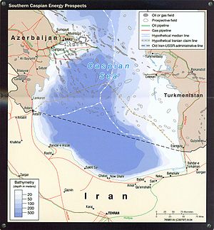 Southern Caspian Energy Prospects (portion of Iran). Country Profile 2004.
Negotiations related to the demarcation of the Caspian Sea have been going on for nearly a decade among the states bordering the Caspian - Azerbaijan, Russia, Kazakhstan, Turkmenistan and Iran.
The status of the Caspian Sea[34] is the key problem. There are three major considerations affected by the Caspian Sea status: access to mineral resources (oil and natural gas), access for fishing and access to international waters (through Russia's Volga river and the canals connecting it to the Black Sea and Baltic Sea). Access to the Volga River is particularly important for the landlocked states of Azerbaijan, Kazakhstan and Turkmenistan. This matter is of course sensitive to Russia, because this potential traffic will move through its territory (albeit onto the inland waterways). If a body of water is labeled as Sea then there would be some precedents and international treaties obliging the granting of access permits to foreign vessels. If a body of water is labeled merely as lake then there are no such obligations. Environmental issues are also somewhat connected to the status and borders issue.
It should be mentioned that Russia got the bulk of the former Soviet Caspian military fleet (and also currently has the most powerful military presence in the Caspian Sea). Some assets were assigned to Azerbaijan. Kazakhstan and especially Turkmenistan got a very small share because they lack major port cities.
According to a treaty signed between Iran (Persia) and the Soviet Union, the Caspian Sea is technically a lake and it is to be divided into two sectors (Persian and Soviet), but the resources (then mainly fish) would be commonly shared. The line between the two sectors was to be seen as an international border in a common lake, like Lake Albert. Also the Soviet sector was sub-divided into administrative sectors of the four littoral republics.
After the dissolution of the Soviet Union not all of the newly independent states assumed continuation of the old treaty. At first Russia and Iran announced that they would continue to adhere to the old treaty.
After the old Soviet Union split into fifteen nations, including Caspian Sea neighbors Azerbaijan, Turkmenistan and Kazakhstan, Iran has called for an equal division of the Caspian Sea among the five countries: Iran, Azerbaijan, Turkmenistan, Kazakhstan, and Russia. If this division does not come to pass, then Iran intends to recognize only its old treaty (between Iran and Russia) and will challenge Russia to divide its 50% share among the three littoral states - Azerbaijan, Turkmenistan and Kazakhstan - over a more friendly position toward the West and the U.S, such as opening of U.S interest section in Tehran.[citation needed]
Kazakhstan, Azerbaijan and Turkmenistan announced that they do not consider themselves parties to this treaty.
Later[clarification needed] followed some proposals for common agreement between all littoral states about the status of the sea:
- Azerbaijan, Kazakhstan and Turkmenistan insisted that the sectors should be based on the median line, thus giving each state a share proportional to its Caspian coastline length. Also the sectors would form part of the sovereign territory of the particular state (thus making them international borders and also allowing each state to deal with all resources within its sector as it wishes unilaterally).
- Iran insisted that the sectors should be such that each state gets a 1/5 share of the whole Caspian Sea. This was advantageous to Iran, because it has a proportionally smaller coastline.
- Russia proposed a somewhat compromising solution: the seabed (and thus mineral resources) to be divided along sectoral lines (along the two above-described variants), the surface (and thus fishing rights) to be shared between all states (with the following variations: the whole surface to be commonly shared; each state to receive an exclusive zone and one single common zone in the center to be shared. The second variant is deemed not practical, because of the small size of the whole sea).[citation needed]
Current situation
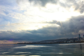 Caspian sea, Azerbaijan
Russia, Kazakhstan and Azerbaijan have agreed to a solution about their sectors. There are no problems between Kazakhstan and Turkmenistan, but the latter is not actively participating, so there is no agreement either. Azerbaijan is at odds with Iran over some oil fields that the both states claim. There have been occasions where Iranian patrol boats have opened fire at vessels sent by Azerbaijan for exploration into the disputed region. There are similar tensions between Azerbaijan and Turkmenistan (the latter claims that the former has pumped more oil than agreed from a field, recognized by both parties as shared). Less acute are the issues between Turkmenistan and Iran. Regardless, the southern part of the sea remains disputed.
- Russia and Kazakhstan signed a treaty, according to which, they divide the northern part of the Caspian Sea between them into two sectors along the median line. Each sector is an exclusive zone of its state. Thus all resources, seabed and surface are exclusive to the particular state.
- Russia and Azerbaijan signed a similar treaty regarding their common border.
- Kazakhstan and Azerbaijan signed a similar treaty regarding their common border.
- Iran does not recognize the bilateral agreements between the other littoral states. Iran continues to insist on a single multilateral agreement between all five littoral states (as the only way to achieve 1/5-th share).
- The position of Turkmenistan is unclear.
After Russia adopted the median line sectoral division and the three treaties already signed between some littoral states this is looking like the realistic method for regulating the Caspian borders. The Russian sector is fully defined. The Kazakhstan sector is not fully defined, but is not disputed either. Azerbaijan's, Turkmenistan's and Iran's sectors are not fully defined. It is not clear if the issue of Volga-access to vessels from Azerbaijan and Kazakhstan is covered by their agreements with Russia and also what the conditions are for Volga-access for vessels from Turkmenistan and Iran.[citation needed]
The Caspian littoral States meeting in 2007 signed an agreement that bars any ship not flying the national flag of a littoral state from entering Caspian waters.[35]
Transport
Several scheduled ferry services (including train ferries) operate on the Caspian Sea, including:
- a line between Türkmenbaşy, Turkmenistan (formerly Krasnovodsk) and Baku.
- a line between Baku and Aktau.
- several lines between cities in Iran and Russia.
See also
- Baku Oil Fields
- Caspian people
- Ekranoplan, a plane dubbed the "Caspian Sea Monster"
- Framework Convention for the Protection of the Marine Environment of the Caspian Sea
- Shah Deniz gas field
- Tengiz Field
Notes
- ^ a b van der Leeden, Troise, and Todd, eds., The Water Encyclopedia. Second Edition. Chelsea, MI: Lewis Publishers, 1990, page 196.
- ^ "Caspian Sea » General background". CaspianEnvironment.org. http://www.caspianenvironment.org/caspian.htm. Retrieved 2007-05-25.
- ^ "ESA: Observing the Earth - Earth from Space: The southern Caspian Sea". ESA.int. http://www.esa.int/esaEO/SEM5GYTLWFE_index_0.html. Retrieved 2007-05-25.
- ^ Lake Profile: Caspian Sea. LakeNet.
- ^ Drainage Basins - Caspian Sea
- ^ In system dynamics, a sink is a place where a flow of materials ends its journey, removed from the system.
- ^ Comparable evaporite beds underlie the Mediterranean.
- ^ a b "General background of the Caspian Sea". Caspian Environment Program. Retrieved 29-01-2008.
- ^ a b "Caspian Sea". Iran Gazette. http://www.irangazette.com/12.html. Retrieved 2010-05-17.[dead link]
- ^ a b Amirahmadi, Hooshang. The Caspian Region at a Crossroad: Challenges of a New Frontier of Energy and Development (Hardcover). Page 112. St. Martin's Press. Retrieved 28-01-2008.
- ^ Khain V. E. Gadjiev A. N. Kengerli T. N, "Tectonic origin of the Apsheron Threshold in the Caspian Sea" Doklady Earth Sciences 414.4 (June 2007:552-556).
- ^ a b Dumont, Henri J. et al. Aquatic Invasions in the Black, Caspian, and Mediterranean Seas (Nato Science Series). Kluwer Academic Publishers. Retrieved 28-01-2008.
- ^ Kostianoy, Andrey and Aleksey N. Kosarev. The Caspian Sea Environment (Hardcover). Springer. Retrieved 28-01-2008.
- ^ C.Michael Hogan Overfishing. Encyclopedia of Earth. eds. Sidney Draggan and Cutler Cleveland]. National council for Science and the Environment, Washington DC
- ^ a b iran-daily.com[dead link]
- ^ Caspian Environment Programme http://www.caspianenvironment.org/newsite/Caspian-EnvironmentalIssues.htm
- ^ "Welcome to the Caspian Sea Level Project Site". Caspage.citg.tudelft.nl. http://www.caspage.citg.tudelft.nl/project.html. Retrieved 2010-05-17.
- ^ Iranair.com - "Major Monuments"
- ^ [1][dead link]
- ^ Caspian Sea. (2006). In Encyclopædia Britannica. Retrieved August 13, 2006, from Encyclopædia Britannica Premium Service: http://www.britannica.com/eb/article-9110540
- ^ "Strabo. Geography. 11.3.1". Perseus.tufts.edu. http://www.perseus.tufts.edu/hopper/text?doc=Perseus:text:1999.01.0198:book=11:chapter=4&highlight=caspiane. Retrieved 2011-04-14.
- ^ Iran (5th ed., 2008), by Andrew Burke and Mark Elliott, p. 28, Lonely Planet Publications, ISBN 9781741042931
- ^ "Indian History". Indiafirstfoundation.org. http://www.indiafirstfoundation.org/glimpses%20of%20indian%20history/Articles/Didyouknow_m.htm. Retrieved 2010-05-17.
- ^ "India-The mother of western civilisation". Organiser.org. http://www.organiser.org/dynamic/modules.php?name=Content&pa=showpage&pid=45&page=20. Retrieved 2010-05-17.
- ^ "Article on Hinduism". Trsiyengar.com. http://www.trsiyengar.com/id94.shtml. Retrieved 2010-05-17.
- ^ www.livius.org - Hyrcania
- ^ a b The Development of the Oil and Gas Industry in Azerbaijan SOCAR
- ^ Back to the Future: Britain, Baku Oil and the Cycle of History SOCAR
- ^ The Great Gas Game Christian Science Monitor (October 25, 2001)
- ^ Russia Tries to Scuttle Proposed Trans-Caspian Pipeline Eurasianet
- ^ Russia Seeking To Keep Kazakhstan Happy Eurasianet
- ^ Nikolaĭ Gavrilovich Kharin, "Vegetation Degradation in Central Asia Under the Impact of Human Activities". Pp. 56-58. Springer, 2002. ISBN 1402003978. On Google Books
- ^ Caspian Canal Could Boost Kazakh Trade Business Week, July 9, 2007.
- ^ "8.3 The Status of the Caspian Sea - Dividing Natural Resources Between Five Countries - Khoshbakht B.Yusifzade". Azer.com. http://www.azer.com/aiweb/categories/magazine/83_folder/83_articles/83_yusifzade.html. Retrieved 2010-05-17.
- ^ Russia Gets Way In Caspian Meet[dead link]
References
- Gurbanov, Turab. Le pétrole de la Caspienne et la politique extérieure de l'Azerbaïdjan: tome 1- Questions économiques et juridiques, l’Harmattan, 2007, 304 pages.
- Gurbanov, Turab. Le pétrole de la Caspienne et la politique extérieure de l'Azerbaïdjan: tome 2- Questions géopolitiques, l’Harmattan, 2007, 297 pages.
- Author=Shiryayev, Boris|Title=Großmaechte auf dem Weg zur neuen Konfrontation?. Das „Great Game“ am Kaspischen Meer: eine Untersuchung der neuen Konfliktlage am Beispiel Kasachstan|Publisher=Verlag Dr. Kovac|Place=Hamburg|Year=2008
External links
- [2]
- Caspian Sea Region
- Caspian Environment Programme
- Target: Caspian Sea Oil John Robb, 2004
- Dating Caspian sea level changes
- Caspian Sea Is Dying
Ashuradeh • Baku Archipelago • Batkachnyy Island • Blinov Island • Bolshiye Peshnyye Islands • Bolshoy Setnoy Island • Boyuk Zira • Bulla Island • Chechen Island • Chikil • Chilov • Chistoy Banki • Durneva Island • Gil Island • Malyy Zhemchuzhnyy • Morskaya Chapura • Morskoy Biryuchek • Morskoy Ivan-Karaul • Nargin • Nizhniy Oseredok Island • Nordovyy • Ogurja Ada / Ogurchinskiy Island • Osushnoy • Pirallahı Island • Qara Su • Qum Island • Sedmoy • Spirkin Oseredok Island • Svinoy • Tyuleniy Archipelago • Tyuleniy Island • Verkhniy Oseredok Island • Vulf • Zenbil • Zhanbay Island • Zyudev Island Lakes of Kazakhstan
 Russia topics
History - Timeline
- Proto-Indo-Europeans
- Scythians
- Bosporan Kingdom
- Khazaria
- East Slavs
- Rus' Khaganate
- Kievan Rus'
- Novgorod Republic
- Vladimir-Suzdal
- Mongol invasion of Rus'
- Tatar invasions
- Volga Bulgaria
- Golden Horde
- Grand Duchy of Moscow
- Tsardom of Russia
- Russian Empire
- World War I
- Russian Revolution (1917)
- Russian Civil War
- Russian SFSR
- Soviet Union
- World War II
- Cold War
- Soviet war in Afghanistan
- Russian Federation
- Military history
- Postal history

Geography Governance Politics Economy Demographics - Russians
- Public holidays
- Languages
- Religion
- Crime
- 2002 Census
- 2010 Census
- Famous Russians
Culture - Architecture
- Literature
- Ballet
- Avant-garde
- Cinema
- Material culture
- Music (Opera)
- Language
- Cuisine
- Martial arts
- Folklore
- Russian Internet
- Sports
Symbols Categories:- Caspian Sea
- Lowest points
- Azerbaijan–Iran border
- Iran–Turkmenistan border
- Kazakhstan–Turkmenistan border
- Kazakhstan–Russia border
- Azerbaijan–Russia border
- Iran–Soviet Union relations
- International lakes of Asia
- International lakes of Europe
- Disputed territories in Asia
- Border tripoints


Wikimedia Foundation. 2010.