- Makhachkala
-
Makhachkala (English)
Махачкала (Russian)
МахIачхъала (Avar)
Магьачкъала (Kumyk)- City[citation needed] - 
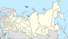
Location of the Republic of Dagestan in Russia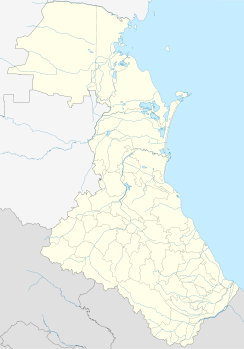
 Makhachkala
Coordinates: 42°58′N 47°30′E / 42.967°N 47.5°ECoordinates: 42°58′N 47°30′E / 42.967°N 47.5°E 

Coat of arms Flag Administrative status Country Russia Federal subject Republic of Dagestan Capital of Republic of Dagestan[citation needed] Municipal status Urban okrug Makhachkala Urban Okrug[citation needed] City Head[citation needed] Said Amirov[citation needed] Representative body Assembly of Deputies[citation needed] Statistics Area 466.3 km2 (180.0 sq mi)[citation needed] Population (2010 Census,
preliminary)577,990 inhabitants[1] - Rank in 2010 26th Population (2002 Census) 462,412 inhabitants[2] - Rank in 2002 37th Density 1,240 /km2 (3,200 /sq mi)[3] Time zone MSD (UTC+04:00)[4] Founded 15th century[citation needed] Previous names Petrovskoye (until 1857),[citation needed]
Petrovsk-Port (until 1921)[citation needed]Dialing code(s) +7 8722[citation needed] Official website Makhachkala (Russian: Махачкала́; Avar: МахIачхъала; Lezgian: Магьачкъала; Kumyk: Магьачкъала, Mağaçqala) is the capital city of the Republic of Dagestan, Russia. It is located on the western shore of the Caspian Sea. According to the preliminary results of the 2010 Census, the city had a population of 577,990.[1]
Contents
History
Makhachkala's historic predecessor was the town of Tarki, now a near suburb, whose history goes back to the 15th century and possibly much earlier. The modern city of Makhachkala was founded in 1844 as a fortress; town status was granted in 1857. The original Russian name of the city was Petrovskoye (Петро́вское)—after the Russian tsar Peter the Great who visited the region in 1722. However, among the locals it was known as Anzhi-Qala (A Fortress of Soil, Qala or Kala قلعه means Fortress in Arabic and Turkic). The city was renamed Petrovsk-Port (Петро́вск-Порт) in 1857, sometimes simply Petrovsk, and then Makhachkala in 1921. The city incurred major damage during the earthquake of May 14, 1970. It was shortly renamed as Shamilkala in 1920s.
In January 1919, during the Russian Civil War, the British based No. 221 Squadron Royal Air Force at Petrovsk. In March they were joined by No. 266 Squadron and both squadrons were involved in bombing operations against Bolshevik forces in Astrakhan and elsewhere. In August 1919 both squadrons were withdrawn from Petrovsk.[5]
City districts
Administratively, the city is divided into three city districts: Kirovsky, Leninsky, and Sovetsky.
Demographics
 The parliament of Dagestan in Makhachkala
 The grand mosque in Makhachkala
 Beach in Makhachkala
The population of Makhachkala included: [1]
- Avars (21%)
- Russians (18%)
- Kumyks (15%)
- Dargins (12.4%)
- Laks (12%)
- Lezgins (9.5%)
- Chechens (4.3%)
- Azeri (1.6%)
Transportation
The city is served by Uytash Airport, Russian Railways and Caspian Sea International Port.
Sport
The city's football team, FC Anzhi Makhachkala, play in the Russian Premier League.
Climate
Climate of Makhachkala has elements of (warm) subtropical and (chill) continental climate, with influence of semi-arid climate (Köppen climate classification: BSk) - which occurs in the entire basin of the Caspian Sea.
Climate data for Makhachkala Month Jan Feb Mar Apr May Jun Jul Aug Sep Oct Nov Dec Year Average high °C (°F) 3.2
(37.8)3.5
(38.3)7.2
(45.0)14.1
(57.4)20.7
(69.3)25.7
(78.3)28.5
(83.3)27.6
(81.7)23.3
(73.9)16.6
(61.9)11.0
(51.8)6.1
(43.0)15.63 Daily mean °C (°F) 0.6
(33.1)1.1
(34.0)4.5
(40.1)10.7
(51.3)17.0
(62.6)22.0
(71.6)25.0
(77.0)24.1
(75.4)19.9
(67.8)13.5
(56.3)8.3
(46.9)3.6
(38.5)12.53 Average low °C (°F) −2.1
(28.2)−1.4
(29.5)1.7
(35.1)7.3
(45.1)13.3
(55.9)18.3
(64.9)21.4
(70.5)20.5
(68.9)16.5
(61.7)10.3
(50.5)5.6
(42.1)1.0
(33.8)9.37 Precipitation mm (inches) 24
(0.94)31
(1.22)22
(0.87)19
(0.75)24
(0.94)24
(0.94)25
(0.98)23
(0.91)36
(1.42)44
(1.73)27
(1.06)29
(1.14)328
(12.91)Avg. precipitation days 6 6 5 4 4 5 4 4 5 5 5 6 59 Sunshine hours 74.4 72.5 105.4 171.0 244.9 279.0 282.1 269.7 195.0 151.9 81.0 68.2 1,995.1 Source: World Meteorological Organization (UN),[6] Hong Kong Observatory[7] for data of sunshine hours International relations
Main article: List of twin towns and sister cities in RussiaTwin towns/sister cities
Makhachkala is twinned with:
References
- ^ a b Федеральная служба государственной статистики (Federal State Statistics Service) (2011). "Предварительные итоги Всероссийской переписи населения 2010 года (Preliminary results of the 2010 All-Russian Population Census)" (in Russian). Всероссийская перепись населения 2010 года (All-Russia Population Census of 2010). Federal State Statistics Service. http://www.perepis-2010.ru/results_of_the_census/results-inform.php. Retrieved 2011-04-25.
- ^ Федеральная служба государственной статистики (Federal State Statistics Service) (2004-05-21). "Численность населения России, субъектов Российской Федерации в составе федеральных округов, районов, городских поселений, сельских населённых пунктов – районных центров и сельских населённых пунктов с населением 3 тысячи и более человек (Population of Russia, its federal districts, federal subjects, districts, urban localities, rural localities—administrative centers, and rural localities with population of over 3,000)" (in Russian). Всероссийская перепись населения 2002 года (All-Russia Population Census of 2002). Federal State Statistics Service. http://www.perepis2002.ru/ct/doc/1_TOM_01_04.xls. Retrieved 2010-03-23.
- ^ The value of density was calculated automatically by dividing the 2010 Census population by the area specified in the infobox. Please note that this value may not be accurate as the area specified in the infobox does not necessarily correspond to the area of the entity proper or is reported for the same year as the population.
- ^ Правительство Российской Федерации. Постановление №725 от 31 августа 2011 г. «О составе территорий, образующих каждую часовую зону, и порядке исчисления времени в часовых зонах, а также о признании утратившими силу отдельных Постановлений Правительства Российской Федерации». Вступил в силу по истечении 7 дней после дня официального опубликования. Опубликован: "Российская Газета", №197, 6 сентября 2011 г. (Government of the Russian Federation. Resolution #725 of August 31, 2011 On the Composition of the Territories Included into Each Time Zone and on the Procedures of Timekeeping in the Time Zones, as Well as on Abrogation of Several Resolutions of the Government of the Russian Federation. Effective as of after 7 days following the day of the official publication).
- ^ Bowyer, Chaz (1988). RAF Operations 1918-1938. London: William Kimber. pp. 40, 41. ISBN 0718306716.
- ^ "Weather Information for Mahackala". http://www.worldweather.org/107/c01038.htm.
- ^ "Climatological Information for Mahackala, Russia". http://www.weather.gov.hk/wxinfo/climat/world/eng/europe/russia/mahackala_e.htm.
See also
Administrative divisions of the Republic of Dagestan Capital: Makhachkala 
Cities and towns Buynaksk · Dagestanskiye Ogni · Derbent · Izberbash · Kaspiysk · Khasavyurt · Kizilyurt · Kizlyar · Yuzhno-Sukhokumsk
Administrative districts Agulsky · Akhtynsky · Akhvakhsky · Akushinsky · Babayurtovsky · Botlikhsky · Buynaksky · Charodinsky · Dakhadayevsky · Derbentsky · Dokuzparinsky · Gergebilsky · Gumbetovsky · Gunibsky · Karabudakhkentsky · Kayakentsky · Kaytagsky · Kazbekovsky · Khasavyurtovsky · Khivsky · Khunzakhsky · Kizilyurtovsky · Kizlyarsky · Kulinsky · Kumtorkalinsky · Kurakhsky · Laksky · Levashinsky · Magaramkentsky · Nogaysky · Novolaksky · Rutulsky · Sergokalinsky · Shamilsky · Suleyman-Stalsky · Tabasaransky · Tarumovsky · Tlyaratinsky · Tsumadinsky · Tsuntinsky · UntsukulskyCapitals of the Republics of Russia Categories:- Capitals of republics of Russia
- Makhachkala
- Populated places established in 1844


Wikimedia Foundation. 2010.