- Lake Markakol
-
Lake Markakol
Маркаколь көлі

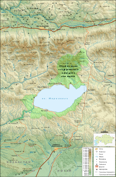
Map of the area Coordinates 48°45′N 85°45′E / 48.75°N 85.75°ECoordinates: 48°45′N 85°45′E / 48.75°N 85.75°E Primary outflows Kaldzhir River Basin countries Kazakhstan Max. length 19 km Max. width 38 km Surface area 455 km² Average depth 14 m Max. depth 30 m Shore length1 ~ 100 km Surface elevation 1447 m 1 Shore length is not a well-defined measure. Lake Markakol (Kazakh: Маркаколь көлі, Russian: озеро Маркаколь) is a lake in East Kazakhstan. The lake is fed with small rivers and streams. Its coasts are cut up by gulfs. It is the largest lake in the Katonkaragay District of the East Kazakhstan Province.
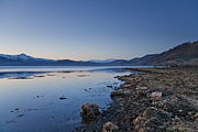
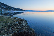
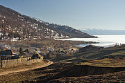
Gallery
 East Kazakhstan Province
Capital: Oskemen Districts Abay · Ayagoz · Beskaragay · Borodulikha · Glubokoe · Katonkaragay · Kokpekti · Kurshim · Shemonaikha · Tarbagatay · Ulan · Urzhar · Zaysan · Zharma · Zyryan
Major cities  Lakes of KazakhstanCategories:
- Lakes of Kazakhstan
- Altai
- Kazakhstan geography stubs
Wikimedia Foundation. 2010.


