- Nargin (island)
-
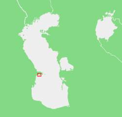 Map showing the location of the Baku Archipelago.
Boyuk Zira (Böyük Zirə), also known as Nargin, is an uninhabited island off the Bay of Baku, Azerbaijan.
Nargin Island is part of the Baku Archipelago, which consists of the following islands: Boyuk Zira, Dash Zira, Kichik Zira (Qum or Sandy Island), Zenbil, Sangi-Mugan, Chikil, Qara Su, Khara Zira, Gil, Ignat Dash and a few smaller ones.
Nargin is the biggest island that separates the Bay of Baku from the sea south of the Absheron Peninsula. It has a length of 3.1 km, and a width of 900 m. The northwestern side of the island is vertical and steep. There is little vegetation.
Caspian seals, sturgeon, and numerous types of birds, like teal ducks, herring gulls, and grebes are some of the species that can be found on and around Boyuk Zira Island.
Contents
History
A turning light house was built on Nargin in 1814. This island was the former site of a Soviet military base, with a number of abandoned naval vessels sunk on the north side of the island. The name of the island comes from German language meaning "a narrow strait" [1].
Gallery

Panoramic views of the Nargin island. References
- General information
- Caspian Sea Biodiversity Project
- Travel
- Satellite picture
- Archipelago of Absheron
External links
Coordinates: 40°17′38″N 49°55′18″E / 40.29389°N 49.92167°E
Ashuradeh • Baku Archipelago • Batkachnyy Island • Blinov Island • Bolshiye Peshnyye Islands • Bolshoy Setnoy Island • Boyuk Zira • Bulla Island • Chechen Island • Chikil • Chilov • Chistoy Banki • Durneva Island • Gil Island • Malyy Zhemchuzhnyy • Morskaya Chapura • Morskoy Biryuchek • Morskoy Ivan-Karaul • Nargin • Nizhniy Oseredok Island • Nordovyy • Ogurja Ada / Ogurchinskiy Island • Osushnoy • Pirallahı Island • Qara Su • Qum Island • Sedmoy • Spirkin Oseredok Island • Svinoy • Tyuleniy Archipelago • Tyuleniy Island • Verkhniy Oseredok Island • Vulf • Zenbil • Zhanbay Island • Zyudev IslandCategories:- Uninhabited islands of Azerbaijan
- Islands of the Caspian Sea
- Azerbaijan geography stubs


Wikimedia Foundation. 2010.