- Atlasov Island
-
Atlasov Alaid 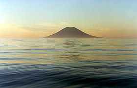
Elevation 2,339 m (7,674 ft) Prominence 2,339 m (7,674 ft) Listing Ultra Location Kuril Islands, Russia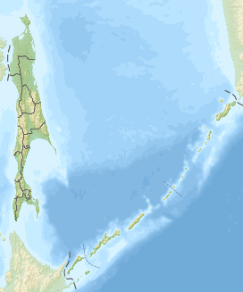
 Atlasov
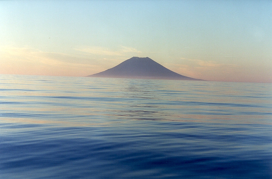
Coordinates 50°51′28.8″N 155°33′00″E / 50.858°N 155.55°ECoordinates: 50°51′28.8″N 155°33′00″E / 50.858°N 155.55°E Geology Type Stratovolcano Last eruption 1996 Atlasov Island, known in Russian as Ostrov Atlasova (Остров Атласова), or in Japanese as Araido (阿頼度島), is the northernmost island and volcano and also the highest volcano of the Kuril islands, part of the Sakhalin Oblast in Russia. The Russian name is sometimes rendered in English as Atlasova Island. Other names for the island include Uyakhuzhach, Oyakoba and Alaid.
The island is named after Vladimir Atlasov, a 17th century Russian explorer who incorporated the nearby Kamchatka Peninsula into Russia. It is essentially the cone of a submarine volcano called Vulkan Alaid protruding above the Sea of Okhotsk to a height of 2,339 m (7,672 ft). The island has an area of 119 km² (46 sq mi), but is currently uninhabited.Numerous pyroclastic cones dot the lower flanks of basaltic to basaltic andesite volcano, particularly on the NW and SE sides, including an offshore cone formed during the 1933-34 eruption.[1]
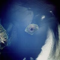 Atlasov Island from space, September 1992
Its near perfect shape gave rise to many legends about the volcano among the peoples of the region, such as the Itelmens and Kuril Ainu. The Russian scientist Stepan Krasheninnikov was told the story that it was once a mountain in Kamchatka, but the neighbouring mountains became jealous of its beauty and exiled it to the sea, leaving behind Lake Kurile in southern Kamchatka. Geographically, this story is not without evidence, as after the last Ice Age most of the icecaps melted, raising the world's water level, and possibly submerging a landbridge to the volcano.[citation needed]
Ito Osamu (1926) described it as more exquisitely shaped than Mount Fuji.
Administratively this island belongs to the Sakhalin Oblast of the Russian Federation.
See also
References
- ^ "Alaid". Global Volcanism Program, Smithsonian Institution. http://www.volcano.si.edu/world/volcano.cfm?vnum=0900-39=.
External links

 Islands of the Sea of OkhotskAntsiferov · Arka · Atlasov · Banka Zotova · Baydukov Island · Belyakov Island · Bolshoy Chome · Bolshoy Shantar · Brat Chirpoyev · Broutona · Chastye Islands · Chetyre Paltsa · Chirinkotan · Chirpoy · Chkalov Island · Dobrzhansky Island · Ekarma · Feklistova · Hokkaidō · Iony Island · Iturup · Kamen-Mukdykyn · Kamen Opasnosti · Kekurniy Island · Ketoy · Khalpili Islands · Kharimkotan · Konus · Krayniy Island · Kunashir · Kuril Islands · Makanrushi · Matua · Menshikov Island · Morskaya Matuga · Nansikan Island · Nedorazumeniya · Onekotan · Oremif · Paramushir · Pilamif · Raikoke · Rasshua · Rechnaya Matuga · Reyneke Island · Rovnyy · Sakhalin · Shantar Islands · Shelikan · Shiashkotan · Shumshu · Simushir · Spafaryev Islands · Talan Island · Telan Island · Tretiy Island · Tyuleniy Island · Umara · Urup · Ush · Ushishir · Vtoroy · Yam Islands · Yengalychev Island · Zavyalov · ZubchatyCategories:
- Kuril Islands
- Mountains of Russia
- Stratovolcanoes
- Active volcanoes
- Uninhabited islands of Russia


Wikimedia Foundation. 2010.