- Baja California Sur
Infobox Settlement
name = Baja California Sur
other_name =
native_name = Estado Libre y Soberano de Baja California Sur
nickname =
settlement_type =
motto =
imagesize =
image_caption =
flag_size = 140px
image_
seal_size =
image_shield = Escudo de Baja California Sur.svg
shield_size = 76px
city_logo =
citylogo_size =
mapsize =
map_caption = Location within Mexico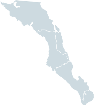
mapsize1 = 180px
map_caption1 = Municipalities of Baja California Sur
image_dot_
dot_mapsize =
dot_map_caption =
dot_x = |dot_y =
pushpin_
pushpin_label_position =
pushpin_map_caption =
pushpin_mapsize =
subdivision_type = Country
subdivision_name = MEX
subdivision_type1 = Capital
subdivision_name1 = La Paz
subdivision_type2 = Municipalities
subdivision_name2 = 5
subdivision_type3 = Largest City
subdivision_name3 = La Paz
subdivision_type4 =
subdivision_name4 =
government_footnotes =
government_type =
leader_title =Governor
leader_name =Narciso Agúndez Montaño
(PRD)
leader_title1 = Federal Deputies
leader_name1 =PRD: 2
leader_title2 =Federal Senators
leader_name2 = PT: 2
PAN: 1
leader_title3 =
leader_name3 =
leader_title4 =
leader_name4 =
established_title =
established_date =
established_title2 =
established_date2 =
established_title3 =
established_date3 =
area_magnitude =
unit_pref =
area_footnotes =Ranked 9th
area_total_km2 = 73475
area_land_km2 =
area_water_km2 =
area_total_sq_mi =
area_land_sq_mi =
area_water_sq_mi =
area_water_percent =
area_urban_km2 =
area_urban_sq_mi =
area_metro_km2 =
area_metro_sq_mi =
area_blank1_title =
area_blank1_km2 =
area_blank1_sq_mi =
population_as_of =2005
population_footnotes =
population_note =
population_total = 512,170 (Ranked 32nd)
population_density_km2 =
population_density_sq_mi =
population_metro =
population_density_metro_km2 =
population_density_metro_sq_mi =
population_urban =
population_density_urban_km2 =
population_density_urban_sq_mi =
population_blank1_title =Demonym
population_blank1 =Sudcaliforniano
population_density_blank1_km2 =
population_density_blank1_sq_mi =
timezone = MST
utc_offset = -7
timezone_DST = MDT
utc_offset_DST = -6
latd= |latm= |lats= |latNS=
longd= |longm= |longs= |longEW=
elevation_footnotes =
elevation_m =
elevation_ft =
postal_code_type =
postal_code =
area_code =
blank_name =HDI (2004)
blank_info =0.8269 - high
Ranked 4th
blank1_name =ISO 3166-2
blank1_info =MX-BCS
blank2_name =Postal abbr.
blank2_info =B.C.S.
blank3_name =
blank3_info =
website = [http://www.gbcs.gob.mx www.gbcs.gob.mx]
footnotes =Baja California Sur (pron. BAH-hah kahl'-ee-FORE-nyah SOOR) is one of the 31
states of Mexico . Before becoming a state in 1974, the area was known as the South Territory of Baja California. It has an area of convert|73475|km2|sqmi|0|abbr=on, or 3.57% of the land mass of Mexico and comprises the southern half of theBaja California peninsula , south of the 28th parallel. It is bordered to the north by the state ofBaja California , to the west by thePacific Ocean , and to the east by theGulf of California , also known as the "Sea of Cortés".Also,the state has maritime borders withSonora andSinaloa to the east across theGulf of California .The state is known for its natural riches and tourism. The
Vizcaíno Desert and small coastal lakes San Ignacio and Ojo de Liebre in the north are protected by the federal government. The state includes the Pacific islands of Natividad, Magdalena, and Santa Margarita, as well as the islands of San Marcos, Coronados, Carmen, Montserrat, Santa Catalina, Santa Cruz, San Diego, San José, San Francisco, Partida, Espíritu Santo, and Cerralvo, which are located in the Gulf of California.Rocas Alijos are a group of tiny, steep and barren volcanic islets found offshore.As of 2005 population was 512,170. The state is home to the tourist resorts of
Cabo San Lucas andSan José del Cabo . Its largest city and capital is La Paz, a tourist resort and historic landmark. It includes Loreto, the historic first capital of all three Californias (Baja California Sur, Baja California, andCalifornia ), the town of Santa Rosalía which is the site of a historic church designed byGustave Eiffel .History
Pre-Columbian period
The first inhabitants are thought to have arrived to the peninsula at least 11,000 years ago, to judge by the archaeological discovery of several
Clovis point s in the northern part of the state. The possibility of an even earlier occupation has been raised by radiocarbon dates from a site on Isla Espíritu Santo, but this interpretation still remains controversial. It comprised ofLas Californias .Before phases of the state's prehistory are manifested in several archaeological complexes:
* The
Las Palmas Complex in the Cape Region and on nearby islands in the Gulf of California is primarily a mortuary pattern. Hallmarks include caves or rockshelters containing secondary burials of human bones painted with red ochre.
* TheComondú Complex represents late prehistoric occupation throughout the central portion of the peninsula, perhaps dating between about A.D. 500 and 1700. It is recognized, in particular, by small, triangular projectile points that attest to the introduction of the bow and arrow into the region.
* The Great Mural Rock Art is the best-known archaeological phenomenon in northern Baja California Sur. In the Sierra de Guadalupe and Sierra de San Francisco, many rockshelters contain larger-than-life paintings of humans, deer and other animals.Four distinct ethnolinguistic groups were encountered in Baja California Sur by the early explorers and missionaries: the Pericú in the south, between
Cabo San Lucas and La Paz, and on several of the islands in the Gulf; theGuaycura from La Paz to south of Loreto; theMonqui , in the area around Loreto; and the Cochimí, in extensive areas throughout the middle of the peninsula.Colonial period
The European discovery of Baja California Sur is credited to
Fortún Ximénez , a mutineer on an expedition dispatched by the conqueror of central Mexico,Hernán Cortés in early 1533. Cortés himself led an expedition to the "Island of California " 1535, but he soon abandoned the fruitless enterprise. In 1539-1542, both coasts of Baja California Sur were reconnoitered byFrancisco de Ulloa andJuan Rodríguez Cabrillo . Over the next century and a half, a variety of explorers and pearl hunters (includingSebastián Vizcaíno ) visited the peninsula's shores but seem to have had little lasting impact.The Jesuits began their involvement in 1683-1685 when Eusebio Francisco Kino, along with the admiral Isidro de Atondo y Antillón, made two major but ultimately unsuccessful efforts at colonization, at La Paz and then at San Bruno, north of Loreto. In 1697 the Jesuit missionary
Juan María de Salvatierra establishedMisión de Nuestra Señora de Loreto Conchó , the first permanent mission in Baja California Sur. Jesuit control over the peninsula was gradually extended, first in the region around Loreto, then to the south in the Cape region, and finally toward the north across the northern boundary of Baja California Sur.The Jesuits were expelled from the peninsula in 1768 and replaced by the
Franciscans underJunípero Serra . In 1773, the Franciscans in turn ceded control of the Baja California missions to the Dominicans. The native population of Baja California Sur steadily diminished during the colonial period, primarily under the impacts of Old World diseases but also in occasional violent conflicts. While the Jesuits had striven to limit lay Spanish or Mexican settlement on the peninsula, fearful of corrupting influences and competing power centers, the missions under the Franciscans and Dominicans had to accept a growing lay presence and increased control from central New Spain.The peninsula was divided into two separate entities in 1804, with the southern one having the seat of government established in the port of Loreto.
*The colonial governors were:
*1804 - 1805 José Joaquín de Arillaga (s.a.)
*1806 - 1814 Felipe de Goycoechea
*1814 -11 April 1822 José Darío Argüello Post-independence period
After the
Mexican War of Independence , PresidentGuadalupe Victoria named Lt. Col. José María Echeandía governor of Baja California Sur and divided it in four "municipios" (municipalities). In 1830, the capital was moved to La Paz after Loreto was partially destroyed by heavy rains.On
October 2 ,1847 the army of the United States was defeated near the town of Mulegé by Captain Manuel Pineda, as part of theMexican-American War . As a consequence of this battle, the U.S. army was forced to withdraw from the peninsula and could not lay claim to it as part of the new territories acquired through theTreaty of Guadalupe Hidalgo of 1848.In 1853, a group of 45, led by journalist William Walker, without the authorization of the United States Government, captured the city of La Paz, before the Mexican Army forced the 45 to retreat back to the United States.
The Territory of Baja California was created in 1888 under the government of President
Porfirio Díaz . In 1930, Baja California was further divided into North and South parties, renamed later as North and South districts, then, into North and South territories.In 1952, the North Territory of Baja California became the 29th state of Mexico,
Baja California . The southern portion, below 28°N, remained a federally administered territory until 1974, when the South Territory of Baja California became the 31st state,Baja California Sur , along with the state ofQuintana Roo .Municipalities
Baja California Sur is subdivided into five municipalities "(municipios)". See
municipalities of Baja California Sur .Major communities
*Cabo San Lucas
*Ciudad Constitución
*Ciudad Insurgentes
*Colonia del Sol
*Guerrero Negro
*La Paz
*Las Veredas
*Loreto
*San José del Cabo
*Santa RosalíaEtymology
Higher education institutions
*
Universidad Autonoma de Baja California Sur (UABCS)
*Instituto Tecnologico de La Paz (ITLP)
*Centro de investigaciones biologicas del noroeste (CIBNOR)
*Centro Interdiciplinario de Ciencias Marinas (CICIMAR)
*Universidad Pedagógica Nacional (UPN)
*Universidad Internacional de la Paz (UNIPAZ)
*Instituto Tecnológico Superior de Ciudad Constitución (ITSCC)ee also
*
Las Californias
* Spanish missions in present–day Baja California
*Isla Espíritu Santo island lying off La Paz in the Sea of CortezReferences
* Laylander, Don, and Jerry Moore (editors). 2006. "The Prehistory of Baja California: Advances in the Archaeology of the Forgotten Peninsula". University Press of Florida, Gainesville.
* Massey, William C. 1947. "Brief Report on Archaeological Investigations in Baja California". "Southwestern Journal of Anthropology" 3:344-359.
* Crosby, Harry W. 20000005 "Antigua California: Mission and Colony on the Peninsular Frontier, 1697-1768". University of New Mexico Press, Albuquerque.
* Río, Ignacio del. "A la diestra mano de las Indias: descubrimiento y ocupación colonial de la Baja California". Gobierno del Estado de Baja California Sur, La Paz.
* [http://www.worldstatesmen.org/ WorldStatesmen — see each present country]External links
*es icon [http://www.bcs.gob.mx/ Baja California Sur State Government]
*es icon [http://www.e-local.gob.mx/wb2/ELOCAL/EMM_bajasur Enciclopedia de los Municipios de México] Entry on Baja California Sur


Wikimedia Foundation. 2010.