- Tahiti
-
Tahiti 
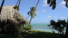
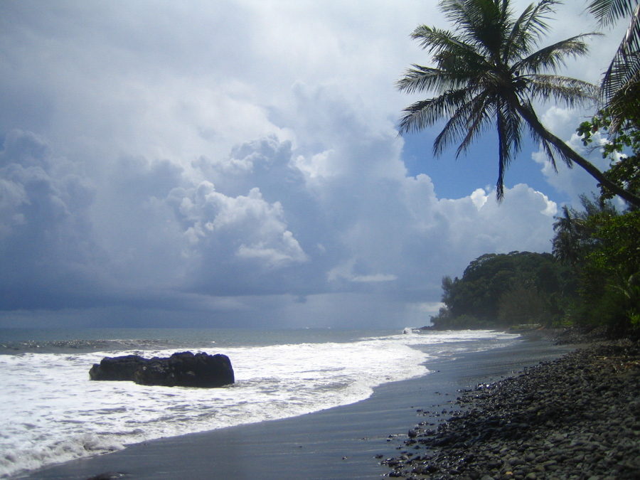
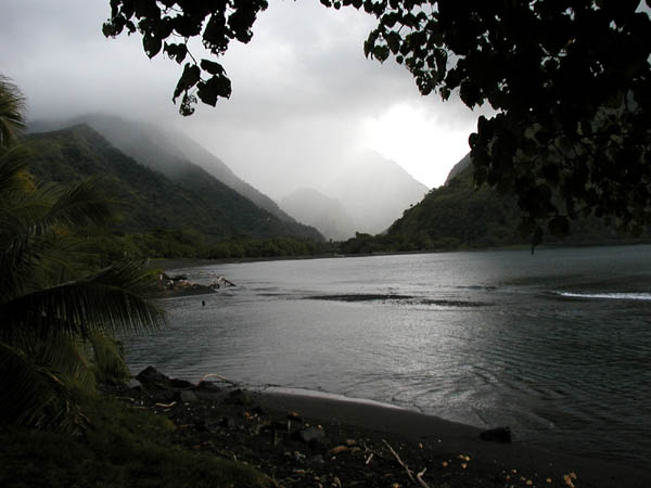
Tahiti is famous for black sand beaches.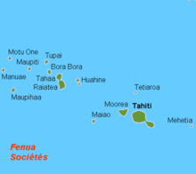
Geography Location Pacific Ocean Coordinates 17°40′S 149°25′W / 17.667°S 149.417°WCoordinates: 17°40′S 149°25′W / 17.667°S 149.417°W Archipelago Society Islands Major islands Tahiti Area 1,045 km2 (403.5 sq mi) Highest elevation 2,241 m (7,352 ft) Highest point Mou'a 'Orohena Country Overseas country French Polynesia Largest city Papeete (pop. 131,695 urban) Demographics Population 178,133[1] (as of August 2007 census) Density 170 /km2 (440 /sq mi) 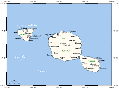 Tahiti-Mo'orea map
 Location of French Polynesia
Tahiti is the largest island in the Windward group of French Polynesia, located in the archipelago of the Society Islands in the southern Pacific Ocean. It is the economic, cultural and political centre of French Polynesia. The island was formed from volcanic activity and is high and mountainous with surrounding coral reefs. The population is 178,133 (2007 census),[1] making it the most populous island of French Polynesia and accounting for 68.6% of the group's total population. Tahiti was formerly known as Otaheite.[2]
The capital, Papeete, is located on the northwest coast with the only international airport in the region, Faa'a International Airport, situated 5 km (3.1 mi) from the town centre. Tahiti was originally settled by Polynesians between AD 300 and 800. They comprise about 70% of the island's population with the rest made up of Europeans, Chinese and those of mixed heritage. The island was proclaimed a colony of France in 1880 although it was not until 1946 that the indigenous Tahitians were legally authorised to be French citizens. French is the only official language although the Tahitian language (Reo Tahiti) is widely spoken. It was part of the Kingdom of Tahiti until its annexation by France in 1880.
Contents
Geography
Tahiti is the highest and largest island in French Polynesia. It is located 4,400 km (2,734 mi) south of Hawaii, 7,900 km (4,909 mi) from Chile and 5,700 km (3,542 mi) from Australia.
The island is 45 km (28 mi) across at its widest point and covers an area of 1,045 km2 (403 sq mi). The highest peak is Mont Orohena (Mou'a 'Orohena) (2,241 m (7,352 ft)). Mount Ronui (Mou'a Rōnui) in the southeast rises to 1,332 m (4,370 ft). The island consists of two roughly round portions centred on volcanic mountains and connected by a short isthmus named after the small town of Taravao, situated there.
The northwestern portion is known as Tahiti Nui ("big Tahiti"), while the much smaller southeastern portion is known as Tahiti Iti ("small Tahiti") or Tai'arapū. Tahiti Nui is heavily populated along the coast, especially around the capital, Papeete.
The interior of Tahiti Nui is almost entirely uninhabited.[3] Tahiti Iti has remained isolated, as its southeastern half (Te Pari) is accessible only to those travelling by boat or on foot. The rest of the island is encircled by a main road which cuts between the mountains and the sea.
An interior road climbs past dairy farms and citrus groves with panoramic views. Tahiti's landscape features lush rainforests and many streams, including the Papenoo River on the north side.
Climate
November to April is the wet season, the wettest month of which is January with 13.2 in (340 mm) of rain in Papeetē. August is the driest with 1.9 in (48 mm).
The average temperature ranges between 21 °C (70 °F) and 31 °C (88 °F) with little seasonal variation. The lowest and highest temperatures recorded in Bibys are 16 °C (61 °F) and 34 °C (93 °F), respectively.[4]
History
See also: Kingdom of TahitiTahitians
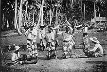
Tahiti is estimated to have been settled between AD 300 and 800 by Polynesians, although some estimates place the date earlier. These first settlers are believed to have travelled thousands of miles across open sea by Polynesian navigation from the western archipelagoes of Fiji, Samoa or Tonga. In 1770, James Cook observed in Tahiti, a great traditional ship (va'a) 33 m (108 ft) in length.[5] Tahitian society was composed of chiefdoms and territories based on kinship and military power among various clans. A clan was led by a chief (Ali'i rahi), nobles (Ari'i) and lesser chiefs. The Ari'i were believed to be descendants of Polynesian gods and invested with supernatural power (mana). A symbol of their status were belts made of red feathers.
However, clan leaders did not hold absolute power and their role included consulting with general assemblies or councils, especially in times of war. The marae was a sacred place of worship constructed of raised stone platforms in open ground, performing a cultural function similar to such structures in other Polynesian societies. The marae were at the centre of the spiritual and social life of the clan. Here, gods were invoked and leaders enthroned. It was also a place for ceremonies such as preparation for war, birth celebrations as well as burial rituals. Types of marae ranged from simple family platforms to larger edifices for leaders of high status, although all were considered tapu. Early European contact saw the arrival of the London Missionary Society in 1797 who introduced Christianity and documented the Tahitian language (Reo Tahiti).
European contact
1700s
Samuel Wallis, an English sea captain, sighted Tahiti on 18 June 1767, received by Queen Purea and is considered the first European visitor. (A later report of an earlier sighting of Tahiti by the Portuguese navigator Pedro Fernandes de Queirós, serving the Spanish Crown, in 1606, is likely to have been mistaken with a sighting of La Sagitaria Island (Rekareka), to the SE of Tahiti.)[6]
The relaxed and contented nature of the people and the characterisation of the island as a paradise impressed early Europeans, planting the seed for a romanticisation by the West that endures to this day.
Wallis was followed in April 1768 by the French explorer Louis Antoine de Bougainville, completing the first French circumnavigation. Bougainville made Tahiti famous in Europe when he published Voyage autour du monde. He described the island as an earthly paradise where men and women live happily in innocence, away from the corruption of civilization. His account illustrated the concept of the noble savage, and influenced utopian thoughts of philosophers such as Jean-Jacques Rousseau before the French Revolution.
In April 1769, Captain James Cook made his first visit to the island on orders from the Lords Commissioners of the Admiralty and the Royal Society to view the transit of Venus on 2 June. He, along with Charles Green and Daniel Solander, set up camp at Matavai Bay and stayed on until 9 August. Cook estimated the population to be 200,000 including all the nearby islands in the chain.[7] This estimate was later lowered to 35,000 by anthropologist Douglas L. Oliver, the foremost modern authority on Tahiti, at the time of discovery in 1767.[8] After Cook, European ships landed with greater frequency. The best-known was HMS Bounty, whose crew mutinied after leaving Tahiti in 1789. On later visits Cook made harbour at Tautira Bay which is sometimes known as Cooks Anchorage.
After European contact, the population fell rapidly and traditional society was disrupted by guns, prostitution, venereal disease, alcohol, and Christianity. Introduced diseases including typhus, influenza and smallpox killed so many Tahitians that by 1797, the population was only 16,000. Later it was to drop as low as 6,000.[9]
The London Missionary Society, founded in 1795, instructed its Tahitian missionaries to intervene in what they saw as wretched conditions and demonic influence.[10]
The Viceroy of Peru, Manuel de Amat y Juniet, following the instructions of the Spanish Crown, decided to take possession of the island in 1772, largely to control the expansion of other countries and also to evangelize. So, he sent four expeditions within the period 1772-1775, but Charles III of Spain finally cancelled the mission as a consequence of his secular policy. Most notable of these expeditions was the drafting of a diary by a soldier of the Marine named Maximo Rodriguez, covering a period of 12 months, revealing many ethnological details about the Tahitians of the 18th century.
Pōmare I founded the Pōmare Dynasty and his lineage was the first to unify Tahiti from 1788-1791. He and his descendants founded and expanded Tahitian influence to all of the lands that now constitute modern French Polynesia.
1800s
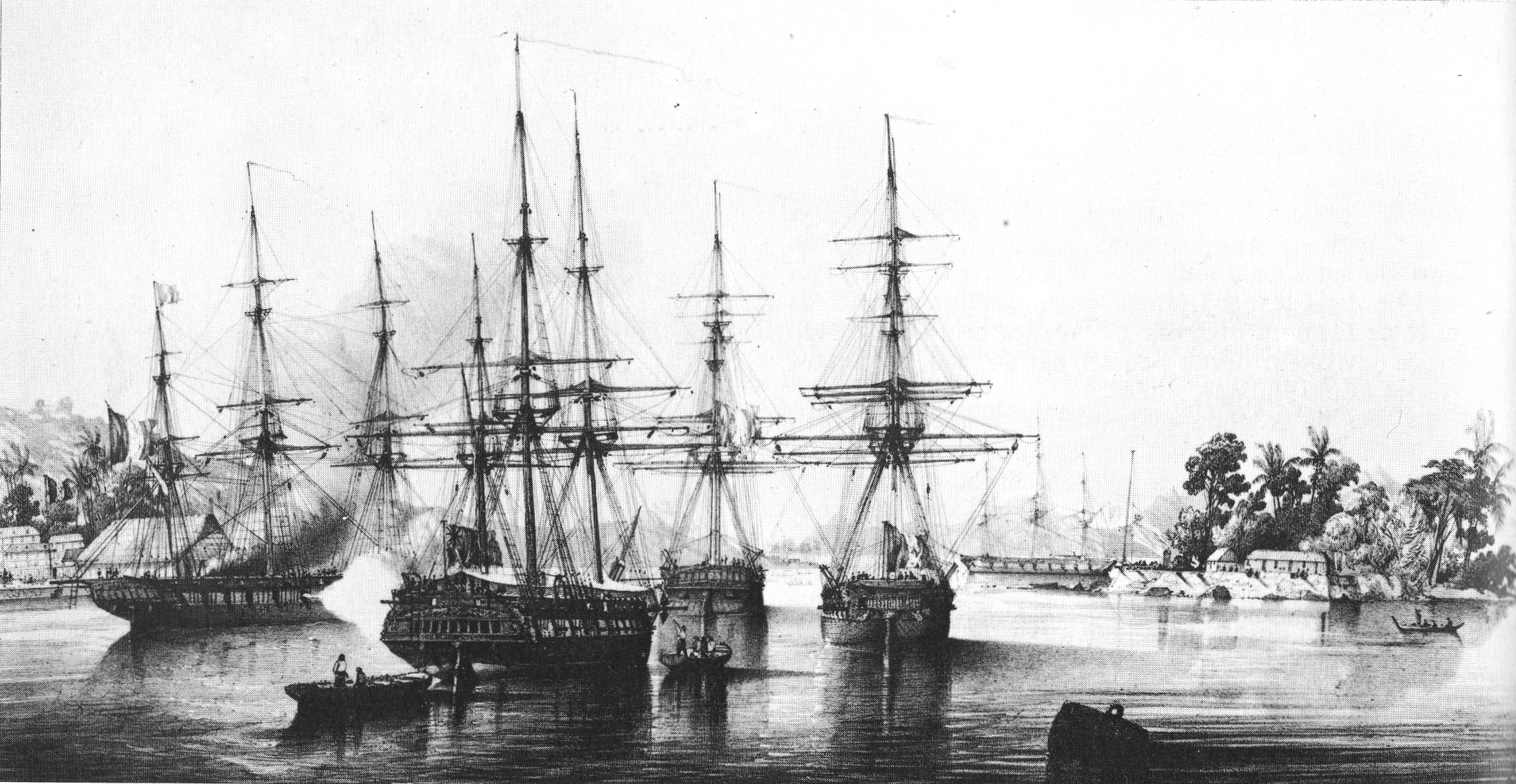
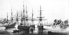 Dupetit Thouars taking over Tahiti on September 9, 1842.
In 1803 Pōmare I died and was succeeded by Pōmare II. In 1821 Pōmare II died and the throne went to his son Pōmare III who was 18 months old. He was to die at the age of six in 1827 and was succeeded by his sister, Pōmare IV.
In November 1835 Charles Darwin visited Tahiti aboard the HMS Beagle on her circumnavigation, captained by Robert FitzRoy. He was impressed by what he perceived to be the positive influence the missionaries had had on the sobriety and moral character of the population. Darwin praised the scenery, but was not flattering towards Tahiti's Queen Pōmare IV. Captain Fitzroy negotiated payment of compensation for an attack on an English ship by Tahitians, which had taken place in 1833.[11]
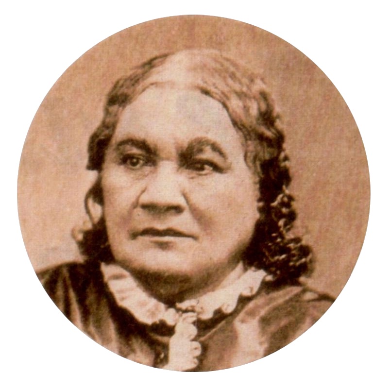
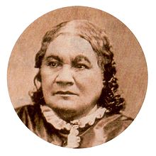 Queen Pōmare IV, 1813-1877.
In 1839 the island was visited by the United States Exploring Expedition; one of its members, Alfred Thomas Agate, produced a number of sketches of Tahitian life, some of which were later published in the United States.
In 1842, a European crisis involving Morocco escalated between France and Great Britain when Admiral Dupetit Thouars, acting independently of the French government, convinced Tahiti's Queen Pōmare IV to accept a French protectorate. George Pritchard, a Birmingham-born missionary and acting British Consul, had been away at the time. However he returned to work towards indoctrinating the locals against the Roman Catholic French. In June 1843, Dupetit-Thouars (again on his own initiative) landed sailors on the island, annexing it to France. He then threw Pritchard into prison, subsequently sending him back to Britain.
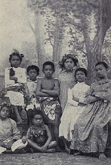 Tahitian children, c. 1906
News of Tahiti reached Europe in early 1844. The French statesman François Guizot, supported by King Louis-Philippe of France, had denounced annexation of the island. However, war between the French and the Tahitians continued until 1847. The island remained a French protectorate until June 29, 1880, when King Pōmare V (1842–1891) was forced to cede the sovereignty of Tahiti and its dependencies to France. He was given the titular position of Officer of the Orders of the Legion of Honour and Agricultural Merit of France.
French painter Paul Gauguin lived on Tahiti in the 1890s and painted many Tahitian subjects. Papeari has a small Gauguin museum.
In 1891 Matthew Turner, an American shipbuilder from San Francisco, who had been looking for a fast passage between the city and Tahiti built the Papeete. The Papeete, a two masted schooner, made the trip in seventeen days.
Twentieth century
In 1946, Tahiti and the whole of French Polynesia became an overseas territory (Territoire d'outre-mer). Tahitians were granted French citizenship, a right that had been campaigned for by nationalist leader Pouvanaa a Oopa for many years.[12] In 2003, French Polynesia's status was changed to that of an overseas collectivity (Collectivité d'outre-mer) and in 2004 it was declared an overseas country (pays d'outre-mer or POM).
During the First World War, the Papeete region of the island was attacked by two German warships. A French gunboat as well as a captured German freighter were sunk in the harbour and the two German warships bombarded the colony. Between 1966 and 1996 the French Government conducted 193 nuclear bomb tests above and below the atolls of Moruroa and Fangataufa. The last test was conducted on 27 January 1996.[13]
Twenty-first century
In 2009, Tauatomo Mairau claimed the Tahitian throne, and has attempted to re-assert the status of the monarchy in court.
Politics
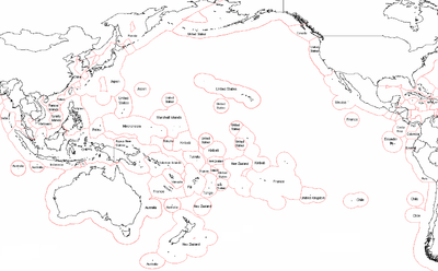 Political map of Oceania, EEZ borders
Tahitians are French citizens with complete civil and political rights. French is the official language but Tahitian and French are both in use. However, there was a time during the 1960s and 1970s when children were forbidden to speak Tahitian in schools. Present day thinking has changed and Tahitian is now being taught in schools; it is sometimes even a requirement for employment.
Tahiti is part of French Polynesia. French Polynesia is a semi-autonomous territory of France with its own assembly, president, budget and laws. France's influence is limited to subsidies, education and security. The former President of French Polynesia, Oscar Temaru, advocates full independence from France. However, only about 20% of the population is thought to be in favour.
During a press conference on 26 June 2006 during the second France-Oceania Summit, French President Jacques Chirac said he did not think the majority of Tahitians wanted independence. He would keep an open door to a possible referendum in the future.
Elections for the Assembly of French Polynesia, the Territorial Assembly of French Polynesia, were held on 23 May 2004.
In a surprise result, Oscar Temaru's pro-independence progressive coalition, Union for Democracy, formed a government with a one-seat majority in the 57-seat parliament, defeating the conservative party, Tahoera'a Huiraatira, led by Gaston Flosse. On 8 October 2004, Flosse succeeded in passing a censure motion against the government, provoking a crisis. A controversy is whether the national government of France should use its power to call for new elections in a local government in case of a political crisis.
Demographics
Further information: TahitiansThe indigenous Tahitians are of Polynesian ancestry comprising 70% of the population alongside Europeans, East Asians (essentially Chinese) and people of mixed heritage sometimes referred to as Demis. They make up the largest population in French Polynesia. Most people from metropolitan France live in Papeete and its suburbs, notably Punaauia where they make up almost 20% of the population.[citation needed]

Historical population
1767 1797 1848 1897 1911 1921 1926 1931 1936 1941 50,000[14] to
200,000[15]16,000[14] 8,600 10,750 11,800 11,700 14,200 16,800 19,000 23,100 1951 1956 1962 1971 1977 1983 1988 1996 2002 2007 30,500 38,100 45,400 79,494 95,604 115,820 131,309 150,721 169,674 178,133 Official figures from past censuses.[1][16][17][18][19][20] Administrative divisions
The island consists of 12 communes, which, along with Moorea-Maiao, make up the Windward Islands administrative subdivision.
The capital is Papeete and the largest commune by population is Faaa while Taiarapu-Est has the largest area.
Communes of Tahiti
The following is a list of communes and their subdivisions sorted alphabetically:[21]
Rank Commune Population Area Density Subdivisions Notes 1. Arue 9,494 21.45 km2 (8.28 sq mi) 443 /km2 (1,150 /sq mi) Tetiaroa, an atoll north of Arue belongs to the commune 2. Faaa 29,781 34.2 km2 (13.2 sq mi) 871 /km2 (2,260 /sq mi) Largest commune (by population) in Tahiti and French Polynesia 3. Hitiaa O Te Ra 8,691 218.2 km2 (84.2 sq mi) 40 /km2 (100 /sq mi) Hitiaa, Mahaena, Papenoo, Tiarei The administrative centre of the commune is the settlement of Hitiaa 4. Mahina 14,356 51.6 km2 (19.9 sq mi) 278 /km2 (720 /sq mi) The 3rd largest city in French Polynesia 5. Paea 12,084 64.5 km2 (24.9 sq mi) 187 /km2 (480 /sq mi) 6. Papara 10,634 92.5 km2 (35.7 sq mi) 115 /km2 (300 /sq mi) 7. Papeete 26,050 17.4 km2 (6.7 sq mi) 1,497 /km2 (3,880 /sq mi) Capital of French Polynesia 8. Pirae 14,551 35.4 km2 (13.7 sq mi) 411 /km2 (1,060 /sq mi) Located between Papeete and Arue 9. Punaauia 25,399 75.9 km2 (29.3 sq mi) 335 /km2 (870 /sq mi) French painter Paul Gaugin lived in Punaauia in the 1890s 10. Taiarapu-Est 11,538 218.3 km2 (84.3 sq mi) 53 /km2 (140 /sq mi) Afaahiti, Faaone, Pueu, Tautira An offshore island called Mehetia belongs to the commune 11. Taiarapu-Ouest 7,007 104.3 km2 (40.3 sq mi) 67 /km2 (170 /sq mi) Teahupo'o, Taohotu, Vairao Extends over half of the peninsula of Tahiti Iti 12. Teva I Uta 8,591 119.5 km2 (46.1 sq mi) 72 /km2 (190 /sq mi) Mataiea, Papeari The administrative centre of the commune is the settlement of Mataiea Economy
Tourism is a significant industry.
In July, the Heivā festival in Papeete celebrates Polynesian culture and the commemoration of the storming of the Bastille in Paris.
After the establishment of the CEP (Centre d'Experimentation du Pacifique) in 1963, the standard of living in French Polynesia increased considerably and many Polynesians abandoned traditional activities and emigrated to the urban centre of Papeete. Even though the standard of living is elevated (due mainly to French foreign direct investment), the economy is reliant on imports. At the cessation of CEP activities, France signed the Progress Pact with Tahiti to compensate the loss of financial resources and assist in education and tourism with an investment of about US$150 million a year from the beginning of 2006.
The main trading partners are France for about 40% of imports and about 25% of exports, the other main trading partners are the US, Japan, Australia and New Zealand.
Tahitian pearl (Black pearl) farming is also a substantial source of revenues, most of the pearls being exported to Japan, Europe and the US. Tahiti also exports vanilla, fruits, flowers, monoi, fish, copra oil, and noni.
Unemployment affects about 13% of the active population, especially women and unqualified young people.
Tahiti’s currency, the French Pacific Franc (CFP, also known as XPF), is pegged to the Euro at 1 CFP = EUR .00838 (approx. 81 CFP to the US Dollar in January 2008). Hotels and financial institutions offer exchange services.
Sales tax in Tahiti is called Taxe sur la Valeur Ajoutée (TVA or value added tax (V.A.T.) in English). V.A.T. 2009 on tourist services is 10% and V.A.T. 2009 on hotels, small boarding houses, food and beverages is 6%. V.A.T. on the purchase of goods and products is 16%.
Culture
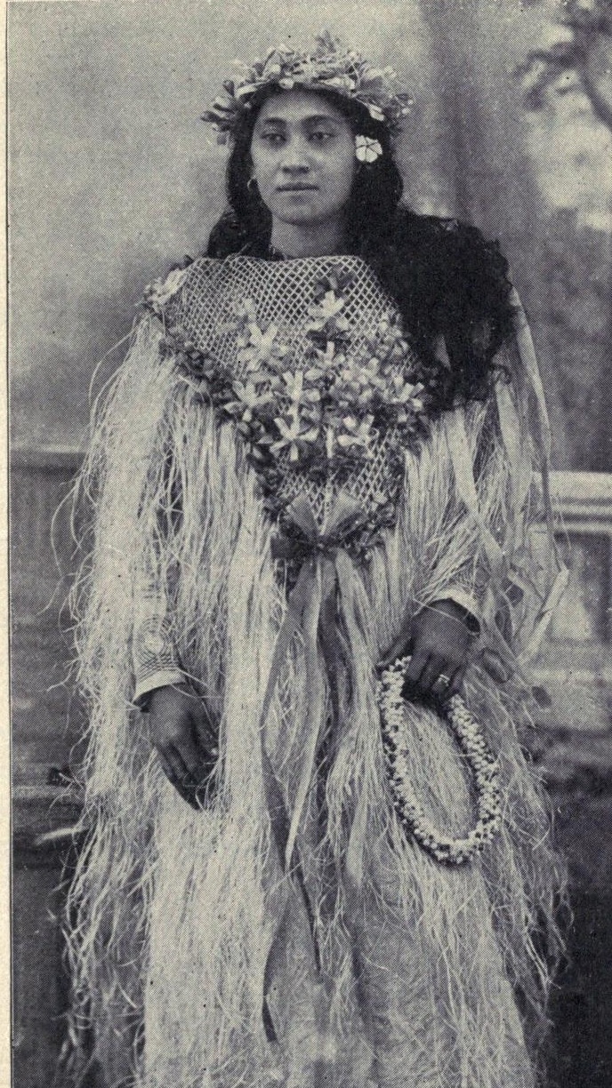
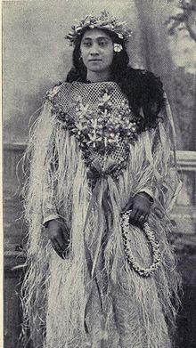 Tahitian woman in festive costume c. 1906See also: Music of Tahiti and Arioi
Tahitian cultures included an oral tradition that involved the mythology of various gods, such as 'Oro and beliefs, as well as ancient traditions such as tattooing and navigation. The annual Heivā Festival in July is a celebration of traditional culture, dance, music and sports including a long distance race between the islands of French Polynesia, in modern outrigger canoes (va'a).
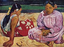
Situated in Tahiti is the Paul Gauguin Museum, dedicated to the life and works of French artist Paul Gauguin (1848–1903) who painted famous works such as Two Tahitian Women, Tahitian Women on the Beach and Where Do We Come From? What Are We? Where Are We Going?.
Located at Punaauia is the Musée de Tahiti et des Îles (Museum of Tahiti and the Island). It is an ethnographic museum that was founded in 1974 to conserve and restore Polynesian artifacts and cultural practices.
The Robert Wan Pearl Museum is the world's only museum dedicated to pearls. The Papeete Market also sells local arts and crafts.
Dance
 Tahitians wearing the Pareo wrap around garment and practicing a ʻupaʻupa dance
One of the most widely recognized images of the islands is the world famous Tahitian dance. The 'ote'a, sometimes written as otea, is a traditional dance from Tahiti, where the dancers, standing in several rows, execute different figures. This dance, easily recognized by its fast hip-shaking, and grass skirts is often confused with the Hawaiian hula, a generally slower more graceful dance which focuses more on the hands and story telling than the hips.
The ʻōteʻa is one of the few dances which already existed in pre-European times as a male dance. On the other hand, the hura (Tahitian vernacular for hula), a dance for women, has disappeared, and the couple's dance 'upa'upa is likewise gone but may have reemerged as the tamure. Nowadays, however, the ʻōteʻa can be danced by men (ʻōteʻa tāne), by women (ʻōteʻa vahine), or by both genders (ʻōteʻa ʻāmui = united ʻō.). The dance is with music only, drums, but no singing. The drum can be one of the different types of the tōʻere, a laying log of wood with a longitudinal slit, which is struck by one or two sticks. Or it can be the pahu, the ancient Tahitian standing drum covered with a shark skin and struck by the hands or with sticks. The rhythm from the tōʻere is fast, from the pahu it is slower. A smaller drum, the faʻatete, can also be used.
The dancers make gestures, reenacting daily occupations of life. For the men the themes can be chosen from warfare or sailing, and then they may use spears or paddles.
For women the themes are closer to home or from nature, combing their hair, or the flight of a butterfly for example. But also more elaborate themes can be chosen, for example one where the dancers end up in a map of Tahiti, highlighting important places. In a proper ʻōteʻa the story of the theme should pervade the whole dance.
The group dance called 'Aparima is often performed with the dancers dressed in pareo and maro. There are two types of ʻaparima: the ʻaparima hīmene (sung handdance) and the ʻaparima vāvā (silent handdance), the latter being performed with music only, and no singing.
Newer dances include the hivinau and the pa'o'a.
The indigenous Tahitians are Polynesians, part of the greater family of Oceanic peoples, noted in their history and culture for their navigation skills, essential for trade and communications in their maritime environs.
In Polynesian navigation, the star found directly above Tahiti's night sky, Sirius, has served as a location beacon in traditional wayfinding during open ocean travels.
Education
Tahiti is home to the University of French Polynesia (Université de la Polynésie Française). It is a growing university, with 3,200 students and 62 researchers. Many courses are available such as law, commerce, science, and literature. There is also the Collège La Mennais located in Papeete.
Transport
Air
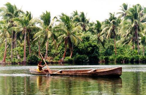
 Tahitian coast
Faa'a International Airport is located 5 km (3.1 mi) from Papeete in the commune of Faaa and is the only international airport in French Polynesia. Because of limited level terrain, rather than levelling large stretches of sloping agricultural land, the airport is built primarily on reclaimed land on the coral reef just off-shore.
International destinations such as Auckland, Hanga Roa, Honolulu, Los Angeles, Paris, Santiago de Chile, Sydney and Tokyo are served by Air France, Air New Zealand, Air Tahiti Nui French Polynesia's flag carrier, Hawaiian Airlines and LAN Airlines.
Flights within French Polynesia and to New Caledonia are available from Aircalin, Air Moorea and Air Tahiti, the last two airlines have their headquarters at the airport.
Ferry
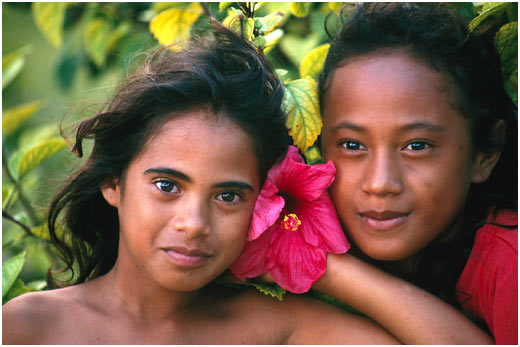
 Two Tahitian girls with a hibiscus flower
The Mo'orea Ferry operates from Papeete and takes about 45 minutes to travel to Moorea. Other ferries are the Aremiti 5 and the Aremiti 7 and these two ferries sail to Moorea in about half an hour. There are also several ferries that transport people and goods throughout the islands. The Bora Bora cruiseline sails to Bora Bora about once a week. The main hub for these ferries is the Papeete Wharf.
Streets
Tahiti has a freeway that runs across the west coast. This freeway starts in Arue and continues across the Papeete urban area. Then it continues along the west coast of Tahiti Nui through smaller villages. The freeway turns east toward Taravao where Tahiti Nui meets Tahiti Iti. Tahiti's west coast freeway keeps going until Teahupo'o where the freeway becomes a thin paved road. Once the road runs out of Teahupoo, it is a small dirt road. Most of Tahiti's paved roads are in the Papeete urban area. Mahina has many dirt roads leading from the main paved road to the mountains of Tahiti.
Sport
Major sports in Tahiti include rugby union and football and the island has fielded a national basketball team, which is a member of FIBA Oceania.
Rugby union in Tahiti is governed by the Fédération Tahitienne de Rugby de Polynésie Française which was formed in 1989. The Tahiti national rugby union team has been active since 1971 but have only played 12 games since then.
Football in Tahiti is administered by the Fédération Tahitienne de Football and was founded in 1938. The Tahiti Division Fédérale is the top division on the island and the Tahiti Championnat Enterprise is the second tier. Some of the major clubs are AS Manu-Ura, who play in Stade Hamuta, AS Pirae, who play in the Stade Pater Te Hono Nui and AS Tefana, who play in the Stade Louis Ganivet. Lesser clubs include Matavai and Tubuia.
The Tahiti Cup is the islands premier football knockout tournament and has been played for since 1938. The winner of the Tahiti Cup goes on to play the winner of the Tahiti Division Fédérale in the Tahiti Coupe des Champions.
See also
- Cultural variations in adoption#Polynesia
- List of volcanoes in French Polynesia
- Nuclear-free zone
- Postage stamps and postal history of French Polynesia
References
- ^ a b c (French) Institut Statistique de Polynésie Française (ISPF). "Recensement de la population 2007" (PDF). Archived from the original on 2007-12-03. http://web.archive.org/web/20071203110626/http://www.ispf.pf/(k1aciwf4z0fyap45ghzhgm55)/stat/demo/rp2007/pdfs/poplegales2007.pdf. Retrieved 2007-12-02.
- ^ Chart of the Island Otaheite, by Lieut. J. Cook 1769 NATIONAL MARITIME MUSEUM
- ^ Population Densité de population
- ^ Papeete, French Polynesia. Weatherbase.com. Last retrieved 2007-09-26.
- ^ Laneyrie-Dagen, Nadeije (1996). Larousse. ed. Les grands explorateurs, sous la direction de Nadeije Laneyrie-Dagen. p. 148. ISBN 2-03-505305-6.
- ^ Journal of the Polynesian Society: Who Discovered Tahiti? By Geo. Collingridge, P184-186
- ^ Robert W. Cook, Pitcairn Island, the Bounty Mutineers and Their Descendants, (2008), p. 78
- ^ Oswald A. Bushnell (1993). The gifts of civilization: germs and genocide in Hawaiʻi. University of Hawaii Press. p.240. ISBN 0824814576
- ^ Emerging Infectious Diseases and the Depopulation of French Polynesia in the 19th century
- ^ Alan Moorehead, The Fatal Impact (1966)
- ^ [1] Vogage of the Beagle
- ^ The Pacific Islands: An Encyclopedia
- ^ Noni Article: Nuclear Tests in Tahiti
- ^ a b Robert C. Schmitt in Population Trends in Hawaii and French Polynesia
- ^ Estimate by James Cook
- ^ 2002 census
- ^ 1971, 1977, 1983, 1988, and 1996 censuses[dead link]
- ^ Censuses from 1911 to 1962 in Population, 1972, #4-5, page 720, published by INED[dead link]
- ^ La Grande Encyclopédie for the 1897 census
- ^ 1848 census
- ^ Recensement 2007 - Population : Chiffres clés Iles Du Vent
External links
- Official website for citizens of the United Kingdom and the Republic of Ireland (Tahiti Tourism Board)
- Official website for citizens of North America (Tahiti Tourism Board)
- Tahiti documentary
- CIA Factbook entry
- Tahitian Heritage in French with Google Translation available


Clockwise from Papeetē, the capital Papeetē · Pīra'e · 'Ārue · Māhina · Hitia'a O Te Rā · Tai'arapū-Est · Tai'arapū-Ouest · Teva I Uta · Paparā · Pā'ea · Puna'auiā · Fa'a'aCategories:


Wikimedia Foundation. 2010.