- Arica, Chile
Infobox Settlement
official_name = Arica
other_name =
native_name =
nickname =
settlement_type =
motto =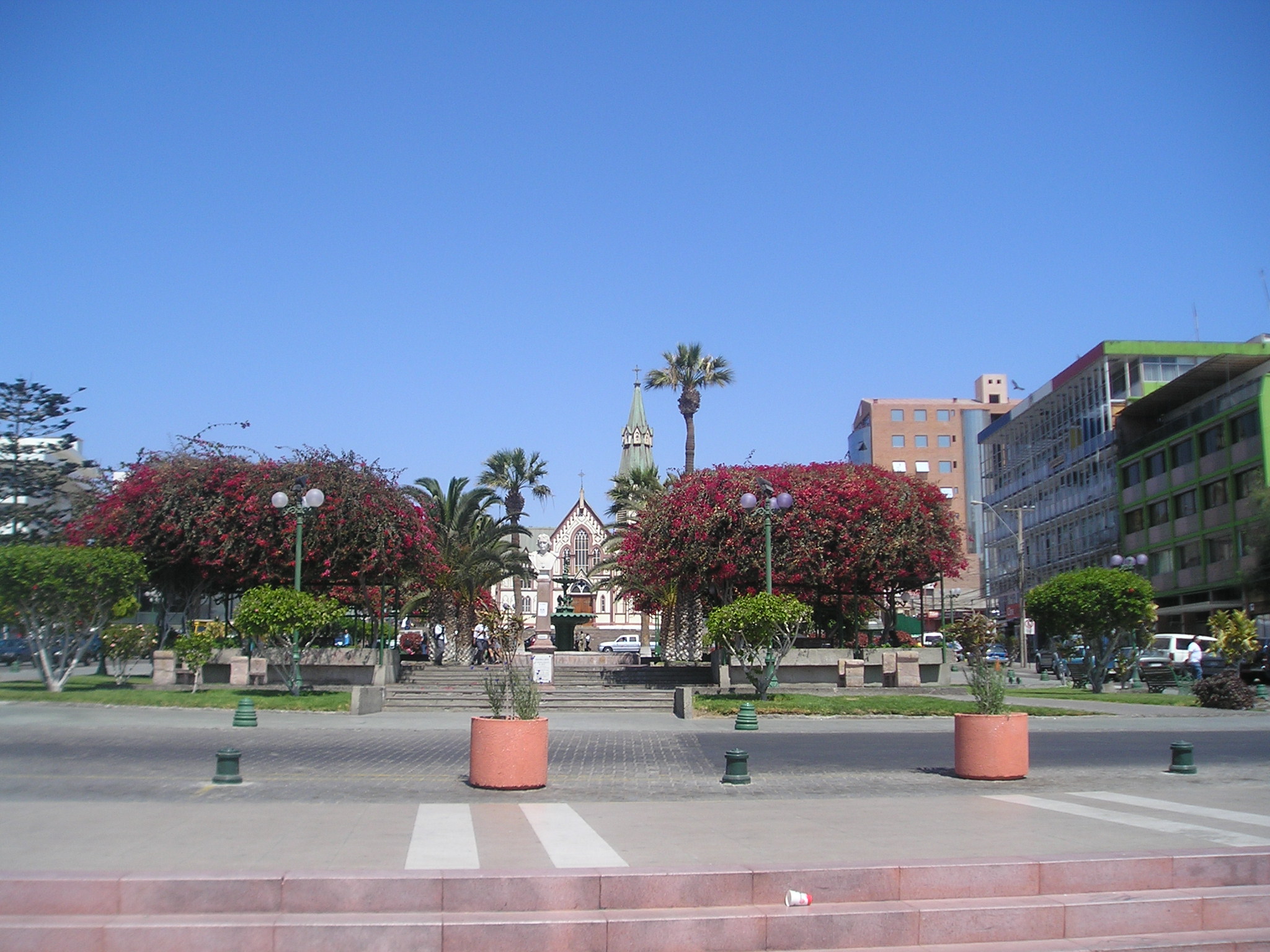
imagesize = 300px
image_caption = "Plaza de Colón": Columbus Square
flag_size =
image_
seal_size =
image_shield =
shield_size =
image_blank_emblem =
blank_emblem_type =
blank_emblem_size =
mapsize =
map_caption =
mapsize1 =
map_caption1 =
image_dot_
dot_mapsize =
dot_map_caption =
dot_x = |dot_y =
pushpin_
pushpin_label_position = bottom
pushpin_map_caption =Location in Chile
pushpin_mapsize = 80
subdivision_type = Country
subdivision_name =
subdivision_type1 = Admin. division
subdivision_name1 =Arica y Parinacota Region
subdivision_type2 =
subdivision_name2 =
subdivision_type3 =
subdivision_name3 =
subdivision_type4 =
subdivision_name4 =
government_footnotes =
government_type =
leader_title =
leader_name =
leader_title1 =
leader_name1 =
leader_title2 =
leader_name2 =
leader_title3 =
leader_name3 =
leader_title4 =
leader_name4 =
established_title =
established_date =
established_title2 =
established_date2 =
established_title3 =
established_date3 =
area_magnitude =
unit_pref =Imperial
area_footnotes =
area_total_km2 =
area_land_km2 =
area_water_km2 =
area_total_sq_mi =
area_land_sq_mi =
area_water_sq_mi =
area_water_percent =
area_urban_km2 =
area_urban_sq_mi =
area_metro_km2 =
area_metro_sq_mi =
area_blank1_title =
area_blank1_km2 =
area_blank1_sq_mi =
population_as_of =2005
population_footnotes =
population_note =
population_total =
population_density_km2 =
population_density_sq_mi =
population_metro =
population_density_metro_km2 =
population_density_metro_sq_mi =
population_urban =
population_density_urban_km2 =
population_density_urban_sq_mi =
population_blank1_title =Ethnicities
population_blank1 =
population_blank2_title =Religions
population_blank2 =
population_density_blank1_km2 =
population_density_blank1_sq_mi =
timezone =
utc_offset =
timezone_DST =
utc_offset_DST =
latd=18 |latm=29 |lats= |latNS=S
longd=70 |longm=20 |longs= |longEW=W
elevation_footnotes =
elevation_m =
elevation_ft =
postal_code_type =
postal_code =
area_code =
blank_name =
blank_info =
blank1_name =
blank1_info =
website =
footnotes =Arica is a port city in northern
Chile , located only 18 km (11 miles) south of the border withPeru .History
Archaeological research has indicated the site of Arica was inhabited by different native groups for at least ten thousand years. The city was founded by Spanish captain Lucas Martinez de Begazo in 1541, and in 1570 was entitled as "La Muy Ilustre y Real Ciudad San Marcos de Arica" (the very illustrious and royal city of San Marcos of Arica). This city was since 1545 the port for exporting the silver of
Potosí . The city is the capital of the recently createdArica-Parinacota Region (October 2007). It has a population of approximately 200,000 and is known as the "city of the eternal spring". The city was part ofPeru until June 7, 1880, when it was taken by Chilean forces during theWar of the Pacific and militarily occupied after thebattle of Arica for the "Morro de Arica" ("Arica's Cape"), which was one of the war's most famous actions, with hundreds of casualties on the Peruvian and Chilean sides, in a matter of only a few hours of fighting.The city's status was not clear until August 29th, 1929, when it was definitely incorporated to the Chilean sovereignty.Features
The Potosi silver mine was the largest such mine in world history. Because of it, Arica became a crucial port for the
Spanish Empire . This port was visited (and looted) by such famous pirates and bucaneers as Francis Drake, Thomas Cavendish, Richard Hawkins, Joris van Spilbergen, Watling, Simón de Cordes, Leandro de Valencia, Sharp, Dampier, and Clipperton.In 1855 the Peruvian government inaugurated the train Arica-
Tacna (53 km long), one of the first in Latin America. The rail line still functions.The "Morro de Arica" is a steep and tall hill located in the city. Its height is 139 meters above sea level. It was the last bulwark of defence for the Peruvian troops who garrisoned the city. It was assaulted and captured on
June 7 ,1880 by Chilean troops in the last part of their "Campaña del Desierto" (Desert Campaign) during theWar of the Pacific .Near the city is the
Azapa Valley , anoasis wherevegetable s and Azapaolive s are grown. Economically, it is an important port for Chileanore , and its tropical latitude, dryclimate , and the city'sbeach , have made Arica a popular tourist destination. It is also a center of rail communication with Bolivia and has its own internationalairport . Arica has strong ties with the city ofTacna ,Peru ; many people cross the border daily to travel between the cities, partly because many services (for example, dentists) are cheaper on the Peruvian side. Arica is connected to Tacna and toLa Paz, Bolivia by separaterailroad lines.Arica is also known as one of the driest inhabited places on Earth, at least as measured by
rainfall : average annual precipitation is 0.76 mm (0.03 inches), as measured at the airport meteorological station. [cite web
url=http://www.metoffice.gov.uk/education/primary/students/weather_recorders.html
title=Weather recorders
accessdate=2007-08-24
publisher=Met Office] Oxford geographerNick Middleton 's book on people who live in extreme climates, "Going to Extremes" (ISBN 0-330-49384-1), discusses his visit to this city.Infobox Weather
single_line=yes
location=Arica
Jan_Hi_°F =79 |Jan_REC_Hi_°F =
Feb_Hi_°F =80 |Feb_REC_Hi_°F =
Mar_Hi_°F =78 |Mar_REC_Hi_°F =
Apr_Hi_°F =75 |Apr_REC_Hi_°F =
May_Hi_°F =71 |May_REC_Hi_°F =
Jun_Hi_°F =67 |Jun_REC_Hi_°F =
Jul_Hi_°F =65 |Jul_REC_Hi_°F =
Aug_Hi_°F =65 |Aug_REC_Hi_°F =
Sep_Hi_°F =66 |Sep_REC_Hi_°F =
Oct_Hi_°F =69 |Oct_REC_Hi_°F =
Nov_Hi_°F =72 |Nov_REC_Hi_°F =
Dec_Hi_°F =76 |Dec_REC_Hi_°F =
Year_Hi_°F =72 |Year_REC_Hi_°F =
Jan_Lo_°F =68 |Jan_REC_Lo_°F =
Feb_Lo_°F =68 |Feb_REC_Lo_°F =
Mar_Lo_°F =66 |Mar_REC_Lo_°F =
Apr_Lo_°F =63 |Apr_REC_Lo_°F =
May_Lo_°F =60 |May_REC_Lo_°F =
Jun_Lo_°F =58 |Jun_REC_Lo_°F =
Jul_Lo_°F =57 |Jul_REC_Lo_°F =
Aug_Lo_°F =58 |Aug_REC_Lo_°F =
Sep_Lo_°F =59 |Sep_REC_Lo_°F =
Oct_Lo_°F =60 |Oct_REC_Lo_°F =
Nov_Lo_°F =62 |Nov_REC_Lo_°F =
Dec_Lo_°F =65 |Dec_REC_Lo_°F =
Year_Lo_°F =61 |Year_REC_Lo_°F =
Jan_Precip_inch =0
Feb_Precip_inch =0
Mar_Precip_inch =0
Apr_Precip_inch =0
May_Precip_inch =0
Jun_Precip_inch =0
Jul_Precip_inch =0
Aug_Precip_inch =0
Sep_Precip_inch =0
Oct_Precip_inch =0
Nov_Precip_inch =0
Dec_Precip_inch =0
Year_Precip_inch =0
publisher= |language=fact|date=August 2008Important events
*On
August 16 1868 , the Peruvian port of Arica was devastated by atsunami which followed a magnitude 8.5earthquake in the now calledPeru-Chile Trench off the coast. Some historians clam that the earthquake and tsunami killed an estimated 25,000 people in Arica and perhaps 70,000 people in all. [ [http://www.usc.edu/dept/tsunamis/peru/ptsu_1868.html The 1868 Arica Tsunami] ] Others estimate that the population of Arica was less than 3000 people and the death toll was around 300.
*Arica was one of the four host cities of the 1962 football (soccer) World Cup.
*Arica was the venue for aRip Curl Pro Search surfing event that took place fromJune 20 toJuly 1 2007 .References
External links
* [http://www.municipalidaddearica.cl Municipality of Arica] (Spanish)
* [http://www.infoarica.cl Independent community website]
* [http://www.infoarica.cl/1g/aricacity.kmz Google Earth marks in Arica, Tacna and Iquique]
* [http://www.infoarica.cl/1g/aricaparinacota.kmz Google Earth marks in Arica, Geo, roads and archeology sites]
* [http://www.estrellaarica.cl/ Local newspaper]
* [http://www.puertoarica.cl/ Port of Arica]
* [http://www.wunderground.com/global/stations/85406.html Arica weather]
* [http://www.AricaChile.com/Links/ Validated links to websites about Arica]
* [http://query.nytimes.com/mem/archive-free/pdf?_r=1&res=9C00EFDA1330EE34BC4C52DFBF668383679FDE&oref=slogin New York Times article about the 1868 earthquake]

Wikimedia Foundation. 2010.