- Kaneohe, Hawaii
Infobox Settlement
official_name = Kaneohe, Hawaii
other_name =
native_name =
nickname =
settlement_type = CDP
motto =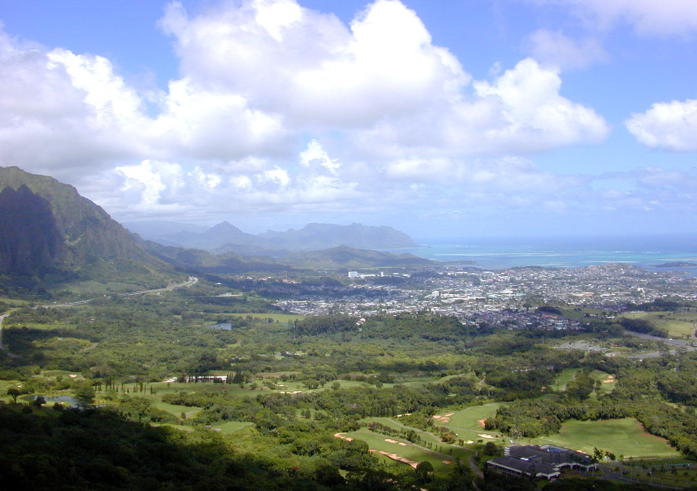
imagesize = 250px
image_caption = View from the Nuokinauanu Pali Lookout of Kaneokinaohe
flag_size =
image_
seal_size =
image_shield =
shield_size =
image_blank_emblem =
blank_emblem_type =
blank_emblem_size =
flag_size =
image_
seal_size =
image_shield =
shield_size =
image_blank_emblem =
blank_emblem_type =
blank_emblem_size =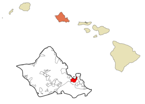
mapsize =
map_caption = Location in Honolulu County and the state ofHawaii
mapsize1 =
map_caption1 =
image_dot_
dot_mapsize =
dot_map_caption =
dot_x =
dot_y =
pushpin_
pushpin_label_position =
pushpin_map_caption =
pushpin_mapsize =
subdivision_type = Country
subdivision_name =United States
subdivision_type1 = State
subdivision_name1 =Hawaii
subdivision_type2 =
subdivision_name2 =
subdivision_type3 =
subdivision_name3 =
subdivision_type4 =
subdivision_name4 =
government_footnotes =
government_type =
leader_title =
leader_name =
leader_title1 =
leader_name1 =
leader_title2 =
leader_name2 =
leader_title3 =
leader_name3 =
leader_title4 =
leader_name4 =
established_title =
established_date =
established_title2 =
established_date2 =
established_title3 =
established_date3 =
area_magnitude =
unit_pref = Imperial
area_footnotes =
area_total_km2 = 22.1
area_land_km2 = 17.0
area_water_km2 = 5.0
area_total_sq_mi = 8.5
area_land_sq_mi = 6.6
area_water_sq_mi = 1.9
area_water_percent =
area_urban_km2 =
area_urban_sq_mi =
area_metro_km2 =
area_metro_sq_mi =
area_blank1_title =
area_blank1_km2 =
area_blank1_sq_mi =
population_as_of = 2000
population_footnotes =
population_note =
population_total = 34970
population_density_km2 = 2054.3
population_density_sq_mi = 5320.7
population_metro =
population_density_metro_km2 =
population_density_metro_sq_mi =
population_urban =
population_density_urban_km2 =
population_density_urban_sq_mi =
population_blank1_title =
population_blank1 =
population_density_blank1_km2 =
population_density_blank1_sq_mi =
timezone = Hawaii-Aleutian
utc_offset = -10
timezone_DST =
utc_offset_DST =
latd = 21
latm = 24
lats = 33
latNS = N
longd = 157
longm = 47
longs = 57
longEW = W
elevation_footnotes =
elevation_m = 28
elevation_ft = 92
postal_code_type =ZIP code
postal_code = 96744
area_code = 808
blank_name = FIPS code
blank_info = 15-28250
blank1_name = GNIS feature ID
blank1_info = 0360391
website =
footnotes = Kāneokinaohe is acensus-designated place (CDP) included in theCity & County of Honolulu and located in Hawaiokinai state District of Kookinaolaupoko on the Island of Ookinaahu. In theHawaiian language , "kāne okinaohe" means "bamboo man". According to an ancient Hawaiian story a local woman compared her husband's cruelty to the sharp edge of cutting bamboo; thus the place was named Kāneokinaohe or "Bamboo man". The population was 34,970 at the 2000 census. Kāneokinaohe is the largest of several communities along Kāneokinaohe Bay and one of the two largest residential communities on the windward side of Ookinaahu (the other is Kailua). The commercial center of the town is spread mostly along Kamehameha Highway.From ancient times, Kāneokinaohe was important as an agricultural area, owing to an abundance of rainfall. Today, Kāneokinaohe is mostly a residential community, with very little agriculture in evidence. The only commercial crop of any consequence in the area is
banana .Features of note are Hookinaomaluhia Botanical Garden and the new Hawaiokinai National Veterans Cemetery. Access to Kāneokinaohe Bay is mainly from the public pier and boat ramp located at nearby Heokinaeia Kea. Access to Coconut Island (restricted) is from the state pier off Lilipuna Road.
Marine Corps Base Hawaii lies across the south end of Kāneokinaohe Bay from the central part of Kāneokinaohe, although the town stretches along Kāneokinaohe Bay Drive to the base perimeter.The U.S. Postal Code for Kaneohe is 96744.
There are three golf courses in Kāneokinaohe: Pali Golf Course (public), Kookinaolau Golf Club (privately owned but open to the public), and Bayview Golf Park (privately owned but open to the public).
Geography
Kaneohe is located at coor dms|21|24|33|N|157|47|57|W|city (21.409200, -157.799084)GR|1. Nearby towns include Kailua to the east, reached either by Kāneokinaohe Bay Drive (State Rte. 630) or Kamehameha Highway (State Rte. 83), the former also providing a connection to
Marine Corps Base Hawaii , and the latter connecting toInterstate H-3 and (at Castle Junction) Pali Highway (State Rte. 61) to Honolulu.Likelike Highway (State Rte. 63) runs southwest over and through the Kookinaolau to Honolulu. Likelike provides connections to Kahekili Highway and Heokinaeia, and H-3 southbound to Hālawa. The first three exits on the windward side ofInterstate H-3 east (north) bound access Kāneokinaohe. Following Kamehameha Highway northward from Kāneokinaohe (State Rte. 830) leads through Heokinaeia to Heokinaeia Kea.According to the
United States Census Bureau , the CDP has a total area of 8.5square mile s (22.0km² ), of which, 6.6 square miles (17.0 km²) of it is land and 1.9 square miles (5.0 km²) of it is water. The total area is 22.80% water, although this is merely a portion of Kāneokinaohe Bay included in the census tract.Demographics
As of the 2000 Census, there were 34,970 people, 10,976 households, and 8,682 families residing in Kāneokinaohe. The
population density was 5,320.7 people per square mile (2,055.1/km²). There were 11,472 housing units at an average density of 1,745.5/sq mi (674.2/km²). The racial makeup of the CDP was 20.49% White, 0.81% Black or African American, 0.20% Native American, 38.48% Asian, 11.44% Pacific Islander, 0.68% from other races, and 27.90% from two or more races. 7.21% of the population were Hispanic or Latino of any race.There were 10,976 households out of which 32.7% have children under the age of 18 living with them, 60.4% were married couples living together, 13.7% had a female householder with no husband present, and 20.9% were non-families. 15.4% of all households were made up of individuals and 6.5% had someone living alone who is 65 years of age or older. The average household size was 3.14 and the average family size is 3.48.
The population was spread out with 24.6% under the age of 18, 8.2% from 18 to 24, 29.0% from 25 to 44, 23.4% from 45 to 64, and 14.7% who were 65 years of age or older. The median age was 38 years. For every 100 females there were 96.1 males. For every 100 females age 18 and over, there were 93.2 males.
The median income for a household in Kāneokinaohe in 2000 was $66,006, and the median income for a family was $71,316. Males had a median income of $40,389 versus $31,504 for females. The
per capita income for the CDP was $23,476. 6.1% of the population and 4.4% of families were below thepoverty line . Out of the total population, 7.3% of those under the age of 18 and 4.2% of those 65 and older were living below the poverty line.Education
Ahuimanu, Heeia, Kahaluu, Kaneohe, Kapunahala, Benjamin Parker, Puohala, and Waiahole are the eight public elementary schools in Kaneohe. Meanwhile, only one middle school, King Intermediate, is located here.
Also within the boundaries of Kaneohe are the [http://homepage.mac.com/hakipuu1/home/hakipuulearningcenter.htm Hakipuu Learning Center] , a public charter school for grades 7 thru 12, and four private schools: [http://www.koolaubc.org/academyhome.asp Koolau Baptist Academy] , St Ann’s, [http://www.smls-hawaii.org/ St Mark Lutheran School] , and [http://www.kcn-wna.org/wnaaboutaloha.htm Windward Nazarene Academy] .
High school students from the surrounding area attend
James B. Castle High School .Windward Community College , part of the expanding state college system, is located on the south side of central Kāneokinaohe. Hawaiokinai Pacific University operates its Windward Hawaiʻi Loa campus on Kamehameha Highway near Castle Junction.References
External links
* [http://www.pixi.com/~isd/watershed_9.html Kāneokinaohe watershed description]
*
Wikimedia Foundation. 2010.