- Captain Cook, Hawaii
Infobox Settlement
official_name = Captain Cook, Hawaii
other_name =
native_name =
nickname =
settlement_type = CDP
motto =
imagesize =
image_caption =
flag_size =
image_
seal_size =
image_shield =
shield_size =
image_blank_emblem =
blank_emblem_type =
blank_emblem_size =
imagesize =
image_caption =
flag_size =
image_
seal_size =
image_shield =
shield_size =
image_blank_emblem =
blank_emblem_type =
blank_emblem_size =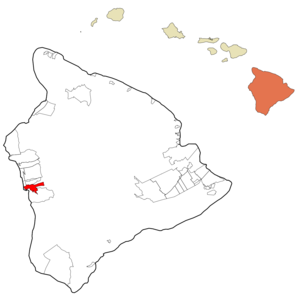
mapsize =
map_caption = Location in Hawaii County and the state ofHawaii
mapsize1 =
map_caption1 =
image_dot_
dot_mapsize =
dot_map_caption =
dot_x =
dot_y =
pushpin_
pushpin_label_position =
pushpin_map_caption =
pushpin_mapsize =
subdivision_type = Country
subdivision_name =United States
subdivision_type1 = State
subdivision_name1 =Hawaii
subdivision_type2 = County
subdivision_name2 = Hawaii
subdivision_type3 =
subdivision_name3 =
subdivision_type4 =
subdivision_name4 =
government_footnotes =
government_type =
leader_title =
leader_name =
leader_title1 =
leader_name1 =
leader_title2 =
leader_name2 =
leader_title3 =
leader_name3 =
leader_title4 =
leader_name4 =
established_title =
established_date =
established_title2 =
established_date2 =
established_title3 =
established_date3 =
area_magnitude =
unit_pref = Imperial
area_footnotes =
area_total_km2 = 31.5
area_land_km2 = 31.5
area_water_km2 = 0.0
area_total_sq_mi = 12.2
area_land_sq_mi = 12.2
area_water_sq_mi = 0.0
area_water_percent =
area_urban_km2 =
area_urban_sq_mi =
area_metro_km2 =
area_metro_sq_mi =
area_blank1_title =
area_blank1_km2 =
area_blank1_sq_mi =
population_as_of = 2000
population_footnotes =
population_note =
population_total = 3206
population_density_km2 = 101.8
population_density_sq_mi = 263.6
population_metro =
population_density_metro_km2 =
population_density_metro_sq_mi =
population_urban =
population_density_urban_km2 =
population_density_urban_sq_mi =
population_blank1_title =
population_blank1 =
population_density_blank1_km2 =
population_density_blank1_sq_mi =
timezone = Hawaii-Aleutian
utc_offset = -10
timezone_DST =
utc_offset_DST =
latd = 19
latm = 29
lats = 54
latNS = N
longd = 155
longm = 54
longs = 15
longEW = W
elevation_footnotes =
elevation_m = 381
elevation_ft = 1250
postal_code_type =ZIP code
postal_code = 96704
area_code = 808
blank_name = FIPS code
blank_info = 15-03850
blank1_name = GNIS feature ID
blank1_info = 0358717
website =
footnotes = Captain Cook is acensus-designated place (CDP) in Hawaiokinai County, Hawaiokinai, in theUnited States . As of the 2000 census, the CDP population was 3,206. The town, which is actually located in the land division of Kealakekua, is so named because the post office for the area was located in the Captain Cook Coffee Co. during the early 1900s.Geography
Captain Cook is located at coor dms|19|29|54|N|155|54|15|W|city (19.498211, -155.904275)GR|1. According to the
United States Census Bureau , the CDP has a total area of 12.2 square miles (31.5 km²), all of it land.Most of Captain Cook lies between the 800- and convert|2000|ft|m|sing=on elevation, which makes it ideal as a
coffee growing region. It sits on the top of an ancient fault which created the famousKealakekua Bay . Prior to the 1960s, most of Captain Cook was part of the vastKealakekua Ranch , founded in the 1850s by English immigrant Henry Nicholas Greenwell. [http://www.westhawaiitoday.com/articles/2007/07/04/local/local02.txt]Demographics
As of the
census GR|2 of 2000, there were 3,206 people, 1,152 households, and 822 families residing in the CDP. Thepopulation density was 263.6 people per square mile (101.8/km²). There were 1,223 housing units at an average density of 100.6/sq mi (38.8/km²). The racial makeup of the CDP was 33.44% White, 0.22% African American, 0.19% Native American, 31.63% Asian, 7.86% Pacific Islander, 1.09% from other races, and 25.58% from two or more races. Hispanic or Latino of any race were 8.05% of the population.There were 1,152 households out of which 30.9% had children under the age of 18 living with them, 52.5% were married couples living together, 12.4% had a female householder with no husband present, and 28.6% were non-families. 21.4% of all households were made up of individuals and 9.4% had someone living alone who was 65 years of age or older. The average household size was 2.78 and the average family size was 3.24.
In the CDP the population was spread out with 26.2% under the age of 18, 6.9% from 18 to 24, 22.6% from 25 to 44, 29.7% from 45 to 64, and 14.6% who were 65 years of age or older. The median age was 42 years. For every 100 females there were 103.7 males. For every 100 females age 18 and over, there were 98.2 males.
The median income for a household in the CDP was $47,644, and the median income for a family was $60,179. Males had a median income of $36,250 versus $27,155 for females. The
per capita income for the CDP was $21,237. About 5.4% of families and 8.5% of the population were below thepoverty line , including 10.5% of those under age 18 and 3.6% of those age 65 or over.Points of interest
*
Amy B. H. Greenwell Ethnobotanical Garden
*Koa Coffee Plantation
*Uchida Coffee Farm Museum
*Rodney J. T. Yano Memorial HallReferences
External links
Wikimedia Foundation. 2010.