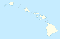
- Nīnole, Hawaii
-
Nīnole, Kaʻū, Hawaii Location within the state of Hawaii Coordinates: 19°8′2″N 155°30′45″W / 19.13389°N 155.5125°W Country United States State Hawaii County Hawaii Elevation 85 ft (26 m) Time zone Hawaii-Aleutian (HAST) (UTC-10) – Summer (DST) HADT (UTC-9) GNIS feature ID 362657 Nīnole, Hāmākua, Hawaii Location within the state of Hawaii Coordinates: 19°56′17″N 155°10′8″W / 19.93806°N 155.16889°WCoordinates: 19°56′17″N 155°10′8″W / 19.93806°N 155.16889°W ZIP code 96773 GNIS feature ID 362658 Nīnole (also spelled Hinole, Ninole, or Ninoli) is the name of two unincorporated communities on the island of Hawaiʻi in Hawaii County, Hawaii, United States. In the Hawaiian language Nīnole means "bending".[1] Ninole also has the highest percentage of people of Italian descent in Hawaii.
Kaʻū
One Nīnole is in the Kaʻū District south of Route 11 (Hawaii Belt Road) adjacent to the south of Punaluʻu Beach.[2] It was on Nīnole Cove,[3] a small bay at the shore of what is now Sea Mountain Gold Course. The village was the birthplace of Henry ʻŌpūkahaʻia (1792–1818) who inspired the missionary movement that forever changed Hawaii. It was mostly destroyed by a tsunami after the 1868 Hawaii earthquake.[4] Its elevation is 85 feet (26 m). Because the community has borne multiple names, the Board on Geographic Names officially designated it "Nīnole" in 2000.[5]
Hāmākua
The other Nīnole is on the Hāmākua Coast north of Hilo along Route 19 (Mamalahoa Highway) south of Pāpaʻaloa and north of Hakalau.[6][7] Although it is unincorporated, it has a post office, with the ZIP code of 96773.[8] It is located at 19°56′17″N 155°10′4″W / 19.93806°N 155.16778°W.[9]
References
- ^ Mary Kawena Pukui, Samuel Hoyt Elbert and Esther T. Mookini (2004). "lookup of Ninole ". in Place Names of Hawai'i. Ulukau, the Hawaiian Electronic Library, University of Hawaii Press. http://wehewehe.org/gsdl2.5/cgi-bin/hdict?j=pp&l=en&q=Ninole&d=. Retrieved November 8, 2010.
- ^ Lloyd J. Soehren (2010). "lookup of Ninole ". in Hawaiian Place Names. Ulukau, the Hawaiian Electronic Library. http://ulukau.org/gsdl2.5/cgi-bin/hpn?l=en&a=d&d=HASHa39876e35ac79bf1d42f11. Retrieved November 8, 2010.
- ^ U.S. Geological Survey Geographic Names Information System: Nīnole Cove Retrieved November 8, 2010.
- ^ John R. K. Clark (2004). "lookup of Ninole ". in Hawai'i Place Names: Shores, Beaches, and Surf Sites. Ulukau, the Hawaiian Electronic Library, University of Hawaii Press. http://wehewehe.org/gsdl2.5/cgi-bin/hdict?j=cl&l=en&q=Ninole&d=. Retrieved November 8, 2010.
- ^ U.S. Geological Survey Geographic Names Information System: Nīnole Retrieved November 8, 2010.
- ^ U.S. Geological Survey Geographic Names Information System: Nīnole Retrieved November 8, 2010.
- ^ Lloyd J. Soehren (2010). "lookup of Ninole ". in Hawaiian Place Names. Ulukau, the Hawaiian Electronic Library. http://ulukau.org/gsdl2.5/cgi-bin/hpn?l=en&a=d&d=HASH01fbe6569763730c832c4b92. Retrieved November 8, 2010.
- ^ "Search Results for Zip code 96773". http://www.zipinfo.com/cgi-local/zipsrch.exe?cnty=cnty&zip=96773. Retrieved November 8, 2010.
- ^ U.S. Geological Survey Geographic Names Information System: Nīnole Post Office Retrieved November 8, 2010.
Municipalities and communities of Hawaii County, Hawaii CDPs Ainaloa | Captain Cook | Eden Roc | Fern Acres | Fern Forest | Halaula | Hawaiian Acres | Hawaiian Beaches | Hawaiian Ocean View | Hawaiian Paradise Park | Hawi | Hilo | Holualoa | Honalo | Honaunau-Napoopoo | Honokaa | Honomu | Kahaluu-Keauhou | Kailua | Kalaoa | Kapaau | Keaau | Kealakekua | Kukuihaele | Kurtistown | Laupāhoehoe | Leilani Estates | Mountain View | Naalehu | Nanawale Estates | Orchidlands Estates | Paauilo | Pahala | Pahoa | Papaikou | Pepeekeo | Paukaa | Puako | Volcano | Waikoloa Village | Waimea | Wainaku
Unincorporated
communitiesDistricts Categories:- Unincorporated communities in Hawaii County, Hawaii
- Populated places on Hawaii (island)
- Hawaii geography stubs
Wikimedia Foundation. 2010.


