- Waimea, Hawaii County, Hawaii
Infobox Settlement
official_name = Waimea, Hawaii
other_name =
native_name =
nickname =
settlement_type = CDP
motto = |thumb|280px
imagesize = 250px
image_caption = Cattle pastures just outside of Waimea
flag_size =
image_
seal_size =
image_shield =
shield_size =
image_blank_emblem =
blank_emblem_type =
blank_emblem_size =
flag_size =
image_
seal_size =
image_shield =
shield_size =
image_blank_emblem =
blank_emblem_type =
blank_emblem_size =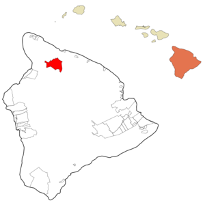
mapsize = 250px
map_caption = Location in Hawaii County and the state ofHawaii
mapsize1 =
map_caption1 =
image_dot_
dot_mapsize =
dot_map_caption =
dot_x =
dot_y =
pushpin_
pushpin_label_position =
pushpin_map_caption =
pushpin_mapsize =
subdivision_type = Country
subdivision_name =United States
subdivision_type1 = State
subdivision_name1 =Hawaii
subdivision_type2 = County
subdivision_name2 = Hawaii
subdivision_type3 =
subdivision_name3 =
subdivision_type4 =
subdivision_name4 =
government_footnotes =
government_type =
leader_title =
leader_name =
leader_title1 =
leader_name1 =
leader_title2 =
leader_name2 =
leader_title3 =
leader_name3 =
leader_title4 =
leader_name4 =
established_title =
established_date =
established_title2 =
established_date2 =
established_title3 =
established_date3 =
area_magnitude =
unit_pref = Imperial
area_footnotes =
area_total_km2 =
area_land_km2 =
area_water_km2 =
area_total_sq_mi =
area_land_sq_mi =
area_water_sq_mi =
area_water_percent =
area_urban_km2 =
area_urban_sq_mi =
area_metro_km2 =
area_metro_sq_mi =
area_blank1_title =
area_blank1_km2 =
area_blank1_sq_mi =
population_as_of = 2000
population_footnotes =
population_note =
population_total = 7028
population_density_km2 = 25.8
population_density_sq_mi = 66.8
population_metro =
population_density_metro_km2 =
population_density_metro_sq_mi =
population_urban =
population_density_urban_km2 =
population_density_urban_sq_mi =
population_blank1_title =
population_blank1 =
population_density_blank1_km2 =
population_density_blank1_sq_mi =
timezone = Hawaii-Aleutian
utc_offset = -10
timezone_DST =
utc_offset_DST =
latd = 20
latm = 14
lats = 31
latNS = N
longd = 155
longm = 50
longs = 2
longEW = W
elevation_footnotes =
elevation_m =
elevation_ft =
postal_code_type =ZIP code
postal_code = 96743
area_code = 808
blank_name = FIPS code
blank_info =
blank1_name = GNIS feature ID
blank1_info =
website =
footnotes =Waimea is a
census-designated place (CDP) in Hawaiokinai County, Hawaiokinai,United States . The population was 7,028 at the 2000 census. Since eachU.S. state cannot have more than one post office of the same name, the officialUSPS name for Waimea is Kamuela, since there are many 'Waimeas' on the islands of Hawaiokinai.Waimea is the largest town in the interior of the Big Island, and is the center for ranching activities and
paniolo culture.Parker Ranch in and around Waimea is the largest privately-owned cattle ranch in the US, and the annualFourth of July rodeo is a major event.Waimea is also home to the headquarters of two astronomical observatories located on
Mauna Kea , theKeck Observatory and theCanada-France-Hawaii Telescope .History
It is believed that the watershed area of the Kohalas once supported several thousand native Hawaiians living sustainably off the land, farming and cultivating
sandlewood ,kapa andhale . As the Europeans arrived to the area, most of the forests were harvested and the land became ideal for grazing animals. Blacklonghorn cattle were introduced as a gift to HawaiianKing Kamehameha I by British CaptainGeorge Vancouver . In 1809, John Parker arrived to the area after jumping ship and over time became employed by the king to tame the population of cattle, which at this point had grown out of control. In 1815 Parker married Kipikane, the daughter of a high-ranking chief, and as a family developed what is now Parker Ranch, the largest ranch in the area. [http://www.kamuela.com/history.asp] Wiamea's other name Kamuela is the Hawaiian name for Samuel, named after Samuel Parker, the son of John parker. [http://gohawaii.about.com/od/bigisland/p/profile_waimea.htm]The early 1800's also saw the arrival if the horse and Latin American vaqueros (cowboys), bringing traditional western culture, riding and roping skills. The king hired these vaqueros to teach Hawaiians herding and ranching skills and 1836, the island had working cowboys. As the Hawaiian culture and Latin vaquero cultured commingled, a unique breed of cowboy emerged, the
paniolo . [http://gohawaii.about.com/od/bigisland/a/waimea_001a.htm]During World War II beef and vegetable prices increased and farmers returned to cultivate the corn, beets, cabbage and a variety of other green vegetables. Farm and ranchland acreage increased from 75 in 1939 to 518 in 1946. [http://www.kamuela.com/history.asp] Waimea also saw many soldiers during this time who built a large temporary tent city. When the war was over and the military had left, Waimea had an entertainment center, now
Kahilu Hall , and an airstrip, nowWaimea-Kohala Airport .Geography
Waimea is located at coor dms|20|1|26|N|155|38|50|W|city (20.023926, -155.647357)GR|1.
According to the
United States Census Bureau , the CDP has a total area of 38.8square mile s (100.5km² ), of which, 38.8 square miles (100.4 km²) of it is land and 0.1 square miles (0.2 km²) of it (0.15%) is water.Demographics
As of the
census GR|2 of 2000, there were 7,028 people, 2,371 households, and 1,782 families residing in the CDP. Thepopulation density was 181.4 people per square mile (70.0/km²). There were 2,589 housing units at an average density of 66.8/sq mi (25.8/km²). The racial makeup of the CDP was 30.65% White, 0.33% African American, 0.17% Native American, 20.29% Asian, 15.61% Pacific Islander, 0.73% from other races, and 32.23% from two or more races. Hispanic or Latino of any race were 7.80% of the population.There were 2,371 households out of which 39.0% had children under the age of 18 living with them, 56.6% were married couples living together, 13.2% had a female householder with no husband present, and 24.8% were non-families. 18.9% of all households were made up of individuals and 5.7% had someone living alone who was 65 years of age or older. The average household size was 2.95 and the average family size was 3.36.
In the CDP the population was spread out with 29.7% under the age of 18, 7.1% from 18 to 24, 28.1% from 25 to 44, 25.0% from 45 to 64, and 10.1% who were 65 years of age or older. The median age was 36 years. For every 100 females there were 97.4 males. For every 100 females age 18 and over, there were 94.0 males.
The median income for a household in the CDP was $51,150, and the median income for a family was $55,822. Males had a median income of $36,710 versus $27,217 for females. The
per capita income for the CDP was $20,773. About 4.2% of families and 6.0% of the population were below thepoverty line , including 8.7% of those under age 18 and 5.4% of those age 65 or over.References
External links
Wikimedia Foundation. 2010.