- Hōlualoa, Hawai'i
Infobox Settlement
official_name = Holualoa, Hawaii
other_name =
native_name =
nickname =
settlement_type = CDP
motto =
imagesize =
image_caption =
flag_size =
image_
seal_size =
image_shield =
shield_size =
image_blank_emblem =
blank_emblem_type =
blank_emblem_size =
imagesize =
image_caption =
flag_size =
image_
seal_size =
image_shield =
shield_size =
image_blank_emblem =
blank_emblem_type =
blank_emblem_size =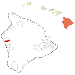
mapsize =
map_caption = Location in Hawaii County and the state ofHawaii
mapsize1 =
map_caption1 =
image_dot_
dot_mapsize =
dot_map_caption =
dot_x =
dot_y =
pushpin_
pushpin_label_position =
pushpin_map_caption =
pushpin_mapsize =
subdivision_type = Country
subdivision_name =United States
subdivision_type1 = State
subdivision_name1 =Hawaii
subdivision_type2 = Counties
subdivision_name2 = Hawaii
subdivision_type3 =
subdivision_name3 =
subdivision_type4 =
subdivision_name4 =
government_footnotes =
government_type =
leader_title =
leader_name =
leader_title1 =
leader_name1 =
leader_title2 =
leader_name2 =
leader_title3 =
leader_name3 =
leader_title4 =
leader_name4 =
established_title =
established_date =
established_title2 =
established_date2 =
established_title3 =
established_date3 =
area_magnitude =
unit_pref = Imperial
area_footnotes =
area_total_km2 = 39.3
area_land_km2 = 36.7
area_water_km2 = 2.6
area_total_sq_mi = 15.2
area_land_sq_mi = 14.2
area_water_sq_mi = 1
area_water_percent =
area_urban_km2 =
area_urban_sq_mi =
area_metro_km2 =
area_metro_sq_mi =
area_blank1_title =
area_blank1_km2 =
area_blank1_sq_mi =
population_as_of = 2000
population_footnotes =
population_note =
population_total = 6107
population_density_km2 = 155.4
population_density_sq_mi = 401.8
population_metro =
population_density_metro_km2 =
population_density_metro_sq_mi =
population_urban =
population_density_urban_km2 =
population_density_urban_sq_mi =
population_blank1_title =
population_blank1 =
population_density_blank1_km2 =
population_density_blank1_sq_mi =
timezone =
utc_offset =
timezone_DST =
utc_offset_DST =
latd=
latm=
lats=
latNS=
longd=
longm=
longs=
longEW=
elevation_footnotes =
elevation_m =
elevation_ft =
postal_code_type =
postal_code =
area_code =
blank_name =
blank_info =
blank1_name =
blank1_info =
website =
footnotes = Hōlualoa is acensus-designated place (CDP) in Hawai‘i County, Hawai‘i,United States . The population was 6,107 at the 2000 census.Geography
Hōlualoa is located at coor dms|19|36|59|N|155|58|6|W|city (19.616353, -155.968278)GR|1.
According to the
United States Census Bureau , the CDP has a total area of 15.2square mile s (39.3km² ), of which, 14.1 square miles (36.6 km²) of it is land and 1.0 square miles (2.6 km²) of it (6.66%) is water.Demographics
As of the
census GR|2 of 2000, there were 6,107 people, 2,383 households, and 1,560 families residing in the CDP. Thepopulation density was 431.6 people per square mile (166.6/km²). There were 3,330 housing units at an average density of 235.3/sq mi (90.9/km²). The racial makeup of the CDP was 55.51% White, 0.59% African American, 0.54% Native American, 17.11% Asian, 7.63% Pacific Islander, 1.49% from other races, and 17.13% from two or more races. Hispanic or Latino of any race were 7.35% of the population.Ancestries: German (12.1%), English (10.4%), Irish (8.4%), Scottish (4.1%), Italian (3.5%), Polish (3.3%).
There were 2,383 households out of which 26.5% had children under the age of 18 living with them, 51.9% were married couples living together, 8.9% had a female householder with no husband present, and 34.5% were non-families. 23.8% of all households were made up of individuals and 6.4% had someone living alone who was 65 years of age or older. The average household size was 2.56 and the average family size was 3.01.
In the CDP the population was spread out with 21.4% under the age of 18, 6.2% from 18 to 24, 27.6% from 25 to 44, 31.8% from 45 to 64, and 13.0% who were 65 years of age or older. The median age was 42 years. For every 100 females there were 102.6 males. For every 100 females age 18 and over, there were 100.2 males.
The median income for a household in the CDP was $50,492, and the median income for a family was $52,193. Males had a median income of $37,461 versus $27,733 for females. The
per capita income for the CDP was $25,222. About 3.4% of families and 7.8% of the population were below thepoverty line , including 7.2% of those under age 18 and 8.9% of those age 65 or over.References
External links
Wikimedia Foundation. 2010.