- National Register of Historic Places listings in Washington County, Utah
-
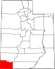
 Location of Washington County in Utah
This is a list of the National Register of Historic Places listings in Washington County, Utah.
This is intended to be a complete list of the properties and districts on the National Register of Historic Places in Washington County, Utah, United States. Latitude and longitude coordinates are provided for many National Register properties and districts; these locations may be seen together in a Google map.[1]
There are 78 properties and districts listed on the National Register in the county.
-
- This National Park Service list is complete through NPS recent listings posted November 10, 2011.[2]
Current listings
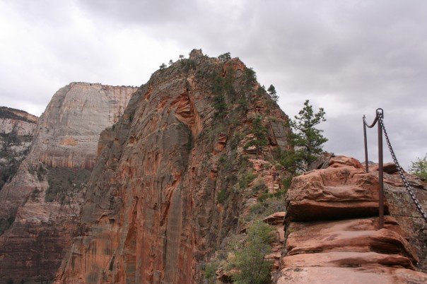
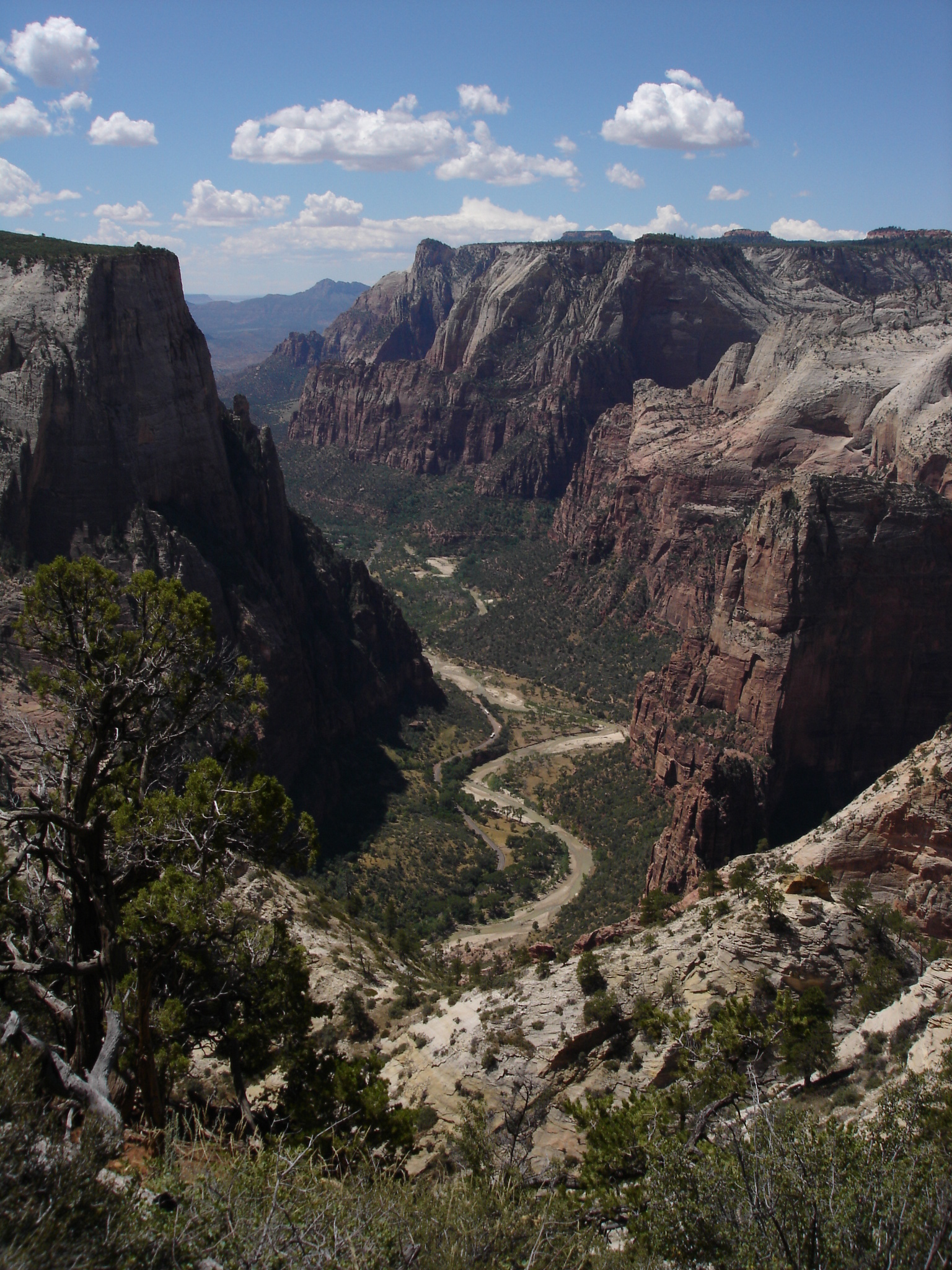
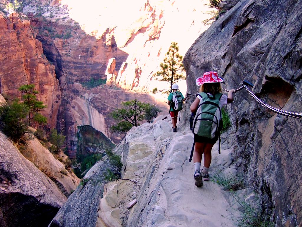
[3] Landmark name [4] Image Date listed Location City or town Summary 1 Angels Landing Trail-West Rim Trail 
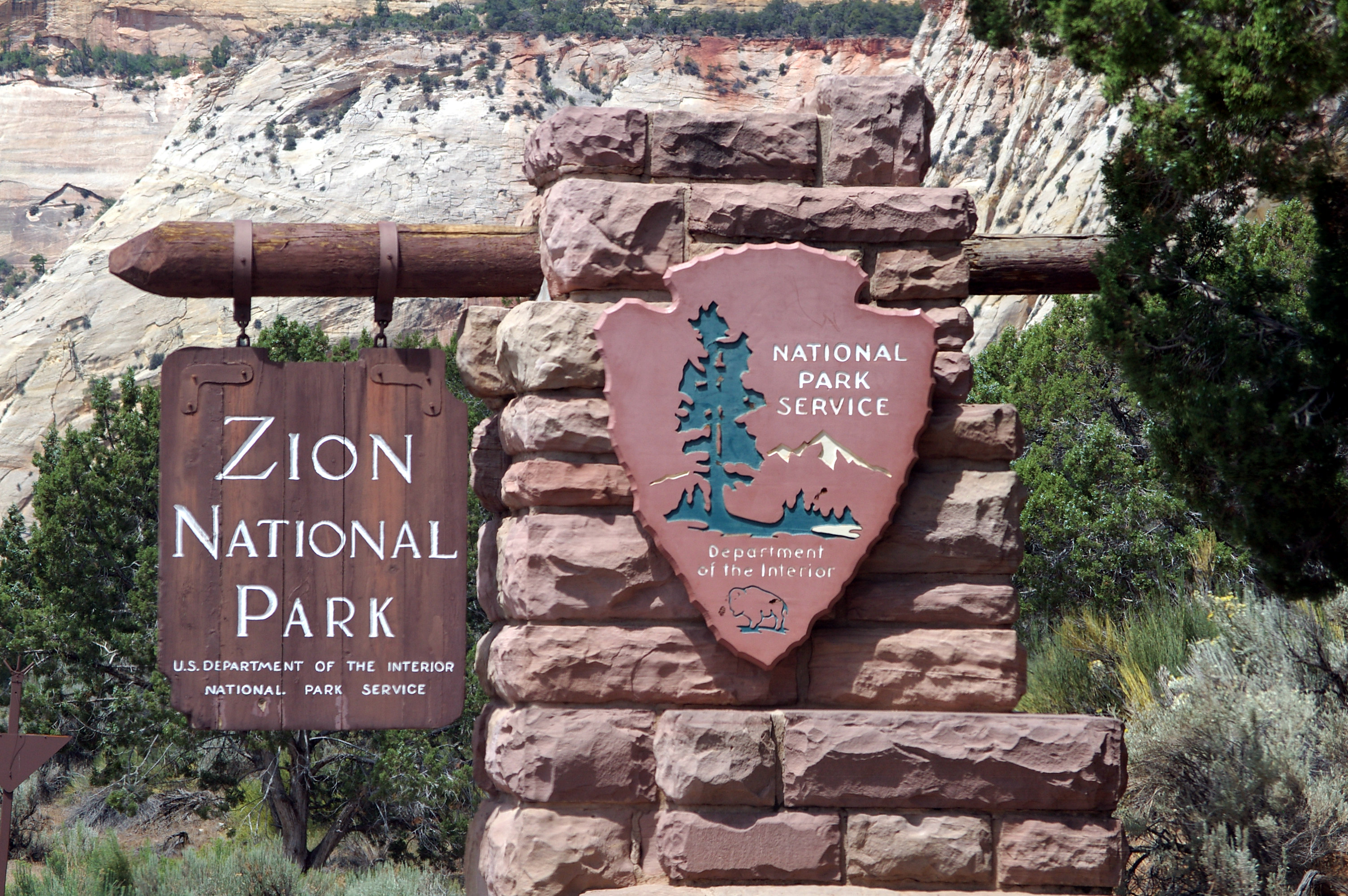
February 14, 1987 South of Scout Lookout across the Virgin River and Refrigerator Canyon
37°16′06″N 112°56′58″W / 37.268333°N 112.949444°WSpringdale 2 Wallace Blake House November 14, 1978 South of St. George
37°02′49″N 113°36′15″W / 37.046944°N 113.604167°WSt. George 3 Bradshaw House-Hotel September 26, 1991 85 S. Main St.
37°10′31″N 113°17′13″W / 37.175278°N 113.286944°WHurricane 4 William F. Butler House July 13, 1984 168 S. 300 West
37°06′19″N 113°35′21″W / 37.105278°N 113.589167°WSt. George 5 Cable Creek Bridge 
February 16, 1996 Floor of the Valley Rd. at milepost 4.48, south of Weeping Rock Parking Area entrance
37°16′13″N 112°56′19″W / 37.270278°N 112.938611°WSpringdale 6 Cable Mountain Draw Works 
May 24, 1978 North of Springdale in Zion National Park
37°15′57″N 112°55′59″W / 37.265833°N 112.933056°WSpringdale 7 Canyon Overlook Trail 
February 14, 1987 Across the highway from the parking area at the eastern end of the Zion-Mt. Carmel Tunnel to a point directly above the Great Arch of Zion
37°12′49″N 112°56′54″W / 37.213611°N 112.948333°WSpringdale 8 Robert D. Covington House 
April 20, 1978 200 N. 200 East
37°08′05″N 113°30′20″W / 37.134722°N 113.505556°WWashington 9 Crawford Irrigation Canal 
July 7, 1987 Western bank of the Virgin River from 1 mile north of the Virgin River bridge to the base of the Virgin River Formation and 0.5 miles up Oak Creek
37°12′40″N 112°59′33″W / 37.211111°N 112.9925°WSpringdale 10 Deseret Telegraph and Post Office 
February 23, 1972 On State Route 9
37°09′39″N 113°02′34″W / 37.160833°N 113.042778°WRockville 11 East Entrance Checking Station 
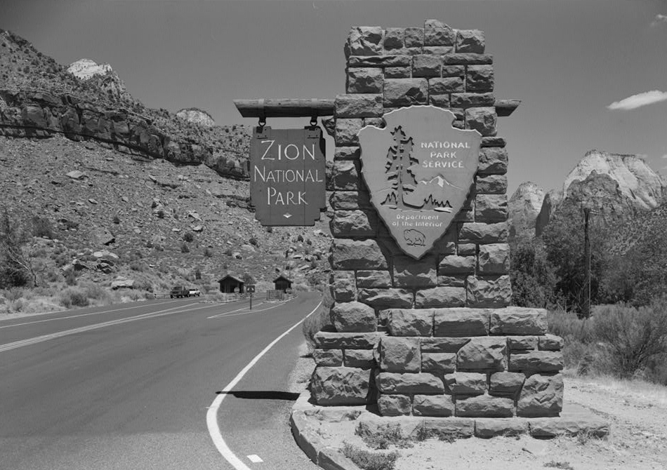
February 14, 1987 Island in middle of State Route 9
37°14′01″N 112°52′06″W / 37.233611°N 112.868333°WSpringdale 12 East Entrance Residence 
February 14, 1987 Eastern entrance 150 feet north of State Route 9
37°14′01″N 112°52′41″W / 37.233611°N 112.878056°WSpringdale 13 East Entrance Sign 
July 7, 1987 East Entrance Checking Station on northern and southern sides of State Route 9
37°14′07″N 112°52′07″W / 37.235278°N 112.868611°WSpringdale 14 East Rim Trail 
July 7, 1987 Between Weeping Rock Parking Area and Observation Point
37°16′42″N 112°55′45″W / 37.278333°N 112.929167°WSpringdale 15 Emerald Pools Trail 
February 14, 1987 Footbridge across the highway from Utah Parks Lodge proceeding west to the Lower Emerald Pool
37°14′58″N 112°57′16″W / 37.249444°N 112.954444°WSpringdale 16 Enterprise Meetinghouse May 14, 1993 Approximately 24 S. Center St.
37°34′23″N 113°43′16″W / 37.573056°N 113.721111°WEnterprise 17 Flanigan Ditch 
January 12, 1998 Zion National Park
37°12′53″N 112°58′28″W / 37.214722°N 112.974444°WSpringdale 18 Floor of the Valley Road 
February 16, 1996 From its junction with the Zion-Mt. Carmel Highway along the North Fork of the Virgin River in Zion National Park
37°15′20″N 112°57′17″W / 37.255556°N 112.954722°WSpringdale 19 Thomas Forsyth House February 11, 1982 111 N. Toquer Boulevard
37°15′05″N 113°17′04″W / 37.251389°N 113.284444°WToquerville 20 Fort Harmony Site November 16, 1979 East of New Harmony on Interstate 15
37°28′46″N 113°14′05″W / 37.479444°N 113.234722°WNew Harmony 21 Fort Pearce November 20, 1975 12 miles southeast of Washington off Interstate 15
37°00′28″N 113°24′41″W / 37.007778°N 113.411389°WWashington 22 Gateway to the Narrows Trail 
July 7, 1987 Temple of Sinawava at the end of Zion Canyon Scenic Dr. to a point 1 mile north on the Virgin River
37°17′48″N 112°56′42″W / 37.296667°N 112.945°WSpringdale 23 George and Bertha Graff House December 4, 1998 2865 Santa Clara Dr.
37°07′56″N 113°39′01″W / 37.132222°N 113.650278°WSanta Clara 24 Grafton Historic District 
September 9, 2010 Beginning at Hall and Grafton Ditch and the Grafton to Rockville Rd.
37°10′0″N 113°5′6″W / 37.166667°N 113.085°W[5]Rockville 25 Grotto Camping Ground North Comfort Station 
February 14, 1987 Grotto Picnic Area near Grotto Residence, east of Scenic Dr.
37°15′33″N 112°56′33″W / 37.259167°N 112.9425°WSpringdale 26 Grotto Camping Ground South Comfort Station 
February 14, 1987 Grotto Picnic Area near Grotto Residence, east of Scenic Dr.
37°15′31″N 112°56′27″W / 37.258611°N 112.940833°WSpringdale 27 Grotto Trail 
February 14, 1996 Zion National Park, 120 feet north of Zion Lodge extending south 0.2 miles parallel to the eastern side of Zion Canyon Scenic Dr.
37°15′01″N 112°57′26″W / 37.250278°N 112.957222°WSpringdale 28 Hans George Hafen House December 4, 1998 3003 Santa Clara Dr.
37°07′57″N 113°39′10″W / 37.1325°N 113.652778°WSanta Clara 29 Jacob Hamblin House 
March 11, 1971 3400 Hamblin Dr.
37°08′00″N 113°39′36″W / 37.133333°N 113.66°WSanta Clara 30 Hidden Canyon Trail 
February 14, 1987 Hidden Canyon junction on the East Rim Trail to the mouth of Hidden Canyon
37°16′01″N 112°55′50″W / 37.266944°N 112.930556°WSpringdale 31 Hurricane Canal 
August 29, 1977 East of Hurricane
37°10′45″N 113°15′59″W / 37.179167°N 113.266389°WHurricane 32 Hurricane Historic District August 4, 1995 Roughly bounded by 300 South, 200 West, State St. and the Hurricane Canal
37°10′26″N 113°17′19″W / 37.173889°N 113.288611°WHurricane 33 Hurricane Library-City Hall September 26, 1991 35 W. State St.
37°10′35″N 113°17′17″W / 37.176389°N 113.288056°WHurricane 34 Hurricane-LaVerkin Bridge 
April 14, 1995 East of State Route 9 over the Virgin River
37°11′22″N 113°16′13″W / 37.189444°N 113.270278°WHurricane 35 Samuel and Elizabeth Isom House March 4, 1993 188 S. 100 West
37°10′26″N 113°17′21″W / 37.173889°N 113.289167°WHurricane 36 James Jepson, Jr. House June 22, 2000 15 E. Jepson St.
37°11′59″N 113°11′08″W / 37.199722°N 113.185556°WVirgin 37 Thomas Judd House January 31, 1978 269 S. 200 East
37°06′08″N 113°34′40″W / 37.102222°N 113.577778°WSt. George 38 Lemuel and Mary Ann Leavitt House February 12, 1999 1408 N. Quail St.
37°07′58″N 113°39′18″W / 37.132778°N 113.655°WSanta Clara 39 Leeds CCC Camp Historic District March 4, 1993 96 W. Mulberry
37°14′05″N 113°22′00″W / 37.234722°N 113.366667°WLeeds 40 Leeds Tithing Office January 25, 1985 Southwestern corner of 100 West and 100 North
37°14′11″N 113°21′44″W / 37.236389°N 113.362222°WLeeds 41 Main Building of Dixie College June 19, 1980 86 S. Main St.
37°06′25″N 113°34′58″W / 37.106944°N 113.582778°WSt. George 42 Mountain Meadows Historic Site August 28, 1975 7 miles south of Enterprise on State Route 18
37°28′57″N 113°38′10″W / 37.4825°N 113.636111°WEnterprise 43 Mountain Meadows Massacre Site June 23, 2011 West of State Route 18, approximately 3 miles north of Central
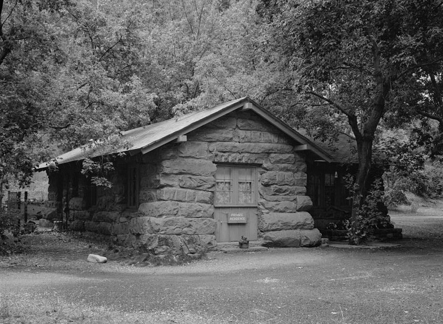
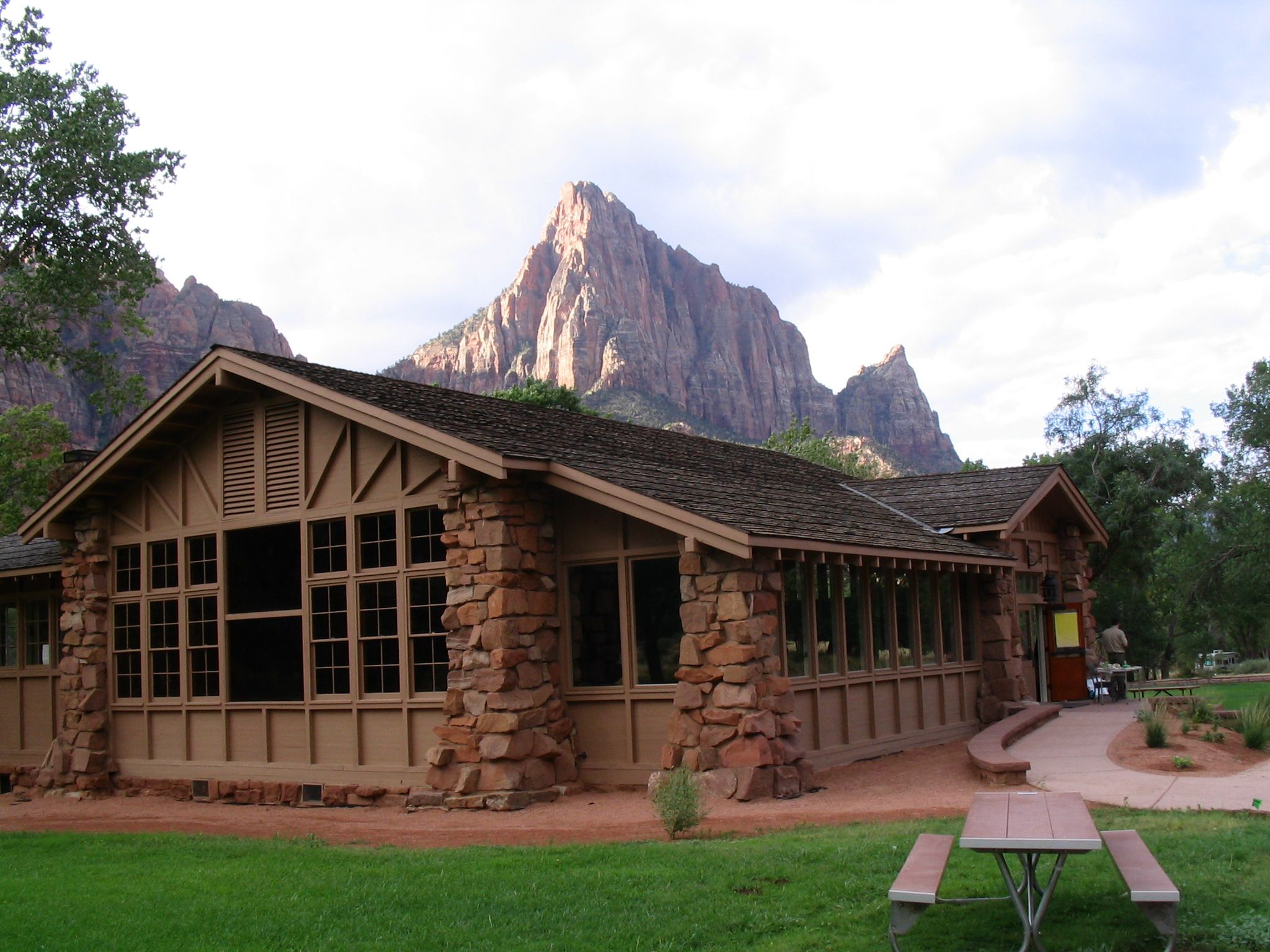
37°28′32″N 113°38′37″W / 37.475556°N 113.643611°WCentral vicinity Comprises approximately 760 acres within the 3,000-acre Mountain Meadows Historic Site[6] 44 Museum-Grotto Residence 
February 14, 1987 Southeast of Grotto Picnic Area
37°15′28″N 112°57′03″W / 37.257778°N 112.950833°WSpringdale 45 Naegle Winery 
February 20, 1980 110 S. Toquer Boulevard
37°14′55″N 113°17′48″W / 37.248611°N 113.296667°WToquerville 46 Oak Creek Historic District 
July 7, 1987 Off U.S. Route 9 along bank of Oak Creek
37°12′40″N 112°59′10″W / 37.211111°N 112.986111°WSpringdale 47 Oak Creek Irrigation Canal 
July 7, 1987 Western side of the North Fork of the Virgin River, 1/8 miles north of the Virgin River Bridge to the northern side of Watchman Campground Entrance Rd.
37°12′09″N 112°59′28″W / 37.2025°N 112.991111°WSpringdale 48 Old Washington County Courthouse 
September 22, 1970 85 E. 100 North
37°06′39″N 113°34′50″W / 37.110833°N 113.580556°WSt. George 49 Parunuweap Canyon Archeological District 
November 7, 1996 Address Restricted Springdale 50 Pine Creek Irrigation Canal 
July 7, 1987 Eastern bank of the Virgin River 0.25 miles north of the Virgin River bridge to the southwestern end of the Watchman Residential Loop
37°12′06″N 112°58′40″W / 37.201667°N 112.977778°WSpringdale 51 Pine Creek Residential Historic District 
July 7, 1987 Western side of State Route 9 500 feet south of the bridge over the Virgin River
37°12′59″N 112°58′32″W / 37.216389°N 112.975556°WSpringdale 52 Pine Valley Chapel and Tithing Office 
April 16, 1971 Main and Grass Valley Sts.
37°23′39″N 113°30′56″W / 37.394167°N 113.515556°WPine Valley 53 Orson Pratt House August 11, 1983 76 W. Tabernacle St.
37°06′31″N 113°35′01″W / 37.108611°N 113.583611°WSt. George 54 Frederick and Anna Maria Reber House December 4, 1998 2988-2990 Santa Clara Dr.
37°07′59″N 113°39′09″W / 37.133056°N 113.6525°WSanta Clara 55 Frederick, Jr., and Mary F. Reber House February 12, 1999 3334 Hamblin Dr.
37°08′01″N 113°39′32″W / 37.133611°N 113.658889°WSanta Clara 56 Rockville Bridge 
August 4, 1995 150 S. Bridge Rd. over the East Fork of the Virgin River
37°09′30″N 113°02′16″W / 37.158333°N 113.037778°WRockville 57 St. George Elementary School April 1, 1985 120 S. 100 West
37°06′28″N 113°35′06″W / 37.107778°N 113.585°WSt. George 58 St. George Social Hall April 3, 1991 212 N. Main St.
37°06′43″N 113°34′56″W / 37.111944°N 113.582222°WSt. George 59 St. George Tabernacle 
May 14, 1971 Junction of Tabernacle and Main Sts.
37°06′29″N 113°34′58″W / 37.108056°N 113.582778°WSt. George 60 St. George Temple 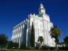
November 7, 1977 Bounded by 200 East, 300 East, 400 South, and 500 South
37°06′02″N 113°34′38″W / 37.100556°N 113.577222°WSt. George 61 Santa Clara Hydroelectric Power Plants Historic District April 21, 1989 Off State Route 18 on the Santa Clara River
37°18′25″N 113°42′40″W / 37.306944°N 113.711111°WGunlock and Veyo 62 Santa Clara Relief Society House 
February 2, 1994 Approximately 3036 W. Santa Clara Dr.
37°07′59″N 113°39′10″W / 37.133056°N 113.652778°WSanta Clara 63 Santa Clara Tithing Granary December 4, 1998 3105 Santa Clara Dr.
37°07′58″N 113°39′18″W / 37.132778°N 113.655°WSanta Clara 64 South Campground Amphitheater 
February 14, 1987 South Campground
37°12′12″N 112°58′55″W / 37.203333°N 112.981944°WSpringdale 65 South Campground Comfort Station 
February 14, 1987 South Campground at the northern end of the campsite loop
37°12′14″N 112°58′21″W / 37.203889°N 112.9725°WSpringdale 66 South Entrance Sign 
February 14, 1987 South Entrance
37°12′04″N 112°59′22″W / 37.201111°N 112.989444°WSpringdale 67 Southern Paiute Archeological District 
June 11, 1982 Address Restricted[7] Washington 68 Emanuel and Ursella Stanworth House December 17, 1992 198 S. Main St.
37°10′26″N 113°17′15″W / 37.173889°N 113.2875°WHurricane 69 John Steele House April 7, 1988 263 N. Toquerville Boulevard
37°15′20″N 113°17′05″W / 37.255556°N 113.284722°WToquerville 70 Washington Cotton Factory 
April 16, 1971 385 Telegraph St.
37°07′45″N 113°30′53″W / 37.129167°N 113.514722°WWashington 71 Washington Relief Society Hall August 27, 1980 100 W. Telegraph St.
37°07′48″N 113°30′58″W / 37.13°N 113.516111°WWashington 72 Washington School November 23, 1980 Main and Telegraph Sts.
37°08′58″N 113°30′31″W / 37.149444°N 113.508611°WWashington 73 Wells Fargo and Company Express Building 
March 11, 1971 Wells Fargo Rd.
37°15′11″N 113°22′00″W / 37.253056°N 113.366667°WSilver Reef 74 Woodward School November 23, 1980 100 West and Tabernacle Sts.
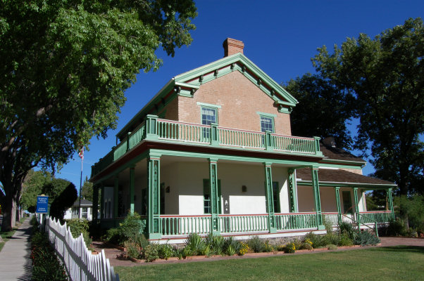
37°06′28″N 113°35′02″W / 37.107778°N 113.583889°WSt. George 75 Brigham Young Winter Home and Office 
February 22, 1971 Corner of 200 North and 100 West
37°06′41″N 113°35′06″W / 37.111389°N 113.585°WSt. George 76 Zion Lodge Historic District 
August 24, 1982 North of Springdale in Zion National Park; also west of State Route 9 on the eastern and western sides of The Zion Canyon Scenic Drive near Birch Creek
37°15′01″N 112°57′17″W / 37.250278°N 112.954722°WSpringdale Second set of boundaries represents a boundary increase 77 Zion Nature Center-Zion Inn 
February 14, 1987 North of South Campground facilities
37°12′21″N 112°58′25″W / 37.205833°N 112.973611°WSpringdale 78 Zion – Mount Carmel Highway 
July 7, 1987 Between U.S. Route 89 and State Route 9
37°13′19″N 112°55′58″W / 37.221944°N 112.932778°WSpringdale See also
References
- ^ The latitude and longitude information provided in this table was derived originally from the National Register Information System, which has been found to be fairly accurate for about 99% of listings. For about 1% of NRIS original coordinates, experience has shown that one or both coordinates are typos or otherwise extremely far off; some corrections may have been made. A more subtle problem causes many locations to be off by up to 150 yards, depending on location in the country: most NRIS coordinates were derived from tracing out latitude and longitudes off of USGS topographical quadrant maps created under the North American Datum of 1927, which differs from the current, highly accurate WGS84 GPS system used by Google maps. Chicago is about right, but NRIS longitudes in Washington are higher by about 4.5 seconds, and are lower by about 2.0 seconds in Maine. Latitudes differ by about 1.0 second in Florida. Some locations in this table may have been corrected to current GPS standards.
- ^ "National Register of Historic Places: Weekly List Actions". National Park Service, United States Department of the Interior. Retrieved on November 10, 2011.
- ^ Numbers represent an ordering by significant words. Various colorings, defined here, differentiate National Historic Landmark sites and National Register of Historic Places Districts from other NRHP buildings, structures, sites or objects.
- ^ "National Register Information System". National Register of Historic Places. National Park Service. . http://nrhp.focus.nps.gov/natreg/docs/All_Data.html.
- ^ Geocode coords derived from National Register nomination form.
- ^ "Mountain Meadows Massacre Site NRHP Nomination Form". http://www.nps.gov/nhl/Fall10Noms/MountainMeadowsREVISED.pdf. Retrieved August 1, 2011.
- ^ Some listings on the NRHP are highly sensitive sites and may be subject to looting or vandalism. The NRHP lists this site as "Address Restricted."
External links
 Media related to National Register of Historic Places in Washington County, Utah at Wikimedia Commons
Properties on the National Register of Historic Places in Utah 

U.S. National Register of Historic Places Topics Lists by states Alabama • Alaska • Arizona • Arkansas • California • Colorado • Connecticut • Delaware • Florida • Georgia • Hawaii • Idaho • Illinois • Indiana • Iowa • Kansas • Kentucky • Louisiana • Maine • Maryland • Massachusetts • Michigan • Minnesota • Mississippi • Missouri • Montana • Nebraska • Nevada • New Hampshire • New Jersey • New Mexico • New York • North Carolina • North Dakota • Ohio • Oklahoma • Oregon • Pennsylvania • Rhode Island • South Carolina • South Dakota • Tennessee • Texas • Utah • Vermont • Virginia • Washington • West Virginia • Wisconsin • WyomingLists by territories Lists by associated states Other Municipalities and communities of Washington County, Utah Cities Enterprise | Hildale | Hurricane | Ivins | La Verkin | Santa Clara | St. George | Toquerville | Washington
Towns Apple Valley | Leeds | New Harmony | Rockville | Springdale | Virgin
CDPs Unincorporated
communityGhost towns Adventure | Duncan's Retreat | Grafton | Harrisburg | Hebron | Silver Reef
Categories:- National Register of Historic Places listings in Washington County, Utah
- National Register of Historic Places in Utah by county
-


Wikimedia Foundation. 2010.