- National Register of Historic Places listings in Uintah County, Utah
-
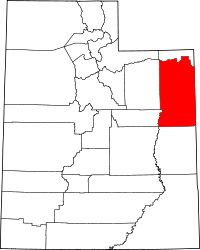 Location of Uintah County in Utah
This is a list of the National Register of Historic Places listings in Uintah County, Utah.
This is intended to be a complete list of the properties and districts on the National Register of Historic Places in Uintah County, Utah, United States. Latitude and longitude coordinates are provided for many National Register properties and districts; these locations may be seen together in a Google map.[1]
There are 19 properties and districts listed on the National Register in the county, including 2 National Historic Landmarks.
-
- This National Park Service list is complete through NPS recent listings posted November 10, 2011.[2]
Contents
Current listings
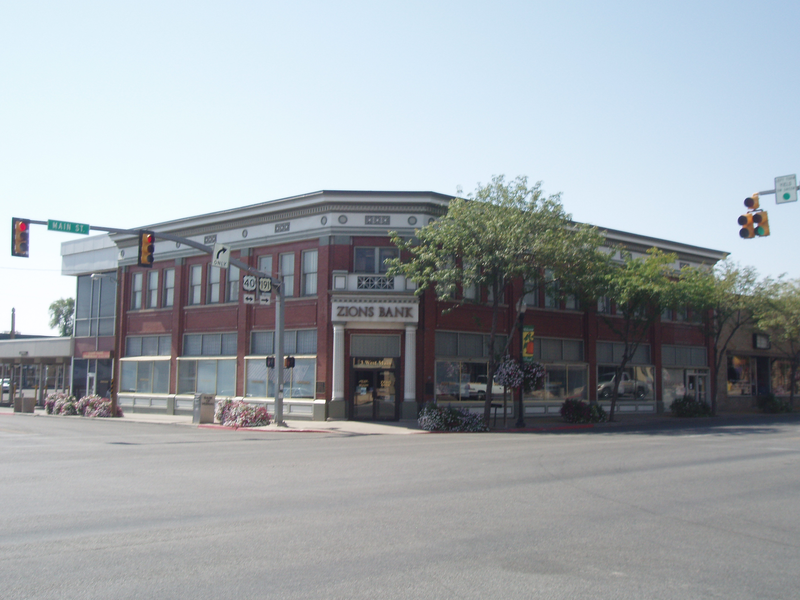
[3] Landmark name [4] Image Date listed Location City or town Summary 1 Bank of Vernal 
December 4, 2008 3 W. Main St.
40°27′21″N 109°31′43″W / 40.4557°N 109.52855°WVernal 2 Carter Road May 21, 2001 Ashley National Forest
40°43′11″N 109°43′10″W / 40.719722°N 109.719444°WAshley National Forest 3 Cockleburr Wash Petroglyphs 
September 4, 1980 Address Restricted[5] Jensen 4 Lewis Curry House 
July 26, 1982 189 S. Vernal Ave.
40°26′39″N 109°31′39″W / 40.444167°N 109.5275°WVernal 5 Desolation Canyon November 24, 1968 Along the Green River in western Uintah County between Ouray and Green River, about twice as close to Ouray
39°50′30″N 109°55′0″W / 39.84167°N 109.916667°W[6]Ouray Split between Emery, Grand, Carbon, and Uintah counties 6 Earl Douglass Workshop-Laboratory 
December 19, 1986 U.S. Route 40
40°26′26″N 109°18′04″W / 40.440556°N 109.301111°WDinosaur National Monument 7 Fenn-Bullock House 
March 25, 1999 388 W. 100 North
40°27′26″N 109°32′07″W / 40.457222°N 109.535278°WVernal 8 Gibson-Sowards House 
November 24, 1997 3110 N. 250 West
40°30′05″N 109°31′59″W / 40.501389°N 109.533056°WVernal 9 Little Brush Creek Petroglyphs March 15, 1976 Address Restricted[5] Vernal 10 Manfred and Ethel Martin House 
December 29, 2004 163 N. Vernal Ave.
40°27′28″N 109°31′41″W / 40.457778°N 109.528056°WVernal 11 McConkie Ranch Petroglyphs 
September 25, 1975 Southeast of Dry Fork
40°32′55″N 109°38′17″W / 40.548611°N 109.638056°WVernal 12 Josie Bassett Morris Ranch Complex 
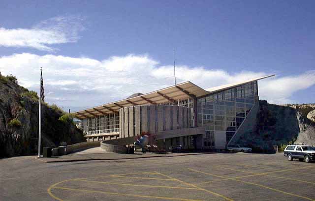
December 19, 1986 U.S. Route 40
40°25′31″N 109°10′31″W / 40.425278°N 109.175278°WDinosaur National Monument 13 Quarry Visitor Center 
December 19, 1986 U.S. Route 40
40°26′33″N 109°18′05″W / 40.4425°N 109.301389°WDinosaur National Monument 14 St. Paul's Episcopal Church and Lodge 
January 3, 1985 226 W. Main St.
40°27′21″N 109°31′57″W / 40.455833°N 109.5325°WVernal 15 William and Emily Siddoway House April 5, 2006 1055 N. Vernal Ave.
40°28′16″N 109°31′44″W / 40.471111°N 109.528889°WVernal 16 Francis 'Frank' and Eunice Smith House 
March 29, 2001 1847 N. 3000 West
40°28′24″N 109°35′12″W / 40.473333°N 109.586667°WVernal 17 Vernal Tithing Office 
January 25, 1985 Northwestern corner of 500 West and 200 South
40°27′11″N 109°32′16″W / 40.453056°N 109.537778°WVernal 18 Washington School-Vernal LDS Relief Society Hall 
December 29, 2004 252 N. 500 West
40°27′34″N 109°32′13″W / 40.459444°N 109.536944°WVernal 19 Whiterocks Village Site January 1, 1976 Address Restricted[5] Whiterocks See also
References
- ^ The latitude and longitude information provided in this table was derived originally from the National Register Information System, which has been found to be fairly accurate for about 99% of listings. For about 1% of NRIS original coordinates, experience has shown that one or both coordinates are typos or otherwise extremely far off; some corrections may have been made. A more subtle problem causes many locations to be off by up to 150 yards, depending on location in the country: most NRIS coordinates were derived from tracing out latitude and longitudes off of USGS topographical quadrant maps created under the North American Datum of 1927, which differs from the current, highly accurate WGS84 GPS system used by Google maps. Chicago is about right, but NRIS longitudes in Washington are higher by about 4.5 seconds, and are lower by about 2.0 seconds in Maine. Latitudes differ by about 1.0 second in Florida. Some locations in this table may have been corrected to current GPS standards.
- ^ "National Register of Historic Places: Weekly List Actions". National Park Service, United States Department of the Interior. Retrieved on November 10, 2011.
- ^ Numbers represent an ordering by significant words. Various colorings, defined here, differentiate National Historic Landmark sites and National Register of Historic Places Districts from other NRHP buildings, structures, sites or objects.
- ^ "National Register Information System". National Register of Historic Places. National Park Service. . http://nrhp.focus.nps.gov/natreg/docs/All_Data.html.
- ^ a b c Some listings on the NRHP are highly sensitive sites and may be subject to looting or vandalism. The NRHP lists this site as "Address Restricted."
- ^ Location and coordinates derived from its GNIS entry; the NRIS lists the site as "Address unknown"
External links
 Media related to National Register of Historic Places in Uintah County, Utah at Wikimedia Commons
Properties on the National Register of Historic Places in Utah 

U.S. National Register of Historic Places Topics Lists by states Alabama • Alaska • Arizona • Arkansas • California • Colorado • Connecticut • Delaware • Florida • Georgia • Hawaii • Idaho • Illinois • Indiana • Iowa • Kansas • Kentucky • Louisiana • Maine • Maryland • Massachusetts • Michigan • Minnesota • Mississippi • Missouri • Montana • Nebraska • Nevada • New Hampshire • New Jersey • New Mexico • New York • North Carolina • North Dakota • Ohio • Oklahoma • Oregon • Pennsylvania • Rhode Island • South Carolina • South Dakota • Tennessee • Texas • Utah • Vermont • Virginia • Washington • West Virginia • Wisconsin • WyomingLists by territories Lists by associated states Other Municipalities and communities of Uintah County, Utah Cities 
Town CDPs Bonanza | Fort Duchesne | Jensen | Maeser | Randlett | Whiterocks
Unincorporated
communitiesIndian
reservationGhost town Categories:- National Register of Historic Places in Utah by county
- Uintah County, Utah
-


Wikimedia Foundation. 2010.