- National Register of Historic Places listings in Summit County, Utah
-
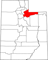 Location of Summit County in Utah
This is a list of the National Register of Historic Places listings in Summit County, Utah.
This is intended to be a complete list of the properties and districts on the National Register of Historic Places in Summit County, Utah, United States. Latitude and longitude coordinates are provided for many National Register properties and districts; these locations may be seen together in a Google map.[1]
There are 109 properties and districts listed on the National Register in the county.
-
- This National Park Service list is complete through NPS recent listings posted November 10, 2011.[2]
Contents
Current listings
[3] Landmark name [4] Image Date listed Location City or town Summary 1 Thomas L. Allen House July 23, 1982 98 N. Main St.
40°55′08″N 111°23′55″W / 40.918889°N 111.398611°WCoalville 2 William Austin House July 11, 1984 247 Ontario Ave.
40°38′32″N 111°29′32″W / 40.642222°N 111.492222°WPark City 3 Dr. William Bardsley House May 26, 1994 517 Park Ave.
40°38′39″N 111°29′47″W / 40.644167°N 111.496389°WPark City 4 Charles Barnes House July 12, 1984 413 Ontario Ave.
40°38′38″N 111°29′34″W / 40.643889°N 111.492778°WPark City 5 Richard Barrett House July 11, 1984 36 Prospect Ave.
40°38′21″N 111°29′35″W / 40.639167°N 111.493056°WPark City 6 George J. Barry House July 12, 1984 250 Grant Ave.
40°38′31″N 111°29′36″W / 40.641944°N 111.493333°WPark City 7 Thomas and Jane Beech House September 7, 2001 47 W. 50 South
40°54′53″N 111°23′53″W / 40.914722°N 111.398056°WCoalville 8 Ellsworth J. Beggs House 
July 11, 1984 703 Park Ave.
40°38′48″N 111°29′52″W / 40.646667°N 111.497778°WPark City 9 Annie Birch House October 22, 1984 Off Interstate 80
40°53′13″N 111°23′56″W / 40.886944°N 111.398889°WHoytsville 10 Bogan Boarding House October 22, 1984 221 Main St.
40°38′29″N 111°29′37″W / 40.641389°N 111.493611°WPark City 11 Boyden Block 
February 6, 2009 2 S. Main St.
40°54′59″N 111°23′55″W / 40.91648°N 111.39861°WCoalville 12 John Boyden House February 11, 1982 47 W. Center St.
40°54′53″N 111°23′53″W / 40.914722°N 111.398056°WCoalville 13 Otis L. Brown House July 11, 1984 713 Woodside Ave.
40°38′47″N 111°29′54″W / 40.646389°N 111.498333°WPark City 14 John W. Buck House July 12, 1984 1110 Woodside Ave.
40°39′01″N 111°30′04″W / 40.650278°N 111.501111°WPark City 15 William Campbell House July 11, 1984 164 Norfolk St.
40°38′26″N 111°29′43″W / 40.640556°N 111.495278°WPark City 16 Benedictus Carling House July 12, 1984 660 Rossie Hill Dr.
40°38′40″N 111°29′16″W / 40.644444°N 111.487778°WPark City 17 James Cassidy House July 11, 1984 33 King Rd.
40°38′22″N 111°29′39″W / 40.639444°N 111.494167°WPark City 18 James Cavanaugh House July 12, 1984 564 Woodside Ave.
40°38′41″N 111°29′49″W / 40.644722°N 111.496944°WPark City 19 Peter Clark House July 11, 1984 1135 Park Ave.
40°39′02″N 111°30′04″W / 40.650556°N 111.501111°WPark City 20 David F. and Elizabeth Condon House July 12, 1984 1304 Park Ave.
40°39′10″N 111°30′08″W / 40.652778°N 111.502222°WPark City 21 John F. Cunningham House July 11, 1984 606 Park Ave.
40°38′45″N 111°29′48″W / 40.645833°N 111.496667°WPark City 22 Thomas Cunningham House July 12, 1984 139 Main St.
40°38′27″N 111°29′37″W / 40.640833°N 111.493611°WPark City 23 John Diem House October 22, 1984 401 Park Ave.
40°38′35″N 111°29′44″W / 40.643056°N 111.495556°WPark City 24 John Doyle House February 6, 1986 339 Park
40°38′32″N 111°29′35″W / 40.642222°N 111.493056°WPark City 25 Durkin Boarding House July 12, 1984 176 Main St.
40°38′27″N 111°29′35″W / 40.640833°N 111.493056°WPark City 26 Joseph Durkin House July 11, 1984 22 Prospect Ave.
40°38′22″N 111°29′34″W / 40.639444°N 111.492778°WPark City 27 Echo Canyon Breastworks October 27, 1988 Address Restricted[5] Echo 28 Echo Church and School 
January 5, 1989 Temple Ln.
40°58′43″N 111°26′25″W / 40.978611°N 111.440278°WEcho 29 Echo Post Office 
August 14, 2003 3455 S. Echo Rd.
40°58′49″N 111°26′37″W / 40.980278°N 111.443611°WEcho 30 Echo School 
August 1, 1997 3441 S. Echo Rd.
40°58′42″N 111°26′57″W / 40.978333°N 111.449167°WEcho 31 Ecker Hill Ski Jump June 4, 1986 Off Interstate 80
40°44′38″N 111°34′36″W / 40.743889°N 111.576667°WSnyderville 32 Peter Farthelos House July 12, 1984 1150 Park Ave.
40°39′03″N 111°30′03″W / 40.650833°N 111.500833°WPark City 33 Mike Frkovich House July 12, 1984 162 Daly Ave.
40°38′16″N 111°29′42″W / 40.637778°N 111.495°WPark City 34 Glenwood Cemetery May 1, 1996 Silver King Dr., approximately 0.5 miles north of Park City Ski Resort
40°39′16″N 111°30′40″W / 40.654444°N 111.511111°WPark City 35 Levins D. Gray House July 12, 1984 355 Ontario Ave.
40°38′37″N 111°29′33″W / 40.643611°N 111.4925°WPark City 36 John Grix Cabin March 8, 1997 0.25 miles west of State Route 150, approximately 20 miles northeast of Kamas
40°40′49″N 110°57′35″W / 40.680278°N 110.959722°WKamas 37 Frank Hansen House July 12, 1984 1025 Park Ave.
40°38′57″N 111°30′01″W / 40.649167°N 111.500278°WPark City 38 Joseph D. Harris House July 12, 1984 959 Park Ave.
40°38′56″N 111°29′59″W / 40.648889°N 111.499722°WPark City 39 William H. Harris House July 12, 1984 39 King Rd.
40°38′22″N 111°29′37″W / 40.639444°N 111.493611°WPark City 40 Harry W. Haumann House July 12, 1984 939 Empire Ave.
40°38′52″N 111°30′04″W / 40.647778°N 111.501111°WPark City 41 Verner O. Hewlett Ranch House May 23, 1985 Off State Route 35
40°33′16″N 111°09′48″W / 40.554444°N 111.163333°WWoodland 42 Henry M. Hinsdill House July 12, 1984 662 Norfolk St.
40°38′46″N 111°29′55″W / 40.646111°N 111.498611°WPark City 43 Samuel Holman House July 12, 1984 307 Norfolk St.
40°38′30″N 111°29′47″W / 40.641667°N 111.496389°WPark City 44 House at 62 Daly Avenue July 12, 1984 62 Daly Ave.
40°38′20″N 111°29′39″W / 40.638889°N 111.494167°WPark City 45 House at 555 Deer Valley Road July 12, 1984 555 Deer Valley Rd.
40°38′44″N 111°29′24″W / 40.645556°N 111.49°WPark City 46 House at 577 Deer Valley Road July 12, 1984 577 Deer Valley Rd.
40°38′44″N 111°29′23″W / 40.645556°N 111.489722°WPark City 47 House at 1101 Norfolk Avenue July 12, 1984 1101 Norfolk Ave.
40°38′26″N 111°30′07″W / 40.640556°N 111.501944°WPark City 48 House at 343 Park Avenue July 12, 1984 343 Park Ave.
40°38′33″N 111°29′43″W / 40.6425°N 111.495278°WPark City 49 House at 463 Park Ave. May 28, 1999 463 Park Ave.
40°38′34″N 111°29′45″W / 40.642778°N 111.495833°WPark City 50 House at 101 Prospect Street October 22, 1984 101 Prospect St.
40°38′17″N 111°29′34″W / 40.638056°N 111.492778°WPark City 51 House at 622 Rossie Hill Drive July 12, 1984 622 Rossie Hill Dr.
40°38′41″N 111°29′18″W / 40.644722°N 111.488333°WPark City 52 Howe Flume Historic District December 12, 1978 Northeast of Oakley on Wasatch National Forest
40°49′50″N 110°49′58″W / 40.830556°N 110.832778°WOakley 53 Samuel P. Hoyt House 
April 19, 1982 285 Hoyt Ln.
40°52′18″N 111°23′04″W / 40.871667°N 111.384444°WHoytsville 54 IOOF Relief Home July 12, 1984 232 Woodside Ave.
40°38′27″N 111°29′41″W / 40.640833°N 111.494722°WPark City 55 Joseph J. Jenkins House July 12, 1984 27 Prospect Ave.
40°38′19″N 111°29′34″W / 40.638611°N 111.492778°WPark City 56 Carl G. Johnson House April 12, 1984 147 Grant Ave.
40°38′29″N 111°29′34″W / 40.641389°N 111.492778°WPark City 57 Elizabeth M. Jones House July 12, 1984 412 Marsac Ave.
40°38′38″N 111°29′35″W / 40.643889°N 111.493056°WPark City 58 Kimball Stage Stop 
April 16, 1971 318 Bitner Rd.
40°43′27″N 111°30′48″W / 40.724167°N 111.513333°WPark City 59 Burt Kimball House July 12, 1984 817 Park Ave.
40°38′51″N 111°29′55″W / 40.6475°N 111.498611°WPark City 60 Ernest Lynn Kimball House July 12, 1984 911 Empire Ave.
40°38′50″N 111°30′03″W / 40.647222°N 111.500833°WPark City 61 LDS Park City Meetinghouse May 22, 1978 424 Park Ave.
40°38′35″N 111°29′43″W / 40.643056°N 111.495278°WPark City 62 Alfred Lindorff House July 12, 1984 40 Sampson Ave.
40°38′25″N 111°29′45″W / 40.640278°N 111.495833°WPark City 63 Oscar F. Lyons House July 14, 1983 Woodenshoe Rd.
40°43′25″N 111°20′22″W / 40.723611°N 111.339444°WPeoa 64 Marsac Elementary School April 1, 1985 431 Marsac Ave.
40°38′39″N 111°29′38″W / 40.644167°N 111.493889°WPark City 65 John Maycock Cabin March 11, 2005 Approximately 20 miles northeast of Kamas and 0.5 miles west of State Route 150 in the Wasatch-Cache National Forest
40°40′50″N 110°57′27″W / 40.680556°N 110.9575°WKamas 66 William and Elizabeth McMichael House December 31, 1998 1259 S. West Hoytsville Rd. Hoytsville 67 McPolin Farmstead August 14, 2003 3000 N. State Route 224
40°40′38″N 111°31′36″W / 40.677222°N 111.526667°WPark City 68 Charles Meadowcroft House July 12, 1984 951 Woodside Ave.
40°38′55″N 111°30′00″W / 40.648611°N 111.5°WPark City 69 Byron T. Mitchell House 
May 18, 1984 U.S. Route 189 and State Route 35
40°36′39″N 111°16′48″W / 40.610833°N 111.28°WFrancis 70 Jesse Morgan House July 12, 1984 1027 Woodside Ave.
40°38′57″N 111°30′03″W / 40.649167°N 111.500833°WPark City 71 Jack M. Murdock House July 12, 1984 652 Rossie Hill Dr.
40°38′41″N 111°29′17″W / 40.644722°N 111.488056°WPark City 72 George Murray House July 12, 1984 44 Chambers Ave.
40°38′21″N 111°29′32″W / 40.639167°N 111.492222°WPark City 73 William and Martha Myrick House March 9, 1982 North of Kamas
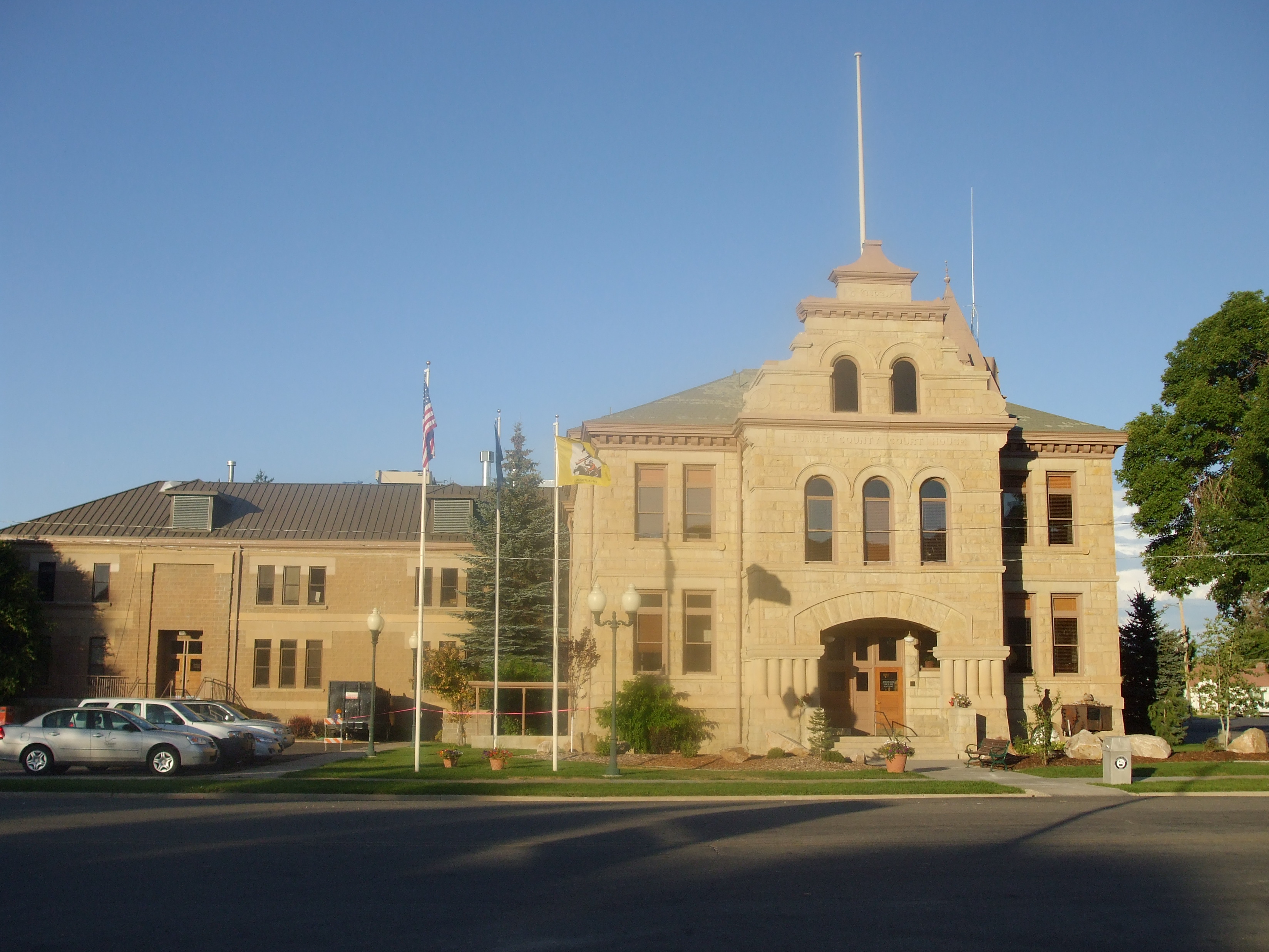
40°40′11″N 111°16′49″W / 40.669722°N 111.280278°WKamas 74 O'Mahony Dining Car No. 1107 August 21, 2009 981 W. Weber Canyon Rd.
40°42′59″N 111°18′00″W / 40.716381°N 111.299889°WOakley 75 Park City Community Church November 25, 1980 402 Park Ave.
40°38′35″N 111°29′42″W / 40.643056°N 111.495°WPark City 76 Park City High School Mechanical Arts Building November 7, 1996 1167 Woodside Ave.
40°39′01″N 111°30′09″W / 40.650278°N 111.5025°WPark City 77 Park City Main Street Historic District March 26, 1979 Main St.
40°38′41″N 111°29′44″W / 40.644722°N 111.495556°WPark City 78 Park City Miner's Hospital December 8, 1978 1354 Park Ave.
40°39′12″N 111°30′22″W / 40.653333°N 111.506111°WPark City 79 LaPage H. Raddon House July 12, 1984 817 Woodside Ave.
40°38′50″N 111°29′56″W / 40.647222°N 111.498889°WPark City 80 Samuel L. Raddon House July 12, 1984 325 Park Ave.
40°38′32″N 111°29′42″W / 40.642222°N 111.495°WPark City 81 Jacob F. Richardson House July 12, 1984 245 Park Ave.
40°38′28″N 111°29′40″W / 40.641111°N 111.494444°WPark City 82 John H. and Margaretta Rogers House April 14, 1988 455 Park Ave.
40°38′38″N 111°29′46″W / 40.643889°N 111.496111°WPark City 83 Nicholas Rowe House October 22, 1984 150 Main St.
40°38′26″N 111°29′36″W / 40.640556°N 111.493333°WPark City 84 St. John's Swedish Lutheran Church February 12, 1999 323 Park Ave.
40°38′29″N 111°29′41″W / 40.641389°N 111.494722°WPark City 85 St. Luke's Episcopal Church November 28, 1980 523 Park Ave.
40°38′39″N 111°29′47″W / 40.644167°N 111.496389°WPark City 86 St. Mary of the Assumption Church and School 
January 25, 1979 121 Park Ave.
40°38′24″N 111°29′38″W / 40.64°N 111.493889°WPark City 87 Wilson I. Snyder House July 12, 1984 1010 Woodside Ave.
40°38′58″N 111°30′01″W / 40.649444°N 111.500278°WPark City 88 Eugene Streeter House July 12, 1984 335 Ontario Ave.
40°38′35″N 111°29′33″W / 40.643056°N 111.4925°WPark City 89 James R. and Mary E. Sullivan House July 12, 1984 146 Main St.
40°38′25″N 111°29′36″W / 40.640278°N 111.493333°WPark City 90 Summit County Courthouse 
December 15, 1978 54 N. Main St.
40°55′05″N 111°23′53″W / 40.918056°N 111.398056°WCoalville 91 Ephraim D. and William D. Sutton House July 12, 1984 713 Norfolk St.
40°38′47″N 111°29′57″W / 40.646389°N 111.499167°WPark City 92 Milton and Minerva Thomas House July 12, 1984 445 Park Ave.
40°38′37″N 111°29′45″W / 40.643611°N 111.495833°WPark City 93 William Tretheway House July 12, 1984 335 Woodside Ave.
40°38′33″N 111°29′46″W / 40.6425°N 111.496111°WPark City 94 Union Pacific Park City Branch Railroad Grade 
April 25, 1996 Railroad grade parallel to Interstate 80 from Echo to Park City
40°47′21″N 111°26′28″W / 40.789167°N 111.441111°WEcho 95 Matthew Urie House July 12, 1984 157 Park Ave.
40°38′26″N 111°29′40″W / 40.640556°N 111.494444°WPark City 96 Samuel D. Walker House July 12, 1984 1119 Park Ave.
40°39′01″N 111°30′04″W / 40.650278°N 111.501111°WPark City 97 Washington School December 8, 1978 541 Park Ave.
40°38′40″N 111°29′49″W / 40.644444°N 111.496944°WPark City 98 Irinda Watson House July 12, 1984 610 Park Ave.
40°38′45″N 111°29′48″W / 40.645833°N 111.496667°WPark City 99 Patrick B. Watson House May 16, 2002 962 Norfolk Ave.
40°38′55″N 111°30′02″W / 40.648611°N 111.500556°WPark City 100 John C. Weeter House January 21, 2004 483 Norfolk Ave.
40°38′51″N 111°30′00″W / 40.6475°N 111.5°WPark City 101 Welch-Sherman House July 12, 1984 59 Prospect Ave.
40°38′19″N 111°29′34″W / 40.638611°N 111.492778°WPark City 102 Hannah Wells House July 12, 1984 1103 Woodside Ave.
40°39′00″N 111°30′05″W / 40.65°N 111.501389°WPark City 103 Charles C. Whitehead House October 22, 1984 937 Park Ave.
40°38′54″N 111°29′58″W / 40.648333°N 111.499444°WPark City 104 Walter and Ann Wilcocks House July 12, 1984 363 Park Ave.
40°38′34″N 111°29′44″W / 40.642778°N 111.495556°WPark City 105 Wilkinson-Hawkinson House July 12, 1984 39 Sampson Ave.
40°38′24″N 111°29′43″W / 40.64°N 111.495278°WPark City 106 Nathaniel J. Williams House July 12, 1984 945 Norfolk Ave.
40°38′53″N 111°30′02″W / 40.648056°N 111.500556°WPark City 107 Reese Williams House July 12, 1984 421 Park Ave.
40°38′36″N 111°29′45″W / 40.643333°N 111.495833°WPark City 108 Joseph S. Willis House July 12, 1984 1062 Park Ave.
40°39′N 111°30′W / 40.65°N 111.5°WPark City 109 Wilson-Shields House July 12, 1984 139 Park Ave.
40°38′26″N 111°29′39″W / 40.640556°N 111.494167°WPark City See also
References
- ^ The latitude and longitude information provided in this table was derived originally from the National Register Information System, which has been found to be fairly accurate for about 99% of listings. For about 1% of NRIS original coordinates, experience has shown that one or both coordinates are typos or otherwise extremely far off; some corrections may have been made. A more subtle problem causes many locations to be off by up to 150 yards, depending on location in the country: most NRIS coordinates were derived from tracing out latitude and longitudes off of USGS topographical quadrant maps created under the North American Datum of 1927, which differs from the current, highly accurate WGS84 GPS system used by Google maps. Chicago is about right, but NRIS longitudes in Washington are higher by about 4.5 seconds, and are lower by about 2.0 seconds in Maine. Latitudes differ by about 1.0 second in Florida. Some locations in this table may have been corrected to current GPS standards.
- ^ "National Register of Historic Places: Weekly List Actions". National Park Service, United States Department of the Interior. Retrieved on November 10, 2011.
- ^ Numbers represent an ordering by significant words. Various colorings, defined here, differentiate National Historic Landmark sites and National Register of Historic Places Districts from other NRHP buildings, structures, sites or objects.
- ^ "National Register Information System". National Register of Historic Places. National Park Service. . http://nrhp.focus.nps.gov/natreg/docs/All_Data.html.
- ^ Some listings on the NRHP are highly sensitive sites and may be subject to looting or vandalism. The NRHP lists this site as "Address Restricted."
External links
 Media related to National Register of Historic Places in Summit County, Utah at Wikimedia Commons
Properties on the National Register of Historic Places in Utah 

U.S. National Register of Historic Places Topics Lists by states Alabama • Alaska • Arizona • Arkansas • California • Colorado • Connecticut • Delaware • Florida • Georgia • Hawaii • Idaho • Illinois • Indiana • Iowa • Kansas • Kentucky • Louisiana • Maine • Maryland • Massachusetts • Michigan • Minnesota • Mississippi • Missouri • Montana • Nebraska • Nevada • New Hampshire • New Jersey • New Mexico • New York • North Carolina • North Dakota • Ohio • Oklahoma • Oregon • Pennsylvania • Rhode Island • South Carolina • South Dakota • Tennessee • Texas • Utah • Vermont • Virginia • Washington • West Virginia • Wisconsin • WyomingLists by territories Lists by associated states Other Municipalities and communities of Summit County, Utah Cities 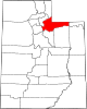
Towns CDPs Echo | Hoytsville | North Snyderville Basin | Peoa | Samak | South Snyderville Basin | Summit Park | Wanship | Woodland
Ghost towns Blacks Fork | Grass Creek | Rockport | Wahsatch
Categories:- National Register of Historic Places in Utah by county
- Summit County, Utah
-


Wikimedia Foundation. 2010.