- North Snyderville Basin, Utah
-
North Snyderville Basin, Utah — CDP — Location within the state of Utah
 North Snyderville Basin, Utah
Coordinates: 40°45′44″N 111°30′20″W / 40.76222°N 111.50556°WCoordinates: 40°45′44″N 111°30′20″W / 40.76222°N 111.50556°W Country United States State Utah County Summit Area – Total 16.5 sq mi (42.6 km2) – Land 16.5 sq mi (42.6 km2) – Water 0.0 sq mi (0.0 km2) Population (2000) – Total 1,821 – Density 110.7/sq mi (42.7/km2) Time zone Mountain (MST) (UTC-7) – Summer (DST) MDT (UTC-6) FIPS code 49-55237[1] North Snyderville Basin is a census-designated place (CDP) in Summit County, Utah, United States. The population was 1,821 at the 2000 census.
Geography
North Snyderville Basin is located at 40°45′44″N 111°30′20″W / 40.76222°N 111.50556°W (40.762334, -111.505598).[2]
According to the United States Census Bureau, the CDP has a total area of 16.5 square miles (43 km2), all of it land.
Demographics
As of the census[1] of 2000, there were 1,821 people, 690 households, and 436 families residing in the CDP. The population density was 110.7 people per square mile (42.7/km2). There were 800 housing units at an average density of 48.6/sq mi (18.8/km2). The racial makeup of the CDP was 94.23% White, 0.33% Native American, 1.21% Asian, 0.05% Pacific Islander, 2.91% from other races, and 1.26% from two or more races. Hispanic or Latino of any race were 5.88% of the population.
There were 690 households out of which 32.8% had children under the age of 18 living with them, 55.7% were married couples living together, 5.1% had a female householder with no husband present, and 36.7% were non-families. 24.8% of all households were made up of individuals and 0.6% had someone living alone who was 65 years of age or older. The average household size was 2.64 and the average family size was 3.25.
In the CDP the population was spread out with 26.6% under the age of 18, 9.8% from 18 to 24, 39.8% from 25 to 44, 21.7% from 45 to 64, and 2.1% who were 65 years of age or older. The median age was 32 years. For every 100 females there were 109.3 males. For every 100 females age 18 and over, there were 112.2 males.
The median income for a household in the CDP was $62,891, and the median income for a family was $83,255. Males had a median income of $42,008 versus $40,833 for females. The per capita income for the CDP was $34,794. About 1.5% of families and 3.6% of the population were below the poverty line, including 5.0% of those under age 18 and none of those age 65 or over.
References
- ^ a b "American FactFinder". United States Census Bureau. http://factfinder.census.gov. Retrieved 2008-01-31.
- ^ "US Gazetteer files: 2010, 2000, and 1990". United States Census Bureau. 2011-02-12. http://www.census.gov/geo/www/gazetteer/gazette.html. Retrieved 2011-04-23.
Municipalities and communities of Summit County, Utah Cities 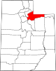
Towns CDPs Echo | Hoytsville | North Snyderville Basin | Peoa | Samak | South Snyderville Basin | Summit Park | Wanship | Woodland
Ghost towns Blacks Fork | Grass Creek | Rockport | Wahsatch
Categories:- Populated places in Summit County, Utah
- Former census-designated places in Utah
- Salt Lake City metropolitan area


Wikimedia Foundation. 2010.