- Tucker, Utah
-
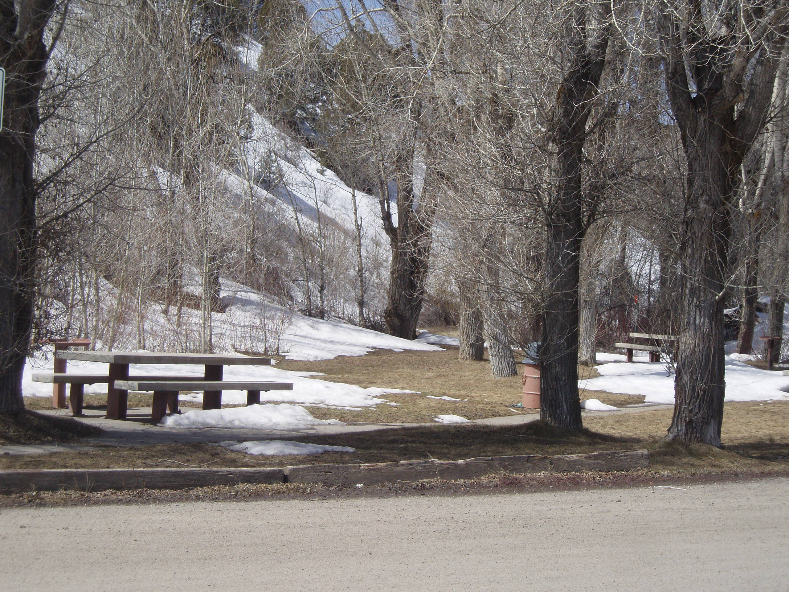
Tucker — Ghost town — 2008 view of the rest stop at the former site of Tucker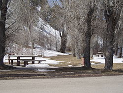 Location of Tucker in Utah
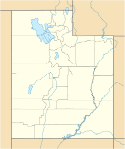
 Tucker
Coordinates: 39°56′04″N 111°11′58″W / 39.93444°N 111.19944°WCoordinates: 39°56′04″N 111°11′58″W / 39.93444°N 111.19944°W Country United States State Utah County Utah Abandoned 1913 Named for James Tucker Elevation[1] 6,227 ft (1,898 m) Time zone Mountain (MST) (UTC-7) – Summer (DST) MDT (UTC-6) ZIP code GNIS feature ID 1446752[1] Tucker is a ghost town located in Utah County, Utah, 7 miles (11 km) below Soldier Summit on U.S. Route 6 through Spanish Fork Canyon. It was once an important loading point and construction camp on the Denver and Rio Grande Western Railroad. After the town was abandoned, the state of Utah used the town site for a rest area. In 2009, the site was buried as part of a project to re-align a portion of US-6's western approach to Soldier Summit. To honor the town, the state of Utah built a replacement about 2 miles (3.2 km) downstream from Tucker, called the Tie Fork Rest Area. This rest area, which is designed to mimic an early 1900s era train depot and roundhouse, was voted one of the most beautiful buildings in Utah in a contest sponsored by the American Institute of Architects.
History
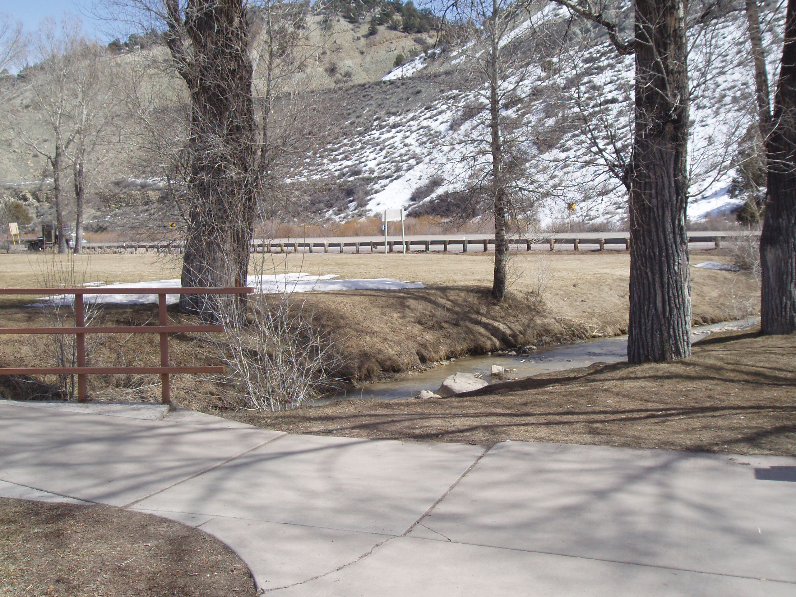
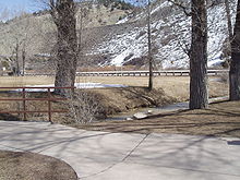 A trace of the old railroad grade is still visible in the background east of Tucker.
Tucker started as a simple railroad junction, between the main line of the Denver and Rio Grande Western railroad and the spur of the Utah and Pleasant Valley Railway, which extended to mines at Winter Quarters, near today's Scofield Reservoir.[2] When a station was built here to house the helper engines used to push freight trains over Soldier Summit,[3] it quickly grew into a town with a population of 500, called Clear Creek.[4] The town had a boarding house, company store, and saloon,[3] and dozens of hastily-constructed houses filled the small valley. By 1900 its name was changed to Tucker, for a certain James Tucker.[4]
Historical populations Census Pop. %± 1900 211 — 1910 373 76.8% 1920 40 −89.3% Tucker came to an end in 1913, when the railroad re-aligned the tracks to reduce the grade up to Soldier Summit from a dangerous 4% grade, to a more manageable 2.0%. With the new alignment, the branch to Scofield was completely re-routed to branch from the main near Colton. The new alignment bypassed and abandoned the town of Tucker and an area called Gilluly, although the new alignment was often called the Gilluly loops or Gilluly horseshoe curves, due to the circuitous route it took up the hill.[2] The railroad filled in much of the location to lift the road bed far above the valley floor. All the buildings are gone, and even most of the old railroad grade is covered by the fill.[4] When U.S. Route 50, the predecessor of the modern U.S. Route 6, was paved in the 1920s, the old railroad alignment was used for the highway. In 1969, the state used the site of the town to build a rest area. Aside from a plaque at the facility, there was no sign that the roadside rest stop sat on top of a ghost town.
Tie Fork Rest Area
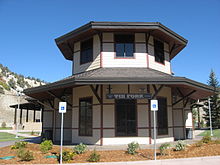 The replacement Tie Fork Rest Area is built in a railroad theme to honor the town of Tucker
The town of Tucker was located near a sharp curve at the bottom of a 5% grade along US-6. In 2009, the Utah Department of Transportation closed and buried the Tucker rest area to build a safer alignment, with a banked curve and reduced grade. In 2010, the department dedicated a replacement rest area about 2 miles (3.2 km) downstream from Tucker. The structure was named the Tie Fork Rest Area after the side canyon where it was located.[5] The replacement rest area was designed to mimic an early 1900s era train depot to honor the town, including a replica roundhouse and non-functional steam locomotive.[6] The rest area was voted one of the most beautiful buildings in the state of Utah in a contest sponsored by the American Institute of Architects.[7]
References
- ^ a b U.S. Geological Survey Geographic Names Information System: Tucker
- ^ a b Carr, Stephen L.; Edwards, Robert W. (1989). Utah Ghost Rails. Western Epics. p. 174,193–194. ISBN 0914740342.
- ^ a b Thompson, George A. (November 1982). Some Dreams Die: Utah's Ghost Towns and Lost Treasures. Salt Lake City, Utah: Dream Garden Press. p. 176. ISBN 0-942688-01-5.
- ^ a b c Carr, Stephen L. (1986) [1972]. The Historical Guide to Utah Ghost Towns (3rd ed.). Salt Lake City: Western Epics. p. 70. ISBN 0-914740-30-X.
- ^ "New Tie-Fork rest area on SR-6 opens". Emery County Progress. August 24, 2010. http://www.ecprogress.com/index.php?tier=1&article_id=9700. Retrieved June 12, 2011.
- ^ Babcock, Dave. "Do the Locomotion". Utah Department of Transportation. http://blog.udot.utah.gov/2010/07/do-the-locomotion/. Retrieved June 12, 2011.
- ^ Cabrero, Alex (December 27, 2010). "Spanish Fork rest stop voted one of the most beautiful buildings in Utah". Deseret News. http://www.deseretnews.com/article/705363548/Spanish-Fork-rest-stop-voted-one-of-the-most-beautiful-buildings-in-Utah.html. Retrieved June 12, 2011.
Municipalities and communities of Utah County, Utah Cities Alpine | American Fork | Cedar Hills | Draper | Eagle Mountain | Elk Ridge | Highland | Lehi | Lindon | Mapleton | Orem | Payson | Pleasant Grove | Provo | Salem | Santaquin | Saratoga Springs | Spanish Fork | Springville | Woodland Hills
Towns Cedar Fort | Fairfield | Genola | Goshen | Vineyard
CDPs Benjamin | Elberta | Lake Shore | Palmyra | Spring Lake | West Mountain
Unincorporated
communitiesIndian
reservationGhost towns Colton | Forest City | Mill Fork | Mosida | Thistle | Tucker
Categories:- Ghost towns in Utah County, Utah
- Denver and Rio Grande Western Railroad
- U.S. Route 6


Wikimedia Foundation. 2010.