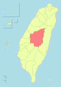
- Nantou County
-
Nantou County
南投縣
Abbreviation(s): Nantou (南投)
County seat Nantou City Region Central Taiwan County Magistrate Lee Chao-ching (李朝卿) Cities 1 Townships 12 Area - Total 4,106.436 km²
(2 of 25)- % water 0 % Population - Total 532,034 (as of Oct, 2008)
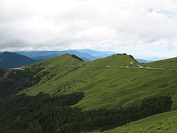
(15 of 25)- Density 129.56/km² Symbols - County flower Plum blossom (Prunus mume) - County tree Camphor Laurel (Cinnamomum camphora) - County bird n/a Official websites (Traditional Chinese) Hehuanshan is one of the higher mountains in Nantou County.
Nantou County (Chinese: 南投縣; pinyin: Nántóu Xiàn; Pe̍h-ōe-jī: Lâm-tâu-kōan) is the second largest county of Taiwan. It is also the only landlocked county in Taiwan. Its name derives from the Hoanya Taiwanese aboriginal word Ramtau. Nantou County is officially administered as a county of Taiwan.
Its mountainous area makes it a tourist destination; Sun Moon Lake is located in this county. Other well known areas of the county are Hehuanshan and Sitou. Notable cities in Nantou: Puli.
Nantou county butterfly is: Broad-tailed swallowtail butterfly (Agehana maraho)
Nantou's Dongding Oolong tea is world-famous.
Contents
Administration
City
- Nantou City (南投市)
Townships
Urban townships
- Caotun Township (草屯鎮)
- Jiji Township (集集鎮)
- Puli Township (埔里鎮)
- Zhushan Township (竹山鎮)
Rural townships
- Guoxing Township (國姓鄉)
- Lugu Township (鹿谷鄉)
- Mingjian Township (名間鄉)
- Ren'ai Township (仁愛鄉)
- Shuili Township (水里鄉)
- Xinyi Township (信義鄉)
- Yuchi Township (魚池鄉)
- Zhongliao Township (中寮鄉)
Sightseeing Spots
- Sun Moon Lake National Scenic Area
- Tri-Mountain National Scenic Area
- Maolan Hiking Trail
- Hanbi Hiking Trail
- Lalu Island
See also
External links
 Administrative divisions of the Republic of China
(Otherwise known as Taiwan). Special municipalities 
Taiwan Province CitiesFujian Province See also: Free Area of the Republic of China. Categories:- Taiwan geography stubs
- Nantou County
- Counties of Taiwan
Wikimedia Foundation. 2010.

