- North Ogden, Utah
-
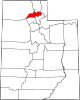
North Ogden, Utah — City — Location of North Ogden, Utah
Coordinates: 41°18′36″N 111°57′32″W / 41.31°N 111.95889°WCoordinates: 41°18′36″N 111°57′32″W / 41.31°N 111.95889°W Country United States State Utah County Weber Settled 1850 Incorporated 1934 Named for Peter Skene Ogden Area – Total 6.5 sq mi (16.8 km2) – Land 6.5 sq mi (16.8 km2) – Water 0.0 sq mi (0.0 km2) Elevation 4,501 ft (1,372 m) Population (2000) – Total 15,026 – Density 2,310.4/sq mi (892.0/km2) Time zone Mountain (MST) (UTC-7) – Summer (DST) MDT (UTC-6) ZIP codes 84404, 84414 Area code(s) 801 FIPS code 49-55100[1] GNIS feature ID 1443962[2] North Ogden is a city in Weber County, Utah, United States. The population was 15,027 at the 2000 census. North Ogden is on SR-235, three miles north of Ogden. It is a suburb of that city and is part of the Ogden –Clearfield, Utah Metropolitan Statistical Area.
Contents
History
North Ogden was originally settled during the winter of 1850 by two sets of cattle ranchers from Ogden. The Campbells and the Riddles had been warned by Brigham Young not to venture from the fort in Ogden due to the troubles with the local Shoshone. After a few months wintering their cattle, they were forced to return to Ogden in fear of Shoshone reprisals. The following year, after the trouble with the Shoshone had been partially settled, Jonathan Campbell returned with a number of other families to permanently settle the spot.[citation needed]
One important early industry in the mid to late 19th century was the sugar beet industry, and a processing and canning plant was built in the town for this. The owner of the canning plant during its operation (it has since shut down), was David Ephriam Randall. North Ogden also built a spur from the Union Pacific Station in Ogden, called the "Dummy Line".
In the 1930s, increasing demand for water led the city to officially incorporate on February 1, 1934.[3] David Gilbert Randall was elected the first mayor. He served in this position for ten years. That same decade saw the creation of the Cherry Days celebration on July 4. As North Ogden grew after World War II, it became a primary suburb for Ogden and other larger cities. Its industries flagged, and most agricultural areas began to be parcelled out for homes.[citation needed]
The Paramount Pictures logo, known as Majestic Mountain, was modeled after North Ogden's own Mount Ben Lomond. William W. Hodkinson (known as the man to have invented Hollywood), a native of the Ogden area, initially drew the image on a napkin during a meeting in 1914.
Geography
North Ogden is located at 41°18′36″N 111°57′32″W / 41.31°N 111.95889°W (41.310042, -111.958935).[4] According to the United States Census Bureau, the city has a total area of 6.5 square miles (16.8 km²), all of it land.
North Ogden is situated at the base of Ben Lomond Peak, a prominent mountain on the Wasatch front, visible from the Salt Lake Airport.
.
Demographics
Historical populations Census Pop. %± 1890 758 — 1900 850 12.1% 1910 579 −31.9% 1920 1,004 73.4% 1930 1,045 4.1% 1940 687 −34.3% 1950 1,105 60.8% 1960 2,621 137.2% 1970 5,257 100.6% 1980 9,309 77.1% 1990 11,668 25.3% 2000 15,026 28.8% As of the census[1] of 2000, there were 15,026 people, 4,416 households, and 3,859 families residing in the city. The population density was 2,310.4 people per square mile (892.5/km²). There were 4,562 housing units at an average density of 701.5 per square mile (271.0/km²). The racial makeup of the city was 95.91% White, 0.37% African American, 0.34% Native American, 0.79% Asian, 0.07% Pacific Islander, 1.62% from other races, and 0.91% from two or more races. Hispanic or Latino of any race were 3.84% of the population.
There were 4,416 households out of which 49.6% had children under the age of 18 living with them, 77.9% were married couples living together, 7.0% had a female householder with no husband present, and 12.6% were non-families. 11.0% of all households were made up of individuals and 5.0% had someone living alone who was 65 years of age or older. The average household size was 3.40 and the average family size was 3.68.
In the city the population was spread out with 35.2% under the age of 18, 10.6% from 18 to 24, 26.1% from 25 to 44, 19.9% from 45 to 64, and 8.2% who were 65 years of age or older. The median age was 30 years. For every 100 females there were 100.8 males. For every 100 females age 18 and over, there were 97.2 males.
The median income for a household in the city was $59,556, and the median income for a family was $63,252. Males had a median income of $43,712 versus $28,180 for females. The per capita income for the city was $20,625. About 3.1% of families and 3.6% of the population were below the poverty line, including 3.9% of those under age 18 and 3.1% of those age 65 or over.
References
- ^ a b "American FactFinder". United States Census Bureau. http://factfinder.census.gov. Retrieved 2008-01-31.
- ^ "US Board on Geographic Names". United States Geological Survey. 2007-10-25. http://geonames.usgs.gov. Retrieved 2008-01-31.
- ^ http://www.northogdencity.com/
- ^ "US Gazetteer files: 2010, 2000, and 1990". United States Census Bureau. 2011-02-12. http://www.census.gov/geo/www/gazetteer/gazette.html. Retrieved 2011-04-23.
External links
Municipalities and communities of Weber County, Utah Cities Farr West | Harrisville | Hooper | Marriott-Slaterville | North Ogden | Ogden | Plain City | Pleasant View | Riverdale | Roy | South Ogden | Uintah | Washington Terrace | West Haven
Town CDP Unincorporated
communitiesNordic Valley | Warren | West Weber
Categories:- Cities in Utah
- Populated places in Weber County, Utah
- Ogden–Clearfield metropolitan area
- Populated places established in 1850

Wikimedia Foundation. 2010.