- Mexican Hat, Utah
-
Mexican Hat, Utah — CDP — Mexican Hat Rock Location of Mexican Hat, Utah
Coordinates: 37°9′54″N 109°51′56″W / 37.165°N 109.86556°WCoordinates: 37°9′54″N 109°51′56″W / 37.165°N 109.86556°W Country United States State Utah County San Juan Area - Total 8.7 sq mi (22.4 km2) - Land 8.2 sq mi (21.2 km2) - Water 0.5 sq mi (1.2 km2) Elevation 4,245 ft (1,294 m) Population (2000) - Total 88 - Density 10.7/sq mi (4.1/km2) Time zone Mountain (MST) (UTC-7) - Summer (DST) MDT (UTC-6) ZIP code 84531 Area code(s) 435 FIPS code 49-49380[1] GNIS feature ID 1430248[2] 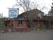 The Mexican Hat Lodge
Mexican Hat is a census-designated place (CDP) on the San Juan River in south-central San Juan County, Utah, United States. Each year, on March 8 the town members meet to celebrate their CDP status. Town members wear hats, as the celebration takes place at the Mexican Hat Rock. It is on U.S. Route 163 just three miles (5 km) south of the junction with State Route 261, and is just outside the northern boundary of both the Navajo Nation and Monument Valley. With a total population of 88 at the 2000 census, the community saw a significant decrease from the 1990 figure of 259.
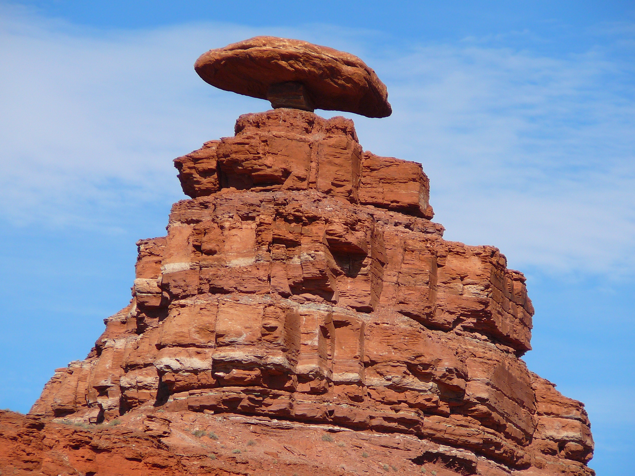
The name "Mexican Hat" comes from a curiously sombrero-shaped, 60-foot (18 m) wide by 12-foot (3.7 m) thick (18.3 x 3.7 m), rock outcropping on the northeast edge of town. The "Hat" has two rock climbing routes ascending it.
Goosenecks State Park is located just nine miles (14 km) west-northwest, Alhambra Rock is six miles (10 km) west-southwest, and the Valley of the Gods is to the north on U.S. 163.
Contents
Geography
Mexican Hat is 4,400 feet (1,300 m) above sea level and located at 37°9′54″N 109°51′56″W / 37.165°N 109.86556°W (37.165131, -109.865446).[3]
According to the United States Census Bureau, the CDP has a total area of 8.6 square miles (22.4 km²), of which, 8.2 square miles (21.2 km²) of it is land and 0.5 square miles (1.2 km²) of it (5.32%) is water.
Demographics
Historical populations Census Pop. %± 1990 259 — 2000 88 −66.0% source:[4][5] As of the census[1] of 2000, there were 88 people, 29 households, and 22 families residing in the CDP. The population density was 10.7 people per square mile (4.1/km²). There were 32 housing units at an average density of 3.9/sq mi (1.5/km²). The racial make-up of the CDP was 37.50% White, 57.95% Native American, 4.55% from other races. Hispanic or Latino of any race were 6.82% of the population.
There were 29 households out of which 48.3% had children under the age of 18 living with them, 51.7% were married couples living together, 27.6% had a female householder with no husband present, and 20.7% were non-families. 20.7% of all households were made up of individuals and 10.3% had someone living alone who was 65 years of age or older. The average household size was 3.03 and the average family size was 3.43.
In the CDP the population was spread out with 31.8% under the age of 18, 19.3% from 18 to 24, 19.3% from 25 to 44, 25.0% from 45 to 64, and 4.5% who were 65 years of age or older. The median age was 24 years. For every 100 females there were 66.0 males. For every 100 females age 18 and over, there were 76.5 males.
The median income for a household in the CDP was $57,656, and the median income for a family was $58,750. Males had a median income of $41,250 versus $18,750 for females. The per capita income for the CDP was $14,973. There were no families and 6.5% of the population living below the poverty line, including no under eighteens and none of those over 64.
References
- ^ a b "American FactFinder". United States Census Bureau. http://factfinder.census.gov. Retrieved 2008-01-31.
- ^ "US Board on Geographic Names". United States Geological Survey. 2007-10-25. http://geonames.usgs.gov. Retrieved 2008-01-31.
- ^ "US Gazetteer files: 2010, 2000, and 1990". United States Census Bureau. 2011-02-12. http://www.census.gov/geo/www/gazetteer/gazette.html. Retrieved 2011-04-23.
- ^ "CENSUS OF POPULATION AND HOUSING (1790-2000)". U.S. Census Bureau. http://www.census.gov/prod/www/abs/decennial/index.html. Retrieved 2010-07-31.
- ^ Part of 1990's census area is now in Halchita.
External links
 Media related to Mexican Hat, Utah at Wikimedia Commons
Municipalities and communities of San Juan County, Utah Cities 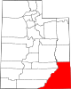
CDPs Aneth | Bluff | Halchita | Halls Crossing | La Sal | Mexican Hat | Montezuma Creek | Navajo Mountain | Oljato-Monument Valley | Spanish Valley | Tselakai Dezza | White Mesa
Unincorporated
communityGhost towns Categories:- Populated places in San Juan County, Utah
- Census-designated places in Utah
- Populated places in Utah with Native American majority populations


Wikimedia Foundation. 2010.