- Town of Pines, Indiana
Infobox Settlement
official_name = Town of Pines, Indiana
settlement_type =Town
nickname =
motto =
imagesize =
image_caption =
image_
imagesize =
image_caption =
image_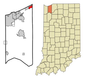
mapsize = 250x200px
map_caption = Location of Town of Pines in the state ofIndiana
mapsize1 =
map_caption1 =subdivision_type = Country
subdivision_name =United States
subdivision_type1 = State
subdivision_name1 =Indiana
subdivision_type2 = County
subdivision_name2 = Porter
subdivision_type3 = Township
subdivision_name3 = Pine
government_footnotes =
government_type =
leader_title =
leader_name =
leader_title1 =
leader_name1 =
established_title =
established_date =area_footnotes =
unit_pref = Imperial
area_magnitude =
area_total_km2 = 5.9
area_land_km2 = 5.9
area_water_km2 = 0.0
area_total_sq_mi = 2.3
area_land_sq_mi = 2.3
area_water_sq_mi = 0.0population_as_of = 2000
population_footnotes =
population_total = 798
population_density_km2 = 135.3
population_density_sq_mi = 350.5timezone = Central (CST)
utc_offset = -6
timezone_DST = CDT
utc_offset_DST = -5
elevation_footnotes =
elevation_m = 191
elevation_ft = 627
latd = 41 |latm = 41 |lats = 19 |latNS = N
longd = 86 |longm = 56 |longs = 47 |longEW = Wpostal_code_type =
postal_code =
area_code =
blank_name = FIPS code
blank_info = 18-76256GR|2
blank1_name = GNIS feature ID
blank1_info = 0444832GR|3
website =
footnotes =Pines is a town in Pine Township, Porter County,
Indiana ,United States . The population was 798 at the 2000 census.Geography
Pines is located at coor dms|41|41|19|N|86|56|47|W|city (41.688486, -86.946297)GR|1.
According to the
United States Census Bureau , the town has a total area of 2.3square mile s (5.9km² ), all of it land.Demographics
As of the
census GR|2 of 2000, there were 798 people, 332 households, and 226 families residing in the town. Thepopulation density was 350.5 people per square mile (135.1/km²). There were 360 housing units at an average density of 158.1/sq mi (61.0/km²). The racial makeup of the town was 96.24% White, 0.13% African American, 1.38% Native American, 0.50% Asian, 0.13% from other races, and 1.63% from two or more races. Hispanic or Latino of any race were 2.13% of the population.There were 332 households out of which 27.1% had children under the age of 18 living with them, 56.0% were married couples living together, 7.8% had a female householder with no husband present, and 31.9% were non-families. 26.8% of all households were made up of individuals and 6.9% had someone living alone who was 65 years of age or older. The average household size was 2.40 and the average family size was 2.92.
In the town the population was spread out with 20.7% under the age of 18, 8.6% from 18 to 24, 30.1% from 25 to 44, 29.6% from 45 to 64, and 11.0% who were 65 years of age or older. The median age was 40 years. For every 100 females there were 108.9 males. For every 100 females age 18 and over, there were 110.3 males.
The median income for a household in the town was $41,875, and the median income for a family was $47,143. Males had a median income of $41,000 versus $22,969 for females. The
per capita income for the town was $19,856. About 4.6% of families and 8.7% of the population were below thepoverty line , including 11.8% of those under age 18 and 14.9% of those age 65 or over.Transportation
The commercial airport closest to Pines is the
Gary/Chicago International Airport in Gary. Pines is the home ofIndiana State Road 520 , a 0.2-mile-long (0.3 km) state highway connectingU.S. Highway 12 toU.S. Highway 20 . It is the shorteststate highway in Indiana.References
External links
Wikimedia Foundation. 2010.