- Chesterton, Indiana
-
Town of Chesterton, Indiana — Town — Calumet Ave, Downtown Location in the state of Indiana
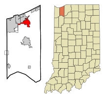
Coordinates: 41°36′15″N 87°3′30″W / 41.60417°N 87.05833°WCoordinates: 41°36′15″N 87°3′30″W / 41.60417°N 87.05833°W Country United States State Indiana County Porter Townships Westchester, Jackson, Liberty Government – Town Manager Bernie Doyle Area – Total 8.6 sq mi (22.4 km2) – Land 8.5 sq mi (22.0 km2) – Water 0.1 sq mi (0.3 km2) Elevation 640 ft (195 m) Population (2010) – Total 13,068 – Density 1,232.3/sq mi (475.8/km2) Time zone CST (UTC-6) – Summer (DST) CDT (UTC-5) ZIP code 46304 Area code(s) 219 FIPS code 18-12412[1] GNIS feature ID 0432457[2] Website http://www.chesterton.net/ Chesterton is a town in Westchester, Jackson and Liberty townships, Porter County, Indiana, United States. The population was 13,068 at the 2010 census. The three towns of Chesterton, Burns Harbor, and Porter are known as the tri-towns or the Duneland area.
See also: History of the Indiana DunesContents
Demographics
As of the census[1] of 2000, there were 10,488 people, 4,039 households, and 2,879 families residing in the town. The population density was 1,232.0 people per square mile (475.8/km²). There were 4,212 housing units at an average density of 494.8 per square mile (191.1/km²). The racial makeup of the town was 96.29% White, 0.44% African American, 0.21% Native American, 1.37% Asian, 0.02% Pacific Islander, 0.51% from other races, and 1.16% from two or more races. Hispanic or Latino of any race were 3.31% of the population.
There were 4,039 households out of which 36.5% had children under the age of 18 living with them, 57.3% were married couples living together, 9.9% had a female householder with no husband present, and 28.7% were non-families. 23.7% of all households were made up of individuals and 8.3% had someone living alone who was 65 years of age or older. The average household size was 2.57 and the average family size was 3.06.
In the town the population was spread out with 26.8% under the age of 18, 8.1% from 18 to 24, 29.6% from 25 to 44, 24.8% from 45 to 64, and 10.7% who were 65 years of age or older. The median age was 37 years. For every 100 females there were 95.6 males. For every 100 females age 18 and over, there were 91.3 males.
The median income for a household in the town was $55,530, and the median income for a family was $66,239. Males had a median income of $50,599 versus $28,300 for females. The per capita income for the town was $26,539. About 3.1% of families and 4.3% of the population were below the poverty line, including 6.5% of those under age 18 and 4.2% of those age 65 or over.
-
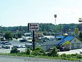
Indian Boundary, where SR 49 and I-94 meet.
Town Government and Community Services
Education
Public Schools
Chesterton High School, or CHS, serves the tri-town area. Chesterton High School operates Chesterton's only local radio station,WDSO 88.3FM. Since this station is non-commercial, it is not serviced by the Arbitron rating system so there is no way to accurately measure its audience.
Private Schools
- St. Patrick Catholic Elementary School
Business and Industry
Chesterton has a local newspaper, the Chesterton Tribune, which is published weekdays and delivered in the afternoons. The newspaper has served the Chesterton area since 1884 and has been published daily since 1961.[3]
Transportation
South Shore Line
The South Shore Line, operated by the Northwest Indiana Commuter Transportation District, has their headquarters here. The South Shore Line stops north of Chesterton at the Dune Park station.
Valparaiso V-Line
V-Line's Orange Line route stops near the South Shore station, indirectly connecting Chesterton to Valparaiso University, and the V-Shuttle service runs between Dune Park station and Valparaiso's Village Center during evenings. V-Line is currently considering adding a route that would make stops within Chesterton proper.
Other Public Transportation
There is no bus service provided within Chesterton.
History
Significant Historical Events
- In 1933, a United Airlines NC13304 flight became the first known case of an attack against an aircraft. It was downed by nitroglycerine bomb above Chesterton on October 10, 1933. All 7 persons aboard the aircraft—four passengers and a crew of three—were killed in the crash.
- In 2009, on the second day of school that year, Chesterton Middle School suffered tornado damage, as did over 100 other homes and apartment buildings. One residential building was severely damaged.
Historic Districts and Structures
- Chesterton Commercial Historic District
- The Brown Mansion
Media Exposure
- In 2008, MTV came to Chesterton in Spring and filmed their hit reality-TV show MADE. Courtney Jurick was made in to a BMX racer and Marie Kosakowski was made into a hip-hop dancer. Both shows aired on 9/13/08.
- The 2009 tornado brought live coverage from The Weather Channel and Chicago news affiliates.
Culture
Festivals
Chesterton is home to the annual Wizard of Oz Festival, which is the largest and most famous of its kind. In 2006, former organizers Lakeshore Festivals and Events moved the event to the Porter County Expo Center in Valparaiso. After 3 years, LFE discontinued the festival and it was brought home to Chesterton by the Duneland Business Initiative Group in 2009.
Notable natives and residents
- Jim Gaffigan, standup comedian and actor
- Matt Nover, former Indiana University basketball player and star of the movie Blue Chips
- Mickey Morandini, former Major League Baseball player
- Ron Kittle, former Major League Baseball player
- Eddie Wineland, professional MMA fighter (Bantamweight)
Environmental Issues and Resources
Resources
Parkland
Chesterton's park system includes several large public parks and sports fields. The town is also served by the Porter County Park District and the nearby Indiana Dunes State Park. Several trails connect Chesterton with Porter and the Indiana Dunes National Lakeshore.
Coffee Creek
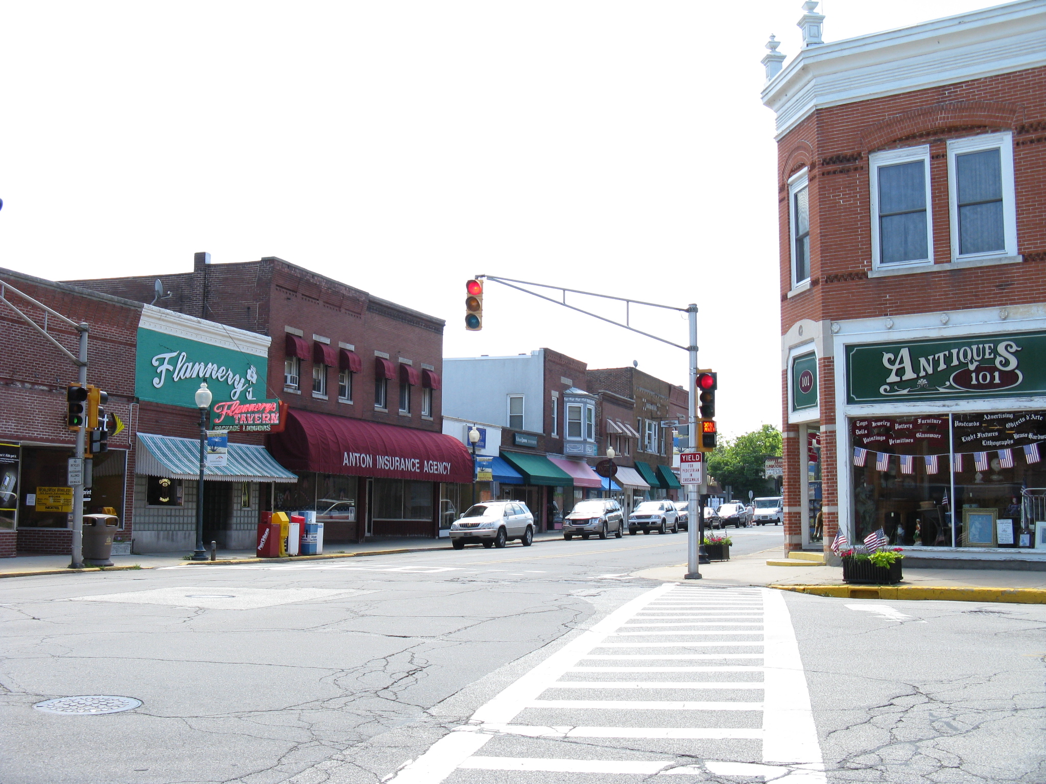
Coffee Creek flows through an area that includes downtown Chesterton. The Coffee Creek Watershed Preserve includes a restored section of the creek and its associated wetland.
Issues
Effluent Discharge
Chesterton is known for dumping hundreds to thousands of gallons of sewage into the nearby Little Calumet River every year during almost all rainfall events. The Little Calumet River then flows to Lake Michigan. Most days after a heavy rainstorm nearby beaches are then closed because of high e.coli counts. The Chesterton Tribune reports any or all waste water treatment plant bypasses. In the Spring of 2010, this is to be fixed permanently when the City is slated to undergo a complete re-working of the sewer systems in the downtown area and other sections of town. The downtown sewer system replacement project was placed on hold this year due to the congestion caused by the enormous roadway re-alignment project already in progress located at Calumet Avenue, State Road 49, and County Road 1100 North.
Geography
Chesterton is located at 41°36′15″N 87°3′30″W / 41.60417°N 87.05833°W (41.604251, -87.058442)[4].
According to the United States Census Bureau, the town has a total area of 8.6 square miles (22 km2), of which 8.5 square miles (22 km2) is land and 0.1 square miles (0.26 km2) (1.27%) is water. Just north of the town is Indiana Dunes State Park and the Indiana Dunes National Lakeshore. Most of the town is flat. However, going south into the city on the Route 49 overpass, one can see the Valparaiso Moraine in the distance.
Climate
Climate data for Chesterton, Indiana Month Jan Feb Mar Apr May Jun Jul Aug Sep Oct Nov Dec Year Average high °F 30.5 34.8 46.9 60.1 71.4 80.5 83.4 81.2 75.1 63.7 49.4 35.4 59.4 Average low °F 14.3 17.8 28.7 38.4 48.3 57.6 62.2 60.2 53.7 43 33.1 21.2 39.9 Rainfall inches 1.96 1.7 3.0 4 3.9 4.2 4 3.8 3.2 3.2 3.4 3 37.2 Snowfall inches 12 11.3 11.3 1.5 0.0 0.0 0.0 0.0 0.0 0.2 3.4 9.1 55.4 Average high °C −0.8 1.6 8.3 15.6 21.9 26.9 28.6 27.3 23.9 17.6 9.7 1.9 {{{year high C}}} Average low °C −9.8 −7.9 −1.8 3.6 9.1 14.2 16.8 15.7 12.1 6 0.6 −6.0 {{{year low C}}} Rainfall mm 49.8 43 76 102 99 107 102 97 81 81 86 76 945 Snowfall cm 30 28.7 28.7 3.8 0 0 0 0 0 0.5 8.6 23.1 140.7 Source: [5] References
- ^ a b "American FactFinder". United States Census Bureau. http://factfinder.census.gov. Retrieved 2008-01-31.
- ^ "US Board on Geographic Names". United States Geological Survey. 2007-10-25. http://geonames.usgs.gov. Retrieved 2008-01-31.
- ^ [1]
- ^ "US Gazetteer files: 2010, 2000, and 1990". United States Census Bureau. 2011-02-12. http://www.census.gov/geo/www/gazetteer/gazette.html. Retrieved 2011-04-23.
- ^ "Weatherbase: Historical Weather for Chesterton, Indiana". http://www.weatherbase.com/weather/weather.php3?s=999821&refer=. Retrieved January 7, 2009.
External links
- Town of Chesterton, Indiana website
- History of Chesterton
- Chesterton Tribune daily newspaper
- Chesterton's Radio Station
Municipalities and communities of Porter County, Indiana Cities 
Towns Beverly Shores | Burns Harbor | Chesterton | Dune Acres | Hebron | Kouts | Ogden Dunes | Porter | Town of Pines
Townships Unincorporated
communitiesBeverly Hill | Blackhawk Beach | Boone Grove | Brummitt Acres | Coolwood Acres | Graham Woods | Haglund | Hillcrest | Lakes of the Four Seasons‡ | Lake View | Lincoln Hills | Long Lake Island | Marian Manor | Northwood Park | Roble Woods | South Haven | Sylvan Manor | Wake Robin Fields | Westhill | Wheeler
Footnotes ‡This populated place also has portions in an adjacent county or counties
Chicago metropolitan area Major city 
Cities
(over 30,000 in 2010)Aurora, Illinois · Berwyn, Illinois · Calumet City, Illinois · Chicago Heights, Illinois · Crystal Lake, Illinois · DeKalb, Illinois · Des Plaines, Illinois · Elgin, Illinois · Elmhurst, Illinois · Evanston, Illinois · Gary, Indiana · Hammond, Indiana · Joliet, Illinois · Kenosha, Wisconsin · Naperville, Illinois · North Chicago, Illinois · Park Ridge, Illinois · Portage, Indiana · St. Charles, Illinois · Valparaiso, Indiana · Waukegan, Illinois · Wheaton, IllinoisTowns and villages
(over 30,000 in 2010)Addison, Illinois · Algonquin, Illinois · Arlington Heights, Illinois · Bartlett, Illinois · Bolingbrook, Illinois · Buffalo Grove, Illinois · Carol Stream, Illinois · Carpentersville, Illinois · Cicero, Illinois · Downers Grove, Illinois · Elk Grove Village, Illinois · Glendale Heights, Illinois · Glenview, Illinois · Gurnee, Illinois · Hanover Park, Illinois · Hoffman Estates, Illinois · Lombard, Illinois · Merrillville, Indiana · Mount Prospect, Illinois · Mundelein, Illinois · Northbrook, Illinois · Oak Lawn, Illinois · Oak Park, Illinois · Orland Park, Illinois · Oswego, Illinois · Palatine, Illinois · Plainfield, Illinois · Romeoville, Illinois · Schaumburg, Illinois · Skokie, Illinois · Streamwood, Illinois · Tinley Park, Illinois · Wheeling, Illinois · Woodridge, IllinoisCounties Cook County, Illinois · DeKalb County, Illinois · DuPage County, Illinois · Grundy County, Illinois · Jasper County, Indiana · Kane County, Illinois · Kendall County, Illinois · Kenosha County, Wisconsin · Lake County, Illinois · Lake County, Indiana · McHenry County, Illinois · Newton County, Indiana · Porter County, Indiana · Will County, IllinoisRegions Sub-regions Categories:- Chicago metropolitan area
- Northwest Indiana
- Towns in Indiana
- Populated places in Porter County, Indiana
- Duneland communities
-


Wikimedia Foundation. 2010.