- DeKalb County, Indiana
-
DeKalb County, Indiana 
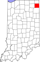
Location in the state of Indiana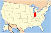
Indiana's location in the U.S.Founded 1835 Named for Johann, Baron de Kalb Seat Auburn Area
- Total
- Land
- Water
363.85 sq mi (942 km²)
362.82 sq mi (940 km²)
1.03 sq mi (3 km²), 0.28%Population
- (2010)
- Density
42,223
116/sq mi (44.92/km²)Congressional district 3rd Footnotes: Indiana county number 17
DeKalb County is a county located in the U.S. state of Indiana. Named for Revolutionary War hero Johann, Baron de Kalb (1721–1780), the county was created by the Indiana legislature in 1835 and organized in 1837. As of 2010, the population was 42,223.[1] The county seat is Auburn[2].
Contents
History
The county was named for the heroic General Johann de Kalb, a Continental Army officer from Bavaria, who was fatally wounded at the Battle of Camden, South Carolina.[3]
Geography
According to the 2010 census, the county has a total area of 363.85 square miles (942.4 km2), of which 362.82 square miles (939.7 km2) (or 99.72%) is land and 1.03 square miles (2.7 km2) (or 0.28%) is water.[4]
Cities and towns
- Altona
- Ashley
- Auburn
- Butler
- Corunna
- Garrett
- Hamilton
- Newville, Indiana
- Orange, Indiana
- Spencerville, Indiana
- Saint Joe
- Waterloo
Townships
- Butler
- Concord
- Fairfield
- Franklin
- Grant
- Jackson
- Keyser
- Newville
- Richland
- Smithfield
- Spencer
- Stafford
- Troy
- Union
- Wilmington
Major highways
 Interstate 69
 U.S. Route 6
 Indiana State Road 8
 Indiana State Road 1
 Indiana State Road 4
 Indiana State Road 101
 Indiana State Road 327
 Indiana State Road 427
 Indiana State Road 205
Adjacent counties
- Steuben County (north)
- Williams County, Ohio (northeast)
- Defiance County, Ohio (southeast)
- Allen County (south)
- Noble County (west)
- LaGrange County (northwest)
Climate and weather
Auburn, Indiana Climate chart (explanation) J F M A M J J A S O N D 1.831171.436202.648293.461393.772494.281583.784622.882603.675542.763433.249342.53723Average max. and min. temperatures in °F Precipitation totals in inches Source: The Weather Channel[5] Metric conversion J F M A M J J A S O N D 46-1-8362-7659-285164942291062714942917722816922412671768091643-5Average max. and min. temperatures in °C Precipitation totals in mm In recent years, average temperatures in Auburn have ranged from a low of 17 °F (−8 °C) in January to a high of 84 °F (29 °C) in July, although a record low of −24 °F (−31 °C) was recorded in January 1984 and a record high of 106 °F (41 °C) was recorded in June 1988. Average monthly precipitation ranged from 1.42 inches (36 mm) in February to 4.17 inches (106 mm) in June.[5]
Government
The county government is a constitutional body, and is granted specific powers by the Constitution of Indiana, and by the Indiana Code.
County Council: The county council is the fiscal branch of the county government and controls all the spending and revenue collection in the county. Representatives are elected from county districts. The council members serve four year terms. They are responsible for setting salaries, the annual budget, and special spending. The council also has limited authority to impose local taxes, in the form of an income and property tax that is subject to state level approval, excise taxes, and service taxes.[6][7]
Board of Commissioners: A three-member board of commissioners combines executive and non-fiscal legislative powers. Commissioners are elected county-wide, in staggered four-year terms. One commissioner serves as president. The commissioners also function as the county drainage board, exercising control over the construction and maintenance of legal drains.[6][7]
Courts: DeKalb County has a Circuit Court (75th Judicial Circuit) and two Superior Courts. By local rule, approved by the Indiana Supreme Court,[8] the jurisdiction of the Circuit Court is currently limited to juvenile and domestic cases. Criminal, civil and domestic cases are heard in the two superior courts. Judges of each court are elected for six-year terms on partisan tickets.
County Officials: The county has several other elected offices, including sheriff, coroner, auditor, treasurer, recorder, surveyor, and circuit court clerk. Each of these elected officers serves a term of four years and oversees a different part of county government. Members elected to county government positions are required to declare a party affiliation and to be residents of the county.[7]
DeKalb County is part of Indiana's 3rd congressional district and in 2008 was represented by Mark Souder in the United States Congress.[9] It is also part of Indiana Senate districts 13 and 14,[10] and Indiana House of Representatives districts 51, 52 and 85.[11]
Demographics
Historical populations Census Pop. %± 1840 1,968 — 1850 8,251 319.3% 1860 13,880 68.2% 1870 17,167 23.7% 1880 20,225 17.8% 1890 24,307 20.2% 1900 25,711 5.8% 1910 25,054 −2.6% 1920 25,600 2.2% 1930 24,911 −2.7% 1940 24,756 −0.6% 1950 26,023 5.1% 1960 28,271 8.6% 1970 30,837 9.1% 1980 33,606 9.0% 1990 35,324 5.1% 2000 40,285 14.0% 2010 42,223 4.8% Sources: United States Department of Commerce,
Bureau of the Census, Population Division[12]
Census Quickfacts[1]As of the census[13] of 2000, there were 40,285 people, 15,134 households, and 10,911 families residing in the county. The population density was 111 people per square mile (43/km²). There were 16,144 housing units at an average density of 44 per square mile (17/km²). The racial makeup of the county was 97.76% White, 0.25% Black or African American, 0.22% Native American, 0.33% Asian, 0.05% Pacific Islander, 0.67% from other races, and 0.73% from two or more races. 1.68% of the population were Hispanic or Latino of any race. 39.3% were of German, 20.8% American, 9.1% English and 6.9% Irish ancestry according to Census 2000.
There were 15,134 households out of which 36.30% had children under the age of 18 living with them, 59.30% were married couples living together, 8.80% had a female householder with no husband present, and 27.90% were non-families. 23.40% of all households were made up of individuals and 9.30% had someone living alone who was 65 years of age or older. The average household size was 2.63 and the average family size was 3.11.
In the county the population was spread out with 28.00% under the age of 18, 8.60% from 18 to 24, 30.30% from 25 to 44, 21.70% from 45 to 64, and 11.40% who were 65 years of age or older. The median age was 35 years. For every 100 females there were 99.20 males. For every 100 females age 18 and over, there were 96.40 males.
The median income for a household in the county was $44,909, and the median income for a family was $51,676. Males had a median income of $37,322 versus $24,120 for females. The per capita income for the county was $19,448. About 3.70% of families and 5.90% of the population were below the poverty line, including 6.10% of those under age 18 and 8.50% of those age 65 or over.
Education
School districts
- DeKalb County Central United School District
- DeKalb County Eastern Community School District
- Garrett-Keyser-Butler Community School District
- Hamilton Community Schools
Private schools
- Lakewood Park Christian School
- St. Joseph's Catholic School (Garrett)
See also
External links
- DeKalb County Government
- Maumee Valley Heritage Corridor
- DeKalb County Visitors Bureau
- DeKalb County American History and Genealogy Project
References
- ^ a b "DeKalb County QuickFacts". United States Census Bureau. http://quickfacts.census.gov/qfd/states/18/18033.html. Retrieved 2011-09-17.
- ^ "Find a County". National Association of Counties. http://www.naco.org/Counties/Pages/FindACounty.aspx. Retrieved 2011-06-07.
- ^ De Witt Clinton Goodrich & Charles Richard Tuttle (1875). An Illustrated History of the State of Indiana. Indiana: R. S. Peale & co.. pp. 555. http://books.google.com/books?id=YDIUAAAAYAAJ.
- ^ "Census 2010 U.S. Gazetteer Files: Counties". United States Census. http://www.census.gov/geo/www/gazetteer/files/Gaz_counties_national.txt. Retrieved 2011-10-10.
- ^ a b "Monthly Averages for Auburn, Indiana". The Weather Channel. http://www.weather.com/weather/wxclimatology/monthly/graph/USIN0022. Retrieved 2011-01-27.
- ^ a b Indiana Code. "Title 36, Article 2, Section 3". IN.gov. http://www.in.gov/legislative/ic/code/title36/ar2/ch3.html. Retrieved 2008-09-16.
- ^ a b c Indiana Code. "Title 2, Article 10, Section 2". IN.gov. http://www.in.gov/legislative/ic/code/title3/ar10/ch2.pdf. Retrieved 2008-09-16.
- ^ Local Rule 17-AR-1-1, approved March 9, 2007, by the Indiana Supreme Court.
- ^ "US Congressman Mark Souder". US Congress. http://souder.house.gov/. Retrieved 2008-10-08.
- ^ "Indiana Senate Districts". State of Indiana. http://www.in.gov/sos/elections/3006.htm. Retrieved 2011-01-23.
- ^ "Indiana House Districts". State of Indiana. http://www.in.gov/sos/elections/3005.htm. Retrieved 2011-01-23.
- ^ Forstall, Richard L. (editor) (1996). Population of states and counties of the United States: 1790 to 1990 : from the twenty-one decennial censuses. United States Department of Commerce, Bureau of the Census, Population Division. pp. 50–53. ISBN 0-934213-48-8. http://books.google.com/books?id=Z12v1lrkv2IC&lpg=PA50&pg=PA50#v=onepage&q&f=false.
- ^ "American FactFinder". United States Census Bureau. http://factfinder.census.gov. Retrieved 2008-01-31.

LaGrange County Steuben County Williams County, Ohio Noble County 
 DeKalb County, Indiana

Allen County Defiance County, Ohio Municipalities and communities of DeKalb County, Indiana Cities 
Towns Townships Unincorporated
communitiesArtic | Auburn Junction | Butler Center | Cedar | Concord | Fairfield Center | Hopewell | Moore | New Era | Newville | Orangeville | Saint Johns | Sedan | Spencerville | Stafford Center | Summit | Taylor Corner
Footnotes ‡This populated place also has portions in an adjacent county or counties
Counties 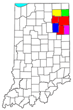
Municipalities with population
over 10,000 in 2000Municipalities with population
1,000-10,000 in 2000Albion · Andrews · Ashley · Avilla · Berne · Bluffton · Butler · Churubusco · Columbia City · Decatur · Garrett · Geneva · Grabill · Hamilton · Harlan · Huntertown · Kendallville · Leo-Cedarville · Ligonier · Markle · Monroeville · Ossian · Roanoke · Rome City · South Whitley · Warren · Waterloo · WoodburnMunicipalities with population
under 1,000 in 2000Altona · Cromwell · Corunna · Monroe · Mount Etna · Larwill · Poneto · Saint Joe · Uniondale · Vera Cruz · Wolcottville · ZanesvilleCoordinates: 41°22′01″N 85°03′32″W / 41.36694°N 85.05889°W
Categories:- Indiana counties
- DeKalb County, Indiana
- 1835 establishments in the United States
- Populated places established in 1835
- 1837 establishments in the United States


Wikimedia Foundation. 2010.