- Dubois County, Indiana
-
Dubois County, Indiana 
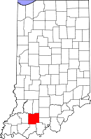
Location in the state of Indiana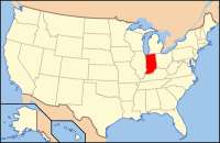
Indiana's location in the U.S.Founded December 20, 1818 Named for Toussaint Dubois Seat Jasper Area
- Total
- Land
- Water
435.33 sq mi (1,127 km²)
427.27 sq mi (1,107 km²)
8.06 sq mi (21 km²), 1.85%Population
- (2010)
- Density
41,889
97/sq mi (37.61/km²)Congressional district 9th Footnotes: Indiana county number 19
Dubois County is a county located in the U.S. state of Indiana. The county seat is Jasper.[1] As of 2010, the population was 41,889.[2]
Dubois County is part of the Jasper Micropolitan Statistical Area.
Contents
History
Dubois County was formed on December 20, 1818 from Orange, Pike and Perry counties. It is named for Toussaint Dubois, a Frenchman who fought in the Revolutionary War, the Battle of Tippecanoe and the War of 1812. DuBois was a merchant who lived mainly in Vincennes. He drowned in 1816 while crossing the Little Wabash River near Lawrenceville, Illinois.[3]
Dubois County switched to the Central Time Zone on April 2, 2006, and returned to the Eastern Time Zone on November 4, 2007; both changes were controversial.[4][5]
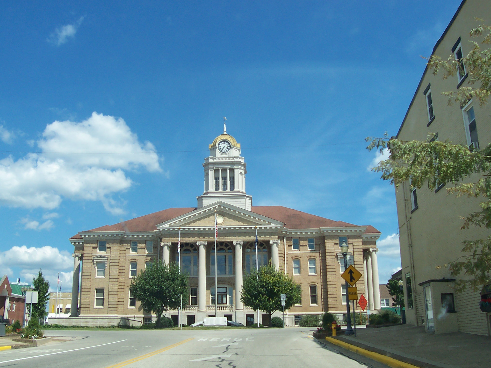
The original county seat was Portersville. In 1830 the county seat was moved south to Jasper.
Geography
According to the 2010 census, the county has a total area of 435.33 square miles (1,127.5 km2), of which 427.27 square miles (1,106.6 km2) (or 98.15%) is land and 8.06 square miles (20.9 km2) (or 1.85%) is water.[6]
Cities and towns
Unincorporated towns
- Hillham
- Ireland
- Johnsburg
- Kellerville
- Kyana
- Mentor
- Millersport
- Portersville
- Schnellville
- Saint Anthony
- Saint Henry
- Saint Marks
- Thales
- Zoar
Townships
Major highways
 Interstate 64
 U.S. Route 231
 Indiana State Road 56
 Indiana State Road 64
 Indiana State Road 145
 Indiana State Road 162
 Indiana State Road 164
Adjacent counties
- Martin County (north)
- Orange County (northeast)
- Crawford County (east)
- Perry County (southeast)
- Spencer County (south)
- Warrick County (southwest)
- Pike County (west)
- Daviess County (northwest)
See also: List of counties bordering eight countiesNational protected area
- Hoosier National Forest (part)
Climate and weather
Jasper, Indiana Climate chart (explanation) J F M A M J J A S O N D 338202.844244.154334.765435.374524.782614.486664.185633.679563.267444.355353.54325Average max. and min. temperatures in °F Precipitation totals in inches Source: The Weather Channel[7] Metric conversion J F M A M J J A S O N D 773-7717-4104121118186134231111928161113019105291790261380197109132896-4Average max. and min. temperatures in °C Precipitation totals in mm In recent years, average temperatures in Jasper have ranged from a low of 20 °F (−7 °C) in January to a high of 86 °F (30 °C) in July, although a record low of −25 °F (−32 °C) was recorded in January 1994 and a record high of 104 °F (40 °C) was recorded in July 1966. Average monthly precipitation ranged from 2.81 inches (71 mm) in February to 5.29 inches (134 mm) in May.[7]
Government
The county government is a constitutional body, and is granted specific powers by the Constitution of Indiana, and by the Indiana Code.
County Council: The county council is the legislative branch of the county government and controls all the spending and revenue collection in the county. Representatives are elected from county districts. The council members serve four year terms. They are responsible for setting salaries, the annual budget, and special spending. The council also has limited authority to impose local taxes, in the form of an income and property tax that is subject to state level approval, excise taxes, and service taxes.[8][9]
Board of Commissioners: The executive body of the county is made of a board of commissioners. The commissioners are elected county-wide, in staggered terms, and each serves a four-year term. One of the commissioners, typically the most senior, serves as president. The commissioners are charged with executing the acts legislated by the council, collecting revenue, and managing the day-to-day functions of the county government.[8][9]
Court: The county maintains a small claims court that can handle some civil cases. The judge on the court is elected to a term of four years and must be a member of the Indiana Bar Association. The judge is assisted by a constable who is also elected to a four-year term. In some cases, court decisions can be appealed to the state level circuit court.[9]
County Officials: The county has several other elected offices, including sheriff, coroner, auditor, treasurer, recorder, surveyor, and circuit court clerk. Each of these elected officers serves a term of four years and oversees a different part of county government. Members elected to county government positions are required to declare party affiliations and to be residents of the county.[9]
Dubois County is part of Indiana's 9th congressional district and is represented in Congress by Democrat Baron Hill.[10] It is also part of Indiana Senate districts 47 and 48,[11] and Indiana House of Representatives districts 63, 73 and 74.[12]
Demographics
Historical populations Census Pop. %± 1820 1,168 — 1830 1,778 52.2% 1840 3,632 104.3% 1850 6,321 74.0% 1860 10,394 64.4% 1870 12,597 21.2% 1880 15,992 27.0% 1890 20,253 26.6% 1900 20,357 0.5% 1910 19,843 −2.5% 1920 19,915 0.4% 1930 20,553 3.2% 1940 22,579 9.9% 1950 23,785 5.3% 1960 27,463 15.5% 1970 30,934 12.6% 1980 34,238 10.7% 1990 36,616 6.9% 2000 39,674 8.4% 2010 41,889 5.6% Sources: United States Department of Commerce,
Bureau of the Census, Population Division[13]
Census Quickfacts[2]As of the census[14] of 2000, there were 39,674 people, 14,813 households, and 10,739 families residing in the county. The population density was 92 people per square mile (36/km²). There were 15,511 housing units at an average density of 36 per square mile (14/km²). The racial makeup of the county was 97.54% White, 0.14% Black or African American, 0.10% Native American, 0.20% Asian, 0.04% Pacific Islander, 1.51% from other races, and 0.47% from two or more races. 2.78% of the population were Hispanic or Latino of any race. 64.7% were of German and 15.8% American ancestry according to Census 2000.
There were 14,813 households out of which 37.10% had children under the age of 18 living with them, 61.80% were married couples living together, 7.40% had a female householder with no husband present, and 27.50% were non-families. 23.50% of all households were made up of individuals and 9.90% had someone living alone who was 65 years of age or older. The average household size was 2.63 and the average family size was 3.13.
In the county the population was spread out with 27.40% under the age of 18, 7.90% from 18 to 24, 29.80% from 25 to 44, 22.10% from 45 to 64, and 12.90% who were 65 years of age or older. The median age was 36 years. For every 100 females there were 97.80 males. For every 100 females age 18 and over, there were 96.30 males.
The median income for a household in the county was $44,169, and the median income for a family was $50,342. Males had a median income of $32,484 versus $23,526 for females. The per capita income for the county was $20,225. About 2.90% of families and 6.20% of the population were below the poverty line, including 5.30% of those under age 18 and 7.30% of those age 65 or over.
Education
Public education in Dubois County is administered through four school corporations:
- Greater Jasper Consolidated Schools
- Southeast Dubois School Corporation
- Southwest Dubois School Corporation
- Northeast Dubois County School Corporation
High Schools
- Jasper High School (Greater Jasper Schools, Jasper)
- Forest Park High School (Southest Dubois Schools, Ferdinand)
- Southridge High School (Southwest Dubois Schools, Huntingburg)
- Northeast Dubois High School (Northeast Dubois Schools, Dubois)
Recreation
Patoka Lake is located along the county's eastern borders with both Crawford and Orange Counties. Patoka lake is home to several annual national tournaments.
See also
External links
References
- ^ "Find a County". National Association of Counties. http://www.naco.org/Counties/Pages/FindACounty.aspx. Retrieved 2011-06-07.
- ^ a b "Dubois County QuickFacts". United States Census Bureau. http://quickfacts.census.gov/qfd/states/18/18037.html. Retrieved 2011-09-17.
- ^ De Witt Clinton Goodrich & Charles Richard Tuttle (1875). An Illustrated History of the State of Indiana. Indiana: R. S. Peale & co.. pp. 556. http://books.google.com/books?id=YDIUAAAAYAAJ.
- ^ http://www.indystar.com/apps/pbcs.dll/article?AID=/20070921/LOCAL/709210491/-1/LOCAL17
- ^ DOT Moves Five Indiana Counties from Central to Eastern Time
- ^ "Census 2010 U.S. Gazetteer Files: Counties". United States Census. http://www.census.gov/geo/www/gazetteer/files/Gaz_counties_national.txt. Retrieved 2011-10-10.
- ^ a b "Monthly Averages for Jasper, Indiana". The Weather Channel. http://www.weather.com/weather/wxclimatology/monthly/graph/USIN0312. Retrieved 2011-01-27.
- ^ a b Indiana Code. "Title 36, Article 2, Section 3". IN.gov. http://www.in.gov/legislative/ic/code/title36/ar2/ch3.html. Retrieved 2008-09-16.
- ^ a b c d Indiana Code. "Title 2, Article 10, Section 2". IN.gov. http://www.in.gov/legislative/ic/code/title3/ar10/ch2.pdf. Retrieved 2008-09-16.
- ^ "Conressman Baron Hill". House.Gov. http://baronhill.house.gov/district.shtml. Retrieved 2008-09-12.
- ^ "Indiana Senate Districts". State of Indiana. http://www.in.gov/sos/elections/3006.htm. Retrieved 2011-01-23.
- ^ "Indiana House Districts". State of Indiana. http://www.in.gov/sos/elections/3005.htm. Retrieved 2011-01-23.
- ^ Forstall, Richard L. (editor) (1996). Population of states and counties of the United States: 1790 to 1990 : from the twenty-one decennial censuses. United States Department of Commerce, Bureau of the Census, Population Division. pp. 50–53. ISBN 0-934213-48-8. http://books.google.com/books?id=Z12v1lrkv2IC&lpg=PA50&pg=PA50#v=onepage&q&f=false.
- ^ "American FactFinder". United States Census Bureau. http://factfinder.census.gov. Retrieved 2008-01-31.

Daviess County Martin County Orange County Pike County 
Crawford County  Dubois County, Indiana

Warrick County Spencer County Perry County The Region of Southwestern Indiana Central Time Counties 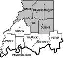
Eastern Time Counties County Seats Boonville (87) • Evansville (82) • Jasper (19) • Mt. Vernon (65) • Petersburg (63) • Princeton (26) Rockport (74) • Shoals (51) • Tell City (62) • Vincennes (42) • Washington (14)Metropolitan &
Micropolitan AreasEvansville Metropolitan Area • Jasper - Pike County Micropolitan Area • Princeton Micropolitan Area Vincennes Micropolitan Area • Warrick County Micropolitan Area • Washington Micropolitan AreaColleges and
UniversitiesUniversity of Evansville • University of Southern Indiana • Oakland City University (Evansville, Oakland City) • Vincennes University (Vincennes, Jasper, Fort Branch) • Ivy Tech Comm. College (Evansville, Princeton) • ITT Technical Institute (Newburgh) • Harrison CollegeMunicipalities and communities of Dubois County, Indiana Cities 
Towns Townships Unincorporated
communitiesBretzville | Celestine | Crystal | Cuzco | Dubois | Dubois Crossroads | Duff | Ellsworth | Haysville | Hillham | Ireland | Johnsburg | Kellerville | Kyana | Maltersville | Mentor | Millersport | Portersville | Saint Anthony | Saint Henry | Saint Marks | Schnellville | Thales | Zoar
Categories:- Indiana counties
- Dubois County, Indiana
- 1818 establishments in the United States
- Populated places established in 1818
- Southwestern Indiana
- Jasper, Indiana micropolitan area


Wikimedia Foundation. 2010.