- Martin County, Indiana
-
This article is about Martin County, Indiana. See Martin County for uses in other states.
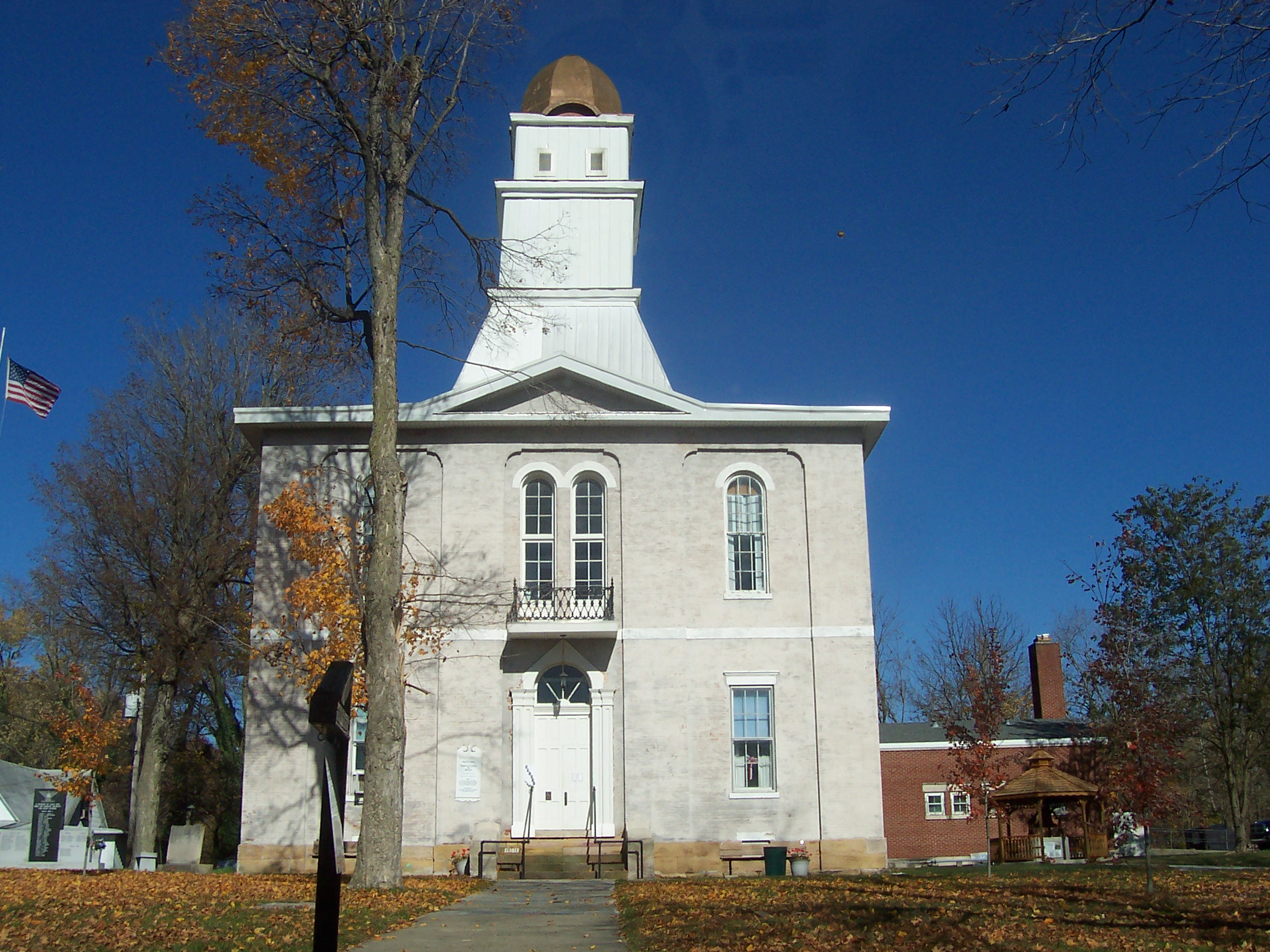
Martin County, Indiana 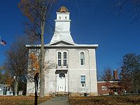 Martin County Courthouse
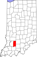
Location in the state of Indiana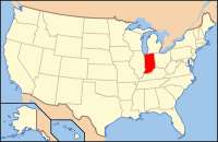
Indiana's location in the U.S.Founded January 20, 1820 Named for Major John T. Martin Seat Shoals Area
- Total
- Land
- Water
340.41 sq mi (882 km²)
335.74 sq mi (870 km²)
4.67 sq mi (12 km²), 1.37%Population
- (2010)
- Density
10,334
31/sq mi (11.87/km²)Congressional district 8th Time zone Eastern: UTC-5/-4 Footnotes: - Indiana county number 51
- Youngest county in Southwestern Indiana
- Smallest county in Southwestern Indiana by population
Martin County is a county located in the U.S. state of Indiana. As of 2010, the population was 10,334.[1] The county seat is Shoals[2]. On April 2, 2006, Martin County switched to the Central Time Zone.[3] Their petition to return to the Eastern Time Zone also caused five other counties to follow suit. It returned to the Eastern Time Zone on November 4, 2007.
Contents
History
Martin County was formed in 1820 from Daviess and Dubois Counties. It was named for Maj. John T. Martin of Newport, Kentucky.[4]
Geography
According to the 2010 census, the county has a total area of 340.41 square miles (881.7 km2), of which 335.74 square miles (869.6 km2) (or 98.63%) is land and 4.67 square miles (12.1 km2) (or 1.37%) is water.[5]
Most of the land in Martin County is owned by the US Government. About a third of the county belongs to the Naval Surface Warfare Center Crane Division, and about a quarter of the county belongs to Hoosier National Forest.
Adjacent counties
- Greene County (north)
- Lawrence County (east)
- Orange County (southeast)
- Dubois County (south)
- Daviess County (west)
National protected area
- Hoosier National Forest (part)
Highways
 Interstate 69*
 U.S. Route 50
 U.S. Route 150
 U.S. Route 231
 Indiana State Road 450
 Indiana State Road 550
- Expected around 2015
Climate and weather
Shoals, Indiana Climate chart (explanation) J F M A M J J A S O N D 3.237192.943224.354314.565405.675504.283594.786643.885623.479543.168424.554343.54224Average max. and min. temperatures in °F Precipitation totals in inches Source: The Weather Channel[6] Metric conversion J F M A M J J A S O N D 803-7746-610812-111418414224101082815120301896291785261280206114121906-4Average max. and min. temperatures in °C Precipitation totals in mm In recent years, average temperatures in Shoals have ranged from a low of 19 °F (−7 °C) in January to a high of 86 °F (30 °C) in July, although a record low of −23 °F (−31 °C) was recorded in January 1994 and a record high of 104 °F (40 °C) was recorded in July 1954. Average monthly precipitation ranged from 2.92 inches (74 mm) in February to 5.60 inches (142 mm) in May.[6]
Cities and towns
Townships
Government
See also: Government of IndianaThe county government is a constitutional body, and is granted specific powers by the Constitution of Indiana, and by the Indiana Code.
County Council: The county council is the legislative branch of the county government and controls all the spending and revenue collection in the county. Representatives are elected from county districts. The council members serve four year terms. They are responsible for setting salaries, the annual budget, and special spending. The council also has limited authority to impose local taxes, in the form of an income and property tax that is subject to state level approval, excise taxes, and service taxes.[7][8]
Board of Commissioners: The executive body of the county is made of a board of commissioners. The commissioners are elected county-wide, in staggered terms, and each serves a four-year term. One of the commissioners, typically the most senior, serves as president. The commissioners are charged with executing the acts legislated by the council, collecting revenue, and managing the day-to-day functions of the county government.[7][8]
Court: The county maintains a small claims court that can handle some civil cases. The judge on the court is elected to a term of four years and must be a member of the Indiana Bar Association. The judge is assisted by a constable who is also elected to a four-year term. In some cases, court decisions can be appealed to the state level circuit court.[8]
County Officials: The county has several other elected offices, including sheriff, coroner, auditor, treasurer, recorder, surveyor, and circuit court clerk Each of these elected officers serves a term of four years and oversees a different part of county government. Members elected to county government positions are required to declare party affiliations and to be residents of the county.[8]
Martin County is part of Indiana's 8th congressional district; Indiana Senate district 48;[9] and Indiana House of Representatives districts 62 and 63.[10]
Education
School Type Enrollment Mascot Colors IHSAA Class Athletic Conference Loogootee High School Public 325 Lions A Blue Chip Conference Shoals High School Public 223 JugRox A Blue Chip Conference Demographics
Historical populations Census Pop. %± 1820 1,032 — 1830 2,010 94.8% 1840 3,875 92.8% 1850 5,941 53.3% 1860 8,975 51.1% 1870 11,103 23.7% 1880 13,475 21.4% 1890 13,973 3.7% 1900 14,711 5.3% 1910 12,950 −12.0% 1920 11,865 −8.4% 1930 10,103 −14.9% 1940 10,300 1.9% 1950 10,678 3.7% 1960 10,608 −0.7% 1970 10,969 3.4% 1980 11,001 0.3% 1990 10,369 −5.7% 2000 10,369 0% 2010 10,334 −0.3% Sources: United States Department of Commerce,
Bureau of the Census, Population Division[11]
Census Quickfacts[1]As of the census[12] of 2000, there were 10,369 people, 4,183 households, and 2,877 families residing in the county. The population density was 31 people per square mile (12/km²). There were 4,729 housing units at an average density of 14 per square mile (5/km²). The racial makeup of the county was 98.93% White, 0.15% Black or African American, 0.12% Native American, 0.14% Asian, 0.03% Pacific Islander, 0.11% from other races, and 0.52% from two or more races. 0.41% of the population were Hispanic or Latino of any race. 35.4% were of American, 24.3% German, 13.0% Irish and 7.9% English ancestry according to Census 2000.
There were 4,183 households out of which 31.60% had children under the age of 18 living with them, 56.50% were married couples living together, 8.20% had a female householder with no husband present, and 31.20% were non-families. 27.60% of all households were made up of individuals and 12.30% had someone living alone who was 65 years of age or older. The average household size was 2.45 and the average family size was 3.00.
In the county the population was spread out with 25.20% under the age of 18, 7.40% from 18 to 24, 27.50% from 25 to 44, 25.60% from 45 to 64, and 14.20% who were 65 years of age or older. The median age was 38 years. For every 100 females there were 102.50 males. For every 100 females age 18 and over, there were 100.20 males.
The median income for a household in the county was $36,411, and the median income for a family was $43,550. Males had a median income of $31,200 versus $21,732 for females. The per capita income for the county was $17,054. About 8.10% of families and 11.20% of the population were below the poverty line, including 13.00% of those under age 18 and 11.80% of those age 65 or over.
See also
- National Register of Historic Places listings in Martin County, Indiana
References
- ^ a b "Martin County QuickFacts". United States Census Bureau. http://quickfacts.census.gov/qfd/states/18/18101.html. Retrieved 2011-09-25.
- ^ "Find a County". National Association of Counties. http://www.naco.org/Counties/Pages/FindACounty.aspx. Retrieved 2011-06-07.
- ^ http://www.wthi.com/newsdet.asp?id=9684§ion=2
- ^ De Witt Clinton Goodrich & Charles Richard Tuttle (1875). An Illustrated History of the State of Indiana. Indiana: R. S. Peale & co.. pp. 567. http://books.google.com/books?id=YDIUAAAAYAAJ.
- ^ "Census 2010 U.S. Gazetteer Files: Counties". United States Census. http://www.census.gov/geo/www/gazetteer/files/Gaz_counties_national.txt. Retrieved 2011-10-10.
- ^ a b "Monthly Averages for Shoals, Indiana". The Weather Channel. http://www.weather.com/weather/wxclimatology/monthly/graph/USIN0616. Retrieved 2011-01-27.
- ^ a b Indiana Code. "Title 36, Article 2, Section 3". IN.gov. http://www.in.gov/legislative/ic/code/title36/ar2/ch3.html. Retrieved 2008-09-16.
- ^ a b c d Indiana Code. "Title 2, Article 10, Section 2". IN.gov. http://www.in.gov/legislative/ic/code/title3/ar10/ch2.pdf. Retrieved 2008-09-16.
- ^ "Indiana Senate Districts". State of Indiana. http://www.in.gov/sos/elections/3006.htm. Retrieved 2011-07-14.
- ^ "Indiana House Districts". State of Indiana. http://www.in.gov/sos/elections/3005.htm. Retrieved 2011-07-14.
- ^ Forstall, Richard L. (editor) (1996). Population of states and counties of the United States: 1790 to 1990 : from the twenty-one decennial censuses. United States Department of Commerce, Bureau of the Census, Population Division. pp. 50–53. ISBN 0-934213-48-8. http://books.google.com/books?id=Z12v1lrkv2IC&lpg=PA50&pg=PA50#v=onepage&q&f=false.
- ^ "American FactFinder". United States Census Bureau. http://factfinder.census.gov. Retrieved 2008-01-31.

Greene County Daviess County 
Lawrence County  Martin County, Indiana

Dubois County Orange County The Region of Southwestern Indiana Central Time Counties 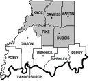
Eastern Time Counties County Seats Boonville (87) • Evansville (82) • Jasper (19) • Mt. Vernon (65) • Petersburg (63) • Princeton (26) Rockport (74) • Shoals (51) • Tell City (62) • Vincennes (42) • Washington (14)Metropolitan &
Micropolitan AreasEvansville Metropolitan Area • Jasper - Pike County Micropolitan Area • Princeton Micropolitan Area Vincennes Micropolitan Area • Warrick County Micropolitan Area • Washington Micropolitan AreaColleges and
UniversitiesUniversity of Evansville • University of Southern Indiana • Oakland City University (Evansville, Oakland City) • Vincennes University (Vincennes, Jasper, Fort Branch) • Ivy Tech Comm. College (Evansville, Princeton) • ITT Technical Institute (Newburgh) • Harrison CollegeMunicipalities and communities of Martin County, Indiana City 
Towns Townships Center | Halbert | Lost River | Mitcheltree | Perry | Rutherford
Unincorporated
communitiesBramble | Burns City | Cale | Dover Hill | Hindostan Falls | Indian Springs | Ironton | Lacy | Mount Olive | Mount Pleasant | Natchez | Pleasant Valley | Rusk | Scenic Hill | South Martin | Trinity Springs | Whitfield | Willow Valley | Windom | Yenne
Categories:- Indiana counties
- Martin County, Indiana
- 1820 establishments in the United States
- Populated places established in 1820
- Southwestern Indiana


Wikimedia Foundation. 2010.