- Ohio County, Indiana
-
Ohio County, Indiana 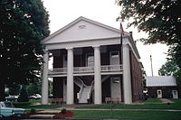 Ohio County courthouse in Rising Sun, Indiana
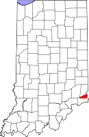
Location in the state of Indiana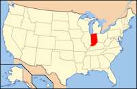
Indiana's location in the U.S.Founded 1844 Seat Rising Sun area_total_sq_mi = 87.43
Area
- Total
- Land
- Water
86.14 sq mi (223 km²)
1.29 sq mi (3 km²), 1.48%Population
- (2010)
- Density
6,128
71/sq mi (27.28/km²)Congressional district 9th Footnotes: - Indiana county number 58
- Smallest county in Indiana by both area and population
Ohio County is a county located in the state of Indiana. In total area, it is the smallest county in Indiana, and also the county in Indiana with the least population. As of 2010, the population was 6,128.[1] The county seat is Rising Sun[2]
Contents
Climate and weather
Rising Sun, Indiana Climate chart (explanation) J F M A M J J A S O N D 3.13921345244.155324.266414.775514.883603.987653.886633.179562.968433.556353.44426Average max. and min. temperatures in °F Precipitation totals in inches Source: The Weather Channel[3] Metric conversion J F M A M J J A S O N D 784-6757-41041301071951202411123281610031189730177826137420688132877-3Average max. and min. temperatures in °C Precipitation totals in mm In recent years, average temperatures in Rising Sun have ranged from a low of 21 °F (−6 °C) in January to a high of 87 °F (31 °C) in July, although a record low of −23 °F (−31 °C) was recorded in January 1994 and a record high of 104 °F (40 °C) was recorded in July 1988. Average monthly precipitation ranged from 2.92 inches (74 mm) in October to 4.83 inches (123 mm) in June.[3]
Government
See also: Government of IndianaThe county government is a constitutional body, and is granted specific powers by the Constitution of Indiana, and by the Indiana Code.
County Council: The county council is the legislative branch of the county government and controls all the spending and revenue collection in the county. Representatives are elected from county districts. The council members serve four year terms. They are responsible for setting salaries, the annual budget, and special spending. The council also has limited authority to impose local taxes, in the form of an income and property tax that is subject to state level approval, excise taxes, and service taxes.[4][5]
Board of Commissioners: The executive body of the county is made of a board of commissioners. The commissioners are elected county-wide, in staggered terms, and each serves a four-year term. One of the commissioners, typically the most senior, serves as president. The commissioners are charged with executing the acts legislated by the council, collecting revenue, and managing the day-to-day functions of the county government.[4][5]
County Officials: The county has several other elected offices, including sheriff, coroner, auditor, treasurer, recorder, surveyor, and circuit court clerk Each of these elected officers serves a term of four years and oversees different parts of the county government. Members elected to county government positions are required to declare party affiliations and to be residents of the county.[5]
Geography
According to the 2010 census, the county has a total area of 87.43 square miles (226.4 km2), the smallest county in Indiana, of which 86.14 square miles (223.1 km2) (or 98.52%) is land and 1.29 square miles (3.3 km2) (or 1.48%) is water.[6]
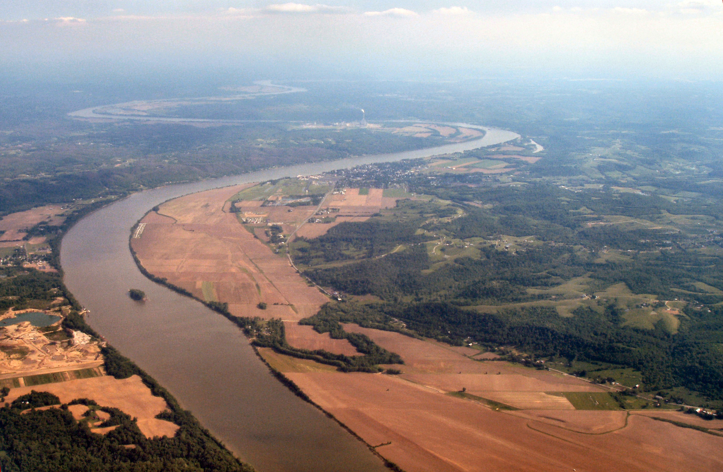
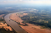 Rising Sun, on the Ohio River.
Adjacent counties
- Dearborn County (north)
- Boone County, Kentucky (east)
- Switzerland County (south)
- Ripley County (northwest)
Major highways
History
Ohio County was formed in 1844. It was is named for the Ohio River, which flows past it.
Demographics
Historical populations Census Pop. %± 1850 5,308 — 1860 5,462 2.9% 1870 5,837 6.9% 1880 5,563 −4.7% 1890 4,955 −10.9% 1900 4,724 −4.7% 1910 4,329 −8.4% 1920 4,024 −7.0% 1930 3,747 −6.9% 1940 3,782 0.9% 1950 4,223 11.7% 1960 4,165 −1.4% 1970 4,289 3.0% 1980 5,114 19.2% 1990 5,315 3.9% 2000 5,623 5.8% 2010 6,128 9.0% Sources: United States Department of Commerce,
Bureau of the Census, Population Division[7]
Census Quickfacts[1]As of the census[8] of 2000, there were 5,623 people, 2,201 households, and 1,586 families residing in the county. The population density was 65 people per square mile (25/km²). There were 2,424 housing units at an average density of 28 per square mile (11/km²). The racial makeup of the county was 98.70% White, 0.48% Black or African American, 0.12% Native American, 0.14% Asian, 0.02% Pacific Islander, 0.05% from other races, and 0.48% from two or more races. 0.44% of the population were Hispanic or Latino of any race. 38.4% were of German, 26.6% American, 10.0% English and 9.9% Irish ancestry according to Census 2000.
There were 2,201 households out of which 31.90% had children under the age of 18 living with them, 59.90% were married couples living together, 8.50% had a female householder with no husband present, and 27.90% were non-families. 23.20% of all households were made up of individuals and 10.20% had someone living alone who was 65 years of age or older. The average household size was 2.53 and the average family size was 3.00.
In the county the population was spread out with 24.80% under the age of 18, 7.80% from 18 to 24, 28.60% from 25 to 44, 25.00% from 45 to 64, and 13.70% who were 65 years of age or older. The median age was 38 years. For every 100 females there were 97.00 males. For every 100 females age 18 and over, there were 96.20 males.
The median income for a household in the county was $41,348, and the median income for a family was $48,801. Males had a median income of $37,297 versus $25,242 for females. The per capita income for the county was $19,627. About 5.80% of families and 7.10% of the population were below the poverty line, including 7.50% of those under age 18 and 11.40% of those age 65 or over.
Cities, towns and communities
- Aberdeen
- Bascom Corner
- Bear Branch
- Blue
- Buffalo
- Camp Shor
- Cofield Corner
- Downey Corner
- French
- Hartford
- Milton
- North Landing
- Pate
- Rising Sun
Townships
See also
References
- ^ a b "Ohio County QuickFacts". United States Census Bureau. http://quickfacts.census.gov/qfd/states/18/18115.html. Retrieved 2011-09-25.
- ^ "Find a County". National Association of Counties. http://www.naco.org/Counties/Pages/FindACounty.aspx. Retrieved 2011-06-07.
- ^ a b "Monthly Averages for Rising Sun, Indiana". The Weather Channel. http://www.weather.com/weather/wxclimatology/monthly/graph/USIN0563. Retrieved 2011-01-27.
- ^ a b Indiana Code. "Title 36, Article 2, Section 3". IN.gov. http://www.in.gov/legislative/ic/code/title36/ar2/ch3.html. Retrieved 2008-09-16.
- ^ a b c Indiana Code. "Title 2, Article 10, Section 2" (PDF). IN.gov. http://www.in.gov/legislative/ic/code/title3/ar10/ch2.pdf. Retrieved 2008-09-16.
- ^ "Census 2010 U.S. Gazetteer Files: Counties". United States Census. http://www.census.gov/geo/www/gazetteer/files/Gaz_counties_national.txt. Retrieved 2011-10-10.
- ^ Forstall, Richard L. (editor) (1996). Population of states and counties of the United States: 1790 to 1990 : from the twenty-one decennial censuses. United States Department of Commerce, Bureau of the Census, Population Division. pp. 50–53. ISBN 0-934213-48-8. http://books.google.com/books?id=Z12v1lrkv2IC&lpg=PA50&pg=PA50#v=onepage&q&f=false.
- ^ "American FactFinder". United States Census Bureau. http://factfinder.census.gov. Retrieved 2008-01-31.

Ripley County Dearborn County 
Boone County, Kentucky  Ohio County, Indiana

Switzerland County Municipalities and communities of Ohio County, Indiana City 
Townships Unincorporated
communitiesAberdeen | Bear Branch | Blue | Buffalo | Camp Shor | Cofield Corner | Hartford | Milton
Categories:- Indiana counties
- Ohio County, Indiana
- 1844 establishments in the United States
- Ohio River counties
- Populated places established in 1844


Wikimedia Foundation. 2010.