- Henry County, Indiana
-
Henry County, Indiana 
Location in the state of Indiana
Indiana's location in the U.S.Founded 1822 Named for Patrick Henry Seat New Castle Area
- Total
- Land
- Water
394.83 sq mi (1,023 km²)
391.88 sq mi (1,015 km²)
2.96 sq mi (8 km²), 0.75%Population
- (2010)
- Density
49,462
126/sq mi (48.6/km²)Congressional district 6th Time zone Eastern: UTC-5/-4 Footnotes: Indiana county number 33
Henry County is a county located in the U.S. state of Indiana. As of 2010, the population was 49,462.[1] The county seat is New Castle[2]. Henry County is the main setting of the novel Raintree County by Ross Lockridge, Jr..
Contents
History
Henry County was formed in 1822. It was named for Patriot Patrick Henry, governor of Virginia.
Geography
According to the 2010 census, the county has a total area of 394.83 square miles (1,022.6 km2), of which 391.88 square miles (1,015.0 km2) (or 99.25%) is land and 2.96 square miles (7.7 km2) (or 0.75%) is water.[3]
Cities and towns
- Ashland
- Blountsville
- Cadiz
- Corwin
- Dunreith
- Fayne Siding
- Foley
- Grant City
- Greensboro
- Hillsboro
- Honey Creek
- Kennard
- Knightstown
- Lewisville
- Luray
- Maple Valley
- Mechanicsburg
- Messick
- Middletown
- Millville
- Mooreland
- Mount Lawn
- Mount Summit
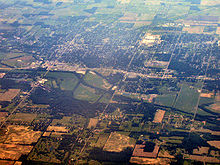
- New Castle
- New Lisbon
- Ogden
- Pierson Station
- Raysville
- Rogersville
- Shirley
Townships
Reservoirs
- Castle Lake
- Giboney Lake
- Haven, Lake
- Summit Lake Reservoir
- Westwood Park Reservoir
Adjacent counties
- Delaware County (north)
- Randolph County (northeast)
- Wayne County (east)
- Fayette County (southeast)
- Rush County (south)
- Hancock County (southwest)
- Madison County (northwest)
Major highways
Sources: National Atlas,[4] U.S. Census Bureau[5]
- Interstate 70
- U.S. Route 35
- U.S. Route 36
- U.S. Route 40
- Indiana State Road 3
- Indiana State Road 38
- Indiana State Road 103
- Indiana State Road 109
- Indiana State Road 140
- Indiana State Road 234
- Indiana State Road 236
Climate and weather
New Castle, Indiana Climate chart (explanation) J F M A M J J A S O N D 2.233162.33819349283.960374.771484.680574.784613.682592.976522.964413.750322.83822Average max. and min. temperatures in °F Precipitation totals in inches Source: The Weather Channel[6] Metric conversion J F M A M J J A S O N D 571-9573-7759-2100163119229117271411929169128157324117518593100713-6Average max. and min. temperatures in °C Precipitation totals in mm In recent years, average temperatures in New Castle have ranged from a low of 16 °F (−9 °C) in January to a high of 84 °F (29 °C) in July, although a record low of −26 °F (−32 °C) was recorded in January 1994 and a record high of 103 °F (39 °C) was recorded in June 1988. Average monthly precipitation ranged from 2.24 inches (57 mm) in January to 4.70 inches (119 mm) in May.[6]
Government
The county government is a constitutional body, and is granted specific powers by the Constitution of Indiana, and by the Indiana Code.
County Council: The county council is the legislative branch of the county government and controls all the spending and revenue collection in the county. Representatives are elected from county districts. The council members serve four year terms. They are responsible for setting salaries, the annual budget, and special spending. The council also has limited authority to impose local taxes, in the form of an income and property tax that is subject to state level approval, excise taxes, and service taxes.[7][8]
Board of Commissioners: The executive body of the county is made of a board of commissioners. The commissioners are elected county-wide, in staggered terms, and each serves a four-year term. One of the commissioners, typically the most senior, serves as president. The commissioners are charged with executing the acts legislated by the council, collecting revenue, and managing the day-to-day functions of the county government.[7][8]
Court: The county maintains three courts. Superior Court I, Superior Court II and Circuit Court. The judge on the court is elected to a term of four years and must be a member of the Indiana Bar Association. In some cases, court decisions can be appealed to the state level circuit court.[8]
County Officials: The county has several other elected offices, including sheriff, coroner, auditor, treasurer, recorder, surveyor, and circuit court clerk Each of these elected officers serves a term of four years and oversees a different part of county government. Members elected to county government positions are required to declare party affiliations and to be residents of the county.[8]
Henry County is part of Indiana's 6th congressional district; Indiana Senate district 28;[9] and Indiana House of Representatives districts 54 and 56.[10]
Demographics
Historical populations Census Pop. %± 1830 6,497 — 1840 15,128 132.8% 1850 17,605 16.4% 1860 20,119 14.3% 1870 22,986 14.3% 1880 24,016 4.5% 1890 23,879 −0.6% 1900 25,088 5.1% 1910 29,758 18.6% 1920 34,682 16.5% 1930 35,238 1.6% 1940 40,208 14.1% 1950 45,505 13.2% 1960 48,899 7.5% 1970 52,603 7.6% 1980 53,336 1.4% 1990 48,139 −9.7% 2000 48,508 0.8% 2010 49,462 2.0% Sources: United States Department of Commerce,
Bureau of the Census, Population Division[11]
Census Quickfacts[1]As of the census[12] of 2000, there were 48,508 people, 19,486 households, and 13,971 families residing in the county. The population density was 124 people per square mile (48/km²). There were 20,592 housing units at an average density of 52 per square mile (20/km²). The racial makeup of the county was 97.96% White, 0.86% Black or African American, 0.15% Native American, 0.20% Asian, 0.01% Pacific Islander, 0.28% from other races, and 0.54% from two or more races. 0.80% of the population were Hispanic or Latino of any race. 33.8% were of American, 19.6% German, 13.8% English and 9.1% Irish ancestry according to Census 2000.
There were 19,486 households out of which 30.70% had children under the age of 18 living with them, 58.40% were married couples living together, 9.9% had a female householder with no husband present, and 28.3% were non-families. 24.8% of all households were made up of individuals and 11.9% had someone living alone who was 65 years of age or older. The average household size was 2.45 and the average family size was 2.91.
In the county the population was spread out with 24.2% under the age of 18, 7.5% from 18 to 24, 27.8% from 25 to 44, 24.8% from 45 to 64, and 15.7% who were 65 years of age or older. The median age was 39 years. For every 100 females there were 93.2 males. For every 100 females age 18 and over, there were 90.2 males.
The median income for a household in the county was $38,150, and the median income for a family was $45,470. Males had a median income of $36,439 versus $22,432 for females. The per capita income for the county was $19,355. About 6.0% of families and 7.8% of the population were below the poverty line, including 10.0% of those under age 18 and 6.8% of those age 65 or over.
Recreation
Notable natives and former residents
- Omar Bundy, Major General, World War One
- William Grose, Major General, Civil War
- Robert Indiana, artist
- Arthur C. Mellette, first Governor of South Dakota
- Wilbur Wright, aviation pioneer
- Steve Alford, NCAA Basketball Coach and Former Player
- Kent Benson, Former NCAA and NBA Basketball Player
See also
- National Register of Historic Places listings in Henry County, Indiana
- Edward E. Moore, Indiana state senator and Los Angeles City Council member
External links
- New Castle Henry County Chamber of Commerce
- Henry County Convention & Visitors Bureau
- Websites in Henry County, Indiana
- EZ-Look.com News & Discussion
References
- ^ a b "Henry County QuickFacts". United States Census Bureau. http://quickfacts.census.gov/qfd/states/18/18065.html. Retrieved 2011-09-20.
- ^ "Find a County". National Association of Counties. http://www.naco.org/Counties/Pages/FindACounty.aspx. Retrieved 2011-06-07.
- ^ "Census 2010 U.S. Gazetteer Files: Counties". United States Census. http://www.census.gov/geo/www/gazetteer/files/Gaz_counties_national.txt. Retrieved 2011-10-10.
- ^ National Atlas
- ^ U.S. Census Bureau TIGER shape files
- ^ a b "Monthly Averages for New Castle, Indiana". The Weather Channel. http://www.weather.com/weather/wxclimatology/monthly/graph/USIN0462. Retrieved 2011-01-27.
- ^ a b Indiana Code. "Title 36, Article 2, Section 3". IN.gov. http://www.in.gov/legislative/ic/code/title36/ar2/ch3.html. Retrieved 2008-09-16.
- ^ a b c d Indiana Code. "Title 2, Article 10, Section 2" (PDF). IN.gov. http://www.in.gov/legislative/ic/code/title3/ar10/ch2.pdf. Retrieved 2008-09-16.
- ^ "Indiana Senate Districts". State of Indiana. http://www.in.gov/sos/elections/3006.htm. Retrieved 2011-07-14.
- ^ "Indiana House Districts". State of Indiana. http://www.in.gov/sos/elections/3005.htm. Retrieved 2011-07-14.
- ^ Forstall, Richard L. (editor) (1996). Population of states and counties of the United States: 1790 to 1990 : from the twenty-one decennial censuses. United States Department of Commerce, Bureau of the Census, Population Division. pp. 50–53. ISBN 0-934213-48-8. http://books.google.com/books?id=Z12v1lrkv2IC&lpg=PA50&pg=PA50#v=onepage&q&f=false.
- ^ "American FactFinder". United States Census Bureau. http://factfinder.census.gov. Retrieved 2008-01-31.

Madison County Delaware County Randolph County 
Wayne County  Henry County, Indiana

Hancock County Rush County Fayette County Municipalities and communities of Henry County, Indiana City 
Towns Blountsville | Cadiz | Dunreith | Greensboro | Kennard | Knightstown | Lewisville | Middletown | Mooreland | Mount Summit | Shirley‡ | Spiceland | Springport | Straughn | Sulphur Springs
Townships Blue River | Dudley | Fall Creek | Franklin | Greensboro | Harrison | Henry | Jefferson | Liberty | Prairie | Spiceland | Stoney Creek | Wayne
Unincorporated
communitiesAshland | Corwin | Foley | Grant City | Hillsboro | Honey Creek | Knox | Luray | Maple Valley | Mechanicsburg | Messick | Millville | Mount Lawn | New Lisbon | Ogden | Stone Quarry Mills | Raysville | Rogersville | Van Nuys | Westwood
Footnotes ‡This populated place also has portions in an adjacent county or counties
Categories:- Indiana counties
- Henry County, Indiana
- 1822 establishments in the United States
- Populated places established in 1822
- National Road


Wikimedia Foundation. 2010.