Indiana State Road 47 — Infobox road state=IN type=IN route=47 alternate name= length mi=64.2 length round=1 length ref= [http://illi indi.com/EndsPage.php?id=1047 section=1 Indiana Highway Ends SR 47] ] established= direction a=South starting terminus= junction=… … Wikipedia
Indiana State Road 4 — Infobox road marker state=IN highway name= name notes= type=IN route=4 alternate name= section= length mi= length round= length ref= length notes= established= decommissioned= direction a= starting terminus= beltway city= junction= direction b=… … Wikipedia
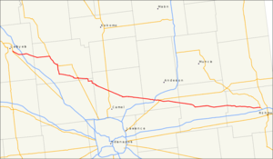
Indiana State Road 43 — Infobox road state=IN type=IN route=43 alternate name= length mi= length round= length ref= established= direction a= starting terminus=IN 54 near Cincinnati direction b= ending terminus=US 24/US 421 in Reynolds counties=Greene, Owen, Tippecanoe … Wikipedia
Indiana State Road 11 — Infobox road marker state=IN highway name= name notes= type=IN route=11 alternate name= maint=Indiana Department of Transportation section= length mi= length round= length ref= length notes= established= decommissioned= direction a= starting… … Wikipedia
Indiana State Road 53 — Infobox road state=IN type=IN route=53 alternate name=Broadway length mi=14.1 length round=1 length ref= [http://illi indi.com/EndsPage.php?id=1053 section=1 Indiana Highway Ends SR 53] ] established= direction a=South starting terminus= junction … Wikipedia
Indiana State Road 14 — Infobox road state=IN type=IN route=14 alternate name= length mi=123 length round= length ref= [http://illi indi.com/EndsPage.php?id=1014 section=1 Indiana Highway Ends SR 14] ] established= direction a=West starting terminus= junction= direction … Wikipedia
Indiana State Road 8 — Infobox road marker state=IN highway name= name notes= type=IN route=8 alternate name= section= length mi= length round= length ref= length notes= established= decommissioned= direction a= starting terminus= beltway city= junction= direction b=… … Wikipedia
Indiana State Road 329 — State Road 329 was a state road in Cass County, Indiana. It was a connector from Indiana State Road 29 s northern terminus at the U.S. Highway 24/U.S. Highway 35 bypass south of the city of Logansport to Indiana State Road 17 s southern terminus… … Wikipedia
Indiana State Road 123 — State Road 123 was a north south state road in Saint Joseph County, Indiana. It ran along the western edge of the city of South Bend. Former routingFollowing Mayflower Road for its entire route, it began from its parent Indiana State Road 23,… … Wikipedia
Indiana State Road 223 — State Road 223 was a northeast southwest state highway in Saint Joseph County, Indiana. It was about 7 miles long.SR 223 began from the south at one of its parent routes, Indiana State Road 23. It followed the Crumstown Highway north through… … Wikipedia