- Adams County, Indiana
-
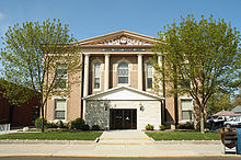
Adams County, Indiana 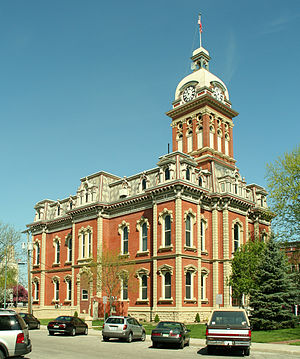 Adams County courthouse in Decatur
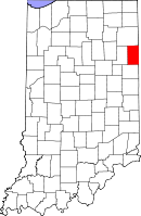
Location in the state of Indiana
Indiana's location in the U.S.Founded 1 March 1836 Seat Decatur Area
- Total
- Land
- Water
339.97 sq mi (881 km²)
339.03 sq mi (878 km²)
0.94 sq mi (2 km²), 0.28%Population
- (2010)
- Density
34,387
101/sq mi (39.1/km²)Congressional district 6th Website www.co.adams.in.us Footnotes: Indiana county number 1
Adams County lies in northeastern Indiana in the United States and shares its eastern border with Ohio. It was officially established in 1836. The county seat is Decatur.[1]
According to the 2010 census, its population was 34,387, an increase of 2.3% from 33,625 in 2000.[2] The county has four incorporated cities and towns with a total population of over 15,000,[3] as well as many small unincorporated communities. The county is divided into 12 townships which provide local services.[4][5] There are four Indiana state roads in the county, as well as three U.S. Routes and one railroad line.[6][7]
Contents
History
Adams County was created by statute on February 7, 1835, and organized March 1, 1836. Its name honors the sixth President of the United States, John Quincy Adams.[8] The site of the county seat was chosen May 18, 1836.[9]
The first courthouse was a two-story frame building and was commissioned in 1839. The first jail was a log building that was completed in 1837.[10] The present Adams County courthouse was built in Decatur in 1872–1873 at a cost of $78,979.[n 1] The designer was J. C. Johnson, who had been trained as a carpenter and joiner and became a self-taught architect; he won second place in the Indiana State Capitol design competition. The construction was done by Christian Boseker of Fort Wayne. It is built of red brick with stone ornamentation.[12]
Geography
 Map of Adams County
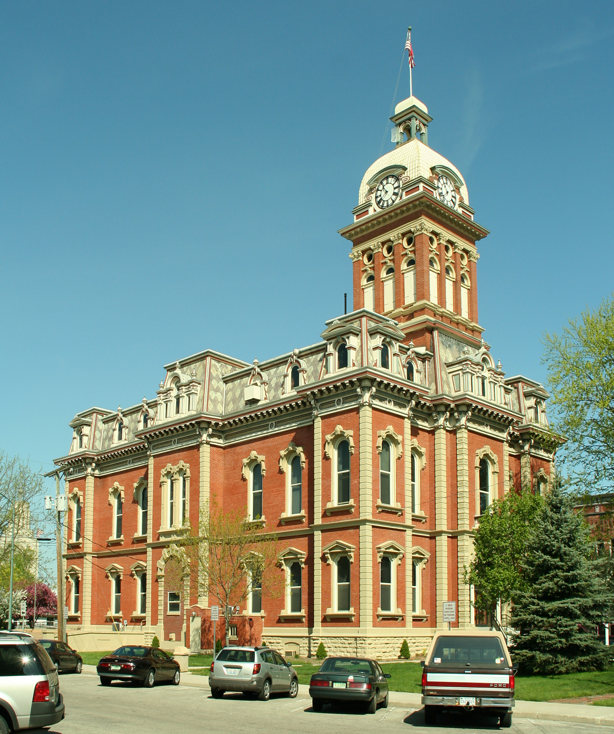
 Adams County superior court, Decatur, Indiana, 2006.
According to the 2010 census, the county has a total area of 339.97 square miles (880.5 km2), of which 339.03 square miles (878.1 km2) (or 99.72%) is land and 0.94 square miles (2.4 km2) (or 0.28%) is water.[13]
Adams County is bordered on the north by Allen County, on the west by Wells County, and on the south by Jay County. The two Ohio counties of Van Wert and Mercer lie to the northeast and southeast, respectively.
The county has four incorporated settlements, all of which lie in a rough north–south line. The city of Decatur is the largest and is also the county seat, and is in the northern part of the county where U.S. Route 27 and U.S. Route 33 intersect with the east–west U.S. Route 224. U.S. Route 27 continues south through the town of Monroe, near the center of the county, and then on through Berne and Geneva.
Unincorporated towns
- Preble
- Linn Grove
- Pleasant Mills
- Ceylon
- Curryville
- Magley
- Monmouth
- Peterson
- Salem
- Perryville
- Elm Tree Crossroads
- Coppess Corner
- Rivare (Bobo)
- Honduras
Townships
Adams County is divided into twelve townships:
Climate and weather
Decatur, Indiana Climate chart (explanation) J F M A M J J A S O N D 2.232172.237212.948303.761393.872504.48160484643.78262376542.664433.250342.83723Average max. and min. temperatures in °F Precipitation totals in inches Source: The Weather Channel[14] Metric conversion J F M A M J J A S O N D 550-8553-6739-193164962210112271610329189528177724126618682101703-5Average max. and min. temperatures in °C Precipitation totals in mm Adams County is in the humid continental climate region of the United States along with most of Indiana. Its Köppen climate classification is Dfa,[15] meaning that it is cold, has no dry season, and has a hot summer.[16] In recent years, average temperatures in Decatur have ranged from a low of 17 °F (−8 °C) in January to a high of 84 °F (29 °C) in July, although a record low of −24 °F (−31 °C) was recorded in January 1985 and a record high of 107 °F (42 °C) was recorded in July 1934. Average monthly precipitation ranged from 2.16 inches (55 mm) in February to 4.42 inches (112 mm) in June.[14]
Transportation
Three U.S Routes cross the county. U.S. Route 27 and U.S. Route 33 enter the north end of the county from Fort Wayne in neighboring Allen County. Passing through Decatur, they split; U.S. Route 27 goes south through Monroe, Berne and Geneva and continues into Jay County, whereas U.S. Route 33 heads southeast into Ohio.[17][18] U.S. Route 224 passes from west to east through the north part of the county, intersecting U.S. Routes 27 and 33 in Decatur, then continuing into Ohio.[19]
Indiana State Road 124 cross the center of the county from west to east, passing from Bluffton in neighboring Wells County through Monroe and on to the Ohio border.[20] Indiana State Road 101 is a north–south road that begins near the Ohio border at State Road 124; it runs north through Pleasant Mills and Rivare and continues into Allen County to the north.[21] Indiana State Road 116 enters the county from Bluffton to the west, runs southwest and then south to Perryville, then runs east and terminates at U.S. Route 27 in Geneva.[22] Indiana State Road 218 runs across the south part of the county from west to east and passes through Berne.[23]
CSX Transportation operates a rail line that runs from Decatur to the northwest toward Fort Wayne.[7]
Government
See also: Government of IndianaThe county government is a constitutional body granted specific powers by the Constitution of Indiana and the Indiana Code. The county council is the legislative branch of the county government and controls all spending and revenue collection. Representatives are elected from county districts. The council members serve four-year terms and are responsible for setting salaries, the annual budget and special spending. The council also has limited authority to impose local taxes, in the form of an income and property tax that is subject to state level approval, excise taxes and service taxes.[24][25] In 2010, the county budgeted approximately $2.2 million for the district's schools and $2.8 million for other county operations and services, for a total annual budget of approximately $5 million.[26]
The executive body of the county is made of a board of commissioners. The commissioners are elected county-wide, in staggered terms, and each serves a four-year term. One of the commissioners, typically the most senior, serves as president. The commissioners are charged with executing the acts legislated by the council, collecting revenue and managing day-to-day functions of the county government.[24][25]
The county maintains a small claims court that can handle some civil cases. The judge on the court is elected to a term of four years and must be a member of the Indiana Bar Association. The judge is assisted by a constable who is elected to a four-year term. In some cases, court decisions can be appealed to the state level circuit court.[25]
The county has several other elected offices, including sheriff, coroner, auditor, treasurer, recorder, surveyor and circuit court clerk. Each of these elected officers serves a term of four years and oversees a different part of county government. Members elected to county government positions are required to declare party affiliations and be residents of the county.[25]
Each of the townships has a trustee who administers rural fire protection and ambulance service, provides poor relief and manages cemetery care, among other duties.[5] The trustee is assisted in these duties by a three-member township board. The trustees and board members are elected to four-year terms.[27]
Adams County is part of Indiana's 6th congressional district; Indiana Senate district 19;[28] and Indiana House of Representatives district 79.[29]
Education
Public schools in Adams County are administered by North Adams Community Schools, Adams Central Community Schools, and South Adams Schools. The Diocese of Fort Wayne and Lutheran Schools of Indiana both operate in Adams County as well. In all, these organizations operate 13 schools in the county.[30]
Festivals and Fairs in Adams County
- Adams County 4-H Fair (Monroe)
- Swiss Days (Berne)
- Calithumpian Festival (Decatur)
- Festival of Kekionga (Decatur)
Media
Radio
- WZBD (Berne)
- WADM (Decatur)
Newspapers
- The Decatur Daily Democrat (Decatur)
- Berne Tri-Weekly (Berne)
Notable people
- Author Gene Stratton-Porter lived in the southern part of the county in the early 1900s.[citation needed]
- Chemist Richard R. Schrock, 2005 Nobel Prize winner in organic chemistry, was born in Berne in 1945 and attended school in Decatur.[31]
- Director David Anspaugh, who directed the movies Hoosiers and Rudy, was born in Decatur in 1946.[32]
- Sculptor David Smith (March 9, 1906 - May 23, 1965) was born in Decatur.[33]
In popular culture
The movie A Stoning in Fulham County, starring Brad Pitt, depicted a true story of an Amish baby who was killed by teens who threw pieces of clay tile and struck a child on a buggy. The event occurred in 1979, and the movie was released in 1988. The movie is set in North Carolina.[citation needed]
Demographics
As of the census[34] of 2000, there were 33,625 people, 11,818 households, and 8,662 families residing in the county. The population density was 99 people per square mile (38/km²). There were 12,404 housing units at an average density of 37 per square mile (14/km²). The racial makeup of the county was 97.31% White, 0.14% Black or African American, 0.17% Native American, 0.20% Asian, 0.03% Pacific Islander, 1.47% from other races, and 0.68% from two or more races. 3.32% of the population were Hispanic or Latino of any race. 40.1% were of German, 15.0% Swiss, 14.2% American, 6.4% English and 6.1% Irish ancestry according to Census 2000.
There were 11,818 households out of which 37.50% had children under the age of 18 living with them, 61.7% were married couples living together, 8.3% had a female householder with no husband present, and 26.70% were non-families. 24.0% of all households were made up of individuals and 11.6% had someone living alone who was 65 years of age or older. The average household size was 2.81 and the average family size was 3.37.
In the county the population was spread out with 31.1% under the age of 18, 9.1% from 18 to 24, 26.3% from 25 to 44, 20.1% from 45 to 64, and 13.4% who were 65 years of age or older. The median age was 33 years. For every 100 females there were 97.7 males. For every 100 females age 18 and over, there were 93.8 males.
The median income for a household in the county was $40,625, and the median income for a family was $46,749. Males had a median income of $32,332 versus $23,119 for females. The per capita income for the county was $16,704. About 6.1% of families and 9.1% of the population were below the poverty line, including 13.9% of those under age 18 and 8.6% of those age 65 or over.
11.7% of the total population and 15.6% of the children in 5-17 age range uses German (Amish) as home language, according to 2000 census. [1]
Historical populations Census Pop. %± 1840 2,264 — 1850 5,797 156.1% 1860 9,252 59.6% 1870 11,382 23.0% 1880 15,385 35.2% 1890 20,181 31.2% 1900 22,232 10.2% 1910 21,840 −1.8% 1920 20,503 −6.1% 1930 19,957 −2.7% 1940 21,254 6.5% 1950 22,393 5.4% 1960 24,643 10.0% 1970 26,871 9.0% 1980 29,619 10.2% 1990 31,095 5.0% 2000 33,625 8.1% 2010 34,387 2.3% Sources: United States Department of Commerce,
Bureau of the Census, Population Division[35]
Adams County Census Quickfacts[2]See also
Notes
References
- ^ "Find a County – Adams County, IN". National Association of Counties. http://www.uscounties.org/cffiles_web/counties/county.cfm?id=18001. Retrieved 2011-10-10.
- ^ a b "Adams County QuickFacts". United States Census Bureau. http://quickfacts.census.gov/qfd/states/18/18001.html. Retrieved 2011-09-17.
- ^ "Adams County, Indiana – County Subdivision and Place. GCT-PH1. Population, Housing Units, Area, and Density: 2000". United States Census Bureau. http://factfinder.census.gov/servlet/GCTTable?_bm=y&-ds_name=DEC_2000_SF1_U&-mt_name=DEC_2000_SF1_U_GCTPH1_CO1&-tree_id=4001&-geo_id=05000US18001&-format=CO-2&-_lang=en. Retrieved 2011-10-10.
- ^ "Adams". Indiana Township Association. http://indianatownshipassoc.org/component/option,com_mtree/task,listcats/cat_id,124/Itemid,76/. Retrieved 2011-10-10.
- ^ a b "Duties". United Township Association of Indiana. http://unitedtownships.org/?page_id=22. Retrieved 2011-01-06.
- ^ "Indiana Transportation Map 2009–2010" (PDF). Indiana Department of Transportation. 2009. http://www.in.gov/indot/files/StateTransportationMap.pdf. Retrieved 2010-12-16.
- ^ a b "State of Indiana 2011 Rail System Map" (PDF). Indiana Department of Transportation. 2011. http://www.in.gov/indot/files/MAIN-RR-11_V1.pdf. Retrieved 2011-06-19.
- ^ Baker, Ronald L.; Carmony, Marvin (1975). Indiana Place Names. Bloomington, Indiana: Indiana University Press. p. 1.
- ^ Goodrich, De Witt Clinton; Tuttle, Charles Richard (1875). An Illustrated History of the State of Indiana. Indianapolis: R. S. Peale and Company. pp. 549–550. http://www.archive.org/stream/illustratedhisto6072good#page/n11/mode/2up.
- ^ Snow 1907, p. 83.
- ^ Williamson, Samuel H. (April 2010). Seven Ways to Compute the Relative Value of a U.S. Dollar Amount, 1774 to present. MeasuringWorth. Calculations made using Nominal GDP Per Capita, a measure of capital intensivity, using "the 'average' per-person output of the economy in the prices of the current year." This is a measure of the amount of capital and volume of labor required to reproduce the work over varying production methods, but assuming that money represents a proportion of the economy.
- ^ Counts, Will; Jon Dilts (1991). The 92 Magnificent Indiana Courthouses. Bloomington, Indiana: Indiana University Press. pp. 8–9. ISBN 978-0253336385.
- ^ "Census 2010 U.S. Gazetteer Files: Counties". United States Census. http://www.census.gov/geo/www/gazetteer/files/Gaz_counties_national.txt. Retrieved 2011-10-10.
- ^ a b "Monthly Averages for Decatur, Indiana". The Weather Channel. http://www.weather.com/weather/wxclimatology/monthly/graph/USIN0152. Retrieved 2011-01-27.
- ^ "Köppen Climate Classification for the Conterminous United States". Idaho State Climate Services. http://snow.cals.uidaho.edu/clim_map/koppen_usa_map.htm. Retrieved 2011-01-23.
- ^ Peel, M. C.; Finlayson, B. L.; McMahon, T. A. (2007). "Updated world map of the Köppen-Geiger climate classification" (PDF). Copernicus Publications. p. 1636. http://www.hydrol-earth-syst-sci.net/11/1633/2007/hess-11-1633-2007.pdf. Retrieved 2011-01-23.
- ^ "U.S. Route 27". Highway Explorer. http://www.highwayexplorer.com/EndsPage.php?id=2027§ion=1. Retrieved 2011-10-12.
- ^ "U.S. Route 33". Highway Explorer. http://www.highwayexplorer.com/EndsPage.php?id=2033§ion=1. Retrieved 2011-10-12.
- ^ "U.S. Route 224". Highway Explorer. http://www.highwayexplorer.com/EndsPage.php?id=2224§ion=1. Retrieved 2011-10-12.
- ^ "State Road 124". Highway Explorer. http://www.highwayexplorer.com/EndsPage.php?id=1124§ion=1. Retrieved 2011-10-12.
- ^ "State Road 101". Highway Explorer. http://www.highwayexplorer.com/EndsPage.php?id=1101§ion=1. Retrieved 2011-10-12.
- ^ "State Road 116". Highway Explorer. http://www.highwayexplorer.com/EndsPage.php?id=1116§ion=1. Retrieved 2011-10-12.
- ^ "State Road 218". Highway Explorer. http://www.highwayexplorer.com/EndsPage.php?id=1218§ion=1. Retrieved 2011-10-12.
- ^ a b Indiana Code. "Title 36, Article 2, Section 3". Government of Indiana. http://www.in.gov/legislative/ic/code/title36/ar2/ch3.html. Retrieved 2008-09-16.
- ^ a b c d Indiana Code. "Title 2, Article 10, Section 2" (PDF). Government of Indiana. http://www.in.gov/legislative/ic/code/title3/ar10/ch2.pdf. Retrieved 2008-09-16.
- ^ State of Indiana Department of Local Government Finance. "2010 Budget Order (Adams County, Indiana)" (PDF). http://in.gov/dlgf/files/BudgetOrder_2010_AdamsCounty.pdf. Retrieved 2010-09-19.
- ^ "Government". United Township Association of Indiana. http://unitedtownships.org/?page_id=95. Retrieved 2011-01-06.
- ^ "Indiana Senate Districts". State of Indiana. http://www.in.gov/sos/elections/3006.htm. Retrieved 2011-01-23.
- ^ "Indiana House Districts". State of Indiana. http://www.in.gov/sos/elections/3005.htm. Retrieved 2011-01-23.
- ^ "DOE Compass". Indiana Department of Education. http://compass.doe.in.gov/SearchResults.aspx?searchVal=3&searchText=01&searchLabel=Adams. Retrieved 2011-10-10.
- ^ "Richard R. Schrock - Autobiography". Nobelprize.org. http://nobelprize.org/nobel_prizes/chemistry/laureates/2005/schrock-autobio.html. Retrieved 2011-10-11.
- ^ "Overview for David Anspaugh". Turner Classic Movies. http://www.tcm.com/tcmdb/person/4577%7C0/David-Anspaugh/. Retrieved 2011-10-11.
- ^ "David Smith chronology". David Smith Estate. http://www.davidsmithestate.org/bio.html. Retrieved 2011-10-11.
- ^ "American FactFinder". United States Census Bureau. http://factfinder.census.gov. Retrieved 2008-01-31.
- ^ Forstall, Richard L. (editor) (1996). Population of states and counties of the United States: 1790 to 1990 : from the twenty-one decennial censuses. United States Department of Commerce, Bureau of the Census, Population Division. pp. 50–53. ISBN 0-934213-48-8. http://books.google.com/books?id=Z12v1lrkv2IC&lpg=PA50&pg=PA50#v=onepage&q&f=false.
Bibliography
- Snow, J. F. (1907). Snow's History of Adams County Indiana. Indianapolis: B. F. Bowen and Company. http://www.archive.org/stream/snowshistoryofad00snow#page/n3/mode/2up.
- Tyndall, John W.; Lesh, O. E., eds (1918). Standard History of Adams and Wells Counties Indiana. 1. Chicago and New York: The Lewis Publishing Company. http://www.archive.org/stream/standardhistoryo01tynd#page/n5/mode/2up.
- Tyndall, John W.; Lesh, O. E., eds (1918). Standard History of Adams and Wells Counties Indiana. 2. Chicago and New York: The Lewis Publishing Company. http://www.archive.org/stream/standardhistoryo02tynd#page/n7/mode/2up.
External links

Allen County Van Wert County, Ohio Wells County 
 Adams County, Indiana

Jay County Mercer County, Ohio Municipalities and communities of Adams County, Indiana Cities 
Towns Townships Unincorporated
communitiesCeylon | Coppess Corner | Curryville | Elm Tree Crossroads | Honduras | Linn Grove | Magley | Monmouth | Perryville | Peterson | Pleasant Mills | Preble | Rivare | Salem | Williams
Counties 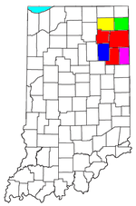
Municipalities with population
over 10,000 in 2000Municipalities with population
1,000-10,000 in 2000Albion · Andrews · Ashley · Avilla · Berne · Bluffton · Butler · Churubusco · Columbia City · Decatur · Garrett · Geneva · Grabill · Hamilton · Harlan · Huntertown · Kendallville · Leo-Cedarville · Ligonier · Markle · Monroeville · Ossian · Roanoke · Rome City · South Whitley · Warren · Waterloo · WoodburnMunicipalities with population
under 1,000 in 2000Altona · Cromwell · Corunna · Monroe · Mount Etna · Larwill · Poneto · Saint Joe · Uniondale · Vera Cruz · Wolcottville · ZanesvilleCategories:- Indiana counties
- Adams County, Indiana
- 1836 establishments in the United States
- Populated places established in 1836


Wikimedia Foundation. 2010.