- Decatur, Indiana
-
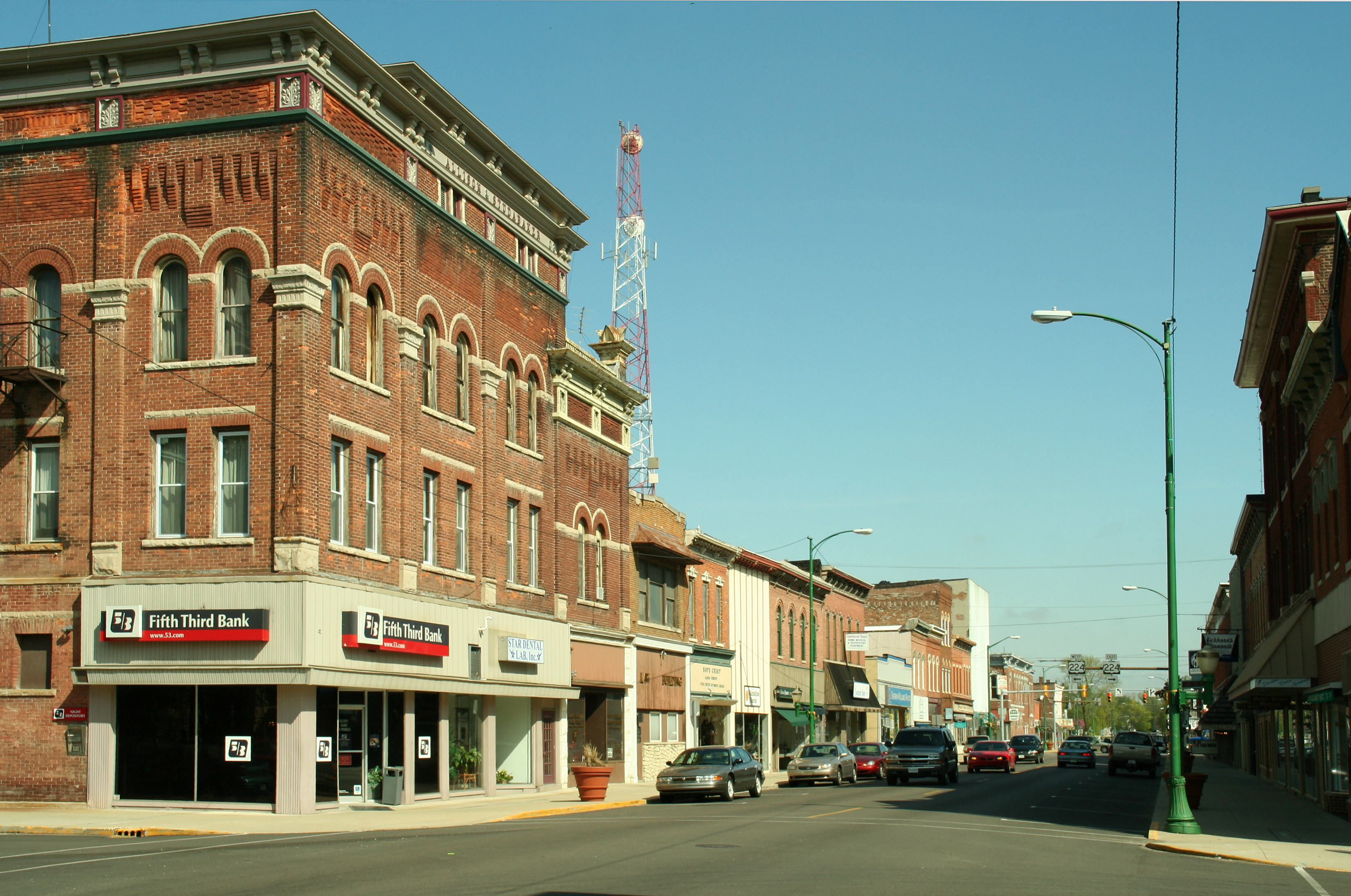
Decatur, Indiana — City — Decatur downtown in 2006. Location in the state of Indiana
Coordinates: 40°49′46″N 84°55′45″W / 40.82944°N 84.92917°WCoordinates: 40°49′46″N 84°55′45″W / 40.82944°N 84.92917°W Country United States State Indiana County Adams Township Root, Washington Government – Mayor John L. Schultz (D) Area – Total 4.9 sq mi (12.8 km2) – Land 4.9 sq mi (12.7 km2) – Water 0.0 sq mi (0.0 km2) Elevation 801 ft (244 m) Population (2010) – Total 9,405 – Density 1,936.5/sq mi (747.7/km2) Time zone EST (UTC-5) – Summer (DST) EDT (UTC-4) ZIP code 46733 Area code(s) 260 FIPS code 18-17074[1] GNIS feature ID 0446543[2] Website http://www.decaturin.org/ Historical populations Census Pop. %± 1870 858 — 1880 1,905 122.0% 1890 3,142 64.9% 1900 4,148 32.0% 1910 4,471 7.8% 1920 4,762 6.5% 1930 5,156 8.3% 1940 5,861 13.7% 1950 7,271 24.1% 1960 8,327 14.5% 1970 8,445 1.4% 1980 8,649 2.4% 1990 8,644 −0.1% 2000 9,528 10.2% 2010 9,405 −1.3% Decatur is a city in Root and Washington townships, Adams County, Indiana, United States. The city, which serves as the county seat of Adams County[3], takes its name after the prominent war hero Stephen Decatur, Jr., one of the captains of the original 6 frigates of the US navy. When Indiana claimed official statehood in 1816, Decatur's name was as well known and revered as any star/celebrity today, thus when the town of Decatur was founded in 1836 it took its name in honor of the war hero. The population of Decatur was 9,405 at the 2010 census
Contents
Geography
Decatur is located at 40°49′46″N 84°55′45″W / 40.82944°N 84.92917°W (40.829581, -84.929185)[4].
According to the United States Census Bureau, the city has a total area of 4.9 square miles (13 km2), of which, 4.9 square miles (13 km2) of it is land and 0.20% is water.
Demographics
As of the 2010 census Decatur had a population of 9,405. The racial and ethnic makeup of the population was 89.7% non-Hispanic white, 0.5% black or African American, 0.4% Native American, 0.4% Asian, 2.6% from some other race, 1.4% from two or more races and 8.4% Hispanic or Latino.[5]
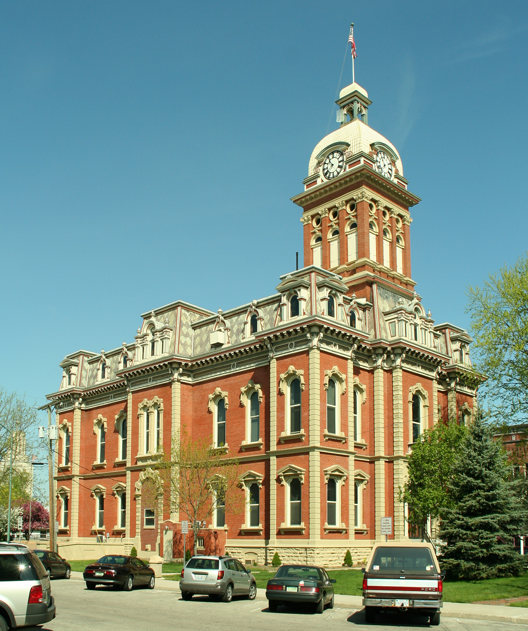
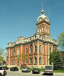 Adams County courthouse, Decatur, Indiana, 2006
As of the census[1] of 2000, there were 9,528 people, 3,960 households, and 2,570 families residing in the city. The population density was 1,935.4 people per square mile (747.7/km²). There were 4,190 housing units at an average density of 851.1 per square mile (328.8/km²). The racial makeup of the city was 94.64% White, 0.24% African American, 0.35% Native American, 0.36% Asian, 0.06% Pacific Islander, 3.58% from other races, and 0.78% from two or more races. Hispanic or Latino of any race were 7.69% of the population.
There were 3,960 households out of which 32.4% had children under the age of 18 living with them, 48.5% were married couples living together, 12.2% had a female householder with no husband present, and 35.1% were non-families. 31.4% of all households were made up of individuals and 13.7% had someone living alone who was 65 years of age or older. The average household size was 2.39 and the average family size was 3.00.
In the city the population was spread out with 26.4% under the age of 18, 9.8% from 18 to 24, 28.7% from 25 to 44, 20.5% from 45 to 64, and 14.6% who were 65 years of age or older. The median age was 35 years. For every 100 females there were 94.9 males. For every 100 females age 18 and over, there were 90.5 males.
The median income for a household in the city was $37,234, and the median income for a family was $44,722. Males had a median income of $31,819 versus $24,310 for females. The per capita income for the city was $18,186. About 5.6% of families and 7.7% of the population were below the poverty line, including 9.7% of those under age 18 and 11.3% of those age 65 or over.
Government
The government consists of a mayor and a city council. The mayor is elected in citywide vote. The city council consists of five members. Four are elected from individual districts. One is elected at-large. There is also a clerk-treasurer who is elected in citywide vote.
Education
The local high school in Decatur is Bellmont High School; approximately 900 students attend BHS.
Economy
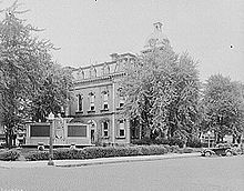 Adams County courthouse, Decatur, Indiana, 1935
- Some of the larger employers in Decatur include All American Homes, Bunge Limited, Fleetwood RV, and Thunderbird Products.
- Five unique restaurants well known in the surrounding area draw a large number of diners: Arnold's Drive-In, Back 40 Junction, The Galley, Two Brothers Bar and Restaurant, and the West End Restaurant.
- Lingenfelter Performance Engineering, well known for performance tuning and producing after-market parts for GM sports cars (especially the Chevrolet Corvette) is located in Decatur.
Notable visitors and residents
- Three non-sitting U.S. Presidents have visited Decatur; John F. Kennedy visited Decatur while he was a Massachusetts Senator, Ronald Reagan visited Decatur to do a television commercial for General Electric, and in 2008, Bill Clinton campaigned at Bellmont Middle School for his wife Hillary Clinton during the 2008 Democratic primary race.
- Hometown of Television and Movie director David Anspaugh who directed Hoosiers and Rudy
- Birthplace of famous sculptor David Smith (March 9, 1906 - May 23, 1965)
- Hometown of famous sculptor Ralph Hurst (September 4, 1918 - December 7, 2003)
- Birthplace of Bob Hite, Sr., radio and television announcer for CBS
References
- ^ a b "American FactFinder". United States Census Bureau. http://factfinder.census.gov. Retrieved 2008-01-31.
- ^ "US Board on Geographic Names". United States Geological Survey. 2007-10-25. http://geonames.usgs.gov. Retrieved 2008-01-31.
- ^ "Find a County". National Association of Counties. http://www.naco.org/Counties/Pages/FindACounty.aspx. Retrieved 2011-06-07.
- ^ "US Gazetteer files: 2010, 2000, and 1990". United States Census Bureau. 2011-02-12. http://www.census.gov/geo/www/gazetteer/gazette.html. Retrieved 2011-04-23.
- ^ 2010 general profile of population and housing characteristics for Decatur for the US Census
External links
Municipalities and communities of Adams County, Indiana County seat: DecaturCities Berne | Decatur

Towns Townships Unincorporated
communitiesCeylon | Coppess Corner | Curryville | Elm Tree Crossroads | Honduras | Linn Grove | Magley | Monmouth | Perryville | Peterson | Pleasant Mills | Preble | Rivare | Salem | Williams
Counties 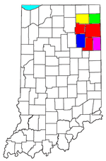
Municipalities with population
over 10,000 in 2000Municipalities with population
1,000-10,000 in 2000Albion · Andrews · Ashley · Avilla · Berne · Bluffton · Butler · Churubusco · Columbia City · Decatur · Garrett · Geneva · Grabill · Hamilton · Harlan · Huntertown · Kendallville · Leo-Cedarville · Ligonier · Markle · Monroeville · Ossian · Roanoke · Rome City · South Whitley · Warren · Waterloo · WoodburnMunicipalities with population
under 1,000 in 2000Altona · Cromwell · Corunna · Monroe · Mount Etna · Larwill · Poneto · Saint Joe · Uniondale · Vera Cruz · Wolcottville · ZanesvilleCategories:- Populated places in Adams County, Indiana
- Cities in Indiana
- Micropolitan areas of Indiana
- County seats in Indiana
- Populated places established in 1836


Wikimedia Foundation. 2010.