- Kendallville, Indiana
Infobox Settlement
official_name = City of Kendallville, Indiana
settlement_type =City
nickname =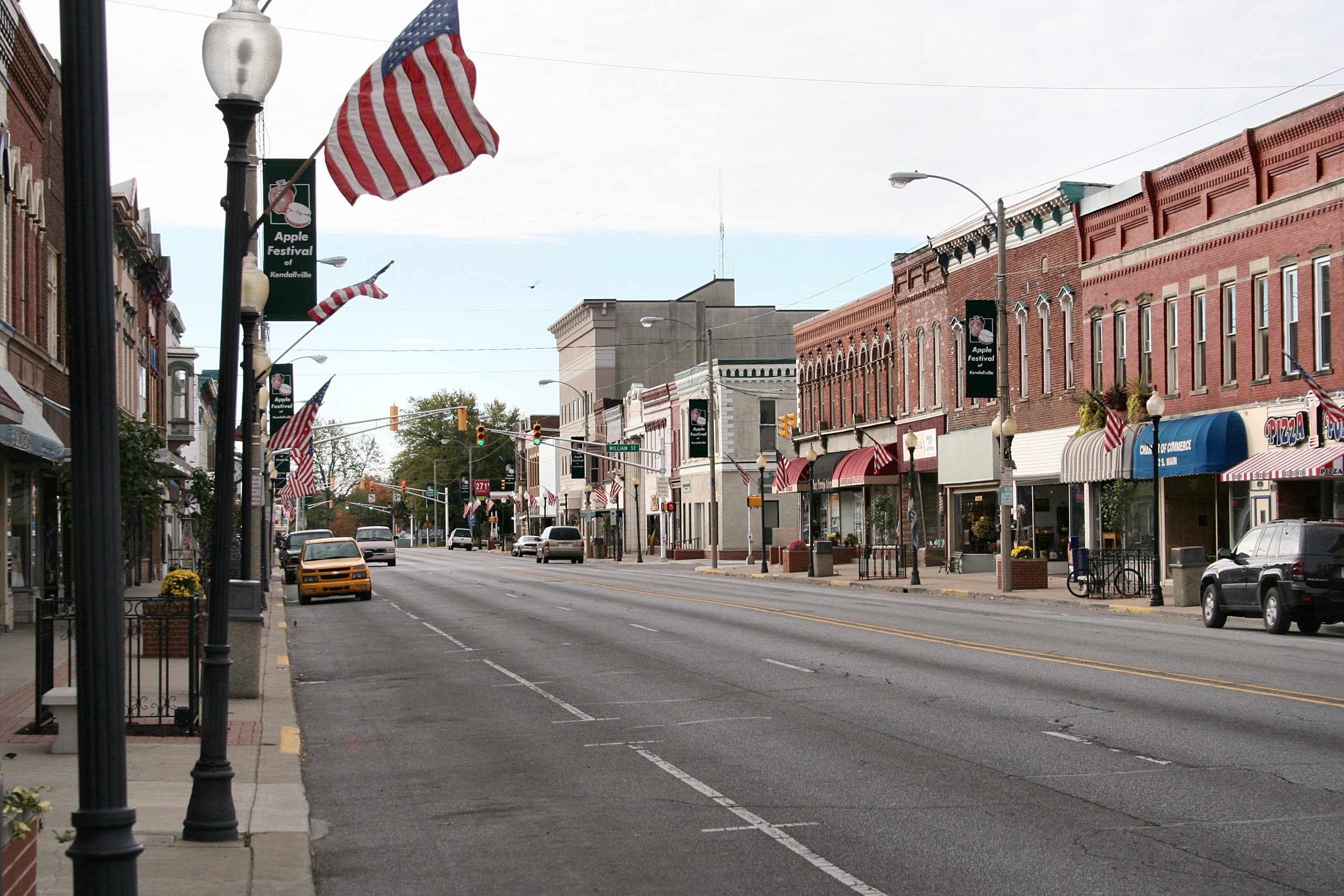
imagesize =
image_caption = Downtown Kendallville.
image_
image_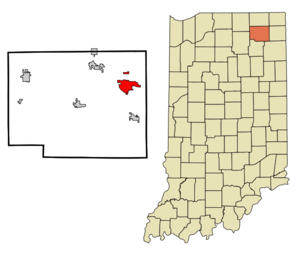
mapsize = 250x200px
map_caption = Location in the state ofIndiana
mapsize1 =
map_caption1 =
subdivision_type = Country
subdivision_name =United States
subdivision_type1 = State
subdivision_name1 =Indiana
subdivision_type2 = County
subdivision_name2 = Noble
subdivision_type3 = Township
subdivision_name3 = Wayne
government_type =
leader_title =Mayor
leader_name = W. Suzanne Handshoe (R)
area_note =
established_date =
area_magnitude = 1 E7
area_total_km2 = 13.8
area_land_km2 = 13.2
area_water_km2 = 0.6
population_as_of = 2000
population_note =
population_total = 9616
population_density_km2 = 729.4
timezone = EST
utc_offset = -5
timezone_DST = EDT
utc_offset_DST = -4
area_total_sq_mi = 5.3
area_land_sq_mi = 5.1
area_water_sq_mi = 0.2
elevation_m = 301
elevation_ft = 988
latd = 41 |latm = 26 |lats = 30 |latNS = N
longd = 85 |longm = 15 |longs = 38 |longEW = W
website = www.kendallville-in.org
postal_code_type =ZIP code
postal_code = 46755
area_code = 260
blank_name = FIPS code
blank_info = 18-39402GR|2
blank1_name = GNIS feature ID
blank1_info = 0437239GR|3
footnotes =Kendallville is a city in Wayne Township, Noble County,
Indiana ,United States . The population was 9,616 at the 2000 census.Geography
Kendallville is located at coor dms|41|26|30|N|85|15|38|W|city (41.441750, -85.260475)GR|1.
According to the
United States Census Bureau , the city has a total area of 5.3square mile s (13.8km² ), of which, 5.1 square miles (13.2 km²) of it is land, 0.2 square miles (0.6 km²) of it (4.14%) is water, and 5.1square mile s (13.2km² ).Demographics
As of the
census GR|2 of 2000, there were 9,616 people, 3,873 households, and 2,459 families residing in the city. Thepopulation density was 1,890.0 people per square mile (729.4/km²). There were 4,172 housing units at an average density of 820.0/sq mi (316.5/km²). The racial makeup of the city was 96.66% White, 0.25% African American, 0.16% Native American, 0.59% Asian, 0.01% Pacific Islander, 1.37% from other races, and 0.96% from two or more races. Hispanic or Latino of any race were 3.16% of the population.There were 3,873 households out of which 35.9% had children under the age of 18 living with them, 46.0% were married couples living together, 13.3% had a female householder with no husband present, and 36.5% were non-families. 31.5% of all households were made up of individuals and 12.7% had someone living alone who was 65 years of age or older. The average household size was 2.44 and the average family size was 3.07.
In the city the population was spread out with 28.0% under the age of 18, 10.3% from 18 to 24, 30.1% from 25 to 44, 17.7% from 45 to 64, and 13.8% who were 65 years of age or older. The median age was 32 years. For every 100 females there were 89.1 males. For every 100 females age 18 and over, there were 86.2 males.
The median income for a household in the city was $33,899, and the median income for a family was $42,341. Males had a median income of $33,258 versus $23,851 for females. The
per capita income for the city was $16,335. About 7.9% of families and 9.9% of the population were below thepoverty line , including 10.7% of those under age 18 and 8.6% of those age 65 or over.Media
WLAB , Star 88.3, broadcasts to the community of Kendallville, Indiana, via its translator on FM radio frequency 89.7 FM.chools
* Schools in the Kendallville area include:
*East Noble High School
* Kendallville Middle School
* South Side Elementary School
* North Side Elementary School
* Wayne Center Elementary School
* St. John Lutheran SchoolArea events
* Apple Festival
* Christmas Parade
* County Fair
* Bluegrass Festival
* Fireworks at Bixler Lake (4th of July)
* Cruise in- downtownNotable natives
*
Alvin M. Strauss , architect, born to German immigrant parents in Kendallville, best known forLincoln Bank Tower
*Brad Miller, two-timeNBA All-Star , currently starting at center for theSacramento Kings
*William Mitchell,United States Representative from IndianaReferences
External links
* [http://www.star883.org Star 88.3 WLAB (89.7 FM in Kendallville)]
* [http://www.kpcnews.net/special-sections/reflections1/reflections22.html Kendallville News-Sun Reflections of a Century]
Wikimedia Foundation. 2010.