- Kentland, Indiana
Infobox Settlement
official_name = Town of Kentland, Indiana
settlement_type =Town
nickname =
mapsize = 250x200px
imagesize =
image_caption =
imagesize =
image_caption =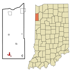
map_caption = Location in the state ofIndiana
mapsize1 =
map_caption1 =
subdivision_type = Country
subdivision_name =United States
area_footnotes =
unit_pref = Imperial
subdivision_type1 = State
subdivision_name1 =Indiana
subdivision_type2 = County
subdivision_name2 = Newton
subdivision_type3 = Township
subdivision_name3 = Jefferson
government_type =
leader_title =
leader_name =
established_date =
area_magnitude = 1 E6
area_total_km2 = 3.8
area_land_km2 = 3.8
area_water_km2 = 0.0
population_as_of = 2000
population_note =
population_total = 1822
population_density_km2 = 481.8
timezone = CST
utc_offset = -6
timezone_DST = CDT
utc_offset_DST = -5
area_total_sq_mi = 1.5
area_land_sq_mi = 1.5
area_water_sq_mi = 0.0
elevation_m = 207
elevation_ft = 679
latd = 40 |latm = 46 |lats = 11 |latNS = N
longd = 87 |longm = 26 |longs = 46 |longEW = W
postal_code_type =ZIP code
postal_code = 47951
area_code = 219
blank_name = FIPS code
blank_info = 18-39546GR|2
blank1_name = GNIS feature ID
blank1_info = 0437256GR|3
footnotes =
website =Kentland is a town in Jefferson Township, Newton County,
Indiana ,United States . The population was 1,822 at the 2000 census. The town was founded in1860 as "Kent", though this name was soon lengthened to Kentland. The name honorsAlexander Kent , who acquired the then marshy plat and prepared it for development. The city is thecounty seat of Newton CountyGR|6. Once primarily a cattle town, Kentland is now an agricultural community with a diversifying economy with the town motto "Where Agriculture and Industry Meet." The town is served by an originalCarnegie library and is an important crossroads on US highways 41 and 24.Geologists believe that the area was the site of an ancientmeteorite impact.Kentland is the birthplace of famous turn-of-the-century humorist,
George Ade , author of such plays as "The College Widow, Artie" and "The Sultan of Sulu" among others.Purdue University 's Rose-Ade Stadium, home of the Boilermakers football team, is named for him and fellow Purdue benefactor David Ross. Disgraced Indiana governorWarren McCray , convicted ofmail fraud and forced to resign in 1924, also hailed from Kentland .Geography
Kentland is located at coor dms|40|46|11|N|87|26|46|W|city (40.769719, -87.446184)GR|1.
According to the
United States Census Bureau , the town has a total area of 1.5square mile s (3.8km² ), all of it land.The
Kentland crater , a probablemeteorite impact crater , is located between Kentland and Goodland.Demographics
As of the
census GR|2 of 2000, there were 1,822 people, 733 households, and 477 families residing in the town. Thepopulation density was 1,250.5 people per square mile (481.8/km²). There were 793 housing units at an average density of 544.3/sq mi (209.7/km²). The racial makeup of the town was 98.30% White, 0.11% African American, 0.27% Asian, 0.82% from other races, and 0.49% from two or more races. Hispanic or Latino of any race were 2.96% of the population.There were 733 households out of which 29.7% had children under the age of 18 living with them, 50.3% were married couples living together, 10.8% had a female householder with no husband present, and 34.9% were non-families. 30.4% of all households were made up of individuals and 14.3% had someone living alone who was 65 years of age or older. The average household size was 2.42 and the average family size was 3.03.
In the town the population was spread out with 24.7% under the age of 18, 9.4% from 18 to 24, 27.2% from 25 to 44, 22.1% from 45 to 64, and 16.6% who were 65 years of age or older. The median age was 39 years. For every 100 females there were 96.8 males. For every 100 females age 18 and over, there were 90.3 males.
The median income for a household in the town was $34,732, and the median income for a family was $45,043. Males had a median income of $32,734 versus $20,714 for females. The
per capita income for the town was $17,797. About 4.7% of families and 7.5% of the population were below thepoverty line , including 5.6% of those under age 18 and 13.8% of those age 65 or over.ee also
George Ade External links
* "Warren T. McCray" http://www.countyhistory.com/doc.gov/033.htm
* "Earth Impact Database: Kentland" http://www.unb.ca/passc/ImpactDatabase/images/kentland.htm
* "South Newton High School" http://www.newton.k12.in.us
References
*George Pence and Nellie C. Armstrong (1933). "Indiana Boundaries: Territory, State and County". Indiana Historical Society.
Wikimedia Foundation. 2010.