- Newton County, Indiana
-
Newton County, Indiana 
Location in the state of Indiana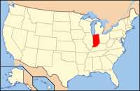
Indiana's location in the U.S.Founded 8 December 1859 Named for Sgt. John Newton Seat Kentland Area
- Total
- Land
- Water
403.44 sq mi (1,045 km²)
401.76 sq mi (1,041 km²)
1.68 sq mi (4 km²), 0.42%Population
- (2010)
- Density
14,244
35/sq mi (13.69/km²)Congressional district 1st Website www.newtoncountyin.com Footnotes: - Indiana county number 56
- Youngest county in Indiana
- Present-day Newton County is the second county with the name
Newton County is a county located in the U.S. state of Indiana. As of 2010, the population was 14,244.[1] The county seat is Kentland[2].
Contents
History
The original Newton County was formed by statute on February 7, 1835, and was a roughly square area some 30 miles on a side, encompassing what is now the northern half of the county, the northern half of Jasper County, and a large section to the north. The northern border was cut back to the Kankakee River on February 1, 1836, with all land north of the Kankakee River going to Lake and Porter counties. The county was abolished and combined with Jasper County in 1839. On December 8, 1859, the county was re-created and the borders were redrawn to essentially their current state.
Newton County is named after Sgt. John Newton, who served under Gen. Francis Marion, the "Swamp Fox", in the American Revolutionary War. It is adjacent to Jasper County, which was named after Sgt. William Jasper, whose story is similar. At least four other states, Georgia, Mississippi, Missouri and Texas, have adjacent Jasper and Newton Counties, as though these two were remembered as a pair.[3]
Newton County was the last county to be organized in Indiana.
Climate and weather
Kentland, Indiana Climate chart (explanation) J F M A M J J A S O N D 1.831141.636182.848293.461384.173504.58260485633.783603.378532.865413.249312.43620Average max. and min. temperatures in °F Precipitation totals in inches Source: The Weather Channel[4] Metric conversion J F M A M J J A S O N D 45-1-10412-8709-28616310323101152816102291793281683261272185819-1622-7Average max. and min. temperatures in °C Precipitation totals in mm In recent years, average temperatures in Kentland have ranged from a low of 14 °F (−10 °C) in January to a high of 85 °F (29 °C) in July, although a record low of −25 °F (−32 °C) was recorded in January 1985 and a record high of 104 °F (40 °C) was recorded in June 1988. Average monthly precipitation ranged from 1.60 inches (41 mm) in February to 4.51 inches (115 mm) in June.[4]
Government
See also: Government of IndianaThe county government is a constitutional body, and is granted specific powers by the Constitution of Indiana, and by the Indiana Code.
County Council: The county council is the legislative branch of the county government and controls all the spending and revenue collection in the county. Representatives are elected from county districts. The council members serve four year terms. They are responsible for setting salaries, the annual budget, and special spending. The council also has limited authority to impose local taxes, in the form of an income and property tax that is subject to state level approval, excise taxes, and service taxes.[5][6]
Board of Commissioners: The executive body of the county is made of a board of commissioners. The commissioners are elected county-wide, in staggered terms, and each serves a four-year term. One of the commissioners, typically the most senior, serves as president. The commissioners are charged with executing the acts legislated by the council, collecting revenue, and managing the day-to-day functions of the county government.[5][6]
Court: The county maintains a small claims court that can handle some civil cases. The judge on the court is elected to a term of four years and must be a member of the Indiana Bar Association. The judge is assisted by a constable who is also elected to a four-year term. In some cases, court decisions can be appealed to the state level circuit court.[6]
County Officials: The county has several other elected offices, including sheriff, coroner, auditor, treasurer, recorder, surveyor, and circuit court clerk Each of these elected officers serves a term of four years and oversees a different part of county government. Members elected to county government positions are required to declare party affiliations and to be residents of the county.[6]
Newton County is part of Indiana's 1st congressional district and in 2008 was represented by Pete Visclosky in the United States Congress.[7]
Geography
According to the 2010 census, the county has a total area of 403.44 square miles (1,044.9 km2), of which 401.76 square miles (1,040.6 km2) (or 99.58%) is land and 1.68 square miles (4.4 km2) (or 0.42%) is water.[8]
Newton County is the site of the Kentland crater, a probable meteorite impact crater located between Kentland and Goodland.
J.C. Murphy Lake is at the center of Willow Slough Fish and Wildlife Area.
Major highways
Railroads
Adjacent counties
- Lake County (north)
- Jasper County (east)
- Benton County (south)
- Iroquois County, Illinois (west)
- Kankakee County, Illinois (northwest)
Demographics
As of the census[9] of 2000, there were 14,566 people, 5,340 households, and 3,999 families residing in the county. The population density was 36 people per square mile (14/km²). There were 5,726 housing units at an average density of 14 per square mile (6/km²). The racial makeup of the county was 97.33% White, 0.17% Black or African American, 0.31% Native American, 0.22% Asian, 0.08% Pacific Islander, 1.14% from other races, and 0.76% from two or more races. 2.90% of the population were Hispanic or Latino of any race. 22.6% were of German, 14.3% American, 11.8% Irish, 10.0% English and 7.7% Polish ancestry according to Census 2000.
There were 5,340 households out of which 34.20% had children under the age of 18 living with them, 63.10% were married couples living together, 7.80% had a female householder with no husband present, and 25.10% were non-families. 20.90% of all households were made up of individuals and 9.40% had someone living alone who was 65 years of age or older. The average household size was 2.69 and the average family size was 3.12.
In the county the population was spread out with 26.40% under the age of 18, 7.90% from 18 to 24, 28.50% from 25 to 44, 24.40% from 45 to 64, and 12.80% who were 65 years of age or older. The median age was 37 years. For every 100 females there were 98.80 males. For every 100 females age 18 and over, there were 96.60 males.
The median income for a household in the county was $40,944, and the median income for a family was $46,741. Males had a median income of $36,152 versus $20,780 for females. The per capita income for the county was $17,755. About 4.80% of families and 6.90% of the population were below the poverty line, including 6.20% of those under age 18 and 10.30% of those age 65 or over.
Historical populations Census Pop. %± 1860 2,360 — 1870 5,829 147.0% 1880 8,167 40.1% 1890 8,803 7.8% 1900 10,448 18.7% 1910 10,504 0.5% 1920 10,144 −3.4% 1930 9,841 −3.0% 1940 10,775 9.5% 1950 11,006 2.1% 1960 11,502 4.5% 1970 11,606 0.9% 1980 14,844 27.9% 1990 13,551 −8.7% 2000 14,566 7.5% 2010 14,244 −2.2% Sources: United States Department of Commerce,
Bureau of the Census, Population Division[10]
Census Quickfacts[1]Cities and towns
Incorporated
Unincorporated
- Lake Village
- Roselawn
- Conrad, now vanished[11]
Townships
Education
Public schools in Newton County are administered by the North Newton School Corporation and the South Newton School Corporation.
High Schools and Middle Schools
- North Newton Junior-Senior High School [1]
- South Newton High School [2]
- South Newton Middle School [3]
Elementary Schools
- Lake Village Elementary School [4]
- Lincoln Elementary School [5]
- Morocco Elementary School [6]
- South Newton Elementary School [7]
See also
External links
References
- ^ a b "Newton County QuickFacts". United States Census Bureau. http://quickfacts.census.gov/qfd/states/18/18111.html. Retrieved 2011-09-25.
- ^ "Find a County". National Association of Counties. http://www.naco.org/Counties/Pages/FindACounty.aspx. Retrieved 2011-06-07.
- ^ De Witt Clinton Goodrich & Charles Richard Tuttle (1875). An Illustrated History of the State of Indiana. Indiana: R. S. Peale & co.. pp. 581. http://books.google.com/books?id=YDIUAAAAYAAJ.
- ^ a b "Monthly Averages for Kentland, Indiana". The Weather Channel. http://www.weather.com/weather/wxclimatology/monthly/graph/USIN0320. Retrieved 2011-01-27.
- ^ a b Indiana Code. "Title 36, Article 2, Section 3". IN.gov. http://www.in.gov/legislative/ic/code/title36/ar2/ch3.html. Retrieved 2008-09-16.
- ^ a b c d Indiana Code. "Title 2, Article 10, Section 2". IN.gov. http://www.in.gov/legislative/ic/code/title3/ar10/ch2.pdf. Retrieved 2008-09-16.
- ^ "US Congressman Pete Visclosky". US Congress. http://www.house.gov/visclosky/. Retrieved 2008-10-08.
- ^ "Census 2010 U.S. Gazetteer Files: Counties". United States Census. http://www.census.gov/geo/www/gazetteer/files/Gaz_counties_national.txt. Retrieved 2011-10-10.
- ^ "American FactFinder". United States Census Bureau. http://factfinder.census.gov. Retrieved 2008-01-31.
- ^ Forstall, Richard L. (editor) (1996). Population of states and counties of the United States: 1790 to 1990 : from the twenty-one decennial censuses. United States Department of Commerce, Bureau of the Census, Population Division. pp. 50–53. ISBN 0-934213-48-8. http://books.google.com/books?id=Z12v1lrkv2IC&lpg=PA50&pg=PA50#v=onepage&q&f=false.
- ^ http://www.kankakeevalleyhistoricalsociety.org/schmal/conrad.htm
- George Pence and Nellie C. Armstrong (1933). Indiana Boundaries: Territory, State, and County. Indiana Historical Society.

Kankakee County, Illinois Lake County Iroquois County, Illinois 
Jasper County  Newton County, Indiana

Benton County Municipalities and communities of Newton County, Indiana Towns 
Townships Unincorporated
communitiesAde | Beaver City | Conrad | Effner | Enos | Foresman | Lake Village | Perkins | Roselawn‡ | Sumava Resorts | Thayer
Footnotes ‡This populated place also has portions in an adjacent county or counties
 State of Indiana
Topics - Index
- Demographics
- Economy
- Geography
- Government
- Governor (List)
- Congressional districts (Delegations)
- History
- Hoosiers
- City Nicknames
- National Historic Landmarks
- Sports
- State parks
- Symbols
- Transportation
- Visitor Attractions
- Index of Indiana-related articles
- Outline
Regions - Central Indiana
- East Central Indiana
- Illinois-Indiana-Kentucky Tri-State Area
- Indiana-Kentucky-Ohio Tri-State Area
- Michiana
- Northern Indiana
- Northwest Indiana
- Southern Indiana
- Southwestern Indiana
- Wabash Valley
Largest cities - Indianapolis
- Fort Wayne
- Evansville
- South Bend
- Hammond
- Bloomington
- Gary
- Carmel
- Lafayette
- Muncie
- Anderson
- Terre Haute
- Elkhart
- Kokomo
- Mishawaka
- Richmond
- Columbus
- Lawrence
- Jeffersonville
- Greenwood
- New Albany
- Portage
- Michigan City
- East Chicago
- Goshen
- Marion
- Valparaiso
- Noblesville
- West Lafayette
- Hobart
- Crown Point
- Franklin
- La Porte
- Seymour
- Logansport
- New Castle
- Connersville
- Vincennes
- Bedford
- Jasper
- Washington
- Princeton
- Westfield
Largest towns Counties - Adams
- Allen
- Bartholomew
- Benton
- Blackford
- Boone
- Brown
- Carroll
- Cass
- Clark
- Clay
- Clinton
- Crawford
- Daviess
- Dearborn
- Decatur
- DeKalb
- Delaware
- Dubois
- Elkhart
- Fayette
- Floyd
- Fountain
- Franklin
- Fulton
- Gibson
- Grant
- Greene
- Hamilton
- Hancock
- Harrison
- Hendricks
- Henry
- Howard
- Huntington
- Jackson
- Jasper
- Jay
- Jefferson
- Jennings
- Johnson
- Knox
- Kosciusko
- LaGrange
- Lake
- LaPorte
- Lawrence
- Madison
- Marion
- Marshall
- Martin
- Miami
- Monroe
- Montgomery
- Morgan
- Newton
- Noble
- Ohio
- Orange
- Owen
- Parke
- Perry
- Pike
- Porter
- Posey
- Pulaski
- Putnam
- Randolph
- Ripley
- Rush
- Saint Joseph
- Scott
- Shelby
- Spencer
- Starke
- Steuben
- Sullivan
- Switzerland
- Tippecanoe
- Tipton
- Union
- Vanderburgh
- Vermillion
- Vigo
- Wabash
- Warren
- Warrick
- Washington
- Wayne
- Wells
- White
- Whitley
Categories:- Indiana counties
- Newton County, Indiana
- 1859 establishments in the United States
- Chicago metropolitan area
- Northwest Indiana


Wikimedia Foundation. 2010.