- Westfield, Indiana
-
Westfield — City — City of Westfield Westfield downtown.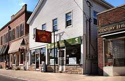

SealLocation in the state of Indiana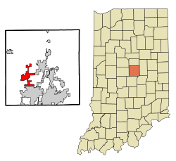
Coordinates: 40°1′56″N 86°7′44″W / 40.03222°N 86.12889°WCoordinates: 40°1′56″N 86°7′44″W / 40.03222°N 86.12889°W Country United States State Indiana County Hamilton Founded 1834 Government – Mayor Andy Cook (R) Area – Total 7.6 sq mi (19.8 km2) – Land 7.6 sq mi (19.8 km2) – Water 0.0 sq mi (0.13 km2) Elevation 886 ft (270 m) Population (2010) – Total 30,068 – Density 3,933.1/sq mi (1,518.59/km2) Time zone Eastern (EST) (UTC-5) – Summer (DST) EDT (UTC-4) ZIP code 46074, 46032 (part), 46033 (part), 46062 (part) Area code(s) 317 FIPS code 18-82700[1] GNIS feature ID 0445833[2] Website westfield.in.gov Westfield is a city in Hamilton County, Indiana, United States. In the year 2010 United States Census, the population was 30,068. Westfield is in the Indianapolis Metropolitan Area.
Contents
History
Westfield was founded on May 6, 1834, by North Carolina Quakers—Asa Bales, Ambrose Osborne, Simon Moon, and Simon Barker. It is believed that the town was planned as a stop on the Underground Railroad with many families of the Religious Society of Friends and the Wesleyan Methodist Church supporting the cause. When the laws against aiding escaped slaves were harshened, part of the Westfield Quaker Friends Meeting House split into the Anti-Slavery Friends meeting. [1]
On January 1, 2008, the town of Westfield incorporated; and Andy Cook was sworn in as Mayor.[2] With recent annexations in southern Washington Township and rapid population growth in areas already occupied by the pre-existing town, the City government estimates Westfield's population to be at roughly 30,000 residents. Because of the growing size of the city, officials are planning a major revamp of the downtown. This would possibly include building a new library and city hall. [3]
Demographics
As of the census[1] of 2010, there were 30,068 people residing in the town. The population density was 3,956.3 people per square mile (1518.6/km²). There were 11,209 housing units at an average density of 1474.9 per square mile (566.1/km²). The racial makeup of the town was 90.90% White, 2.20% African American, 0..20% Native American, 2.50% Asian, 0.00% Pacific Islander, 2.60% from other races, and 1.60% from two or more races. Hispanic or Latino of any race were 5.80% of the population.
The median income for a household was $52,963; and for a family, $65,208. Males had a median income of $45,388; females, $26,864. The per capita income was $22,160. About 2.3% of families and 4.0% of the population were below the poverty line, including 2.5% of those under 18 years and 3.7% 65 years or over.
Geography
Westfield is located at 40°1′56″N 86°7′44″W / 40.03222°N 86.12889°W (40.032266, -86.129015)[3].
According to the United States Census Bureau, the town has a total area of 7.6 square miles (20 km2), of which 7.6 square miles (20 km2) is land and 0.13% is water.
Neighboring Communities

Sheridan Cicero Whitestown 
Noblesville  Westfield

Zionsville Carmel Fishers Demographics
Historical populations Census Pop. %± 1900 670 — 1910 700 4.5% 1920 574 −18.0% 1930 688 19.9% 1940 709 3.1% 1950 849 19.7% 1960 1,217 43.3% 1970 1,837 50.9% 1980 2,783 51.5% 1990 3,304 18.7% 2000 9,293 181.3% 2010 30,068 223.6% Notable residents
Current:
- Jeff Foster - Professional basketball player, most recently for the NBA's Indiana Pacers
Former:
- Herb Baumeister - Alleged serial killer
- Claude Bowers - Writer, Democratic politician, and ambassador to Spain and Chile
- Chris Denari - Television play-by-play basketball announcer, most recently for the Indiana Pacers and Indiana Fever
- Brandon Stokley - Professional football player, formerly of the NFL's Indianapolis Colts
- Jamaal Tinsley - Professional basketball player, formerly of the Indiana Pacers
Schools
- Westfield High School (Grades 9-12)
- Westfield Middle School (Grades 7-8)
- Westfield Intermediate School (Grades 5-6)
- Carey Ridge Elementary School(Grades K-4)
- Maple Glen Elementary School (Grades K-4)
- Monon Trail Elementary School (Grades K-4)
- Montessori School of Westfield (Private)
- Oak Trace Elementary School(Grades K-4)
- Shamrock Springs Elementary School(Grades K-4)
- Washington Woods Elementary School(Grades K-4)
- St Maria Goretti School (Grades K-8)
- Union Bible College
 Westfield water tower. This tower was torn down recently and replaced with another, newer tower outside of downtown.
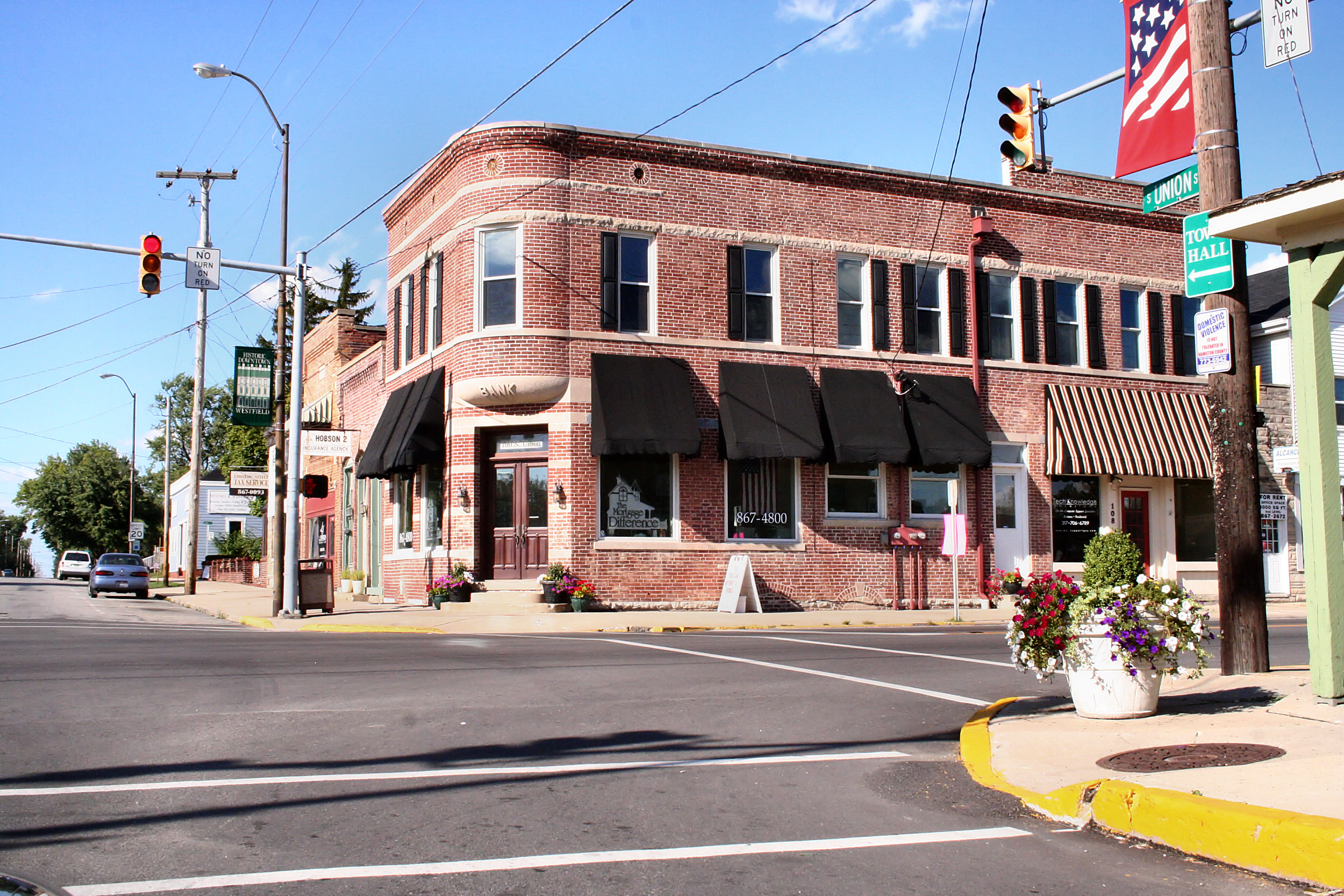
 Westfield downtown.
References
- ^ a b "American FactFinder". United States Census Bureau. http://factfinder.census.gov. Retrieved 2008-01-31.
- ^ "US Board on Geographic Names". United States Geological Survey. 2007-10-25. http://geonames.usgs.gov. Retrieved 2008-01-31.
- ^ "US Gazetteer files: 2010, 2000, and 1990". United States Census Bureau. 2011-02-12. http://www.census.gov/geo/www/gazetteer/gazette.html. Retrieved 2011-04-23.
External links
- Westfield Portal maintained by School System
- City of Westfield, Indiana website
- Westfield Washington Schools official Website
- Westfield-Washington Historical Society Website
Municipalities and communities of Hamilton County, Indiana Cities Carmel | Noblesville | Westfield

Towns Townships Adams | Clay | Delaware | Fall Creek | Jackson | Noblesville | Washington | Wayne | White River
Unincorporated
communitiesAroma | Bakers Corner | Boxley | Brooks | Chesterton | Clare | Clarksville | College Meadows | Deming | Durbin | Echo Crest | Eagletown | Hawthorn Hills | Holaday Hills and Dales | Home Place | Hortonville | Jolietville | Lamong | Luxhaven | Millersburg | New Britton | North Augusta Addition | North Ridge Village | Northern Beach | Northwood Hills | Omega | Orchard Park | Riverwood | Strawtown | Trails End | Walnut Grove
Indianapolis metropolitan area Core cities 
Other municipalities over 20,000 population
(in 2010)Brownsburg • Fishers • Franklin • Greenfield • Greenwood • Lawrence • Noblesville • Plainfield • WestfieldMunicipalities 1,000-20,000 population
(in 2010)Arcadia • Avon • Bargersville • Beech Grove • Brooklyn • Cicero • Clermont • Cloverdale • Cumberland • Danville • Edinburgh • Fairland • Fortville • Greencastle • Lebanon • Martinsville • McCordsville • Mooresville • Morristown • New Palestine • New Whiteland • Pittsboro • Princes Lakes • Shelbyville • Sheridan • Speedway • Southport • St. Paul • Thorntown • Whiteland • ZionsvilleCounties Categories:- Populated places in Hamilton County, Indiana
- Cities in Indiana
- Populated places established in 1834
- Underground Railroad locations
- Indianapolis metropolitan area
- Underground Railroad in Indiana


Wikimedia Foundation. 2010.