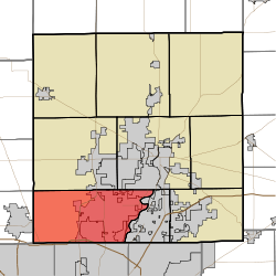
- Clay Township, Hamilton County, Indiana
-
Clay Township — Township — Location in Hamilton County Coordinates: 39°57′48″N 86°08′54″W / 39.96333°N 86.14833°WCoordinates: 39°57′48″N 86°08′54″W / 39.96333°N 86.14833°W Country United States State Indiana County Hamilton Government - Type Indiana township Area - Total 50.28 sq mi (130.23 km2) - Land 50.14 sq mi (129.87 km2) - Water 0.14 sq mi (0.37 km2) 0.28% Elevation 843 ft (257 m) Population (2010) - Total 83,293 - Density 1,661.2/sq mi (641.4/km2) GNIS feature ID 0453209 Clay Township is one of nine townships in Hamilton County, Indiana, USA. As of the 2010 census, its population was 83,293.
Contents
Geography
Clay Township covers an area of 50.28 square miles (130.2 km2); of this, 0.14 square miles (0.36 km2) or 0.28 percent is water. The streams of Ams Run, Blue Woods Creek, Center Creek, Clay Creek, Cool Creek, Elliot Creek, Henley Creek, Hiway Run, Hot Lick Creek, Kirkendall Creek, Little Cool Creek, Spring Mill Run, Well Run, Will Creek and Witt Creek run through this township.
Cities and towns
Unincorporated towns
- Bridlebourne
- Chesterton
- College Meadows
- Echo Crest
- Holaday Hills and Dales
- Home Place
- Kings Mill
- Kingsborough
- Newark Village
- North Augusta Addition
- North Ridge Village
- Northern Beach
- Northwood Hills
- Orchard Park
- Prairie View (subdivision)
- Saddle Creek
- Spring Creek (subdivision)
- Windemere
- Woodfield (subdivision)
(This list is based on USGS data and may include former settlements.)
Adjacent townships
- Washington Township (north)
- Noblesville Township (northeast)
- Delaware Township (east)
- Washington Township, Marion County (south)
- Pike Township, Marion County (southwest)
- Eagle Township, Boone County (west)
- Union Township, Boone County (northwest)
Cemeteries
The township contains six cemeteries: Calvary, Carmel, Farley, Pleasant Grove, Poplar Ridge and White Chapel.
Major highways
References
- "Clay Township, Hamilton County, Indiana". Geographic Names Information System, U.S. Geological Survey. http://geonames.usgs.gov/pls/gnispublic/f?p=gnispq:3:::NO::P3_FID:0453209. Retrieved 2009-09-24.
- United States Census Bureau cartographic boundary files
External links
Municipalities and communities of Hamilton County, Indiana County seat: Noblesville Cities Towns Townships Adams | Clay | Delaware | Fall Creek | Jackson | Noblesville | Washington | Wayne | White River
Unincorporated
communitiesAroma | Bakers Corner | Boxley | Brooks | Chesterton | Clare | Clarksville | College Meadows | Deming | Durbin | Echo Crest | Eagletown | Hawthorn Hills | Holaday Hills and Dales | Home Place | Hortonville | Jolietville | Lamong | Luxhaven | Millersburg | New Britton | North Augusta Addition | North Ridge Village | Northern Beach | Northwood Hills | Omega | Orchard Park | Riverwood | Strawtown | Trails End | Walnut Grove
Categories:- Townships in Hamilton County, Indiana
- Indianapolis-Anderson-Columbus geography stubs
Wikimedia Foundation. 2010.

