- Munster, Indiana
-
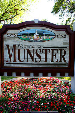
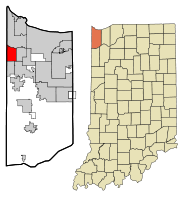
Town of Munster, Indiana — Town — Founded in 1907 Munster's location in Lake County (left) and the state of Indiana (right). Coordinates: 41°33′5″N 87°30′5″W / 41.55139°N 87.50139°WCoordinates: 41°33′5″N 87°30′5″W / 41.55139°N 87.50139°W Country United States State Indiana County Lake Township North Government - Type Town - Town Manager Tom DeGiulio Area - Total 7.6 sq mi (19.8 km2) - Land 7.5 sq mi (19.7 km2) - Water 0.1 sq mi (0.1 km2) Elevation 610 ft (186 m) Population (2010) - Total 23,603 - Density 3,105.7/sq mi (1,199.1/km2) Time zone CST (UTC-6) - Summer (DST) CDT (UTC-5) ZIP code 46321 Area code(s) 219 FIPS code 18-51912[1] GNIS feature ID 0439885[2] Website http://www.munster.org Munster is a town located in North Township, Lake County, in Northwest Indiana in the United States. This bedroom community lies in the Chicago metropolitan area, approximately 30 miles (48 km) southeast of the Chicago Loop, and shares municipal boundaries with Hammond to the north, Highland to the east, Dyer and Schererville to the south, and Lansing and Lynwood directly west of the Illinois border. The 2010 U.S. Census counted the town's population at 23,603.
Contents
Geography
Munster is located at 41°33′5″N 87°30′5″W / 41.55139°N 87.50139°W (41.551457, -87.501431),[3] at a point on an ancient shoreline of Lake Michigan (known as the Calumet Shoreline) which is today Ridge Road. This ridge runs east and west through the north part of town, hence the town's nickname "Town on the Ridge". The town's boundaries contain three small lakes, one of which, located within Centennial Park, is marshy and undeveloped. The town is bordered on the north by the Little Calumet River, a shallow river surrounded by a thin strip of wooded area; and on the west by the Illinois state line.
According to the United States Census Bureau, the town has a total area of 7.6 square miles (20 km2), of which, 7.5 square miles (19 km2) of it is land and 0.1 square miles (0.26 km2) of it (0.66%) is water.
History
The earliest known inhabitants of the area were the Potawatomi. Although a village did not exist in what was to become Munster's town boundaries, a trail along the dry sandy ridge now known as Ridge Road was well traveled by the tribe. Today, Munster's downtown area, the Town Hall, Police and Fire Department headquarters, the Centre for the Visual and Performing Arts, and the Munster Post Office are all situated on Ridge Road.
In the late 17th and early 18th centuries, the area that is today Munster was part of land claimed by France as French territory. In the 1760s the British claimed the land where the Potawatomi lived as part of the British Empire. Twenty years later George Rogers Clark overran the British, claiming the land for the new and independent country known as the United States of America. In 1828 the federal government relocated the Potawatomi Indians to the Oklahoma territory.[citation needed]
As the numbers of native Americans dwindled, pioneer settlers began to inhabit the area which would become Munster.
When Jacob Munster, a young man from the Netherlands who until the 1860s spelled his surname "Monster,"[4] opened an area General Store complete with a U.S. postal station on the back, the local farmers and settlers came to rely on the postal station, which soon became a United States Post Office. The post office was named Munster, as it was located in Jacob Munster's general store.
Before long more and more people moved to the "Munster" Area, and in 1907 Munster was incorporated as a town, with 76 residents voting "yes" for the incorporation and 28 voting "no."
Munster soon became a booming town that attracted many people. Munster saw difficult times through the rough years of the Great Depression and the two World Wars, like many other new towns in America.
During the Cold War, Munster served as the site of the Nike-Zeus Missile defense base C-46. The site was closed in 1971, and is now under private ownership.[5]
In September 2008, Munster's northern portions suffered record flooding resulting from the impact of Hurricane Ike, which caused the Little Calumet River to overflow. A main break occurred in the levee located near the intersection of Calumet Avenue and River Drive in the northwest quadrant of the town. Munster has requested the Army Corps of Engineers to elevate the levee in low lying areas.
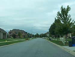
As of present, the levee improvements have been completed and the majority of homes destroyed have been rebuilt, in most cases, with larger, more amenity-filled homes.[6][7]
The 2010 Comprehensive Plan for Munster's next twenty years includes plans for a new town center with upscale shopping and dining to be organized around a proposed train station. [8]
Demographics
As of the census[1] of 2010, there were 23,603 people, 9,015 households, and 6,540 families residing in the town. The population density was 3,105.6 people per square mile (1,101.5/km²). There were 9,393 housing units at an average density of 1,235.9 per square mile (477.2/km²). The racial makeup of the town was 85.60% White, 3.50% African American, 0.20% Native American, 5.80% Asian, 0.00% Pacific Islander, 3.10% from other races, and 1.80% from two or more races. Hispanic or Latino of any race were 10.20% of the population.As of 2009, the median income for a household in the town was $66,945 while the mean income for a household in the town was $87,041. The median income for a family was $96,701, and the mean income for a family is the highest in Lake County at $108,615. The estimated per capita income for the town was $33,837. About 1.6% of families and 3.2% of the population were estimated to be below the poverty line.[9]
Businesses and Attractions
The town is home to a number of local, regional and national companies and extensive community resources. Among them are The Community Hospital, The Centre for Visual and Performing Arts, The Times of Northwest Indiana newspaper, a PepsiCo bottling and distribution facility, a Whole Foods Market distribution center, the Community Veterans Memorial, LEED Certified Centennial Park and Golf Course, Kaske House Museum at Heritage Park, Beiker Woods Nature Area, eleven miles of Bike Paths, an innovative Public Art and Sculpture Program, the new Munster Music Festival, the Munster Centennials Vintage Base Ball Team, Babe Ruth Baseball, the Cancer Resource Centre and Healing Garden, Fitness Pointe, Hartsfield Village, Hospice of the Calumet Area, Cafe Borgia, Tilles Furniture, and The Three Floyds Brewing Company.
In Spring 2011, Simborg Development revitalized plans for a $60 million renovation of the 72-acre Lake Business Center site fronting Calumet Avenue that will open new commercial opportunities for the Town of Munster. This development, to be named Munster Town Center, will create a mixed use center of upscale retail shops & restaurants, commercial offices, medical facilities as well as a three-story extended stay hotel. This area will also be the site of the new South Shore train station as plans move forward to extend the commuter train service from Hammond to Lowell. The site has begun redevelopment as of November 2011.[10]
Transportation
The commercial airport closest to Munster is the Gary/Chicago International Airport in Gary, but most Munster residents and visitors travel from Chicago's O'Hare International Airport or the Chicago Midway International Airport. Lansing Municipal Airport, located immediately west of Munster in Lansing, Illinois, serves the area's general aviation market.
Munster lies just south of the Borman Expressway (I-80/94). Calumet Avenue is a major North-South artery in the town, and becomes U.S. Route 41 just north of the Borman. Interstate 65, The Indiana Toll Road, US 12, US 20 and US 30 are within a 20-mile (32 km) radius.
Education
Historical populations Census Pop. %± 1910 543 — 1920 605 11.4% 1930 975 61.2% 1940 1,751 79.6% 1950 4,753 171.4% 1960 10,313 117.0% 1970 16,514 60.1% 1980 20,671 25.2% 1990 19,949 −3.5% 2000 21,511 7.8% 2010 23,603 9.7% Source: US Census Bureau The School Town of Munster is the town's public school system. All five schools in the system are recognized as Indiana Blue Ribbon schools and have been awarded five star ratings. Munster High School is one of several schools from Indiana on Newsweek's 2006, 2008, and 2010 Top Schools list. The school is also ranked on The Washington Post's 2011 "The High School Challenge".[11]
In 1875, Munster's school board (which at the time was not official referred to as the School Town) operated a single three-room school house located on the corner of Calumet Avenue and Ridge Road. According to local records, enrollment did not exceed 50 students in any given year before 1920. In 1913, the school board decided to add a second school building due to increased enrollment. The new Munster school was dedicated in 1915. By the 1940s, the building had expanded to include twelve classrooms, a new gymnasium, and a 60 seat basement auditorium. The school was renamed Lanier School in 1950.
But even these new additions weren't enough to accommodate Munster's rapidly growing population. By 1948 James B. Eads elementary School was built on Harrison Avenue, for students residing west of Calumet Avenue. In 1952 Earnest R. Elliot Elementary School was built on White Oak Avenue. With the two new elementary schools in operation, Lanier School became a Junior High School (grades 7-9). Following graduation from grade 9, students attended high schools in either Hammond or Highland to complete grades 10-12.
A new, modern facility was planned for the junior high students in the late 1950s. Wilbur Wright Junior High opened in 1960, causing Lanier to downsize to an elementary school. Several classrooms and a resource center were added in the following years. Amid the continuing expansion of the school system, the board gave serious consideration to adding a high school. An expansive building, designed for 1200 students, included a pool, and a large athletic facility was initially planned. However, the cost of more than 6.2 million dollars did not appeal to the public. In response, a modified design was submitted, and construction began in June 1965. The doors to the new high school opened to students in September 1966.
In 1969, a new elementary school was added. Frank H. Hammond boasted an impressive 25 classrooms, an auditorium, and a learning center. When the outdated Lanier school's enrollment dipped in the late 1970s, the board came to a decision to close the facility in 1980.
As of 2011, two of Munster's three elementary schools have since been completely rebuilt; the new buildings for James B. Eads Elementary and Earnest R. Elliot Elementary were completed 2003 and 2006, respectively. Wilbur Wright Middle School has undergone significant expansions and renovations as well. Munster High School dedicated a new state-of-the-art football, track and soccer complex in 2010, and a new $17,000,000 Aquatic Center in January 2011. The latter facility is one of two scholastic aquatic centers in Indiana and only one that is connected to a high school (the other is IUPUI's natatorium). Additionally, a two-story classroom addition will be constructed at Munster High School to accommodate the growing student population.
Two private schools are located in Munster. St. Thomas More Parish added a school in 1949. St. Paul's Lutheran school is located at 8601 Harrison Ave, and was originally founded in Hammond in 1886. The Church and school moved to Munster in 1981.
- List of schools - School Town of Munster
- Munster High School
- Wilbur Wright Middle School
- Ernest R. Elliott Elementary School
- James B. Eads Elementary School
- Frank H. Hammond Elementary School
- List of schools - Private/Parochial
- St. Paul's Pre-school, Elementary, and Middle School (Lutheran - LCMS)
- St. Thomas More Elementary and Middle School (Catholic - Diocese of Gary)
- List of nearby colleges and universities
- Calumet College of St. Joseph (Whiting)
- Indiana University Northwest (Gary)
- Purdue University Calumet (Hammond)
- Valparaiso University (Valparaiso)
Recreation
Munster has ten parks, three lakes, a nine hole golf course and driving range, eleven miles of bike paths, an innovative public art and sculpture program, and two recreational points of interest. Centennial Park, the newest and largest of these facilities, was built on a former landfill and opened in 2007. This award-winning park incorporates several environmentally-friendly design elements conformant to the LEED Silver guidelines. Methane gas from the landfill is captured and converted into electricity to power the park.
Centennial Park includes a clubhouse with green roof and banquet facilities, The View restaurant with outdoor seating, a nine hole Ted Nugent-designed golf course and driving range, a live stage amphitheatre, a lake with two bridges, three fountains, fishing opportunities, and a boardwalk, a sculpture walk (in progress), formal botanical gardens, outdoor pavilions, walking trails, access to the Pennsy Greenway, a 3 acre dog park, and soccer fields. Events held at Centennial Park include Munster Music Festival, Grape Escape Wine Festival, July 4th fireworks displays over the lake, and an outdoor movie series.
Community Park is another popular Munster park and hosts the town's annual Car and Motorcycle Show. Features include an outdoor swimming complex, a skate park, lighted tennis courts, playgrounds, baseball fields, a basketball court, a social center, and picnic areas. The park is immediately east of the Lake County Public Library's Munster branch.
Additionally, the town is renowned for its youth baseball programs. Little League Baseball was first organized in Munster in 1952 and Babe Ruth Baseball was first established in 1954. Munster's Babe Ruth All Star teams have won six state championships since 1985. Most recently, its 13-year-old all star teams won the state championships in 2007 and 2008 and its 14 year old all star team won the state championship in 2008. The Munster High School baseball team won the Indiana State Championship in 2002.
- List of parks & recreational facilities - Munster Parks & Recreation
- Beech Park
- Bieker Woods Nature Area
- Bluebird Park
- Briar Creek Park
- Burlwood Park
- Centennial Park
- Cobblestones Park
- Community Park
- Circle Park
- Evergreen Park
- Frank H. Hammond Park
- Grove Park
- Heritage Park & Kaske House Museum
- Military Memorial Park
- Munster Pool
- Rotary Park
- Sommerset Park
- Stewart Park
- Sunnyside Park
- Twin Creek Park
- White Oak Park
- The Veterans War Memorial
Notable residents
- Stephan Bonnar
- Sue Hendrickson
- Jack Hyles
- Joe Mansueto
- Ryan McMahen
- Hal Morris
- Frank Reynolds
- Todd Rokita
See also
References
- ^ a b "American FactFinder". United States Census Bureau. http://factfinder.census.gov. Retrieved 2008-01-31.
- ^ "US Board on Geographic Names". United States Geological Survey. 2007-10-25. http://geonames.usgs.gov. Retrieved 2008-01-31.
- ^ "US Gazetteer files: 2010, 2000, and 1990". United States Census Bureau. 2011-02-12. http://www.census.gov/geo/www/gazetteer/gazette.html. Retrieved 2011-04-23.
- ^ Hmurovic, Edward, _Munster, Indiana_ (part of the "Images of America" series), Arcadia Publishing, 2003, p. 13
- ^ Nike Missile Sites - Northwest Indiana / Chicagoland
- ^ New homes, some supersized, reviving older neighborhoods
- ^ Rise in signed contracts lifts housing market
- ^ 2010 Comprehensive Plan
- ^ Munster town, Indiana - Selected Economic Characteristics: 2007-2009
- ^ [1]
- ^ apps.washingtonpost.com
Further reading
- Hmurovic, Edward N. Munster, Indiana. 2003 (ISBN 0738523364)
External links
- Town of Munster, Indiana website
- Chabad of Northwest Indiana
- St. Paul's Lutheran Evangelical Church and School
Municipalities and communities of Lake County, Indiana Cities Crown Point | East Chicago | Gary | Hammond | Hobart | Lake Station | Whiting
Towns Cedar Lake | Dyer | Griffith | Highland | Lowell | Merrillville | Munster | New Chicago | St. John | Schererville | Schneider | Winfield
Townships Calumet | Cedar Creek | Center | Eagle Creek | Hanover | Hobart | North | Ross | St. John | West Creek | Winfield
Unincorporated
communitiesAinsworth | Belshaw | Brunswick | Creston | Deep River | Deer Creek | Dinwiddie | Green Acres | Hawthorne Hills | Klaasville | Kreitzburg | Lake Dalecarlia | Lake Hills | Lakes of the Four Seasons‡ | Leroy | Liberty Park | Liverpool | New Elliott | North Hayden | Orchard Grove | Palmer | Range Line | Rolling Hill Estates | Ross | Shady Lawn | Shelby | Southeast Grove | Southmoor Park | Van Loon | Wald View | Woodmar
Footnotes ‡This populated place also has portions in an adjacent county or counties
Categories:- Populated places in Lake County, Indiana
- Towns in Indiana
- Populated places established in 1907
Wikimedia Foundation. 2010.


