- Indiana Toll Road
-
Indiana Toll Road


Indiana East–West Toll Road
Interstate 80 / Interstate 90Route information Maintained by Indiana Toll Road Concession Company Length: 156.28 mi[1] (251.51 km) Existed: August 1956 – present Major junctions West end: 
 I-90 / Chicago Skyway at Illinois state line
 US 41 in Hammond


 I-65 / US 20 / US 12 in Gary


 I-80 / I-94 / US 6 in Lake Station
 US 421 near Michigan City
 US 31 in South Bend

 US 131 / SR 13 near Middlebury
 I-69 near Angola
East end:  I-80 / I-90 / Ohio Tpk. at Ohio state line
Highway system Indiana roads
Interstates • U.S. Routes • State Roads • Former← I-80I-90 I-94 →The Indiana Toll Road, officially the Indiana East–West Toll Road,[2] is a toll road that runs for 157 miles (253 km) east–west across northern Indiana from the Illinois state line to the Ohio state line. It has been advertised as the "Main Street of the Midwest".
It is owned by the Indiana Finance Authority and operated by the Indiana Toll Road Concession Company, a joint-venture between Spanish Cintra Concesiones de Infraestructuras de Transporte and Australian Macquarie Atlas Roads.
Contents
Route description
The Indiana Toll Road is part of the U.S. Interstate Highway System which runs 157 miles (253 km) through Indiana connecting the Chicago Skyway to the Ohio Turnpike.
The toll road is signed with the following route numbers:
- Interstate 80 (I-80) is part of the Toll Road from the Ohio state line to exit 21 Lake Station where it runs concurrently with I-94 to the Illinois state line.
- I-90 runs the entire length of the 157 miles (253 km) toll road, from the Illinois state line to the Ohio state line.
Facts
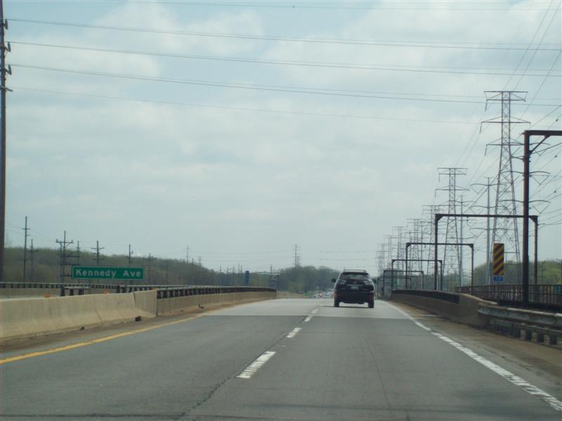
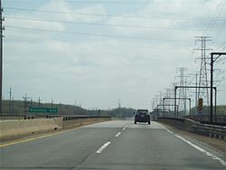 Indiana Toll Road, East Chicago, IN, at Kennedy Avenue
Exit points are based on the milepost system, with exits starting at 0 at the Illinois state line, and increasing to exit 153 at the Eastpoint toll barrier near the Ohio state line (technically, not an exit, as the only access from there is to the Ohio Turnpike, but toll tickets issued at the barrier are marked "Entry 153"). The Toll Road opened in 1956 with sequential exit numbering, which was converted to the current mileage-based scheme in 1981. The original number sequence was amended slightly in 1964 with the opening of the then-Burns Harbor, now Lake Station exit.
The farthest it gets from the Michigan state line or Lake Michigan is about 10 miles (16 km). Although it never enters Michigan, the toll road lies within 10 miles (16 km) of the Michigan state line between La Porte, Indiana and the Ohio state line. Looking north at exit 121, (State Road 9), the "Welcome to Michigan" sign is visible in the distance. At one point in northern Indiana, in Greenfield Township in LaGrange County at approximately mile 129.4, the toll road comes within about 200 yards (180 m), or 0.1 miles (0.16 km), from the Michigan border.[3]
Control cities on guide signs are Chicago and Ohio. Originally they were "Chicago and West" and "Ohio and East".
In December 2006, ITR Concession Company announced that a South Bend student, Andrea Herbster, will receive $5,000 toward her educational expenses for being selected as the grand prizewinner of the Indiana Toll Road logo design contest. The new ITRCC logo roll out occurred in the spring of 2007.[4]
History
 Longtime version of the Indiana Toll Road's logo, still in use on many guide signs on the ITR and Chicago Skyway
The Indiana Toll Road was publicly financed and constructed during the 1950s. It opened in stages, east to west, between August and November 1956.[5] The formal dedication ceremony was held on September 17, 1956.[5][6]
The final course of the Toll Road was the northern of four planned alignments.[7] In addition to the east–west toll road, a north–south toll road was planned, roughly along the path of today's I-65, but the plan was dropped after the Federal-Aid Highway Act of 1956 was passed.[5]
Originally the I-94 designation was applied to the highway west of where the current interchange with I-94 was eventually built, with I-90 following I-80 to the west along the Borman Expressway as I-94 does now, the completed portions of the Borman being designated as I-80, I-90, and I-294. The current arrangement was applied around 1965, to avoid confusion, which resulted in a stretch of I-94 actually being farther south than I-90, and I-90 running the entire length of the Indiana Toll Road. I-294 was cut back to the Tri-State Tollway at that time.
Several interchanges on the Toll Road were constructed between 1980 and 1985 as part of a bond sale in October 1980.[6]
Similar to the Chicago Skyway transaction in 2004, on June 29, 2006, Indiana received $3.8 billion in an auction from a consortium made up of the Spanish construction firm Cintra and the Macquarie Atlas Roads (MQA) of Australia in exchange for the right to maintain, operate and collect tolls for the following 75 years.[8] The two companies formed the Indiana Toll Road Concession Company to operate the road. Goldman Sachs & Co. was reported to have earned some $20 million in fees for putting together the ITR transaction.[9] Mark Florian, who worked on both toll road deals, was subsequently named third-in-charge and chief operating officer of a newly structured municipal finance and infrastructure group at Goldman. Florian was to move from Chicago to the New York office.[10]
Operation
The Indiana Toll Road Commission operated the toll road from its inception until 1981. The Indiana Department of Transportation operated the toll road between 1981 and 2006. On April 1, 1983, the State of Indiana established the Indiana Toll Finance Authority,[6][11] renamed the Indiana Transportation Finance Authority in April 1988.[6]
The Cintra–Macquarie joint-venture assumed operation of the Toll Road from INDOT on June 30, 2006, after the Indiana Supreme Court dismissed a legal challenge by opponents attempting to derail the deal following the failure of the opponents to post a bond. The same partnership had acquired a 99-year lease on the adjoining Chicago Skyway in Illinois in 2004.
Major Moves
Major Moves is the name of a plan conceived by Governor Mitch Daniels to lease the toll road for 75 years to an Australian-Spanish consortium for an upfront payment of $3.8 billion. Part of the proceeds will fund a portion of the planned extension of I-69 through southwestern Indiana.
Legislation
Regarding the legislation, Daniels said "You're either for this bill or you're against our future", at a statehouse rally in Indianapolis on February 28, 2006.[12] Specifically the legislation authorizes the governor to establish a similar public-private partnership agreement for design, construction, and operation of the proposed Southern Indiana Toll Road (SITR), which would make up 117 miles (188 km) of the planned 142-mile (229 km) extension of I-69 from Indianapolis to Evansville. On November 9, 2006, Daniels announced that the I-69 extension would not be tolled; he abandoned the idea of building the I-69/SITR for two reasons: while there is substantial bi-partisan support for building I-69, constructing it as a toll road proved to be widely unpopular.[citation needed] More significantly, several firms[who?] interested in the SITR deal determined that a toll road through southwest Indiana was not economically feasible at the present time. In lieu of the SITR, I-69 will be built using $700 million of the Major Moves payout for the section from I-64/I-164 to Crane Naval Surface Warfare Center. It is expected that the remaining half of the I-69 extension from Crane to Indianapolis will be built using traditional federal/state highway funds.[citation needed]
Distribution of Major Moves funding
On September 15, 2006, funds were distributed by an electronic wire transfer to the seven counties through which the toll road runs.[13] The list below details each county's total share in the Major Moves money. Some of the funds from each counties' distribution was diverted to each city or town within the country.[14] Each county auditor will be responsible for distributing a portion of the money to each city and town.[13]
- Elkhart County: $40 million[14]
- La Grange County: $40 million[13]
- Lake County: $15 million[14]
- La Porte County: $40 million[a][14]
- Porter County: $40 million[14]
- Steuben County: $40 million[13]
- St. Joseph County: $40 million[14]
Opposition to Major Moves
Opponents of the legislation filed a lawsuit in St. Joseph County in late April 2006. Following roughly two weeks of arguments, Judge Michael Scopelitis ruled in favor of the State of Indiana, declaring the lawsuit brought by opponents a public lawsuit, thus requiring the plaintiffs to post a bond of $1.9 billion for the case to proceed. In response, plaintiffs appealed Scopelitis' ruling to the Indiana Supreme Court, which on June 20, 2006, in a 4–0 decision, upheld Judge Scopelitis' earlier decision, paving the way for the deal to lease the Indiana Toll Road to proceed as scheduled on June 30, 2006.
The Libertarian Party of La Porte County, opposed Major Moves quite vocally, proclaiming that "Pirates [have] return[ed] to the shores of Lake Michigan" in a news release. The toll road passes through La Porte County and also has two toll gates in that county.[15]
Elected officials and candidates for office in many toll road counties expressed concerns that the share of funds being allocated to projects in and around Indianapolis was too great. "This is another time where they're taking resources we use to develop our part of the state and taking them down to Indianapolis," said Rep. Scott Pelath (Michigan City). "We've always felt like it's Indianapolis versus the rest of the state," said Rep. Robert Kuzman (Crown Point). "So far, Indianapolis is winning this battle."[16]
Indiana House Democratic leader Pat Bauer of South Bend issued a written statement the day before funding was distributed to the counties mocking Major Moves. “Now that the deal is done, the governor and officials in his administration have traveled the state to claim that the sale has financed every major road project scheduled over the next decade,” Bauer said. “The fact is that most of these projects already were on course to be completed, without any assistance from the sale of the toll road."[13]
Tolls
Between the Westpoint barrier toll, near the Illinois state line, and the Portage barrier at milepost 24, tolls are collected by fixed-amount tolls at exit and entrance ramps.
Between the Portage barrier, east to the Eastpoint barrier toll, near the Ohio state line, it is operated as a closed ticket system toll road, where one receives a ticket upon entering and pays a pre-calculated amount based on distance traveled when exiting. Standard passenger cars are charged a toll of $4.15 for i-Zoom users and $6.75 cash along the section from Portage to Eastpoint, with an extra $0.50 for i-Zoom users and $1.25 cash at the Westpoint barrier.
Originally the entire toll road was on a closed ticket system, with Westpoint at current exit 5, roughly under the East 141st Street overpass. This changed after the Indiana Department of Transportation (INDOT) takeover in 1981. Effective June 25, 2007, the Indiana Toll Road began electronic toll collection with the i-Zoom system. i-Zoom is fully compatible with the E-ZPass and I-Pass electronic toll collection systems. Indiana becomes the 12th state to use the E-ZPass system.
Service areas
Like all other toll highways built in the 1950s, the Indiana Toll Road has had service areas (called travel plazas[17]) since its opening. Originally, there were eight pairs of travel plazas located approximately every 18 miles (29 km). Of these, five featured sit-down restaurants operated by the Host Restaurant chain while the other three had only snack bars. Each travel plaza was named after a prominent Indiana native or resident.[18] Gasoline and other auto services were available at all travel plazas. Originally, various oil companies including Standard Oil, Sinclair, Pure, Gulf, Texaco and Citgo operated each of the travel plazas. Later, Standard Oil, later Amoco and now BP Amoco, assumed operations at all travel plazas. Currently BP Amoco operates the three western travel plazas while Mobil operates the two easternmost pairs. The westernmost snack bar at milepost 37.5 remained open until the mid-70s and is now used as a "Truck Only Parking" rest area[17]with no facilities. The other two at mileposts 72.9 and 108 were closed in 1972, although the one at 108 was also converted into a truck parking area without facilities. All were demolished except for one, the former Benjamin Harrison snack bar on the eastbound side at milepost 72.9. It serves as a state police station and has no public facilities. The restaurant interiors were remodeled into short-order cafeterias in the late 1970s when the Gladieux chain took over operations and have since been remodeled once again for fast food service. However, the original buildings remain relatively unchanged from the outside.
Future
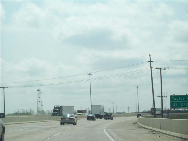
 New three-lane section at US 12/US 20 in Gary
Part of the agreement to privatize operations of the Indiana Toll Road is to invest $600 million in the ITR during the first nine years of the lease. This is above and beyond the $3.8 billion being invested by the State of Indiana in Major Moves projects. More than $300 million has already been invested in improving the Indiana Toll Road. Some examples include: third-lane expansion project at $250 million; electronic toll collection (i-Zoom) at $40 million; and Toll Plaza expansions (MP 1, 23, 156) at $9 million total.
Included in the plans is adding a third lane in each direction in the most congested area of the Indiana Toll Road: from MP 10–15.5. The 10-year Bridge Capital Improvement plan is also under way, which will repair and rehabilitate nearly every structure on the ITR over the next 10 years. The lease agreement also requires ITRCC to maintain or improve the condition of the Toll Road to standards set forth by state and federal law.
Exit list
County Location Mile[19] Old exit New exit Destinations Notes Lake Hammond 0.00 I-90 west / Chicago Skyway westContinuation into Illinois 0.08 0 0 US 12 / US 20 / US 41 (Indianapolis Boulevard)Westbound exit and eastbound entrance 1.06 Westpoint Toll Barrier 2.97 0 3  SR 912 (Cline Avenue)
Eastbound exit and westbound entrance 4.18 1 5 US 41 (Calumet Avenue) – HammondGary 9.52 10 SR 912 (Cline Avenue) – Gary13.69 1A, 2 14A Buchanan Street 14.54 14B  SR 53 (Broadway)
16.90 2, 3 17 I-65 south / US 12 / US 20 – IndianapolisLake Station 20.68 4 21  I-80 / I-94 / US 6 / SR 51 – Detroit, Chicago, Des Moines
West end of I-80 overlap Porter Portage 23.46 23 Willowcreeck Road 23.95 Portage Toll Barrier Chesterton 30.66 3, 5 31  SR 49 – Chesterton, Valparaiso
Serves Indiana Dunes National Lakeshore and Indiana Dunes State Park LaPorte New Durham Township 38.91 4, 6 39 US 421 – Michigan City, WestvilleCenter Township 48.80 5, 7 49  SR 39 – La Porte
St. Joseph South Bend 72.29 72 US 31 – South Bend, Plymouth, Niles76.46 6, 8 77  SR 933 – South Bend
Serves University of Notre Dame Harris Township 82.64 83  SR 331 (Capital Avenue) – Mishawaka
Elkhart Elkhart 91.55 7, 9 92  SR 19 – Elkhart
95.98 96  CR 17 – Elkhart
Bristol 101.12 101  SR 15 – Bristol, Goshen
York Township 107.21 8, 10 107 SR 13 to US 131 – Middlebury, ConstantineLaGrange Howe 120.23 9, 11 121  SR 9 – Howe, LaGrange, Sturgis
Steuben Fremont 143.53 10, 12 144 
 I-69 / SR 120 / SR 127 south – Angola, Fort Wayne, Lansing
Serves Pokagon State Park York Township 152.50 Eastpoint Toll Barrier 156.28 I-80 east / I-90 east / Ohio Tpk. westContinuation into Ohio 1.000 mi = 1.609 km; 1.000 km = 0.621 mi
Concurrency terminus • Closed/Former • Incomplete access • UnopenedSee also
- Illinois State Toll Highway Authority
- New York Thruway
- Pennsylvania Turnpike
References
- ^ Staff (October 31, 2002). "Table 1: Main Routes of the Dwight D. Eisenhower National System Of Interstate and Defense Highways". Route Log and Finder List. Federal Highway Administration. http://www.fhwa.dot.gov/reports/routefinder/table1.htm. Retrieved September 20, 2011.
- ^ Indiana General Assembly (May 4, 2006). "Indiana Administrative Code, Title 105, Article 14: Toll Roads" (PDF). Office of Code Revision Indiana Legislative Services Agency. http://www.in.gov/legislative/iac/T01050/A00140.PDF. Retrieved March 7, 2010.
- ^ Microsoft Research Maps (July 1, 1979). 1 km NE of Greenfield Mills, Indiana, United States (Map). (Topographic). Cartography by US Geological Survey. http://msrmaps.com/image.aspx?S=12&T=2&X=810&Y=5780&Z=16&W=2. Retrieved September 20, 2011.
- ^ [1][dead link]
- ^ a b c Wensits, James (January 22, 2006). "Indiana's toll road seen as link in a chain". South Bend Tribune: p. 1. http://pqasb.pqarchiver.com/southbendtribune/access/987297361.html?FMT=ABS. Retrieved April 24, 2008.
- ^ a b c d Staff (1991). Indiana Toll Road: A Brief History (Brochure). Indiana Department of Transportation. http://home.comcast.net/~bmgorte/freeway/tollrd.html. Retrieved September 20, 2011.
- ^ Staff (1975). "Toll plans". History of the Interstate Highway in Indiana: Final Report. Figure 108. Archived from the original on April 4, 2004. http://web.archive.org/web/20040414044247/http://www.nwindianahwys.homestead.com/tollplans.html. Retrieved April 25, 2008.
- ^ Schulman, Daniel (January 1, 2007). "The Highwaymen". Mother Jones. http://www.motherjones.com/news/feature/2007/01/highwaymen.html. Retrieved April 30, 2007.
- ^ Knight, Jerry (March 20, 2006). "Infrastructure: A Road to Riches?". Washington Post. http://www.washingtonpost.com/wp-dyn/content/article/2006/03/19/AR2006031900913.html. Retrieved May 16, 2011.
- ^ Johnson, Anastasija (March 21, 2006). "Goldman Expands Its Public Finance Focus". The Bond Buyer. http://www.bondbuyer.com/news/-243201-1.html. Retrieved May 16, 2011.
- ^ Indiana General Assembly. "Title 8, Article 9.5, Chapter 8". Indiana Code. Office of Code Revision Indiana Legislative Services Agency. http://www.in.gov/legislative/ic/code/title8/ar9.5/ch8.html. Retrieved September 20, 2011.
- ^ [2][dead link]
- ^ a b c d e [3][dead link]
- ^ a b c d e f g Staff (September 15, 2006) (PDF). Major Moves Construction Fund Distribution (Report). Office of Indiana Auditor of State. Archived from the original on September 27, 2006. http://web.archive.org/web/20060927111330/http://www.in.gov/auditor/pdfs/majormoves/construction_fund_2006_dist.pdf.
- ^ "Libertarians Oppose Toll Road Plan" (Press release). Libertarian Party of Indiana. January 19, 2006. Archived from the original on December 24, 2007. http://web.archive.org/web/20071224200543/http://www.lplp.org/html/toll_road.html. Retrieved September 20, 2011.
- ^ Ruthhart, Bill (February 6, 2006). "Toll Road counties object". The Indianapolis Star. Archived from the original on March 11, 2007. http://web.archive.org/web/20070311100035/http://www.mcdermottformayor.com/web/index.php?id=29,129,0,0,1,0.
- ^ a b Staff. "Northern Indiana Area Map" (PDF). Northern Indiana Tourism Development Commission and Indiana Department of Transportation: Toll Road District. Archived from the original on November 30, 2001. http://web.archive.org/web/20071130221100/http://www.in.gov/dot/div/tollroad/TollRoadInfo.pdf. Retrieved September 20, 2011.
- ^ "The people behind the names". South Bend Tribune. January 22, 2006. http://pqasb.pqarchiver.com/southbendtribune/access/987298441.html?FMT=ABS. Retrieved March 13, 2009.
- ^ Staff (2004). "Reference Post Book" (PDF). Indianapolis, IN: Indiana Department of Transportation. I-90. http://www.in.gov/indot/files/StateWide_2004.pdf. Retrieved September 5, 2011.
External links

Wikimedia Commons has media related to: - Indiana Toll Road
- Indiana Department of Transportation - Toll Road District information
- "Indiana Toll Road Photos". Roadfan.com. http://www.roadfan.com/intrph.html. Includes a 1954 photograph of the Toll Road under construction.
- "City for sale". Rate, Betsy. Need to Know. PBS. September 16, 2011. ITR, Chicago, Indianapolis, Harrisburg and other public entities' experiences with privatization, in a national context.
Interstate 90Previous state:
IllinoisIndiana Next state:
OhioCategories:- Toll roads in Indiana
- Tolled sections of Interstate Highways
- Interstate 80
- Interstate 90
- Transportation in Gary, Indiana
- Freeways in the United States
- Transportation in South Bend, Indiana
- Northwest Indiana
- Transportation in Elkhart, Indiana
- Transportation in Elkhart County, Indiana
- Transportation in Lake County, Indiana
- Transportation in Porter County, Indiana
- Transportation in LaGrange County, Indiana
- Transportation in LaPorte County, Indiana
- Transportation in St. Joseph County, Indiana
- Transportation in Steuben County, Indiana


Wikimedia Foundation. 2010.