- Indiana Dunes State Park
-
Indiana Dunes Designation(s) State Park; National Natural Landmark Location Porter County, Indiana, USA Address 1600 N 25 E
Chesterton, IN 46304Nearest City Porter, Indiana Coordinates 41°40′N 87°02′W / 41.66°N 87.04°W Area 2,182 acres (883.0 ha) Date of Establishment 1925 Governing Body Indiana DNR Indiana Dunes State Park is located 47 miles (75.6 km) east of Chicago, Illinois. The park is bounded by Lake Michigan to the northwest, and is surrounded in the east, south and west by the Indiana Dunes National Lakeshore, a unit of the National Park Service. The 1,530 acres (619.2 ha) Dunes Nature Preserve makes up the bulk of eastern part of the park, and includes most of the park’s hiking trails and dune landscape. This was one of the first places Richard Lieber considered when establishing the Indiana State Park system. Like all Indiana state parks, there is a fee for entrance. It was designated a National Natural Landmark in 1974.[1]
Contents
Geology
Main article: Geology of the Indiana DunesThe beaches were formed by winds coming off Lake Michigan, which drop sand when the wind hits plants, dunes, and hills. As the lake level of Lake Michigan dropped at the end of the Ice Age, the shoreline receded, and new dunes were formed along the lakeshore. Vegetation took over the previous dunes, and eventually forests grew on top of them. There are "blowouts" along the dunes, where dead stumps were revealed after the wind blew away the sand from on top of them; the most notable such blowout is Big Blowout.
History
Main article: History of the Indiana DunesNative Americans used the area for years, primarily the Potawatomi and Miami tribe. The Dunes were along trade routes used by Native Americans from the Mississippi River to trade goods with
Notable attractions
 Forest growing on dunes
- Sand dunes
- Singing sand
- Smelt Fishing
- Haunted Shores (Diana of the Dunes)
- Birding
Facilities and activities
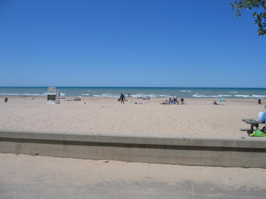
- Swimming and Sunbathing A small portion of the shoreline is set aside as a public swimming beach and is protected by lifeguards between Memorial and Labor Day weekends. It is a clean, all sand beach. The remainder of the beach (approximately 2 miles (3.2 km)) is open for sunbathing, beach combing, and other similar activities. Dogs are permitted on the non-swimming portion of the beach, so long as they are kept on a short leash and any feces is promptly and safely removed from the shores.
- Beach house with concessions during summer season.[2]
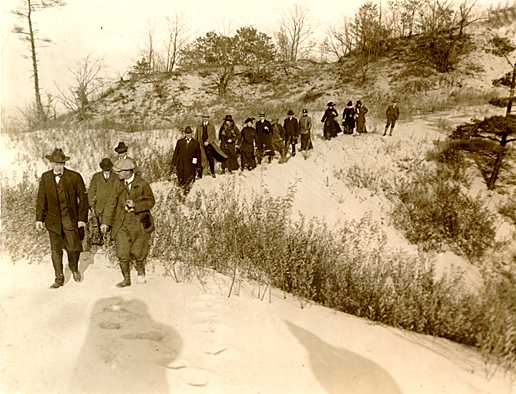
 Richard Lieber (front right) with NPS Director Stephen Mather at what would become Indiana Dunes State Park in 1916
- Observation platform near the top of Mt. Tom. Looking west, Chicago can be seen above the forested sand dunes. Gary, Indiana, is also visible.
- Birdwatching (A bird observation tower is located along Trail 10 overlooking a marsh community.)[2]
- Nature Center The Nature Center is a year-round facility that has a wildlife observation window, library, and a large auditorium. The exhibits were recently updated, so everything is brand new! An interpretive naturalist provides public hikes and programs.
- Picnic Shelters[2]
- Hiking trails 16 miles (26 km), some of which pass not only the sand dunes, but historic structures and wet prairie.[2]
- Guided Hiking Tours
- Cycling is not permitted everywhere within the park, but the Calumet Trail runs through the park and provides both cycling opportunities as well as access to the Indiana Dunes National Lakeshore as well as to some neighboring communities.
- Interpretive Naturalist Service
- Arts and crafts
- Camping The campground was totally rebuilt in 2004. It has 140 roomy campsites laid out on sand with new, level, asphalt paved pads, 50 amp electrical hook-ups, picnic tables. Drinking water hydrants are located throughout the campground. The roads are newly laid out and paved in 2004, arranged in several connecting loops. The smoothly paved loops of roadway lend themselves to bicycling, rollerblading, etc. Most of the trees were spared during the rebuilding so that many sites have full or partial shade. There are two, large, newly built shower house/restroom structures. There is a short, level forest path to the swimming beach.
Dunes Nature Preserve
The Nature Preserve covers the eastern 2/3 of the State Park, 1,530 acres (620 ha). It is accessible only on foot. All eight of the park's trails enter the nature preserve, offering easy to rugged experiences amongst the dunes. The highlights of the preserve include[2]:
- The Tremonts, Mt. Tom,192 feet (59 m) above lake level; Mt. Holden, 184 feet (56 m) above lake level; and Mt. Jackson 176 feet (54 m) above lake level.
- Beach House Blowout and Furnessville Blowout.[2]
- the Marsh with Bird Observation Tower.[2]
- Trails[2]
- Trail 8 takes you up and over all three of the high dunes. It's only 1.5 miles (2.4 km) long from the Wilson Shelter, over the high dunes, ending on the beach at the Pavilion and Beach House.
- Trail 10 is the longest 5.5 miles (8.9 km), but among the easier, listed as Moderate trails. It begins at the Pavilion and Bathhouse, traveling east along the open beach. About 1.25 miles (2.01 km) down the beach, you come to the Beach House Blowout. An additional 0.5 miles (0.80 km) and you reach the Furnessville Blowout. About half way, you come to the eastern boundary of the park and swing up into the dunes through an area called Paradise Valley. From there, the trail parallels a branch of the Dunes Creek, passing through the Pinery and along the marsh. The Bird Observation Tower is accessible from this trail. About 0.75 miles (1.21 km) from the Observation Tower, the trail ends at the Nature Center.
See also: Birds of the Indiana Dunes, Mammals of the Indiana Dunes, and Habitats of the Indiana DunesBlowouts
Blowouts are formed by the on-shore winds of Lake Michigan. The winds move sand and pile it into dunes. As the dunes form, plants begin to take hold, stabilizing the sand. Beach grasses form a large underground system of roots. This root system, creates stable areas of sand, from which the dune can grow. Slowly other plants take root in the protected areas, including bearberry (kinnikinnick) and small evergreens. Over time, larger plants like sumac, sand cherry, cottonwood, and juniper take hold and replace the grasses and smaller plants.
When a nick forms in this armor of roots and plants, the area can become a blowout. First, open sand becomes accessible to the wind. This can be by animal trails or by human footpaths. A tree could fall in a strong wind, exposing the underlying sand. When this happens, the wind once again goes to work on the loose sand. It undercuts the other roots, and begins moving sand southward. If the winds are strong enough or given enough time, a large blowout can occur, reducing the dunes to lake level over a large area. The 3 largest blowouts in the park are Beach House, Furnessville, and Big Blowout. Each extends into the interdunes, between the front rides of dunes and pockets, into the interdunal troughs. Big Blowout has uncovered an area of dead tree trunks known as the Tree Graveyard.[3]
The park also has a Youth Tent Area separate from the public campground.
Gallery
-
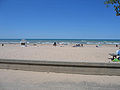
Beach view from the bathhouse on a nice sunny day.
-
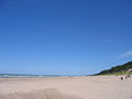
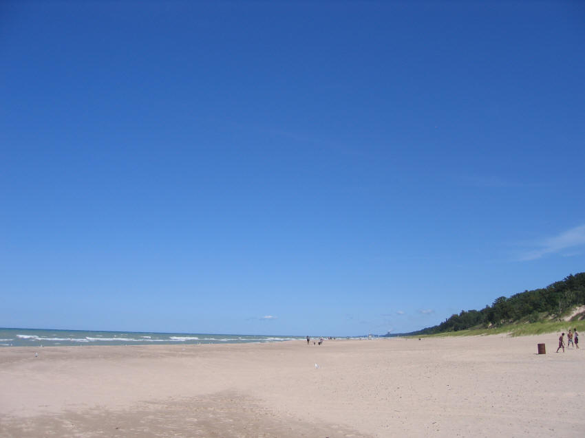
Miles of beautiful sand beach.
-
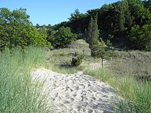
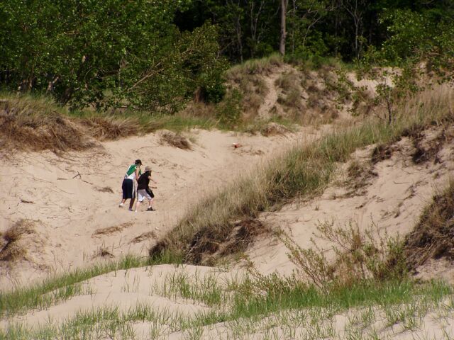
Climb a dune
-

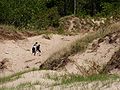
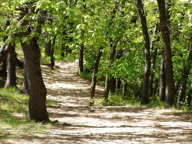
There are seven trails through the park. Although short, trail #8 leads to the tops of the three highest dunes, the 'Tremonts'
-
Bathhouse.
-
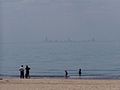
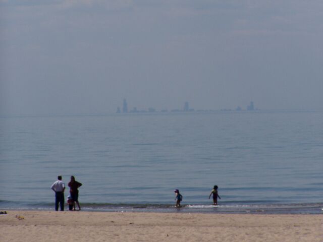
On good days, you can often see Chicago across Lake Michigan, nearly 50 miles away.
See also
- Cross-country skiing
- Sand Trapping
- Sledding
References
External links
- Indiana Dunes State Park DNR Site
- Dunes Nature Preserve Indiana DNR Site
- The Prairie Club
- Save the Dunes Council
- Friends of the Indiana Dunes
- Duneland.com
- Dunes Learning Center
National Natural Landmarks in Indiana Big Walnut Creek • Cabin Creek Bog • Calvert and Porter Woods • Cowles Bog • Davis-Purdue Agriculture Center Forest • Donaldson Cave System and Woods • Dunes Nature Preserve • Fern Cliff • Hanging Rock and Wabash Reef • Harrison Spring • Hammer Woods • Hoosier Prairie • Hoot Woods • Kramer Woods • Marengo Cave • Meltzer Woods • Officer's Woods • Ohio Coral Reef • Pine Hills Natural Area • Pinhook Bog • Pioneer Mother's Memorial Forest • Portland Arch Nature Preserve • Rise at Orangeville • Rocky Hollow Falls Canyon Nature Preserve • Shrader-Weaver Woods • Tamarack Bog • Thornhill Nature Preserve • Tolliver Shallowhole • Wesley Chapel Gulf • Wesselman Woods Nature Preserve • Wyandotte CavesList including county and descriptionProtected Areas of Indiana National Park Service National Forests National Wildlife Refuges National Natural Landmarks State Parks Brown County • Chain O'Lakes • Charlestown • Clifty Falls • Falls of the Ohio • Fort Harrison • Harmonie • Indiana Dunes • Lincoln • McCormick's Creek • Mounds • O'Bannon Woods • Ouabache • Pokagon • Potato Creek • Prophetstown • Shades • Shakamak • Spring Mill • Summit Lake • Tippecanoe River • Turkey Run • Versailles • White River • Whitewater Memorial
State Forests and State Recreation Areas Clark • Deam Lake • Ferdinand • Greene-Sullivan • Harrison-Crawford • Jackson-Washington • Martin • Morgan-Monroe • Owen-Putnam • Pike • Salamonie River • Selmier • Starve-Hollow • Yellowwood
National Historic Landmarks National Register of Historic Places Categories:- Protected areas established in 1925
- Indiana state parks
- National Natural Landmarks in Indiana
- Protected areas of Porter County, Indiana
- Dunes of the United States
- Indiana Dunes National Lakeshore
- Northwest Indiana
- Nature centers in Indiana


Wikimedia Foundation. 2010.