- Clifty Falls State Park
-
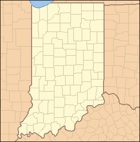
Clifty Falls State Park, Indiana, USA IUCN Category III (Natural Monument)Map of the U.S. state of Indiana showing the location of Clifty Falls State Park

Location Jefferson County, Indiana, USA Nearest city Madison, Indiana Coordinates 38°45′34″N 85°25′07″W / 38.75944°N 85.41861°WCoordinates: 38°45′34″N 85°25′07″W / 38.75944°N 85.41861°W Area 1,416 acres (5.73 km2) Established 1920 Visitors 425,506 (in 2003-2004) Governing body Indiana Department of Natural Resources Clifty Falls State Park is an Indiana state park on 1,416 acres (5.73 km2) in Jefferson County, Indiana in the United States. It is 46 miles (74 km) northeast of Louisville, Kentucky.
On Oct. 27, 1920, citizens of Madison, Indiana gave the land for the park, 570 acres (2.3 km2), to the state of Indiana at the suggestion of Richard Lieber. This was after a year's work by the citizens. A system of naturalist programs for Indiana state parks started in 1927, with Clifty Falls being one of the first four with one.[1]
The park features Clifty Creek, Little Clifty Creek, and a canyon in which the sun only shines during midday.
It has many beautiful nature trails, especially those that go near Clifty Falls. The Clifty Inn is available for overnight guests, and the park contains a campground with sites for RV and tent campers.
Contents
Canyons
Clifty Creek Canyon traverses the entire north-south length of the state park. The upper rim of the canyon at the north end of the park is 800 feet (240 m) above sea level, descending to the valley of the Ohio River which is 500 feet (150 m) above sea level. The creek descends down to about 750 feet (230 m) before dropping over one of the two Clifty Falls.[2] Then it runs downward until reaching the Ohio River. Two other major canyons enter Clifty Creek Canyon from the east, they are Deans Branch (Tunnel Falls) and Hoffman Branch (Hoffman Falls).[3]
Water Falls
Clifty Falls State Park is named for the waterfalls on Clifty Creek.[3]
- Big Clifty Falls - 60 feet (18 m)
- Little Clifty Falls - 60 feet (18 m)
- Hoffman Falls - 78 feet (24 m)
- Tunnel Falls - 83 feet (25 m)
Trails
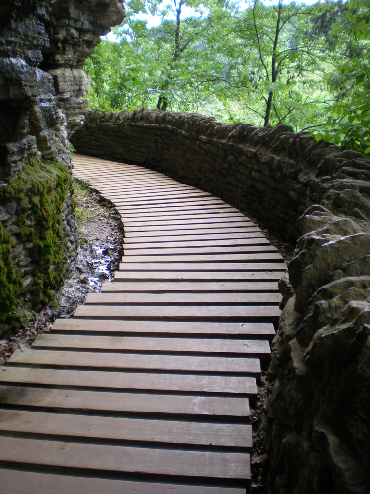
Clifty Falls State Park has ten trails that vary from easy, moderate, rugged and very rugged. Trail two is the only very rugged trail and it is the most rugged trail in all of Indiana. Because of the danger of falling rocks, the end of the trail is blocked from the public. There are old steps, also blocked, that used to lead down to the falls. You can see the falls from an overlook carved out of the side of the canyon.
Gallery
-
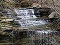
Clifty Falls from the Overlook
-
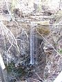
Tunnel Falls from the Tunnel Falls Trail
-
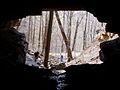
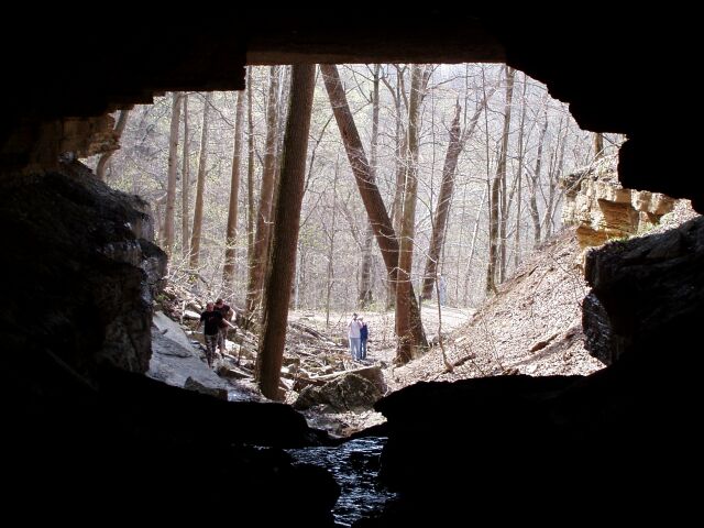
The Tunnel is an abandoned Railroad Tunnel that was never completed. It's currently closed to the public due to the White-Nosed Bat Syndrome.
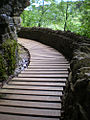
-

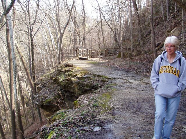
The Tunnel Trail like most of the trails are along the sides of the valley.
-
References
- ^ http://www.in.gov/dnr/history/ Official (Indiana) DNR Historical Timeline
- ^ U.S.G.S. Topographical Map, Madision, Indiana Quadrant
- ^ a b Clifty Falls State Park brochure, Indiana Department of Natural Resources
- "Clifty Falls State Park". Indiana Department of Natural Resources. http://www.in.gov/dnr/parklake/2985.htm. Retrieved 2007-04-02. (Official Site)
- "Statistics: Parks & Reservoirs Visitation". Indiana Department of Natural Resources. http://www.in.gov/dnr/parklake/about_stats.html. Retrieved 2007-04-02.
- United States Geological Survey. "Clifty Falls State Park, USGS Clifty Falls (IN) Topo Map". TopoQuest. http://www.topoquest.com/map.asp?lon=-85.4186&lat=38.7594. Retrieved 2008-07-05.
Protected Areas of Indiana National Park Service National Forests National Wildlife Refuges National Natural Landmarks State Parks Brown County • Chain O'Lakes • Charlestown • Clifty Falls • Falls of the Ohio • Fort Harrison • Harmonie • Indiana Dunes • Lincoln • McCormick's Creek • Mounds • O'Bannon Woods • Ouabache • Pokagon • Potato Creek • Prophetstown • Shades • Shakamak • Spring Mill • Summit Lake • Tippecanoe River • Turkey Run • Versailles • White River • Whitewater Memorial
State Forests and State Recreation Areas Clark • Deam Lake • Ferdinand • Greene-Sullivan • Harrison-Crawford • Jackson-Washington • Martin • Morgan-Monroe • Owen-Putnam • Pike • Salamonie River • Selmier • Starve-Hollow • Yellowwood
National Historic Landmarks National Register of Historic Places Indiana Department of Natural Resources Categories:- IUCN Category III
- Protected areas established in 1920
- Indiana state parks
- Protected areas of Jefferson County, Indiana
- Waterfalls of Indiana
- Canyons and gorges of Indiana


Wikimedia Foundation. 2010.