- McCormick's Creek State Park
-
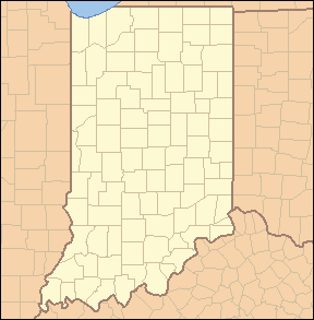
McCormick's Creek State Park, Indiana, USA IUCN Category III (Natural Monument)Map of the U.S. state of Indiana showing the location of McCormick's Creek State Park

Location Owen County, Indiana, USA Nearest city Spencer, Indiana Coordinates 39°17′40″N 86°43′40″W / 39.29444°N 86.72778°WCoordinates: 39°17′40″N 86°43′40″W / 39.29444°N 86.72778°W Area 1,924 acres (778.62 ha) Established 1916 Governing body Indiana Department of Natural Resources McCormick's Creek State Park is the oldest state park in Indiana, dedicated as on July 4, 1916, as part of the state's centennial celebration. It is located 14 miles (23 km) west of Bloomington, Indiana in Owen County, Indiana.
Contents
History
The park was named after the area's first settler John McCormick, who homesteaded on 100 acres (0.40 km2) there in 1816, along the canyon by the waterfalls. Previously, the land was hunted by Miami Indians. McCormick's Creek Falls is the main attraction at McCormick's Creek State Park.
On May 12, 1916, it was suggested by a local newspaper editor to an Indiana state legislator that McCormick's Creek area would be a suitable location for a state park. German-born Indianapolis businessman Richard Lieber championed the idea of establishing a system of state parks for Indiana, and, after winning the property at auction with a bid of $5,250, received it from the Dr. Frederick Denkewalter estate.[1] McCormick's Creek was formally opened on December 11, 1916; the centennial birthday of Indiana. In 1927 a naturalist program was started, a first for Indiana and the United States.[2]
Much of the infrastructure of the park was built by the Civilian Conservation Corps during Franklin D. Roosevelt's New Deal era, and many of the CCC-built structures, retaining walls, and elegant, arched limestone bridges remain in use today. The park entrance gatehouse and a stone arch bridge over McCormick's Creek are listed on the National Register of Historic Places.[3] There are eight numbered hiking trails in the park, accessing features and park attractions, which include a 90-foot (27 m) fire tower, a scenic ravine and waterfall, small cave, interesting sinkhole formations, and towering stands of second-growth Midwestern hardwoods. The park also features a fine system of equestrian paths.
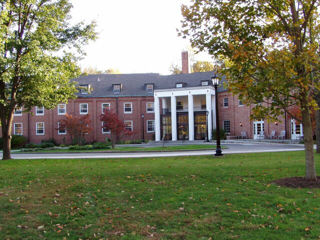
Also on site is The Canyon Inn, a former sanitarium that now hosts guests for the night. It has an Olympic-sized swimming pool. Overnight camping is also available. In addition, the Old State House quarry is a source of the Indiana limestone used in the Indiana State Capitol building.
Canyon
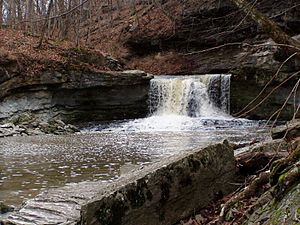 McCormick's Creek falls
The heart of the park is McCormick's Creek Canyon. The upper levels of the canyon are around 700 feet (210 m) above sea levels, dropping to the West Fork of the White River which is near 540 feet (160 m).
Waterfall
McCormick's Creek waterfalls is a primary attraction. Indiana has few waterfalls due to the relatively flat topography, therefore, even a small falls, about 10 feet (3.0 m), is of interest.
Hiking Trails
 Wolf Cave Trail
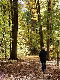
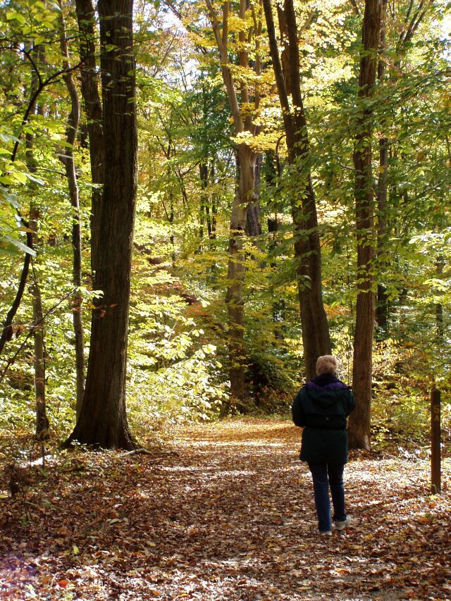
Wolf Cave Nature Preserve Trail #5. The Wolf Cave Trail is considered to be of MODERATE difficulty. The 2 miles (3.2 km) trail is a loop through the Wolf Cave Nature Preserve. The trail is relatively level with a drop into a shallow valley. The trail begins at the Wolf Cave Parking Area. The forest along the route is a Beech-Maple forest. Wolf Cave was formed by the collapse of a cave, leaving only the middle section 'the cave' still roofed.[4]
McCormick's Creek Falls Trail Trail #3. This short 0.8 miles (1.3 km) is considered RUGGED. The trail begins across from Canyon Inn and drops down before rising at the edge of McCormick's Creek Canyon. The trail access and overlook parking lot here before descending to the bottom of the canyon. There are no bridges across the creek. Fluctuating water levels makes some areas seasonably inaccessible. The trail ends at Stoney Restroom, a short walk back to the Canyon Inn.[4]
McCormick's Cove Nature Preserve
Gallery
-

Canyon Inn
-

Inn Dining Room
-

Guest Room
References
- ^ Indiana and Indianans: A History of Aboriginal and Territorial Indiana and the Century of Statehood By Jacob Piatt Dunn pg.51
- ^ http://www.in.gov/dnr/3245.htm Official (Indiana) DNR Historical Timeline
- ^ "National Register Information System". National Register of Historic Places. National Park Service. 2009-03-13. http://nrhp.focus.nps.gov/natreg/docs/All_Data.html.
- ^ a b McCormick's Creek State Park Map, Indiana Dept of Natural Resources
- Indiana Department of Natural Resources' official Web page
- Image of McCormick's Creek Falls
- Genealogy of John McCormick
- Unofficial web page
Protected Areas of Indiana National Park Service National Forests National Wildlife Refuges National Natural Landmarks State Parks Brown County • Chain O'Lakes • Charlestown • Clifty Falls • Falls of the Ohio • Fort Harrison • Harmonie • Indiana Dunes • Lincoln • McCormick's Creek • Mounds • O'Bannon Woods • Ouabache • Pokagon • Potato Creek • Prophetstown • Shades • Shakamak • Spring Mill • Summit Lake • Tippecanoe River • Turkey Run • Versailles • White River • Whitewater Memorial
State Forests and State Recreation Areas Clark • Deam Lake • Ferdinand • Greene-Sullivan • Harrison-Crawford • Jackson-Washington • Martin • Morgan-Monroe • Owen-Putnam • Pike • Salamonie River • Selmier • Starve-Hollow • Yellowwood
National Historic Landmarks National Register of Historic Places Indiana Department of Natural Resources Categories:- IUCN Category III
- Protected areas established in 1916
- Indiana state parks
- Waterfalls of Indiana
- Canyons and gorges of Indiana
- Civilian Conservation Corps in Indiana
- Protected areas of Owen County, Indiana
-


Wikimedia Foundation. 2010.