- Highland, Lake County, Indiana
Infobox Settlement
official_name = Town of Highland, Indiana
nickname =
mapsize = 280px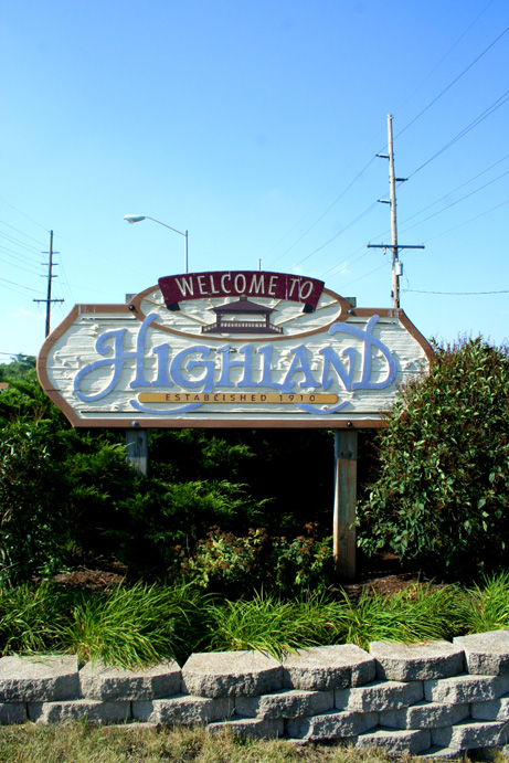 |thumb|center
map_caption = Location in the state ofIndiana
subdivision_type = County
subdivision_name = Lake
leader_title =Town Council President
leader_name = Bernie Zemen
area_footnotes =
area_magnitude = 1 E7
area_total_km2 = 17.8
area_land_km2 = 17.8
area_water_km2 = 0.1
population_as_of = 2000
population_note =
population_total = 23546
population_density_km2 = 1323.3
timezone = CST
utc_offset = -6
timezone_DST = CDT
utc_offset_DST = -5
latd=41 |latm=32 |lats=59 |latNS=N
longd=87 |longm=27 |longs=29 |longEW=W
website = [http://www.highland.in.gov/ www.highland.in.gov]Highland is a town in Lake County,
Indiana ,United States . The population was 23,546 at the 2000 census. It was incorporated on April 4, 1910. It is a part of theChicago metropolitan area . It is surrounded byHammond, Indiana , to the north,Munster, Indiana , to the west,Schererville, Indiana , to the south, andGriffith, Indiana , to the east. It is part ofNorth Township . =History=In 1847, two pioneers, Michael and Judith Johnston, became Highland's first settlers (Judith Johnston Elementary School is named in her honor).The town slowly expanded until 1880, when the arriving railroad brought Dutch settlers.304 people resided in Highland when it was incorporated in 1910.
In 1927, President
Calvin Coolidge visited and delivered the dedication address for Wicker Memorial Park, located on the north side of the town.Highland, as with other towns along the
Little Calumet River , has historically been subject to flooding, [ [http://nwi.com/articles/1999/11/13/export386548.txt Little Calumet Flood Control project reaches halfway mark. / nwi.com ] ] [ [http://nwi.com/articles/2006/09/18/community/family_focus/54b4fc9f7965fbb5862571ea0079ea5c.txt Little Cal's history flows through area / nwi.com ] ] particularly in spring, and particularly in areas away from Ridge Road, which runs along the highest land in the town. More recently the town has been subjected to flooding in 2008, 2007, and particularly in September, 2006.Cityscape
Architecture
Highland's Downtown area features a number of buildings exhibiting Mid-Century Modern style architecture.Fact|date=May 2008
Neighborhoods
Highland has several neighborhoods/subdivisions. They include: Wicker Park Manor, Wicker Park Estates, Brantwood, Meadows, White Oak, and Lakeside, and Frog Hollow.Fact|date=October 2008
Geography
Highland is located at coor dms|41|32|59|N|87|27|29|W|city (41.549851, -87.458064)GR|1. According to the
United States Census Bureau , the town has a total area of 6.9 square miles (17.8 km²), of which, 6.9 square miles (17.8 km²) of it is land and 0.04 square miles (0.1 km²) of it (0.29%) is water.Demographics
As of the
census GR|2 of 2000, there were 23,546 people, 9,636 households, and 6,677 families residing in the town. Thepopulation density was 3,428.3 people per square mile (1,323.3/km²). There were 9,925 housing units at an average density of 1,445.1/sq mi (557.8/km²). The racial makeup of the town was 94.45% White, 1.26% African American, 0.15% Native American, 1.10% Asian, 0.02% Pacific Islander, 1.80% from other races, and 1.21% from two or more races. Hispanic or Latino of any race were 6.61% of the population.Ancestries: German (22.5%), Polish (17.6%), Irish (14.9%), English (9.2%), Dutch (6.8%), Italian (6.4%).
There were 9,636 households out of which 27.6% had children under the age of 18 living with them, 56.5% were married couples living together, 9.6% had a female householder with no husband present, and 30.7% were non-families. 26.5% of all households were made up of individuals and 10.9% had someone living alone who was 65 years of age or older. The average household size was 2.44 and the average family size was 2.97.
In the town the population was spread out with 21.5% under the age of 18, 8.0% from 18 to 24, 28.9% from 25 to 44, 25.0% from 45 to 64, and 16.6% who were 65 years of age or older. The median age was 40 years. For every 100 females there were 92.2 males. For every 100 females age 18 and over there were 89.2 males.
The median income for a household in the town was $51,297, and the median income for a family was $59,106. Males had a median income of $46,217 versus $28,635 for females. The
per capita income for the town was $24,530. About 1.8% of families and 3.0% of the population were below thepoverty line , including 3.4% of those under age 18 and 3.7% of those age 65 or over.Transportation
The commercial airport closest to Highland is the
Gary/Chicago International Airport in Gary, but most Highland residents and visitors travel from Chicago'sO'Hare International Airport orChicago Midway International Airport .Highland lies just south of the
Borman Expressway .U.S. Route 41 , known locally as Indianapolis Boulevard, is a major North-South artery in the town. Due to Highland's proximity to Chicago, several other Interstate and U.S. highways are within a convert|20|mi|km|sing=on radius.The town's pedestrians and cyclists are also served by the Erie-Lackawanna Trail, a cycling/multiuse, paved
rail trail , which cuts diagonally through Highland, connecting the town with Griffith, and Crown Point, to the southeast. The Highland portion of the trail is also known locally as the Crosstown Trail. The trail runs along the former right-of-way of theErie-Lackawanna and Baltimore and Ohio Railroads, and will eventually connect pedestrians toChicago, Illinois , to the northwest and beyond Crown Point to the southeast by planned trail extensions. The trail also links Highland, by connections with other trails, withPorter County, Indiana , to the east. [ [http://www.indianatrails.org/Erie_Trail.htm Erie Lackawanna Trail ] ]Education
School Town of Highland, the town's public school system, operates one high school, one middle school, and four elementary schools (formerly seven): Johnston (northern side), Southridge (central), Warren (south), and Merkley (central). Their two private schools are Highland Christian and Our Lady of Grace (OLG). The area where one of the now-defunct schools once stood is marked by a
gazebo , which was demolished in October 2006, and rebuilt in 2007. It and the surrounding land is named Main Square Park, after Main Elementary, which stood on the site until the early 1980s. One of the other defunct schools, Lincoln Elementary, was converted into a community center in the early 1980s. The other, Orchard Park Elementary, became a Calumet Baptist School in the early 1990s.Highland High School and Highland Middle School are located in the same building, at 9135 Erie Street. Highland High School was established in 1960. At the time the school was established, there were about 280 students graduating in each class. The Northwest Indiana Education Service Center is currently housed in part of Highland Middle School.
Police Department - Fallen Officers
In the history of the Highland Police Department, two officers have been killed in the line of duty. [ [http://www.highlandpolice.com/fallen.htm Highland Police Department Fallen Officers] ]
External links
*http://www.highland.in.gov
*http://www.highlandpolice.com/
*http://www.highlandfd.com/
*http://www.downtownhighland.com
*http://highland.k12.in.usReferences
Wikimedia Foundation. 2010.