- Indiana State Road 10
Infobox road
marker_
state=IN
highway_name=
name_notes=
type=IN
route=10
alternate_name=
maint=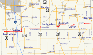
length_mi=85.3
length_round=1
length_ref= [http://illi-indi.com/EndsPage.php?id=1010§ion=1 Indiana Highway Ends - SR 10] ]
length_notes=
established=1926
decommissioned=
direction_a=West
starting_terminus=
beltway_city=
junction= in Argos
direction_b=East
ending_terminus=
counties=Newton, Jasper, Starke, Marshall
cities=Lake Village, Roselawn, DeMotte, San Pierre, North Judson, Bass Lake, Culver, Argos
system=
previous_type=IN
previous_route=9
next_type=IN
next_route=11
browse=
commons=State Road 10 is an east-west road in northwest Indiana. Its western terminus is at the
Illinois state line west of Lake Village. Its eastern terminus is at State Road 19 south of Etna Green.Major intersections
Source: INDOT Roadway Referencing System [cite web|url=http://www.in.gov/indot/3361.htm|title=INDOT Roadway Referencing System]
INint
county=Newton
cspan=3
location=Lake Village
lspan=2
type=
mile=0.00
road=
notes=State line.INint
mile=3.99
road=
street=Wicker Boulevard
notes=Old SR 10.INint
location=Roselawn
lspan=2
mile=10.25
road=
notes=INint
county=Jasper
cspan=5
mile=13.78
road=
notes=Interchange.INint
location=DeMotte
lspan=3
mile=17.26
road=
notes=Western terminus of SR 110.INint
type=concur
mile=20.37
road=
notes=concurrency beginsINint
type=concur
mile=22.75
road=
notes=concurrency ends after 2.38 milesINint
location=Wheatfield
mile=28.19
road=
notes=INint
county=Starke
cspan=9
location=San Pierre
lspan=2
type=concur
mile=36.18
road=
notes=concurrency beginsINint
type=concur
mile=38.16
road=
notes=concurrency ends after 1.98 milesINint
location=North Judson
lspan=2
type=concur
mile=44.21
road=
notes=INint
type=concur
mile=46.28
road=
notes=INint
location=Bass Lake
lspan=5
mile=52.22
type=concur
road=
notes=concurrency beginsINint
mile=53.61
type=concur
road=
notes=concurrency ends after 1.39 milesINint
type=decomd
mile=
road=
notes=Western terminus of former SR 210.INint
type=decomd
mile=
road=
notes=Eastern terminus of former SR 210.INint
mile=58.96
road=
notes=Southern terminus of SR 23.INint
county=Marshall
cspan=7
location=Culver
lspan=3
type=concur
mile=63.86
road=
notes=INint
type=concur
mile=64.84
road=
notes=INint
mile=65.79
road=
notes=Northern terminus of SR 117.INint
location=Argos
lspan=2
mile=73.89
road=
notes=INint
type=decomd
mile=
road=
street=Michigan Street
notes=Former routing of US 31 through Argos.INint
location=Marshall County
lspan=2
mile=81.90
road=
notes=INint
mile=85.30
road=
notes=References

Wikimedia Foundation. 2010.