- Albion, Pennsylvania
Geobox|Borough
name = Albion
official_name =
category =Borough
image_size =
image_caption =
flag_size =
symbol =
symbol_size =
etymology =
nickname =
motto =
country = United States
country_
state = Pennsylvania
state_
region_type = County
region = Erie
district =
part_type =
part_count =
part =
part1 =
area_imperial = 1.1
area_land_imperial =
area_water_imperial =
area_urban_imperial =
area_metro_imperial =
location =
lat_d = 41
lat_m = 53
lat_s = 28
lat_NS = N
long_d = 80
long_m = 21
long_s = 42
long_EW = W
coordinates_type = region:US_type:city
population_as_of = 2000
population = 1607
population_urban =
population_metro =
population_density_imperial = 1510.7
population_density_urban_imperial =
population_density_metro_imperial =
government =
established_type =
established =
established1_type =
established1 =
government_type =
mayor = Stephen K. Smith
leader_type =
leader1_name =
leader1_type =
timezone = EST
utc_offset = -4
timezone_DST = EDT
utc_offset_DST = -5
postal_code = 16401
postal_code_type = Zip code
area_code = 814
area_code_type =
free_type =
free =
free1_type =
free1 =
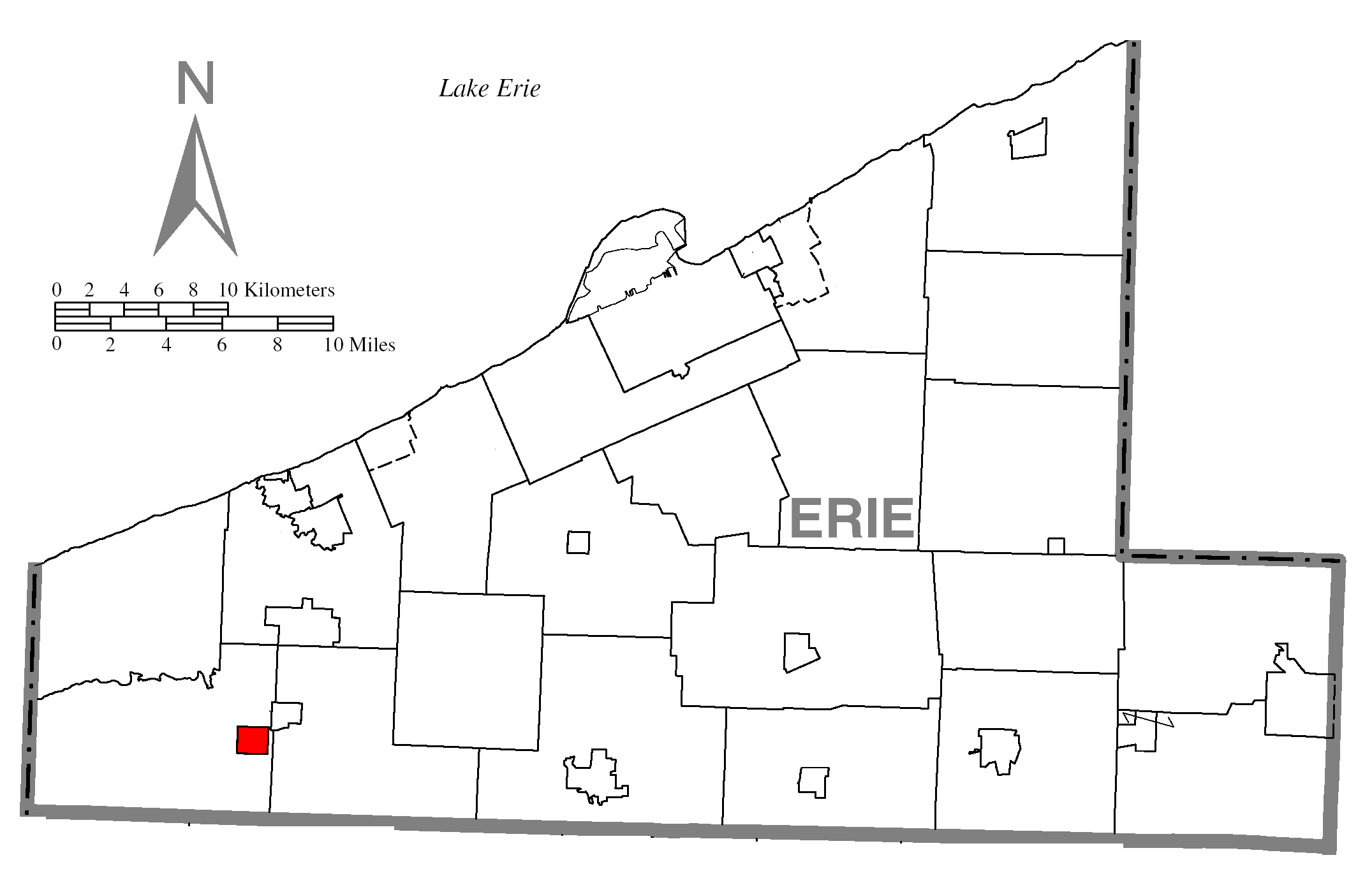
map_caption = Location of Albion in Erie County
map1 = Pennsylvania Locator Map.png
map1_locator = Pennsylvania
map2 = Map of USA PA.svg
map2_caption = Location of Pennsylvania in the United States
website =
footnotes =Albion is a borough in Erie County,
Pennsylvania ,United States . The population was 1,607 at the 2000 census. A neighboring, larger town which many Albionites may associate with isEdinboro, PA , and the much larger but more distant city ofErie, PA . One of their main industries is Albion State Correctional Institute [ [http://www.cor.state.pa.us/albion/site/default.asp albion ] ] . The bordering borough ofCranesville, Pennsylvania , has alittle over a third the population of Albion (600 at the 2000 census) [http://en.wikipedia.org/wiki/ ] [http://en.wikipedia.org/wiki/
 ]
] The town was ravaged by a F4
tornado that was part of the1985 United States-Canadian tornado outbreak on 31 May 1985. [cite web| title=Tornado Outbreak of May 31, 1985| publisher=NOAA | author=National Weather Service Cleveland |url=http://www.erh.noaa.gov/cle/office/localinterest/1985Tornado/1985Tornado.html| accessdate=2007-10-31|date=2005-05-31 ]Geography
Albion is located at coor dms|41|53|28|N|80|21|42|W|city (41.891183, -80.361530)GR|1.
According to the
United States Census Bureau , the borough has a total area of 1.1square mile s (2.8km² ), of which, 1.1 square miles (2.7 km²) of it is land and 0.93% is water.Demographics
As of the
census GR|2 of 2000, there were 1,607 people, 655 households, and 425 families residing in the borough. Thepopulation density was 1,510.7 people per square mile (585.3/km²). There were 695 housing units at an average density of 653.4/sq mi (253.2/km²). The racial makeup of the borough was 98.38% White, 0.50% African American, 0.31% Native American, 0.37% Asian, 0.12% from other races, and 0.31% from two or more races. Hispanic or Latino of any race were 1.18% of the population.There were 655 households out of which 34.0% had children under the age of 18 living with them, 49.0% were married couples living together, 12.2% had a female householder with no husband present, and 35.0% were non-families. 30.2% of all households were made up of individuals and 15.4% had someone living alone who was 65 years of age or older. The average household size was 2.45 and the average family size was 3.07.
In the borough the population was spread out with 28.6% under the age of 18, 6.4% from 18 to 24, 30.4% from 25 to 44, 20.3% from 45 to 64, and 14.2% who were 65 years of age or older. The median age was 35 years. For every 100 females there were 87.3 males. For every 100 females age 18 and over, there were 82.1 males.
The median income for a household in the borough was $33,007, and the median income for a family was $40,650. Males had a median income of $31,620 versus $21,157 for females. The
per capita income for the borough was $15,361. About 10.6% of families and 11.8% of the population were below thepoverty line , including 14.2% of those under age 18 and 13.4% of those age 65 or over.Albion is part of the
Northwestern School District .References

Wikimedia Foundation. 2010.