- Dune Park (NICTD)
-
DUNE PARK 
Dune Park StationStation statistics Address 33 East U.S. Highway 12
Chesterton, IndianaCoordinates 41°38′41″N 87°3′39″W / 41.64472°N 87.06083°W Lines Connections V-Line Platforms 1 Side platform Tracks single with freight lane Parking Yes; free for passengers Bicycle facilities Yes; bike rack Other information Opened 1985 Electrified Yes Accessible 
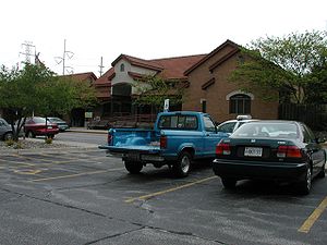
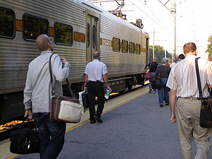
Owned by NICTD Fare zone 6 Services Preceding station NICTD Following station toward Millennium StationSouth Shore Line toward South Bend AirportDune Park is a station in unincorporated Porter County, Indiana located north of the municipalities of Chesterton and Porter. It is used by South Shore Line trains, and serves as the headquarters of the Northern Indiana Commuter Transportation District (NICTD), the umbrella agency that operates the South Shore Line. It is located at the intersection of U.S. Highway 12 and Indiana State Road 49.
Usage
Dune Park is a comparatively new station, built in 1985 to serve as a regional commuter station and as NICTD's corporate headquarters. The station was designed to replace the South Shore's former nearby station at Tremont, Indiana, a location that was becoming depopulated with the expansion of the nearby Indiana Dunes National Lakeshore.
The Dune Park station was built with substantial parking space to consolidate local commuter service, and in 1992 the South Shore Line ceased to offer its traditional flag stop service to Dune Acres, Indiana and Kemil Road, several miles west and east of Dune Park respectively. Users of these low-volume stops were instructed to instead use the consolidated Dune Park station.
"Dune Park" is so called because it the station is physically surrounded by land owned by the Indiana Dunes National Lakeshore. Major units of the National Lakeshore are accessible from the station on U.S. 12 and the Calumet Trail. The station is also adjacent to the Indiana Dunes State Park, which is accessible to the north via Indiana 49.
Dune Park was also the name of a former section of the Indiana Dunes, between Ogden Dunes, Indiana and Dune Acres, that was physically leveled in the 1960s to create the Port of Indiana steelmaking and industrial complex.
Bus connections
- Orange Line (Friday-Sunday only)
External links
- South Shore Line - Stations
- South Shore Railfan.net
Categories:- South Shore Line (NICTD)
- NICTD stations in Indiana
- Transportation in Porter County, Indiana
- Railway stations opened in 1985
- Buildings and structures in Porter County, Indiana
- Midwestern United States railway station stubs
- Indiana building and structure stubs
Wikimedia Foundation. 2010.

